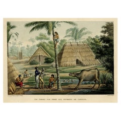
Items Similar to Old Engraving of French Visiting Tomari, a Village in Far East Russia, 1797

Want more images or videos?
Request additional images or videos from the seller
1 of 5
Old Engraving of French Visiting Tomari, a Village in Far East Russia, 1797
About the Item
Plate: 'Costumes des Habitants de la Baie de Langle.' (Costumes of the inhabitants of Langle Bay, Russia).
Tomari (Russian: ??????) is a coastal town and the administrative center of Tomarinsky District in Sakhalin Oblast, Russia, located on the western coast of the Sakhalin Island, 167 kilometers (104 mi) northwest of Yuzhno-Sakhalinsk, the administrative center of the oblast. As of the 2010 Census, its population was 4,541.
The bay on which Tomari now stands was visited between July 12 and 14, 1787 by two French frigates, Boussole and Astrolabe, commanded by Lapérouse. The French named it Langle Bay after the captain of the Astrolabe. At that time, it was no more than a small cluster of huts. The French had good relations with the local people who they considered to be in the very distant past of northern Chinese origin, describing them as intelligent, good-looking, and short in stature. The locals were engaged primarily in fishing, hunting, and herding, with hardly any agriculture. They traded regularly with the communities on the Amur River on the mainland and with Japan. Lapérouse gives a very detailed description of his relations with these people in his work Voyage de Laperouse Autour du Monde, published in 1797.
After the design by Count de Vancy, engraved by Cathelin.
This attractive original old antique print / plate originates from: 'Atlas du Voyage de la Pérouse' (no.50).
- Dimensions:Height: 11.62 in (29.5 cm)Width: 16.93 in (43 cm)Depth: 0 in (0.02 mm)
- Materials and Techniques:Paper,Engraved
- Period:1790-1799
- Date of Manufacture:1797
- Condition:Repaired: small creases around the edges have been backed with tape on the backside. Wear consistent with age and use. General age related toning and creases with repairs. A few small remains of tape on the back side. Nevertheless a very interesting print with lots of details. Please study scan carefully.
- Seller Location:Langweer, NL
- Reference Number:
About the Seller
5.0
Platinum Seller
These expertly vetted sellers are 1stDibs' most experienced sellers and are rated highest by our customers.
Established in 2009
1stDibs seller since 2017
1,933 sales on 1stDibs
Typical response time: <1 hour
- ShippingRetrieving quote...Ships From: Langweer, Netherlands
- Return PolicyA return for this item may be initiated within 14 days of delivery.
More From This SellerView All
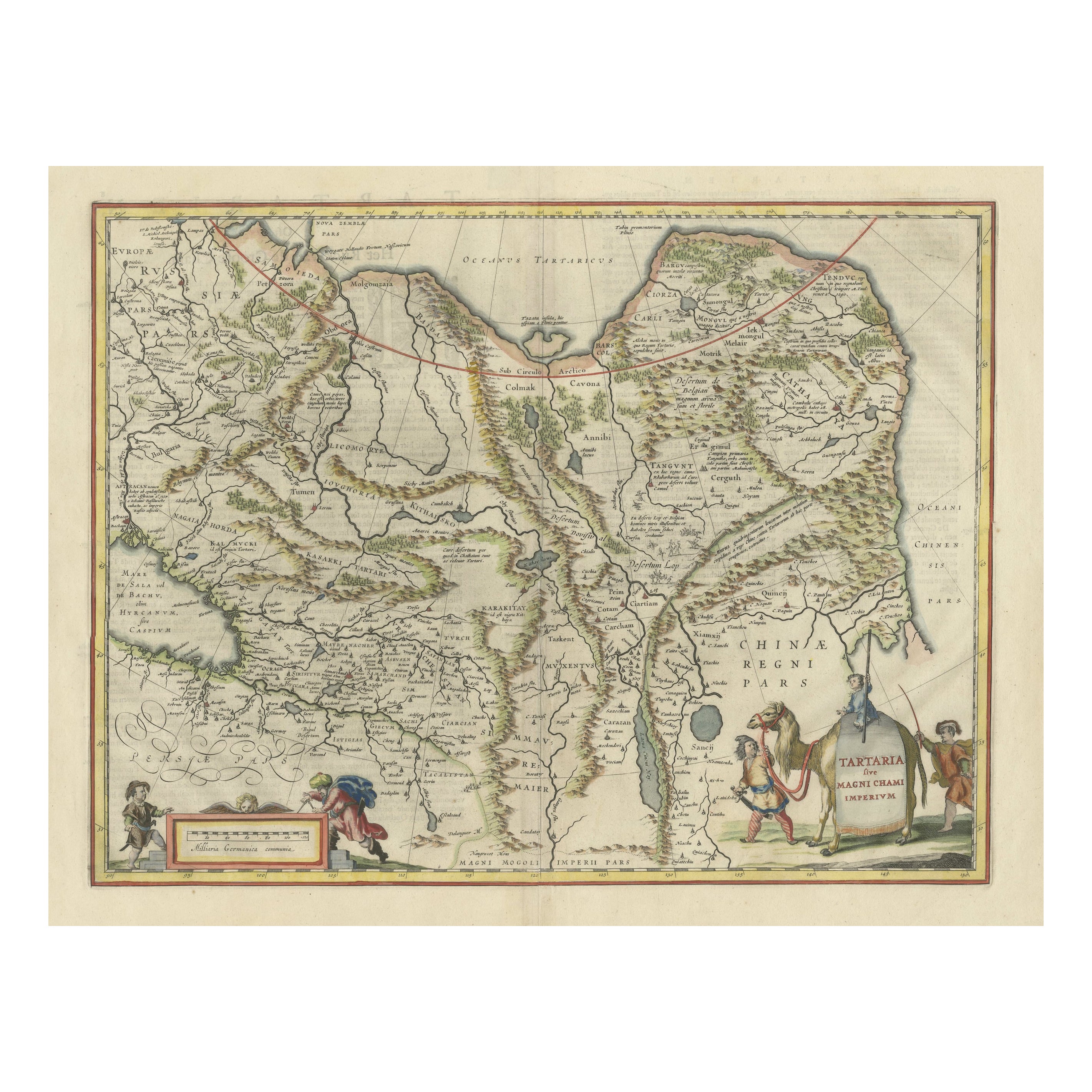
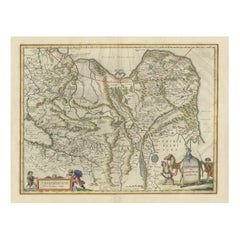
- Old Genuine Antique Map of Tartary in the Russian Far EastLocated in Langweer, NLOriginal antique map titled 'Tartaria sive Magni Chami Imperium'. This great map of Tartary covers all of eastern Asia between the Caspian Sea and northern China and Manchuria. Being...Category
Antique Mid-17th Century Maps
MaterialsPaper
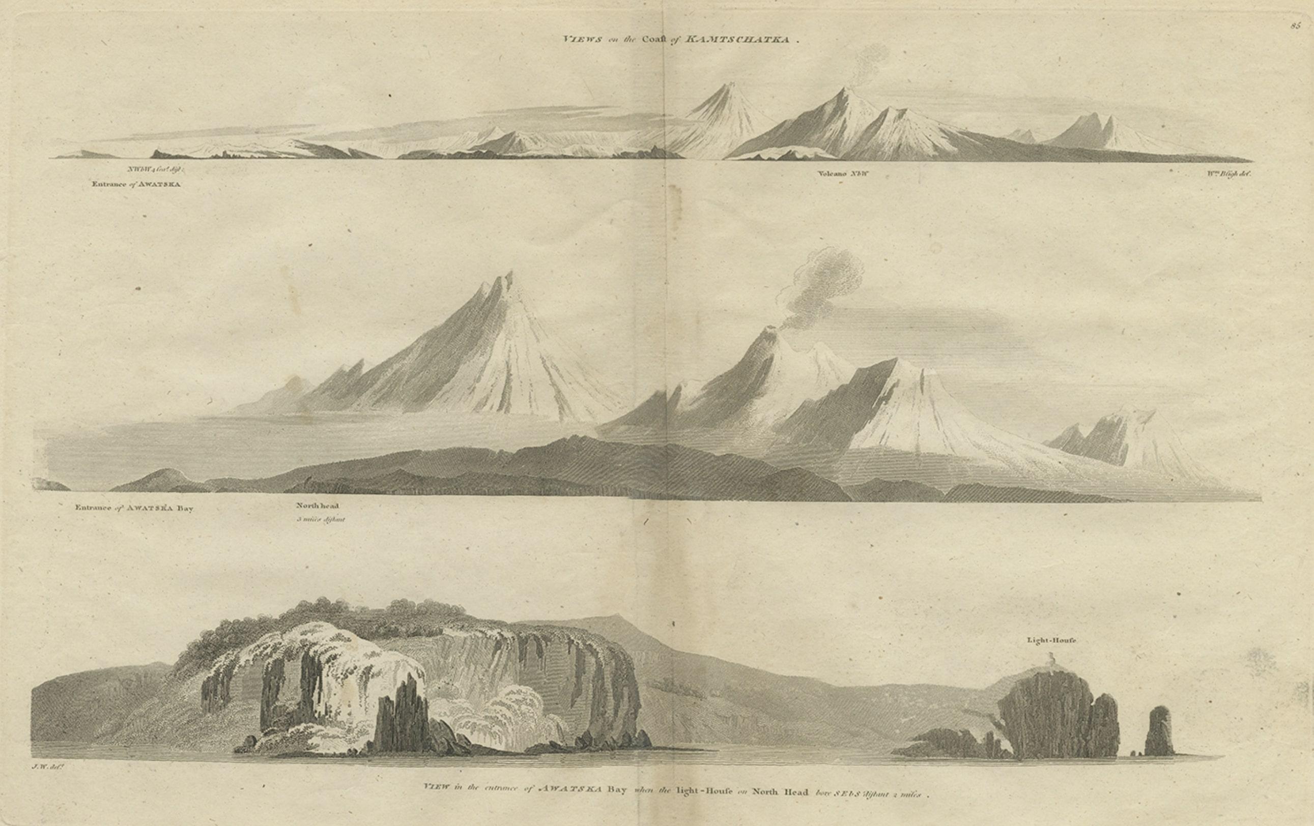
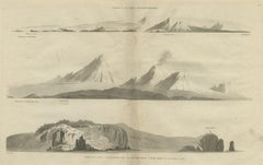
- Antique Print with Coastal Views of Kamchatka in The Russian Far East, c.1784Located in Langweer, NLAntique print titled 'Views of the Coast of Kamtschatka (..)'. Print with coastal views of Kamchatka including volcanoes. Originates from an edition of Cook's Voyages. Artists and ...Category
Antique 18th Century Prints
MaterialsPaper
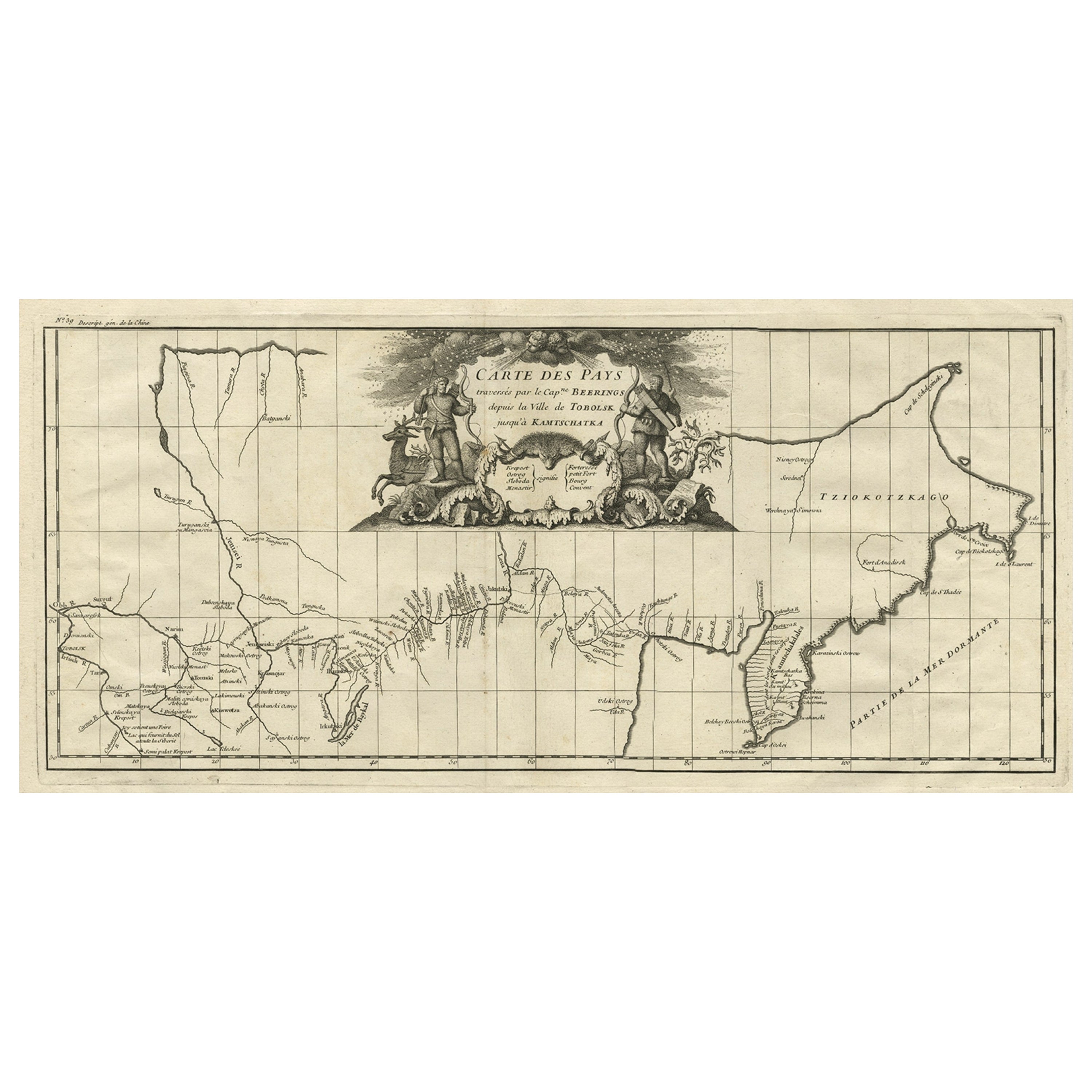
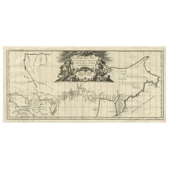
- Antique Map with Details of Berings' Expedition into Russians' Far East, 1737Located in Langweer, NLAntique map titled 'Carte Des Pays traverses par le Capne. Beerings depuis la Ville de Tobolsk jusqua'a Kamtschatka'. This is the first printed map to illustrate Vitus Bering's fir...Category
Antique 1730s Maps
MaterialsPaper
- Old Print of French Travellers Visiting a Village in Kupang, Timor, 1825Located in Langweer, NLAntique print, titled: 'Ile Timor. Vue prise aux Environs de Coupang.' - ('Timor Island. View taken near Coupang'). Source: 'Voyage autour du monde sur les corvettes Uranie et la Phy...Category
Antique 1820s Prints
MaterialsPaper
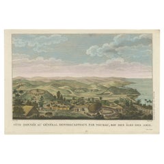
- Beautiful and Rare Original Antique Engraving of a Village in Tonga, 1817Located in Langweer, NLFete donnee au General Dentrecasteaux par Toubau, Roi des Iles des Amis Original antique engraving showing the party given to General Dentrecasteaux by Toubau, King of the Friendl...Category
Antique 1810s Prints
MaterialsPaper
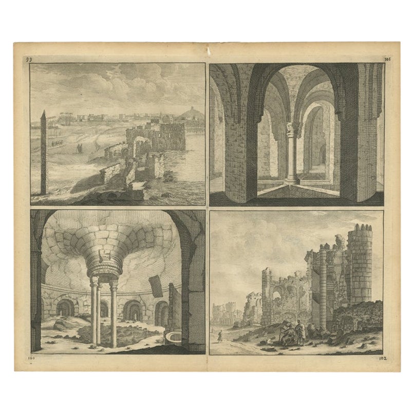
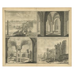
- Old Engraving of the Ruins of the Palace of Cleopatra in Old Egypt, AfricaLocated in Langweer, NLThis plate shows views of the ruins of the Palace of Cleopatra, Egypt. Source unknown, to be determined. Artists and Engravers: Cornelis de Bruijn (also spelled Cornelius de Bruyn, p...Category
Antique 18th Century Prints
MaterialsPaper
You May Also Like
- Framed Johann Elias Ridinger Engraving, 18th Stag EngravingLocated in Perth, GBFine 18th century engraving of a stag, after the hunt, with a magnificient dog at rest, in a country scene, beautifully depicted.Category
Antique 18th Century Prints
MaterialsPaper
- 1876 "Gettysburg, The Repulse of Longstreet's Assault." EngravingLocated in Colorado Springs, COPresented here is an 1876 engraving of John B. Bachelder and James Walker’s Gettysburg. The Repulse of Longstreet’s Assault. The engraved scene depicts the decisive battle on the final day of the Battle of Gettysburg. Researched by the photographer and topographer John B. Bachelder and painted by James Walker, the original painting was created in 1870. This detailed engraving was done by H. B. Hall Jr. and published by James Drummond Ball. Otherwise called Pickett’s Charge, the battle occurred on July 3, 1863. Pickett’s corp commander, Lieutenant General James Longstreet was placed in charge of the attack despite his hesitations. Longstreet’s central role led to the title of the work, Repulse of Longstreet’s Assault. In an attempt to gain control of an important supply route, nine Confederate brigades charged across three-quarters of a mile of open ground against cannon fire to take Cemetery Ridge from the defending Union Army. Despite their overwhelming numbers, the Confederate forces were repelled with considerable casualties marking not only a decisive victory for the Union, but also the beginning of the slow defeat of Lee’s Army. The furthest the charging forces advanced before being repulsed would forever be known as the “High Water Mark of the Confederacy.” The Confederate army never recovered from the losses at Gettysburg and it effectively ended Lee’s campaign into Pennsylvania. The engraving gives the perspective from the Union rear, one that encompasses most of the battlefield, from Big Round Top on the left to the northern reaches of Cemetery Ridge on the right. The Confederate lines at Seminary Ridge are in the far distance, partially obscured by bursting shells. The image centers on the main Confederate assault, in the vicinity of what today are known as "The Copse" and "The Bloody Angle." The composition has elemen...Category
Antique 1870s American Prints
MaterialsPaper
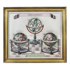
- Framed Engraving By Matthaus Seutter Of Sphaerae ArtificialesLocated in Essex, MACartographer from Germany 1678-1757. Hand colored. Gilt wood frame. Estate of William Hodgins.Category
Antique Early 1700s German Prints
MaterialsPaper
- Original Antique Map of South East Asia, Arrowsmith, 1820Located in St Annes, LancashireGreat map of South East Asia Drawn under the direction of Arrowsmith Copper-plate engraving Published by Longman, Hurst, Rees, Orme and Brown, 1820 Unframed.Category
Antique 1820s English Maps
MaterialsPaper
- Old Nautical Map of CorsicaLocated in Alessandria, PiemonteST/556/1 - Old map of Corsica isle, surveyed by Captain Hell, of the French Royal Navy in 1824, engraved and published on 1874, with additions and corre...Category
Antique Early 19th Century English Other Prints
MaterialsPaper
- Old Horizontal Map of EnglandBy TassoLocated in Alessandria, PiemonteST/520 - Old rare Italian map of England, dated 1826-1827 - by Girolamo Tasso, editor in Venise, for the atlas of M.r Le-Sage.Category
Antique Early 19th Century Italian Other Prints
MaterialsPaper


Recently Viewed
View AllMore Ways To Browse
Chinese Old Plates
Older Chinese Plates
Hunting China
Japan Costume
French Fishing Village
Antique Fishing Prints
East Coast Antiques
Antique Mi
Antique Russian China
East Bay Used Furniture
Bay Antique Center
Russian Hunting
Atlas Du Monde Antique
French White Chest Of Drawers
French Commode Marble Top Walnut
Tapestry Modern Woven
6 Piece Cabinet
Antique Style French Chests