Items Similar to Original 1700s Map of Great Britain, England & Wales in 1757 by Thomas Kitchin


Want more images or videos?
Request additional images or videos from the seller
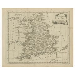
Original 1700s Map of Great Britain, England & Wales in 1757 by Thomas Kitchin
About the Item
A New and Accurate Map of that District of Great Britain called England & Wales &c. from the latest & most Correct Surveys. By T Kitchen, Geographer & Hydrographer to His Majesty.
Upper Center: Engraved for Walpoole's New & Complete British Traveller. Lower Center: N.B. The New & Correct Maps of Scotland, Ireland, &c. will be given Complete in the Course of the Publication.
Source / Publication: New & Complete British Traveller
Publisher: Walpoole
Place of Publication: London
Date: 1784
Date (Depicted): 1757
Artist: Thomas Kitchin
Paper Dimensions: 16 1/8 x 14 5/8 inches.
Platemark Dimensions: 15 1/4 x 13 1/2 inches.
Medium: Copperplate engraving
Language: English
Coloured: Black and white
Condition: The print is in great condition except for the sides, where the print is worn and there are several clean tears into each of the sides of the print, as can barely be seen.
- Dimensions:Height: 16.13 in (40.98 cm)Width: 14.63 in (37.17 cm)Depth: 0.13 in (3.31 mm)
- Materials and Techniques:Paper,Engraved
- Place of Origin:
- Period:
- Date of Manufacture:1784
- Condition:Wear consistent with age and use. The print is in great condition except for the sides, where the print is worn and there are several clean tears into each of the sides of the print, as can barely be seen.
- Seller Location:Montréal, CA
- Reference Number:
About the Seller
New to 1stDibs
Joined in the past six months.
No Reviews Yet
Vetted Seller
These experienced sellers undergo a comprehensive evaluation by our team of in-house experts.
1stDibs seller since 2023
- ShippingRetrieving quote...Ships From: Charleston, SC
- Return PolicyA return for this item may be initiated within 14 days of delivery.
More From This SellerView All
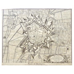
- Original Antique Map of Bethune and the Earldom of Artois c. 1744 by J. BasireLocated in Montréal, CABethune. A Strong Town in the Earldom of Artois in the Low Countries, Subject to the French. J. Basire Sculp. Lower Center: Plan of Bethune. For Mr. Tindal's Continuation of Mr. Rapi...Category
Antique Mid-18th Century British Prints
MaterialsPaper
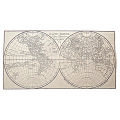
- 1800s French Map of the World in Two Hemispheres - Le Dictionnaire GéographiqueLocated in Montréal, CAMappe-Monde. En deux Hemispheres Pour le Dictionnaire Géographique. Author: Vosgien and Caillot Source / Publication: Le Dictionnaire Géographique, ou Description de toutes les Parti...Category
Antique Early 19th Century French Prints
MaterialsPaper
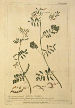
- Original 1750s Antique Botanical Print of Hippocrepis - Gardener’s DictionaryLocated in Montréal, CAHippocrepis. Upper Right: Pl. CCLXXVII. Lower Left: R. Lancake delin. Lower Center: Publish'd according to Act of Parliament by P. Miller January 26, 1759. Lower Right: I. Miller scu...Category
Antique Mid-18th Century British Prints
MaterialsPaper
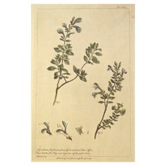
- Original 1750s Antique Botanical Print of Echinops - The Gardener’s DictionaryLocated in Montréal, CAEchinops. Upper Right: Pl. CXXX. Lower Left: R. Lancake delin. Lower Center: Publish'd according to Act of Parliament by P. Miller Novem. the 30th 1756. Lower Right: I. S. Miller Scu...Category
Antique Mid-18th Century British Prints
MaterialsPaper
- Original 1750s Antique Botanical Print of Salvia - The Garderner’s DictionaryLocated in Montréal, CASalvia. Upper Right: Pl. CCXXV. Lower Left: I. Miller delin et Sculp. Lower Center: Publish'd according to Act of Parliament by P Miller April 21. 1758. Author: Philip Miller Source ...Category
Antique Mid-18th Century British Prints
MaterialsPaper
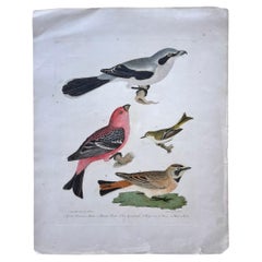
- Early 19th Century Original Alexander Wilson Print of American OrnithologyLocated in Montréal, CA1. Great American Shrike, or Butcher Bird. 2. Pine Grosbeak. 3. Ruby-crowned Wren. 4. Shore Lark. Subscript: Lower Left: Drawn from Nature by A. Wilson.; Lower Center: 5.; Lower Rig...Category
Antique Early 19th Century British Prints
MaterialsPaper

You May Also Like
- Original Antique Map of England and WalesLocated in Langweer, NLAntique map titled 'A New and Correct Map of England and Wales from the Latest and Best Improvements'. Original antique map of England and Wales. Printed by Alex Hogg, London for George Henry Millar's 'New, Complete and Universal System...Category
Antique Late 18th Century Maps
MaterialsPaper
- Original Antique Map of England, Ireland, Scotland and WalesLocated in Langweer, NLAntique map titled 'Les Isles Britanniques, ou sont les Royaumes d Angleterre (..)'. Detailed map of England, Ireland, Scotland and Wales, with French coast and part of the Netherlan...Category
Antique Early 18th Century Maps
MaterialsPaper
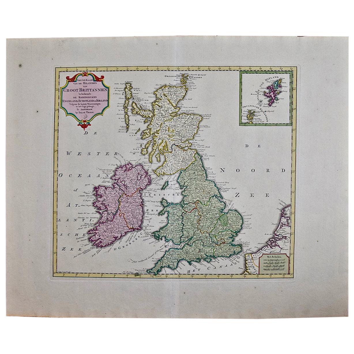
- England, Scotland & Ireland: A Hand Colored Map of Great Britain by TirionBy Isaak TirionLocated in Alamo, CAThis is a hand-colored double page copperplate map of Great Britain entitled "Nieuwe Kaart van de Eilanden van Groot Brittannien Behelzende de Kon...Category
Antique Mid-18th Century Dutch Maps
MaterialsPaper
- Antique Map of England & Wales by Wyld '1845'Located in Langweer, NLAntique map titled 'England & Wales'. Original antique map of England & Wales. This map originates from 'An Atlas of the World, Comprehending Se...Category
Antique Mid-19th Century Maps
MaterialsPaper
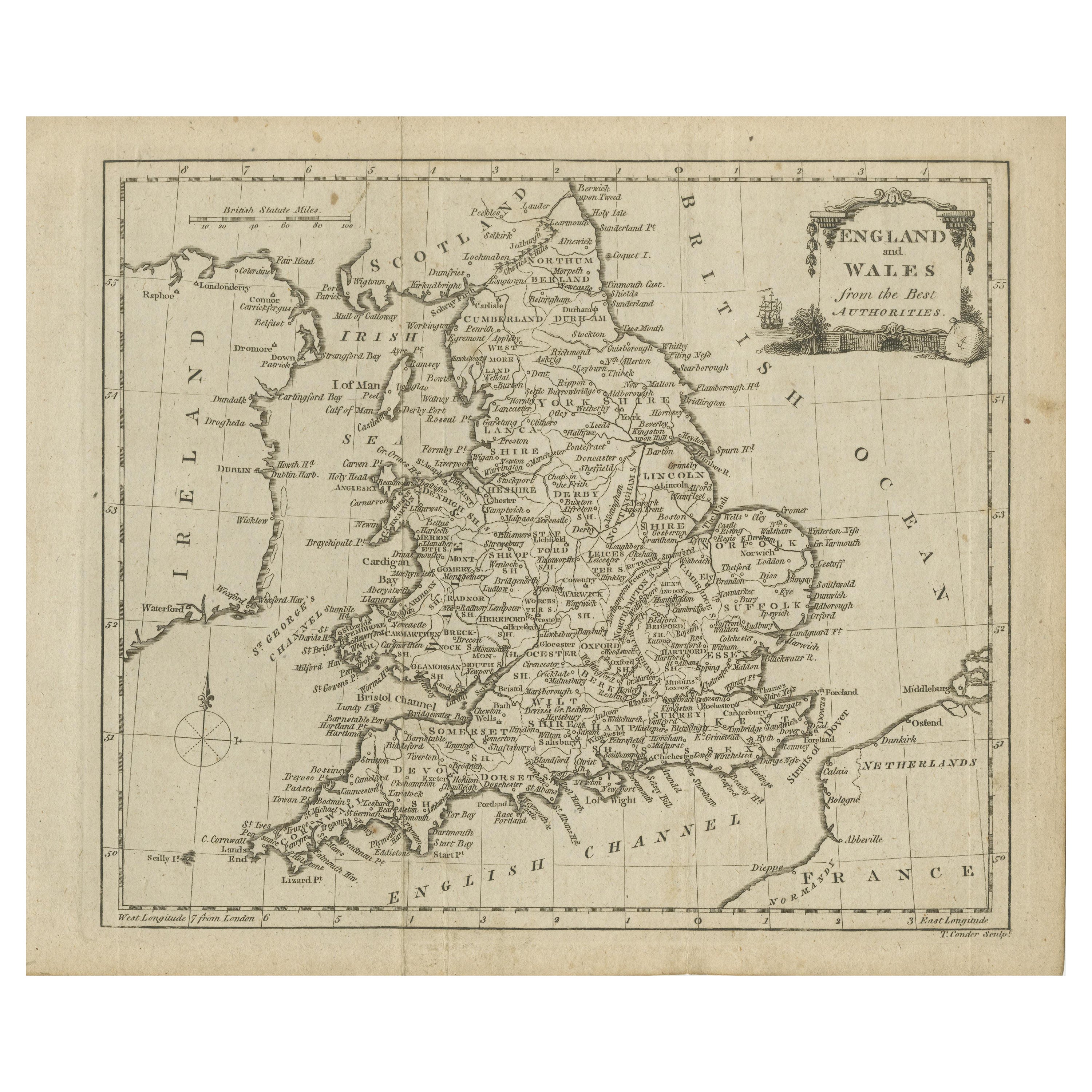
- Original Antique Map of England and Wales, with Decorative CartoucheLocated in Langweer, NLAntique map titled 'England and Wales from the best Authorities'. Original antique map of England and Wales, with decorative cartouche. Engraved by T. Conder. Published circa 1790.Category
Antique Late 18th Century Maps
MaterialsPaper
- Large Antique Map of England and WalesLocated in Langweer, NLAntique map titled 'An Accurate Map of England and Wales'. Original old map of England and Wales. Engraved by John Cary. Originates from 'New British Atlas' by John Stockdale, publis...Category
Antique Early 19th Century Maps
MaterialsPaper