Items Similar to Original Hand-Colored Antique Map of Tartary and Northern India


Want more images or videos?
Request additional images or videos from the seller
1 of 6
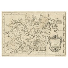
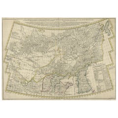
Original Hand-Colored Antique Map of Tartary and Northern India
About the Item
The antique map titled "Carte de la partie meridionale de la tartarie avec la p.tie septentrionale de l'nde" was crafted by Louis Brion de la Tour, a prominent French cartographer, and geographer in the 18th century. The map translates to "Map of the Southern Part of Tartary with the Northern Part of India."
Brion de la Tour was known for his meticulous cartographic skills and contributed significantly to the geographical knowledge of his time. This particular map, created during the 18th century, presents a depiction of the southern portion of Tartary, an ancient region in northern and central Asia, alongside the northern part of India.
As with many maps of that era, it likely features details on geographical boundaries, topographical features, major cities, rivers, and possibly cultural or historical notations relevant to the regions depicted. Brion de la Tour's maps were renowned for their accuracy and aesthetic appeal, often incorporating artistic elements along with precise cartographic information.
This specific map would have provided invaluable geographical knowledge and served as a significant reference tool for explorers, traders, and scholars of the time, shedding light on the territories of Tartary and northern India during the 18th century.
- Dimensions:Height: 9.45 in (24 cm)Width: 13.59 in (34.5 cm)Depth: 0 in (0.02 mm)
- Materials and Techniques:Paper,Engraved
- Period:1780-1789
- Date of Manufacture:ca.1780
- Condition:Good condition. Flattened folding lines from the publication it was taken from. Small margins on the right side, but leaving enough space for framing nicely.
- Seller Location:Langweer, NL
- Reference Number:
About the Seller
5.0
Platinum Seller
These expertly vetted sellers are 1stDibs' most experienced sellers and are rated highest by our customers.
Established in 2009
1stDibs seller since 2017
1,946 sales on 1stDibs
Typical response time: <1 hour
- ShippingRetrieving quote...Ships From: Langweer, Netherlands
- Return PolicyA return for this item may be initiated within 14 days of delivery.
More From This SellerView All
- Original Antique Map of Northern IndiaBy Jakob van der SchleyLocated in Langweer, NLAntique map titled 'Carte de l'Indoustan (..) - Kaart van Hindoestan (..)'. Original antique map of northern India. This map originates from 'His...Category
Antique Mid-18th Century Maps
MaterialsPaper
- Original Antique Map of Tartary 'Northern China & Far Eastern Russia', 1757Located in Langweer, NLAntique map titled 'Carte de la Tartarie Orientale (..)'. Original antique map of what is present day northern China and far eastern Russia. Centere...Category
Antique 1750s Maps
MaterialsPaper
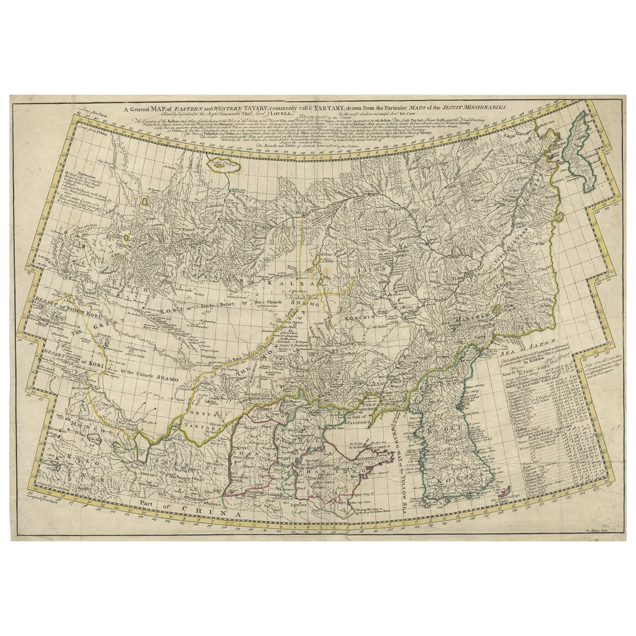
- Rare Hand-Colored Antique Map of Tartary, China and Korea, ca.1741Located in Langweer, NLAntique map titled 'A General Map of Eastern and Western Tatary, commonly call'd Tartary; drawn from the Particular Maps of the Jesuit Missionaries'. Rare antique map of Tartary, C...Category
Antique 1740s Maps
MaterialsPaper
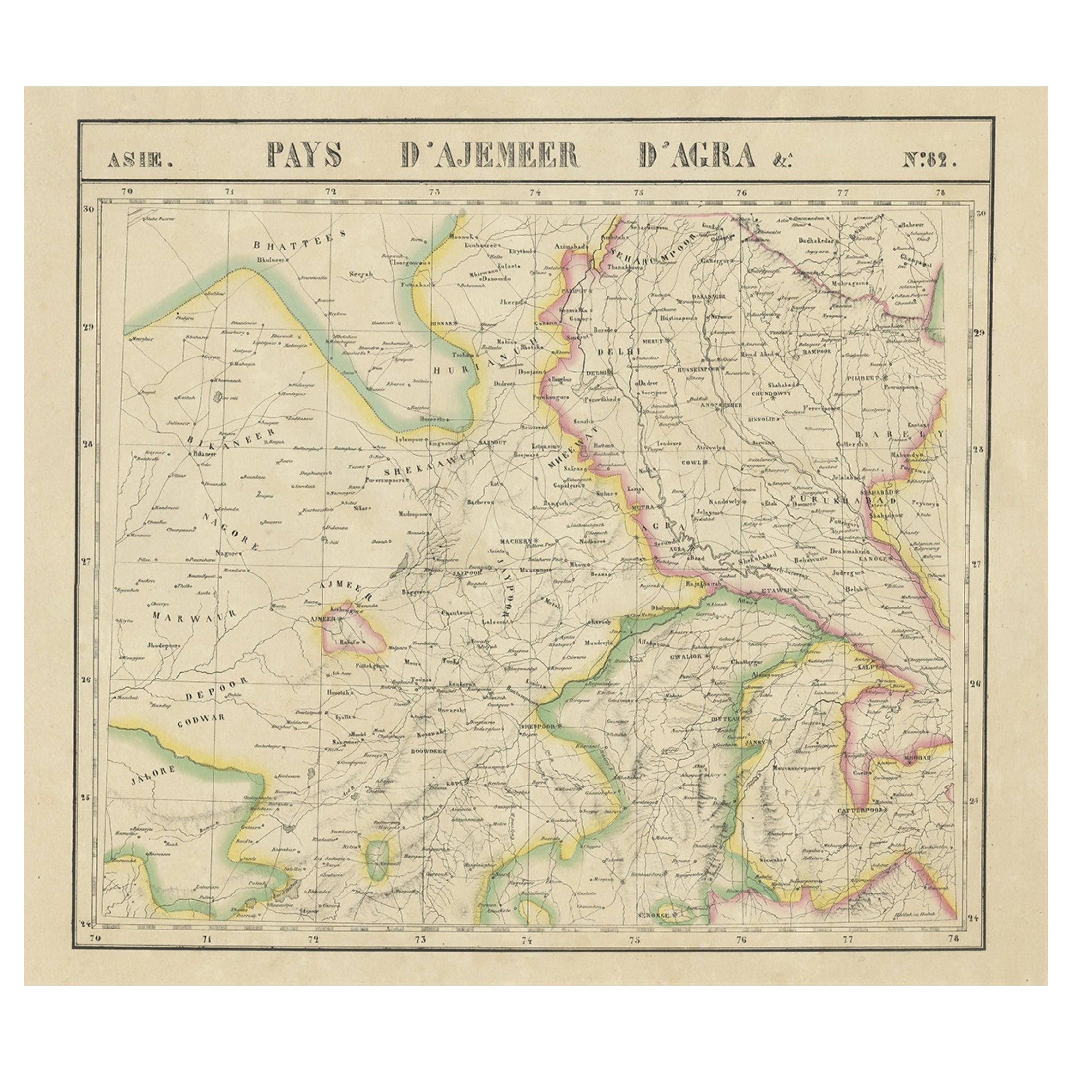
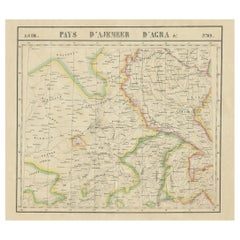
- Large and Rare Antique Map of Northern India in Original Coloring, c.1825Located in Langweer, NLAntique map titled 'No. 82 Pays d'Ajemeer d'Agra'. Detailed map of Northern India. Originates from 'Atlas Universel' by P.M. Vandermaelen. Artists and Engravers: Philippe Marie Van...Category
Antique 19th Century Maps
MaterialsPaper
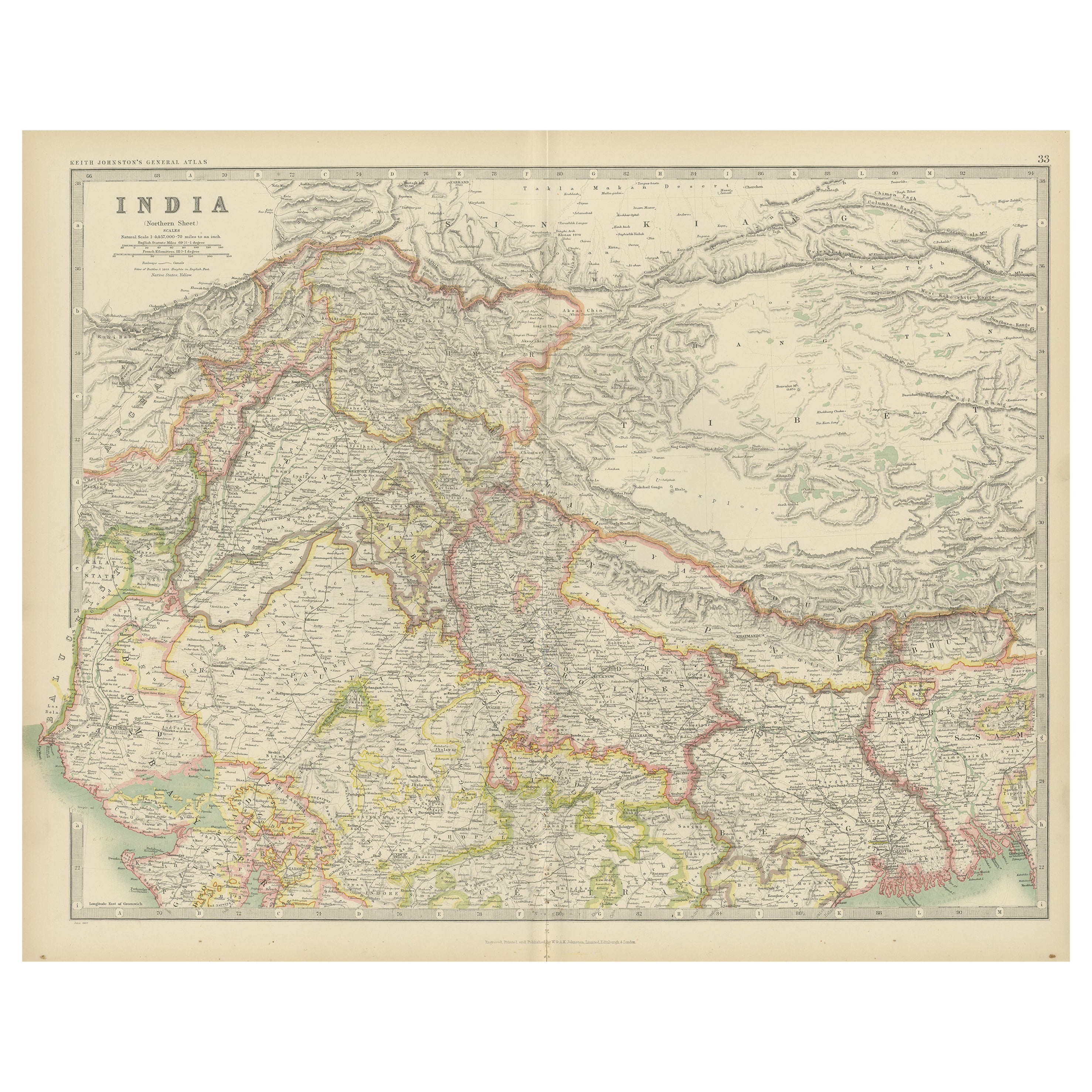
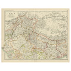
- Antique Map of India 'Northern' by Johnston '1909'Located in Langweer, NLAntique map titled 'India'. Original antique map of India, Northern sheet. This map originates from the ‘Royal Atlas of Modern Geography’. Published by W. & A.K. Johnston, 1909.Category
Early 20th Century Maps
MaterialsPaper
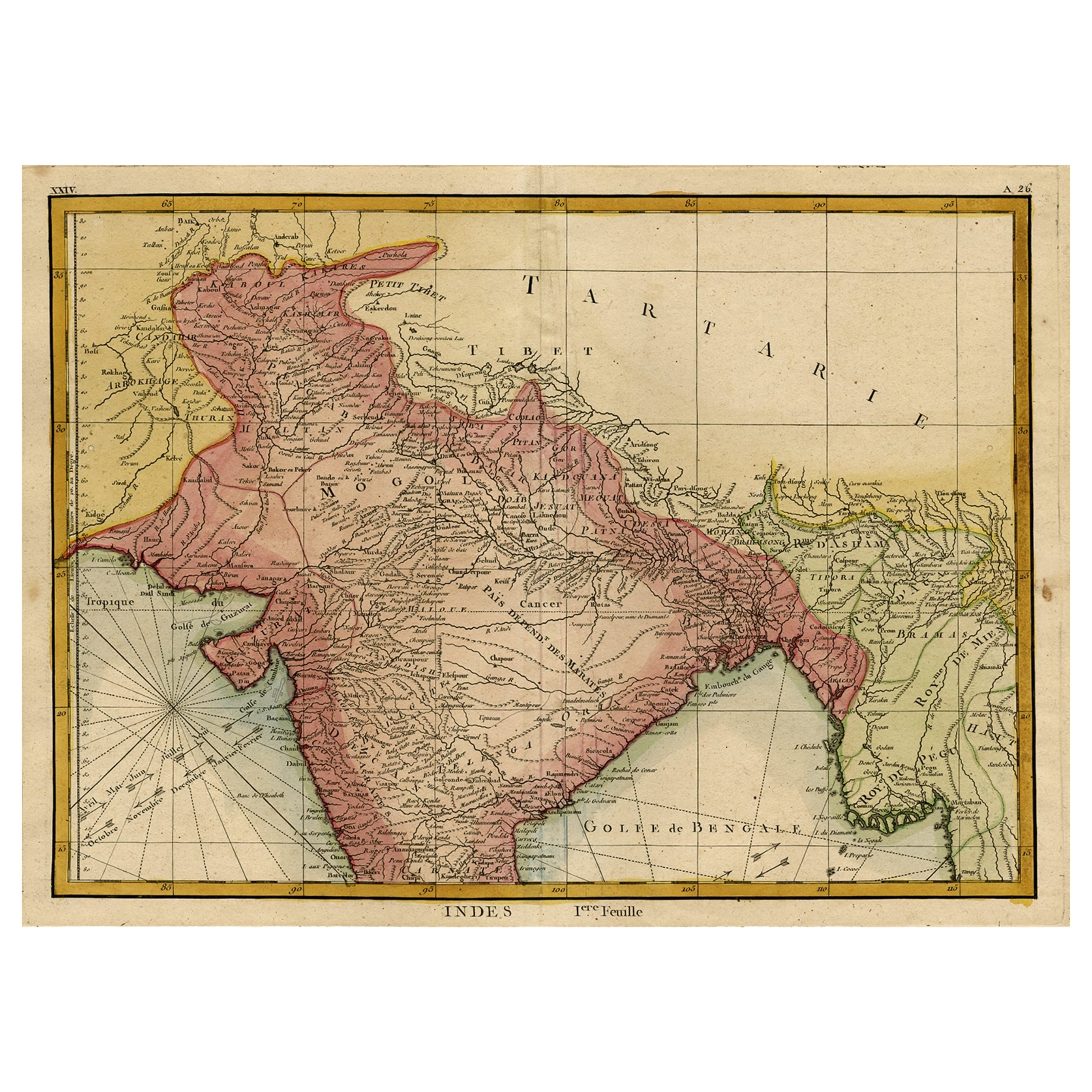
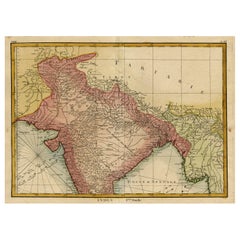
- Original and Colourful Map of Northern India with Surrounding Regions, 1783Located in Langweer, NLAntique map titled 'Indes'. A map of Northern India with surrounding regions. From Lattre's 'Atlas moderne ou collection de cartes sur toutes les parties du globe terrestre...Category
Antique 1780s Maps
MaterialsPaper

You May Also Like
- Original Antique Map of India. C.1780Located in St Annes, LancashireGreat map of India Copper-plate engraving Published C.1780 Three small worm holes to right side of map and one bottom left corner Unframed.Category
Antique Early 1800s English Georgian Maps
MaterialsPaper

- Northern Scotland: A 17th Century Hand-colored Map by MercatorBy Gerard MercatorLocated in Alamo, CAThis is a framed hand-colored 17th century map of Northern Scotland by Gerard Mercator entitled "Scotiae pars Septentrionalis", published in Amsterdam in 1636. It is a highly detailed map of the northern part of Scotland, with the northwest Highlands and the cities Inverness and Aberdeen, as well as the Orkney Islands and the Hebrides. There is a decorative title cartouche in the upper left corner. The map is presented in an antiqued brown wood...Category
Antique 1630s Dutch Maps
MaterialsPaper
- Northern Scotland: A 16th Century Hand-colored Map by MercatorBy Gerard MercatorLocated in Alamo, CAA framed hand-colored 16th century map of Northern Scotland by Gerard Mercator entitled "Scotiae pars Septentrionalis", published in Amsterdam in 1636. It is a highly detailed map of the northern part of Scotland, with the northwest Highlands and the cities Inverness and Aberdeen, as well as the Orkney Islands and the Hebrides. There is a decorative title cartouche in the upper left corner. The map is presented in an antiqued brown wood...Category
Antique 16th Century Dutch Maps
MaterialsPaper
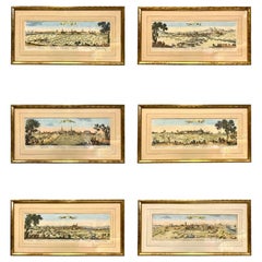
- Set of Six Hand Colored Engravings of Northern FranceLocated in Essex, MAAll featuring the communes of northern France including Rethel, Dunkirk, Mouzon, Gravelines etc. Framed and matted. By C.N. Cochin. Uninspected out of frames. Likely 19th century.Category
Antique 1650s French Prints
MaterialsPaper
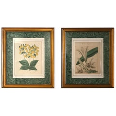
- Pair of Original Antique Hand Colored Botanical EngravingsLocated in West Palm Beach, FLPair of hand colored botanical engravings of flowers.Category
Antique 19th Century English Prints
MaterialsPaper
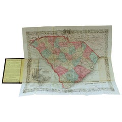
- Antique Engraved Hand Colored Colton & Co. Pocket Book Map of South CarolinaBy G.W. & C.B. ColtonLocated in Charleston, SCVery fine and rare hand colored antique engraved G. W. & C.B. Colton & Co. "Book Map" on onion skin paper of South Carolina, 1874 Published at 172 William Street, New York Below date of "1874" says the following: Entered according to the Act of Congress in the year 1855 by J. H. Colton, in the clerks office of the district court of the United States for the Southern District of New York. Title of pocket book...Category
Antique Late 19th Century American Prints
MaterialsPaper