Items Similar to Vintage Map Print of Saint Martin Island in the Caribbean Sea, Written in Dutch.


Want more images or videos?
Request additional images or videos from the seller
1 of 9
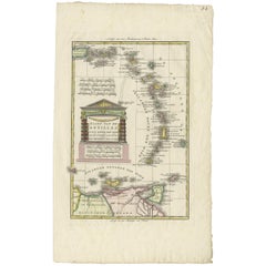
Vintage Map Print of Saint Martin Island in the Caribbean Sea, Written in Dutch.
About the Item
The Saint Martin island was originally St.Marthyn to the Dutch. This is a map of the island and surrounding area. Framed within silver toned professional framing. Vintage Condition Consistent with Age as Pictured.
Dimensions. 24 W ; 1/2 D ; 18 H
- Dimensions:Height: 18 in (45.72 cm)Width: 24 in (60.96 cm)Depth: 0.5 in (1.27 cm)
- Style:Mid-Century Modern (In the Style Of)
- Materials and Techniques:
- Period:
- Date of Manufacture:1970
- Condition:Wear consistent with age and use.
- Seller Location:Seattle, WA
- Reference Number:
About the Seller
5.0
Vetted Seller
These experienced sellers undergo a comprehensive evaluation by our team of in-house experts.
Established in 2018
1stDibs seller since 2021
100 sales on 1stDibs
Typical response time: <1 hour
- ShippingRetrieving quote...Ships From: Seattle, WA
- Return PolicyThis item cannot be returned.
More From This SellerView All
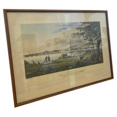
- Vintage Framed Scenic Print of Montreal St. Helens Island by J Gray.Located in Seattle, WADedication and information about this Print are included at the bottom of the frame. Two similar artwork are available through Separate listings. Vintage Condition Consistent with Ag...Category
Vintage 1970s Mid-Century Modern Prints
MaterialsWood
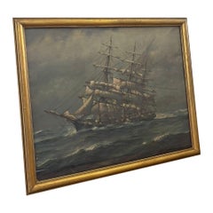
- Vintage Framed and Signed Print of Sail Boat at Sea.Located in Seattle, WAPrint is within a gold toned wooden frame. Slight Patina. Artwork of sailboat going through the stormy weather. Vintage Condition Consistent with Age as Pictured. Dimensions. 15 W ;...Category
Vintage 1970s Mid-Century Modern Prints
MaterialsWood
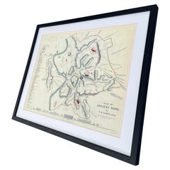
- Vintage Framed Print, Plan of Ancient RomeLocated in Seattle, WAVintage framed print. Plan of Ancient Rome. Dimensions. 27 W ; 22 H.Category
Vintage 1970s Mid-Century Modern Prints
MaterialsGlass, Wood
- Vintage Framed Art Print Titled “ Winter, From the Four Seasons “Located in Seattle, WAThis Art piece has a beautiful Petina throughout due to aging. The print contains a couple sledding through Snow. Reproduction of an original work by Francois Boucher. Vintage Condit...Category
Vintage 1970s Mid-Century Modern Prints
MaterialsWood
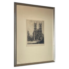
- Vintage Signed and Framed Art Print of Westminster Abbey.Located in Seattle, WAThis print is framed and matted, signed and title in the lower corner. Frame is silver and gold toned. Vintage Condition Consistent with Age as Pictured. Dimensions. 12 W ; 1/2 D ; ...Category
Vintage 1970s Mid-Century Modern Prints
MaterialsSilver
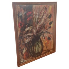
- Vintage Signed and Framed Print of Corn Husk Bouquet.Located in Seattle, WAVintage Print on Paper with Wooden Frame. Abstract Corn Bouquet will Warm Toned Colors throughout. Signed Pierre Mas. Frame has Gold Accents. Vintage Condit...Category
Vintage 1970s Mid-Century Modern Prints
MaterialsWood, Paper

You May Also Like
- Detailed Antique Map of the Windward Islands in the CaribbeanBy Covens & MortierLocated in Langweer, NLAntique map titled 'Carte des Antilles Francoises et des Isles Voisines'. Original antique map of the French Antilles, covering an area stretching from Guadeloupe in the north to Gre...Category
Antique Early 18th Century Maps
MaterialsPaper
- Antique Map of the Antilles in the Caribbean, '1875'Located in Langweer, NLAntique map titled 'Carte des Iles Antilles'. Large map of the Antilles. This map originates from 'Atlas de Géographie Moderne Physique et Politique' by A. Levasseur. Published, 1875.Category
Antique Late 19th Century Maps
MaterialsPaper
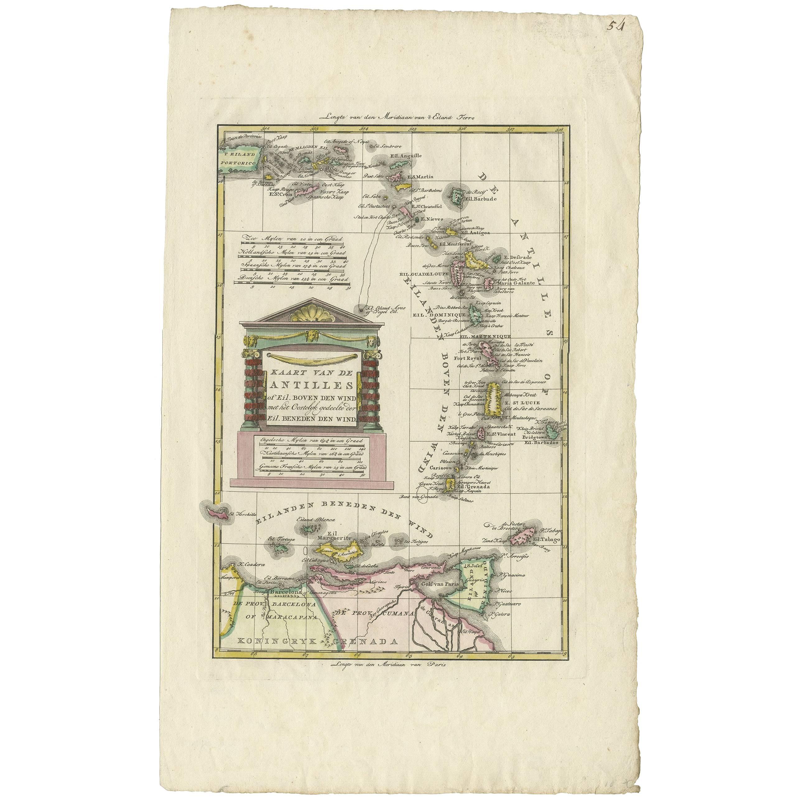
- Antique Map of the Dutch Antilles 'Caribbean' by R. Bonne, circa 1780Located in Langweer, NLAntique map titled 'Kaart van de Antilles (..)'. Rare edition of this map illustrating the Dutch Antilles (Caribbean). Published by R. Bonne, circa 1780. T...Category
Antique Late 18th Century Maps
MaterialsPaper
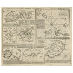
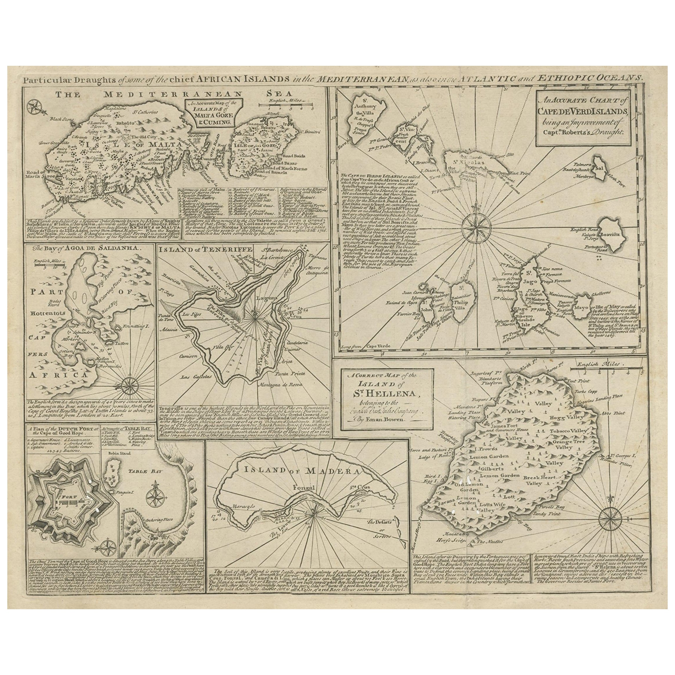
- Antique Map of 'African' Islands in the Mediterranean Sea and The Atlantic, 1747Located in Langweer, NLAntique map titled 'Particular draughts of some of the chief African Islands in the Mediterranean (..)'. Detailed set of eight maps, including a large and detailed Malta, the Bay of Agoa de Saldanha, Tenerife, the Dutch Fortress at the Cape of Good Hope, Table Bay...Category
Antique 18th Century Maps
MaterialsPaper
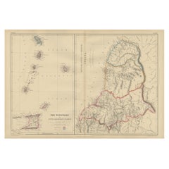
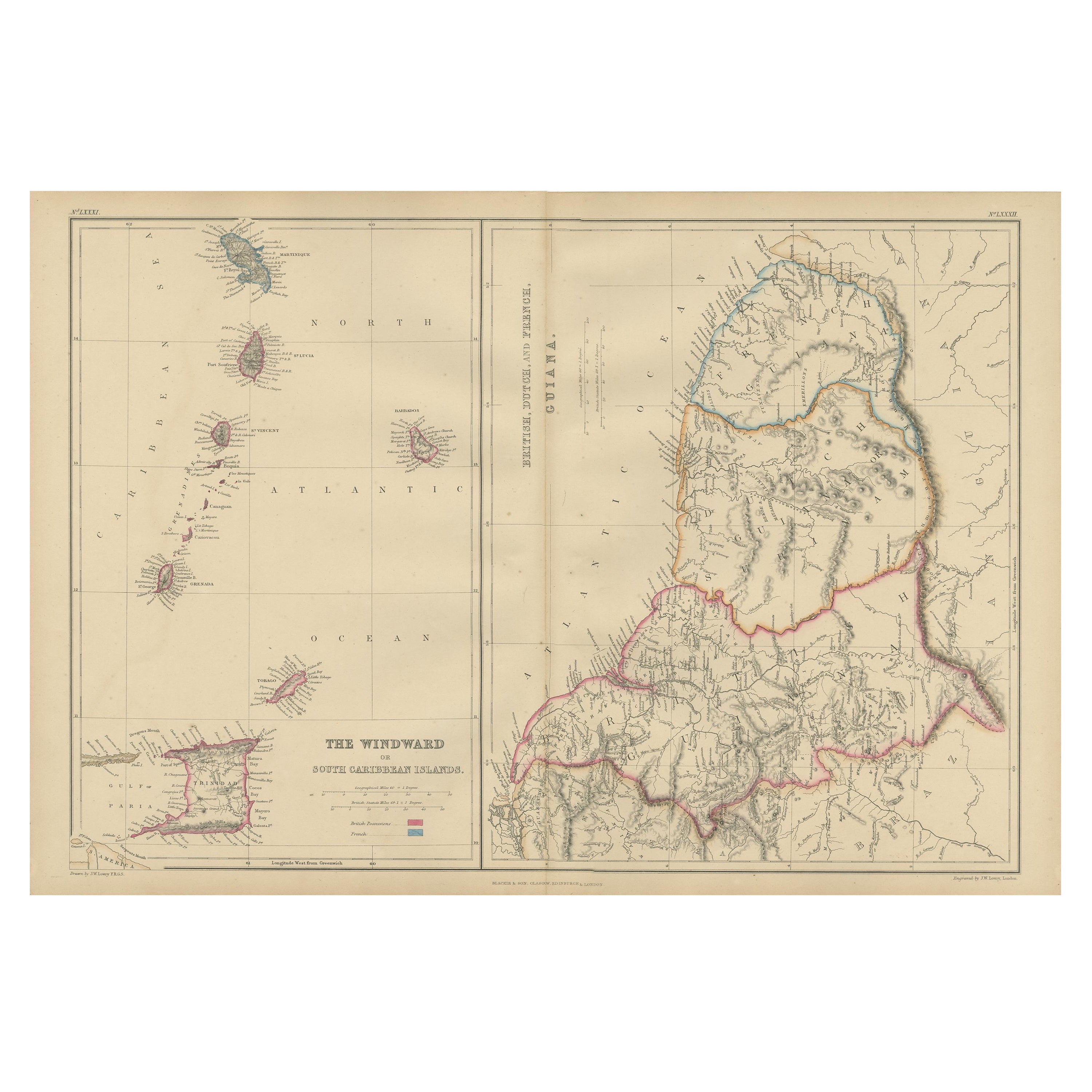
- Antique Map the Windward or South Caribbean Islands and Guiana, 1859Located in Langweer, NLAntique map titled 'The Windward or South Caribbean Islands'. Original antique map of South Caribbean Islands. This map originates from ‘The Imperial Atlas of Modern Geography’. Published by W. G. Blackie, 1859. The Windward Islands, also known as the Islands of Barlovento, are the southern, generally larger islands of the Lesser Antilles. Part of the West Indies, they lie south of the Leeward Islands...Category
Antique Mid-19th Century Maps
MaterialsPaper
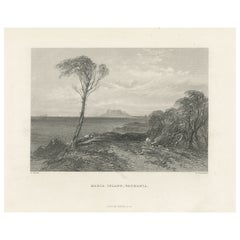
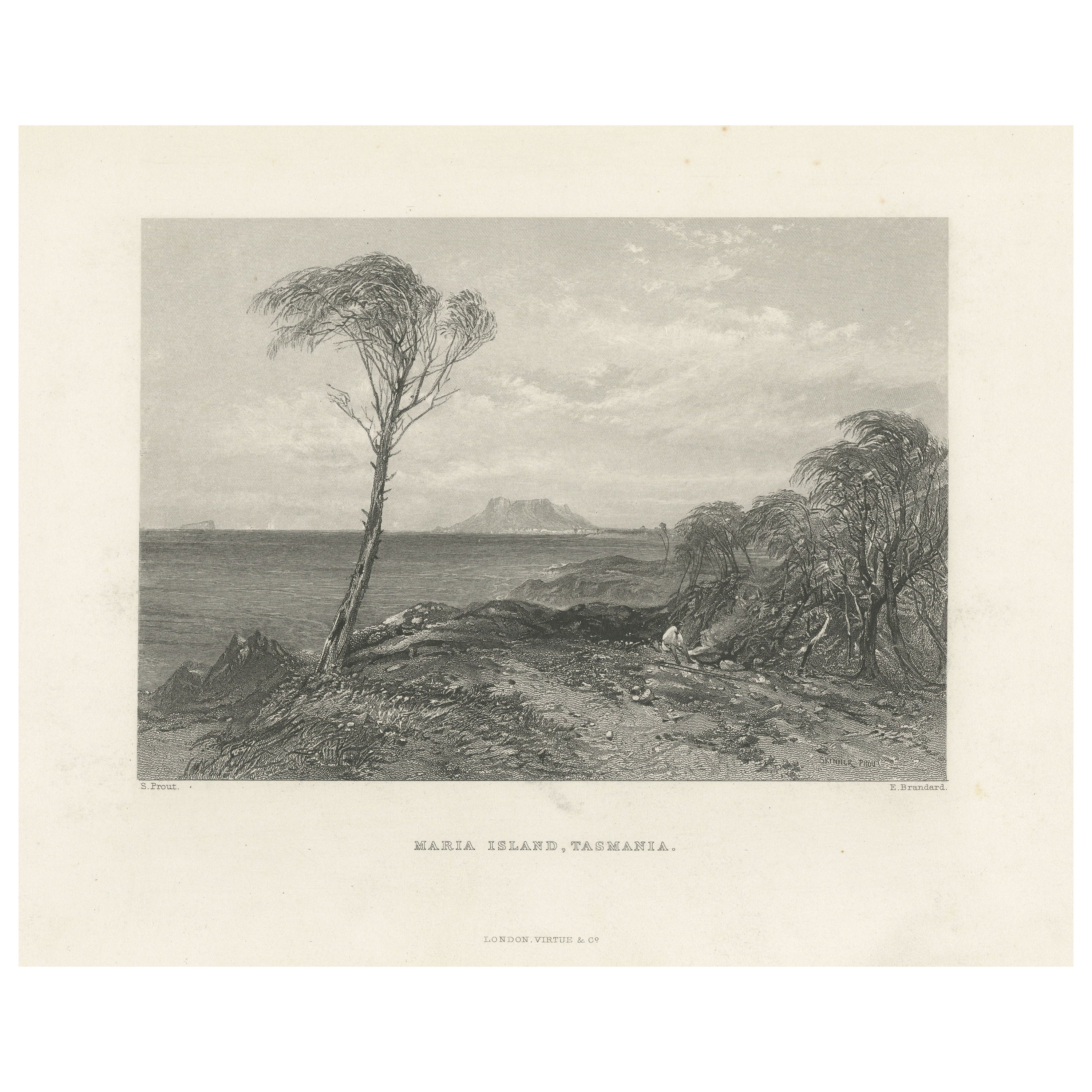
- Antique Print of Maria Island located in the Tasman SeaLocated in Langweer, NLAntique print titled 'Maria Island, Tasmania'. View of Maria Island or 'wukaluwikiwayna', a mountainous island located in the Tasman Sea, off the east coast of Tasmania, Australia. E...Category
Antique Late 19th Century Prints
MaterialsPaper