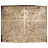
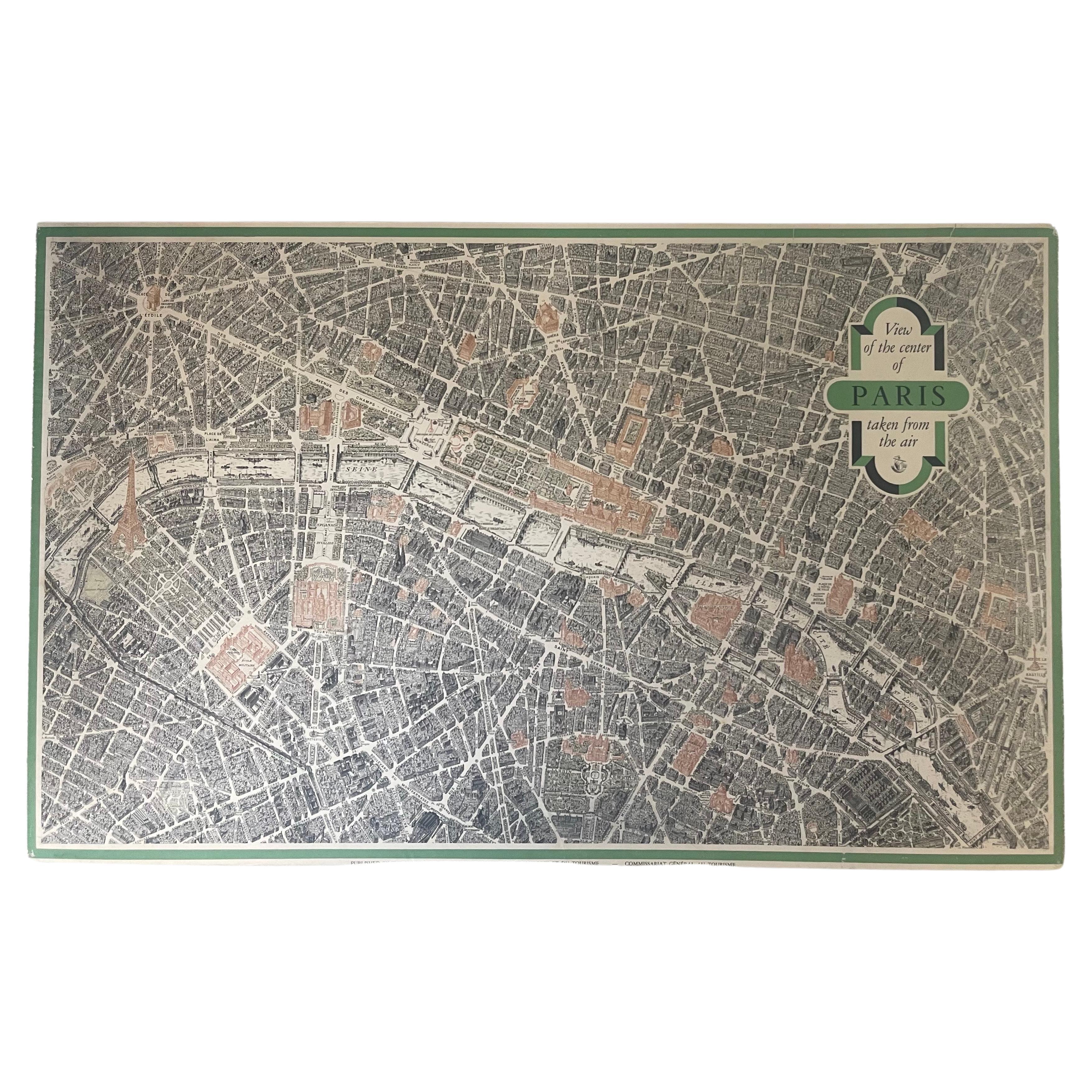
Plan De Paris, wall map, commissioned by Turgot, from 1739
View Similar Items


1 of 10
Plan De Paris, wall map, commissioned by Turgot, from 1739
About the Item
Turgot, Michel Etienne. Plan de Paris,( Paris, 1739. Plan de Paris Commence l'Annee 1734... Levé et Desiné par Louis Bretez Gravé par Claude Lucas / Et Écrit par Aubin. A monumental aerial isometric map of the City of Paris in the year 1739. Twenty (and one diagram plate) copperplate engravings with etching.
One of the most ambitious and beautiful works of urban cartography ever produced. The surveying and rendering was done by Louis Bretez, and the engraving by Claud Lucas. The calligraphy was done by the writing master Aubin. Commissioned by Turgot, Prevot de Marchands of Paris and effectively the city's administrator. The project took five years to complete. A permit was issued to Bretez to enter every building in the city for the purpose of producing the numerous sketches from which the plan was composed. Every building’s exterior has each window shown, while, every garden has all the trees depicted with shade and shadow.
Turgot's Plan de Paris is not only a staggering technical achievement of representation and the engravers art, but it also was conceived and rendered some 44 years before the first manned balloon flight.
- Dimensions:Height: 106 in (269.24 cm)Width: 128 in (325.12 cm)
- Place of Origin:
- Period:
- Date of Manufacture:1739
- Condition:The condition is excellent, a bright clean set; full margins with occasional marginal tears not affecting the image on a few plates reinforced with archival tape.
- Seller Location:Boston, MA
- Reference Number:1stDibs: 090112859312
Authenticity Guarantee
In the unlikely event there’s an issue with an item’s authenticity, contact us within 1 year for a full refund. DetailsMoney-Back Guarantee
If your item is not as described, is damaged in transit, or does not arrive, contact us within 7 days for a full refund. Details24-Hour Cancellation
You have a 24-hour grace period in which to reconsider your purchase, with no questions asked.Vetted Professional Sellers
Our world-class sellers must adhere to strict standards for service and quality, maintaining the integrity of our listings.Price-Match Guarantee
If you find that a seller listed the same item for a lower price elsewhere, we’ll match it.Trusted Global Delivery
Our best-in-class carrier network provides specialized shipping options worldwide, including custom delivery.You May Also Like
Antique Map of the Arabian Peninsula by Franceschini, '1739'
Located in Langweer, NL
Antique map titled 'Conventus et Residentiae'. Rare map of the Arabian Peninsula. This map originates from 'Provinciarum et Conventum Fratrum Discalc...
Category
Antique Mid-18th Century Maps
Materials
Paper

$520 Sale Price
40% Off
Antique Map of Asia 'in Frame, circa 1739'
Located in Langweer, NL
Antique map titled 'Asia Dividida em suas Regioens & Principaes Estados'. Rare and uncommon map of Asia. Signed '1739'. Source unknown, to be determined.
...
Category
Antique Mid-18th Century Maps
Materials
Paper

$601 Sale Price
35% Off
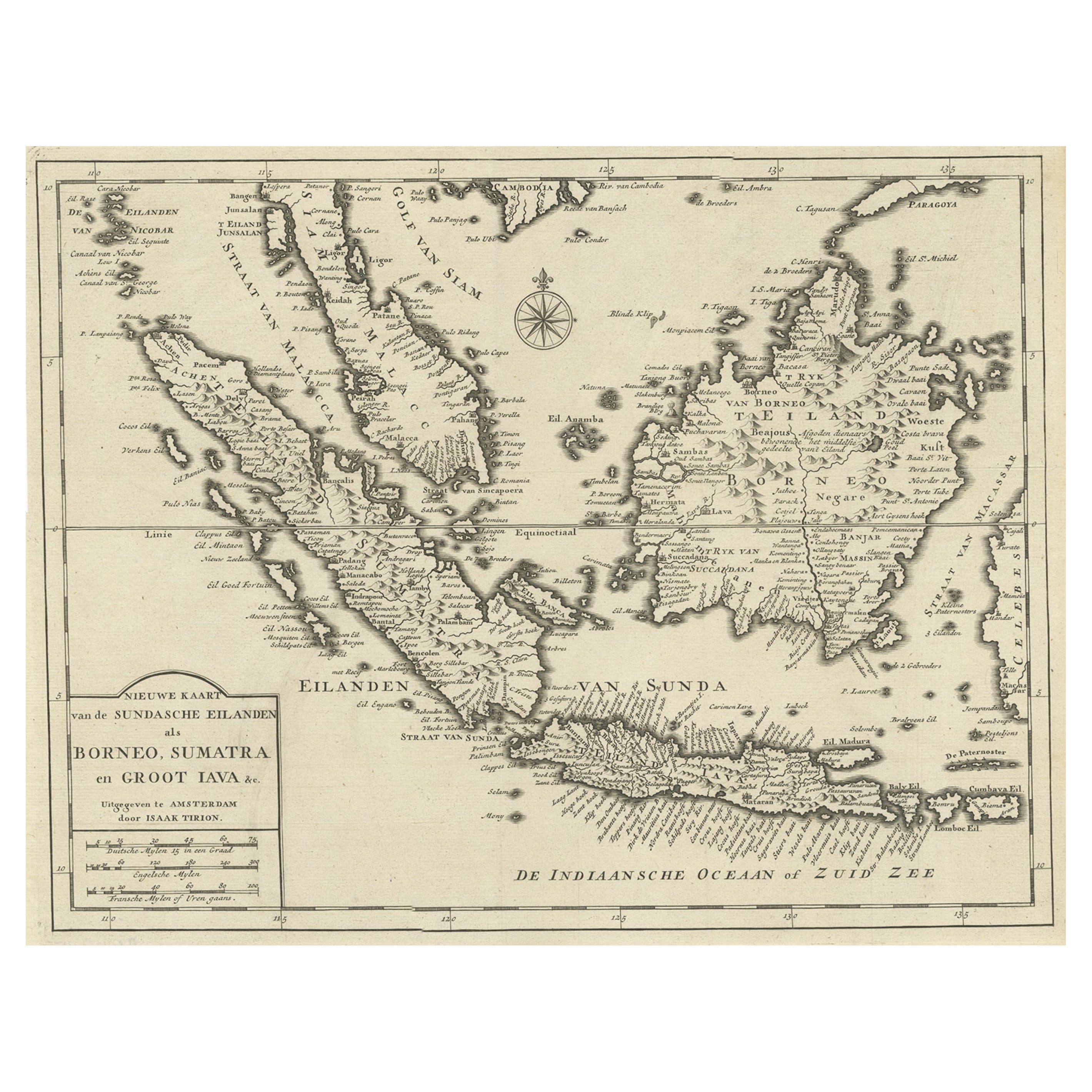
Detailed Map of Southeast Asia From the Tip of Cambodia to Java, 1739
Located in Langweer, NL
Antique map titled 'Nieuwe kaart van de Sundasche Eilanden als Borneo, Sumatra en Groot Iava & c'.
Detailed map of Southeast Asia, extending from the tip of Cambodia to Java. Thi...
Category
Antique 1730s Maps
Materials
Paper
$599 Sale Price
24% Off
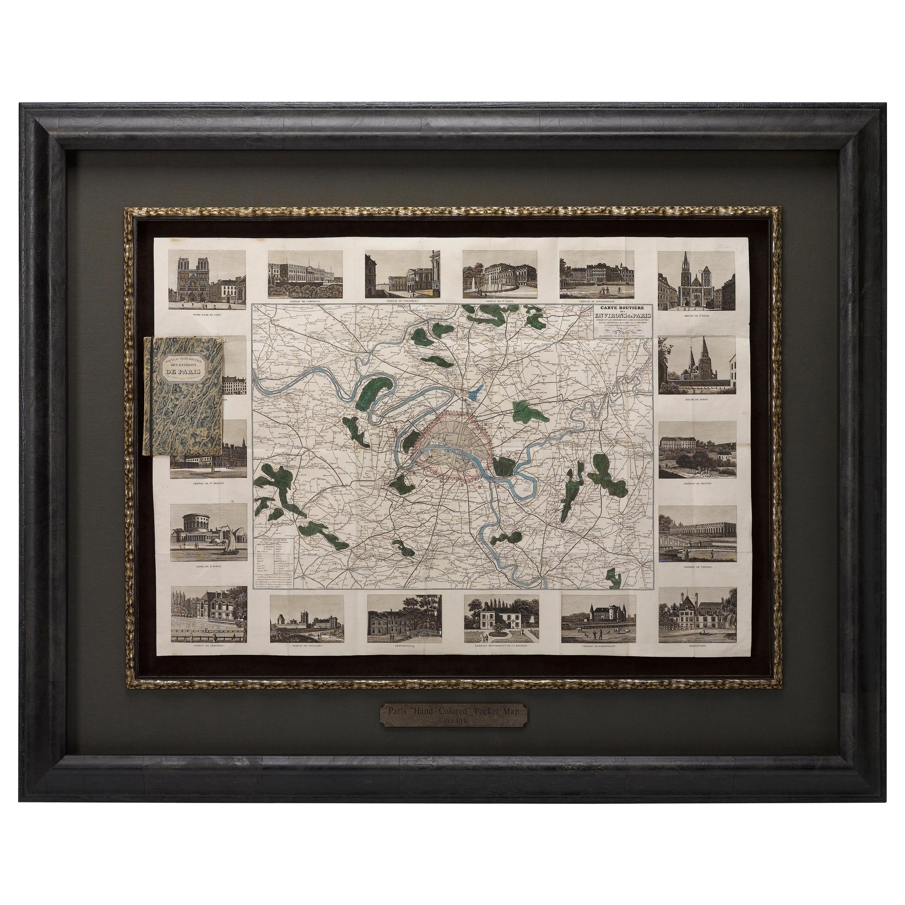
Antique Map of Paris, "Carte Routiere des Environs de Paris" 1841
Located in Colorado Springs, CO
This beautiful hand-colored road map of Paris was published in 1841. The map shows Paris and the surrounding area in a folding pocket map. Organized and detailed for travelers, this ...
Category
Antique 1840s French Maps
Materials
Paper

Antique Map of the Sunda Islands Sumatra, Java, Malay Peninsula & Borneo (1739)
By Isaak Tirion
Located in Langweer, NL
Antique map titled 'Nieuwe kaart van de Sundasche Eilanden als Borneo, Sumatra en Groot Iava & c'. Detailed map of the Sunda Islands, Southeast Asia, extending from the tip of Cambod...
Category
Antique Mid-18th Century Maps
Materials
Paper

$677 Sale Price
21% Off
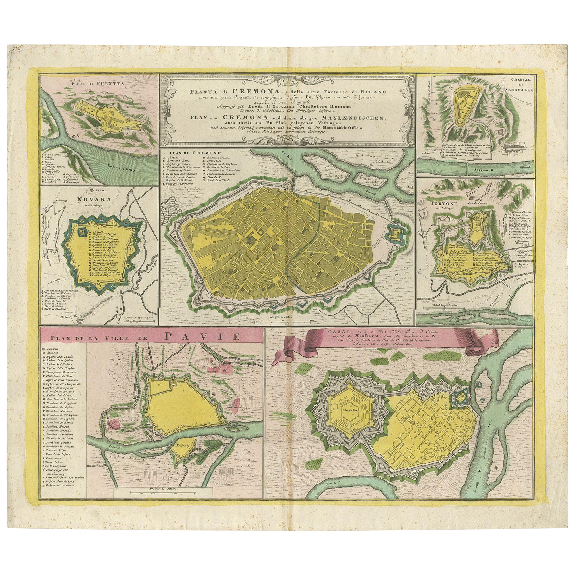
Antique Map with Plans of Cremona, Pavia, Montferrato & Others by Homann, '1734'
Located in Langweer, NL
Antique map titled 'Plan von Cremona und denen übrigen Maylaendischen (..)'. Original antique map showing plans of Cremona, Pavia, Casale Montferrato, Fort de Fuentes, Novara, Serava...
Category
Antique Mid-18th Century Maps
Materials
Paper

$1,128 Sale Price
35% Off