Items Similar to Antique Map of the Siege of Gent by Dumont, 1729
Want more images or videos?
Request additional images or videos from the seller
1 of 5
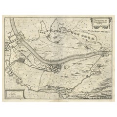
Antique Map of the Siege of Gent by Dumont, 1729
About the Item
Antique map titled 'Plan of the Siege and Attacks of the City and Citadel of Ghent'. Large map depicting the siege of the Belgian city of Gent in 1708 during the war of the Spanish Succession. Originates from 'Military History of Prince Eugene of Savoy, of the Prince and Duke of Marlborough and of the Prince of Nassau-Friesland where we find a detail of the principal actions of the last war and of the battles and sieges commanded by these three Generals'.
Artists and Engravers: Jean Dumont Baron de Carlscroon (1667-1727) was a French publicist.
Condition: Very good, please study image carefully.
Dated: 1729
Overall size: 61 x 54cm.
Picture size: 58.5 x 49cm.
We sell original antique maps to collectors, historians, educators and interior decorators all over the world. Our collection includes a wide range of authentic antique maps from the 16th to the 20th centuries. Buying and collecting antique maps is a tradition that goes back hundreds of years. Antique maps have proved a richly rewarding investment over the past decade, thanks to a growing appreciation of their unique historical appeal. Today the decorative qualities of antique maps are widely recognized by interior designers who appreciate their beauty and design flexibility. Depending on the individual map, presentation, and context, a rare or antique map can be modern, traditional, abstract, figurative, serious or whimsical. We offer a wide range of authentic antique maps for any budget.
- Creator:Dumont (Artist)
- Dimensions:Height: 21.26 in (54 cm)Width: 24.02 in (61 cm)Depth: 0 in (0.01 mm)
- Materials and Techniques:
- Period:
- Date of Manufacture:1729
- Condition:Condition: Very good, please study image carefully.
- Seller Location:Langweer, NL
- Reference Number:
About the Seller
5.0
Platinum Seller
These expertly vetted sellers are 1stDibs' most experienced sellers and are rated highest by our customers.
Established in 2009
1stDibs seller since 2017
1,965 sales on 1stDibs
Typical response time: <1 hour
- ShippingRetrieving quote...Ships From: Langweer, Netherlands
- Return PolicyA return for this item may be initiated within 14 days of delivery.
More From This SellerView All
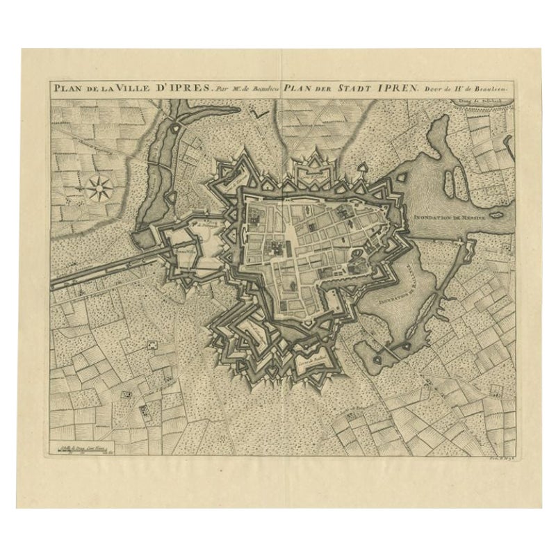
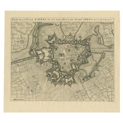
- Antique Map of the City of Ypres by Beaulieu, 1729Located in Langweer, NLAntique map titled 'Plan de la Ville d'Ipren/Plan der Stadt Ipren'. Map of the city of Ieper/Ypres in Belgium. This map originates from 'Histoire Militaire du Prince Eugene de Savoye...Category
Antique 18th Century Maps
MaterialsPaper
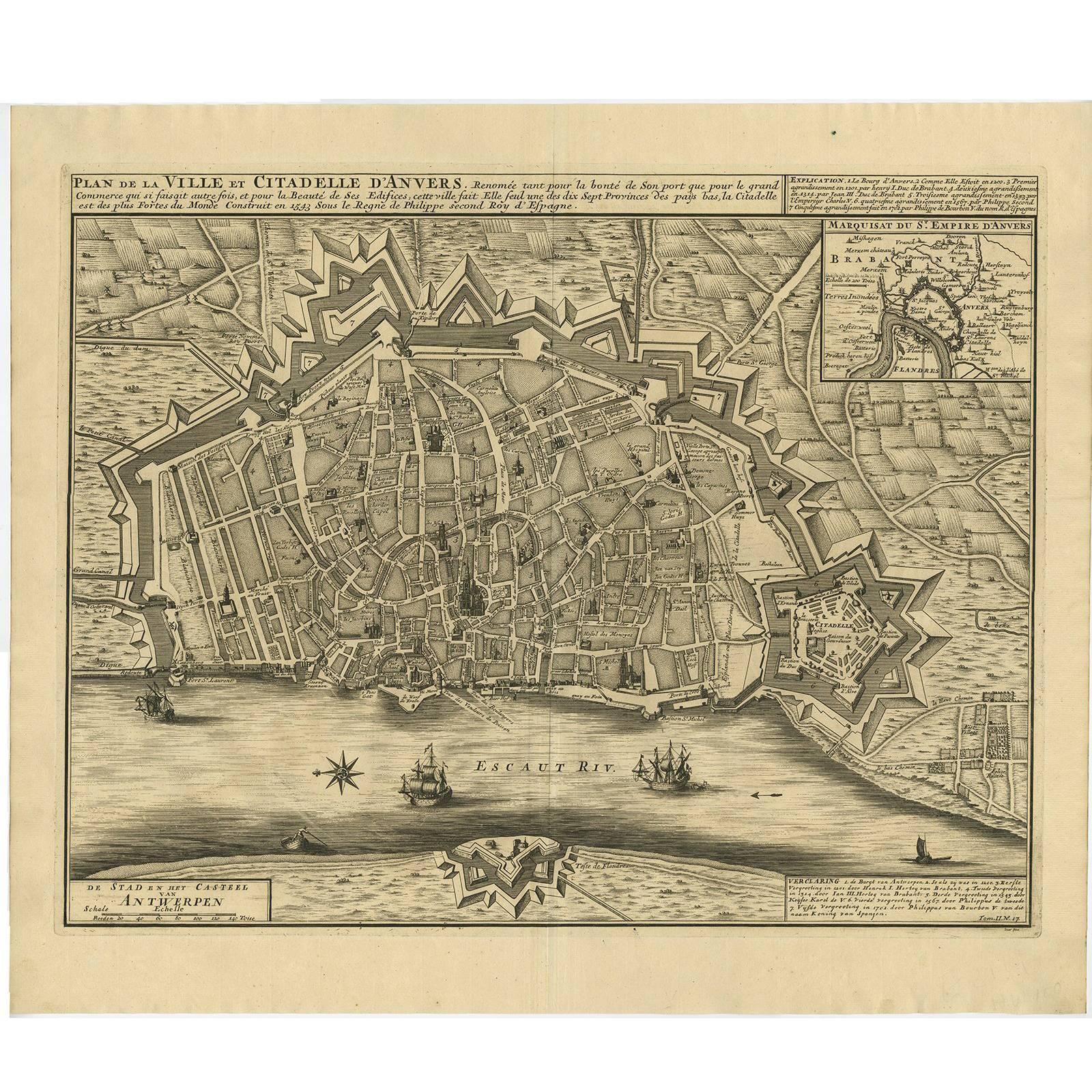
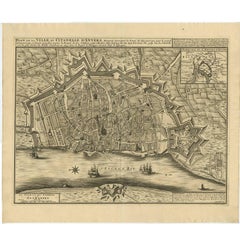
- Antique Map of the City of Antwerpen ‘Belgium’ by A. Deur, 1729Located in Langweer, NLCopper-engraving by A. Deur. Published by I. van der Kloot in Den Haag, 1729. With French and Dutch title-cartouches and explanatory notes, several ships o...Category
Antique Early 18th Century Maps
MaterialsPaper
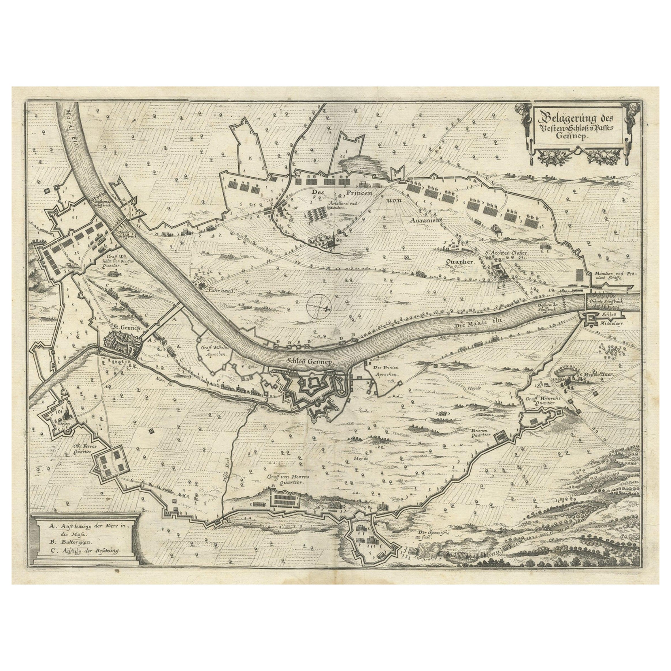
- Antique Map of The Siege of Gennep, the Netherlands, c.1650Located in Langweer, NLAntique map titled 'Belagerung des Besten Schloss und Passes Gennep'. Old map of the Siege of Gennep, the Netherlands. This map originates from 'Theatrum Europaeum' by M. Merian. Art...Category
Antique 17th Century Maps
MaterialsPaper
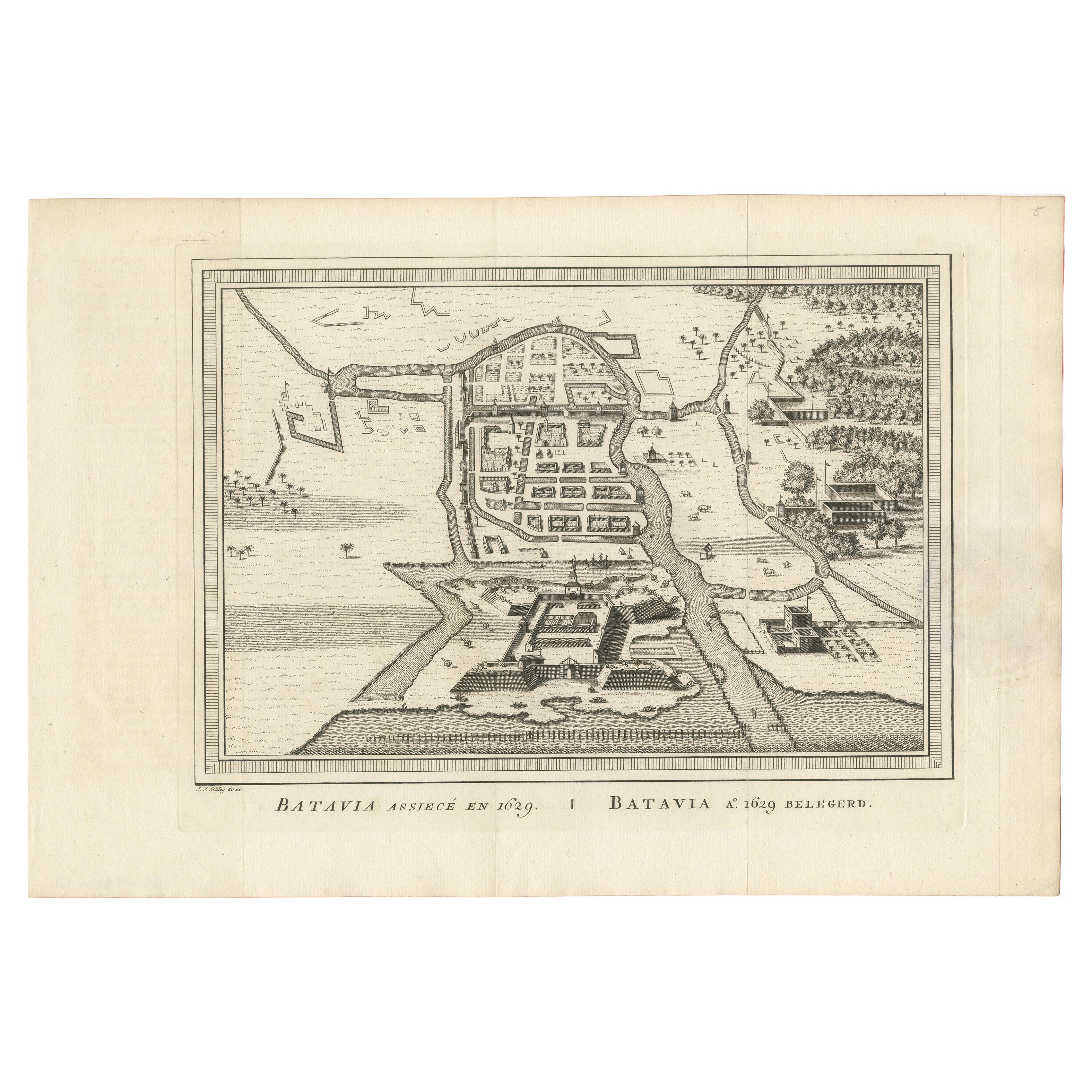
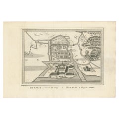
- Antique Map of the Siege of Batavia by Van Schley 'c.1750'Located in Langweer, NLAntique map titled 'Batavia assiecé en 1629 - Batavia 1629 belegerd'. Bird's eye view map of the siege of Batavia in 1629, Jakarta, Indonesia. This print originates from the Dutch ed...Category
Antique Mid-18th Century Prints
MaterialsPaper
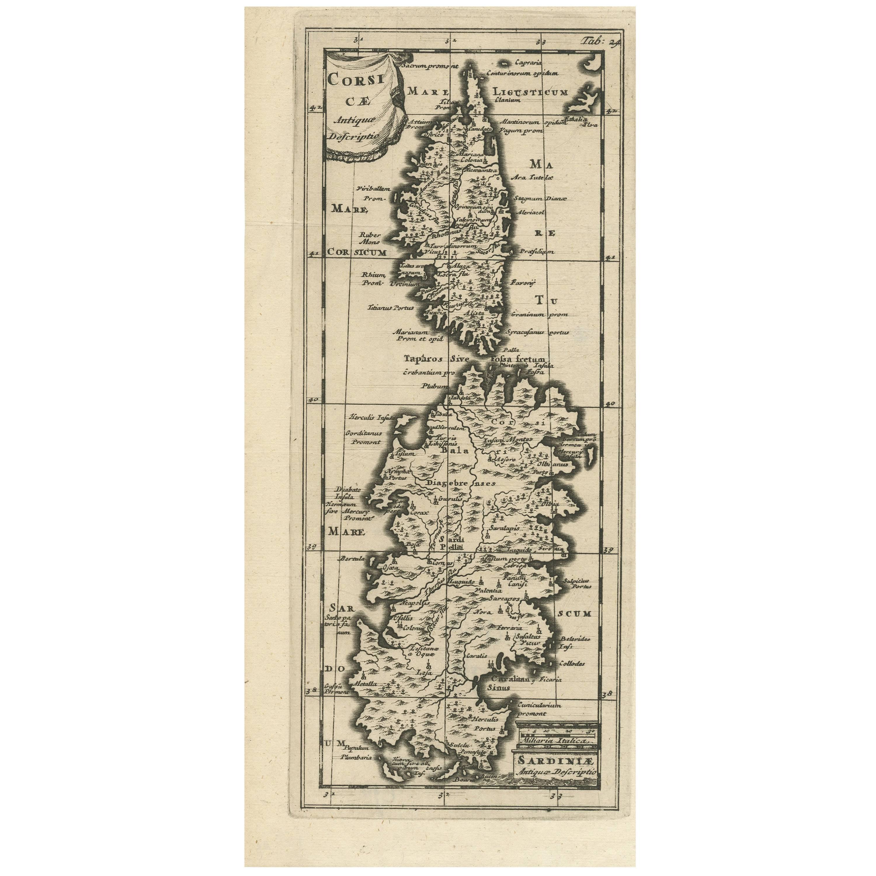
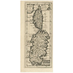
- Antique Map of Corsica and Sardini, 1729Located in Langweer, NLDetailed map of the Islands of Corsica and Sardinia, showing towns, rivers, lakes, mountains, bays, and other features. Cluver's Geography was one of the most enduring works of the ...Category
Antique Early 18th Century Maps
MaterialsPaper
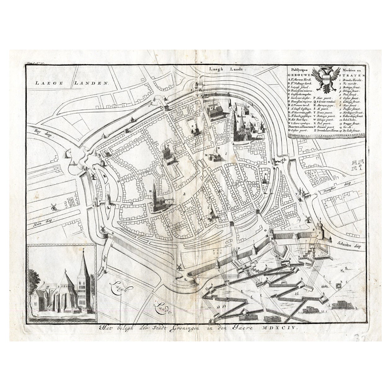
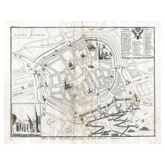
- Antique Map of the Siege of Groningen by Le Clerc, 1730Located in Langweer, NLPlate : 'Het Belegh der Stadt Groningen in den Jaere MDXCIV '. (The siege of Groningen in the year 1594.) This plate shows the fortified city of Groningen, The Netherlands. With legend. This attractive original old antique print / plate was published in several works by Hugo de Groot ('Nederlandtsche Jaerboeken' published in 1681.), P.C. Hooft ('Nederlandsche Historien ...', published 1703-1704.), P.C. Bor ('Oorsprongk, begin, en vervolgh der Nederlandsche oorlogen', published in 1680.)or Jean Le Clerc...Category
Antique 18th Century Maps
MaterialsPaper
You May Also Like
- 1861 Topographical Map of the District of Columbia, by Boschke, Antique MapLocated in Colorado Springs, COPresented is an original map of Albert Boschke's extremely sought-after "Topographical Map of the District of Columbia Surveyed in the Years 1856 ...Category
Antique 1860s American Historical Memorabilia
MaterialsPaper
- Original Antique Map of The World by Thomas Clerk, 1817Located in St Annes, LancashireGreat map of The Eastern and Western Hemispheres On 2 sheets Copper-plate engraving Drawn and engraved by Thomas Clerk, Edinburgh. Published by Mackenzie And Dent, 1817 ...Category
Antique 1810s English Maps
MaterialsPaper
- Ordeal of the Hermitage, The Siege of Leningrad 1941-1944, First EditionBy Boris Rest, Sergei VarshavskyLocated in valatie, NYThe Ordeal of the Hermitage, The Siege of Leningrad 1941-1944. Leningrad: Aurora Art Publishers, 1985. First edition hardcover with dust jacket. 302 pp. A beautifully photographed bo...Category
20th Century Russian Books
MaterialsPaper
- 1907 Map of Colorado, Antique Topographical Map, by Louis NellLocated in Colorado Springs, COThis highly detailed pocket map is a topographical map of the state of Colorado by Louis Nell from 1907. The map "has been complied from all availabl...Category
Antique Early 1900s American Maps
MaterialsPaper
- Original Antique Map of The Netherlands, Engraved by Barlow, Dated 1807Located in St Annes, LancashireGreat map of Netherlands Copper-plate engraving by Barlow Published by Brightly & Kinnersly, Bungay, Suffolk. Dated 1807 Unframed.Category
Antique Early 1800s English Maps
MaterialsPaper
- Original Antique Map of the American State of Pennsylvania, 1889Located in St Annes, LancashireGreat map of Pennsylvania Drawn and Engraved by W. & A.K. Johnston Published By A & C Black, Edinburgh. Original colour Unframed. Repair to a minor tear on bottom edge.Category
Antique 1880s Scottish Victorian Maps
MaterialsPaper


Recently Viewed
View AllMore Ways To Browse
Siege Antique
Antique Furniture Marlborough
The Citadel
Antique Gent
Antique Furniture Nassau
Prince Eugene
Duke Of Marlborough
Chart Cabinet
Antique Surveying Level
J C Walker Map
Map Of Ancient Greece
Antique Mississippi Furniture
Filipino Map
Map Of Eastern Europe
Map Of Norway
Map Of Roman Empire
Map Of Virginia
Roman Empire Map