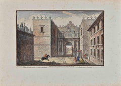
Items Similar to Map of San Georgi - Etching by G. Braun/F. Hogenberg - 1575


Want more images or videos?
Request additional images or videos from the seller
1 of 2
Georg Braun and Franz HogenbergMap of San Georgi - Etching by G. Braun/F. Hogenberg - 15751575
1575
About the Item
Etching by Georg Braun and Frans Hogenberg, realized in 1575 and belonging to the Suite "Civitates Orbis Terrarum".
The first volume of the Civitates Orbis Terrarum was published in Cologne in 1572. The sixth and the final volume appeared in 1617.
This great city atlas, edited by Georg Braun and largely engraved by Franz Hogenberg, eventually contained 546 prospects, bird-eye views and map views of cities from all over the world. Braun (1541-1622), a cleric of Cologne, was the principal editor of the work, and was greatly assisted in his project by the close, and continued interest of Abraham Ortelius, whose Theatrum Orbis Terrarum of 1570 was, as a systematic and comprehensive collection of maps of uniform style, the first true atlas.
The Civitates, indeed, was intended as a companion for the Theatrum, as indicated by the similarity in the titles and by contemporary references regarding the complementary nature of two works. Nevertheless, the Civitates was designs to be more popular in approach, no doubt because the novelty of a collection of city plans and views represented a more hazardous commercial undertaking than a world atlas, for which there had been a number of successful precedents. Franz Hogenberg (1535-1590) was the son of a Munich engraves who settled in Malines. He engraved most of the plates for Ortelius's Theatrum and the majority of those in the Civitates, and may have been responsible for originating the project.
Over a hundred of different artists and cartographers, the most significant of whom was Antwerp artist Georg (Joris) Hoefnagel (1542-1600), engraved the cooper-plates of the Civitates from drawings. He not only contributed most of the original material for the Spanish and Italian towns but also reworked and modified those of other contributors. After Hoefnagel's death his son Jakob continued the work for the Civitates. A large number of Jacob van Deventer (1505-1575), also known as Jacob Roelofszof, unpublished works, plans of towns of the Netherlands were copied, as were Stumpf's woodcuts from the Schweizer Chronik of 1548, and Munster's German views from the 1550 and 1572 editions of his Cosmographia. Another important source for maps was the Danish cartographer Heinrich van Rantzau (1526-1599), beter known under his Latin name Rantzovius, who provided maps of Northern Europe, specially of Danish cities. The Civitates provided a uniquely comprehensive view of urban life at the turn of the sixteenth century. Other sources were the maps of Sebastian Munster from around 1550 and , and of.
Braun added to the maps figures in local dress. This feature was anticipated in Hans Lautensack's etched view of Nuremberg, 1552, those groups of citizens in the rural foreground add further authenticity to the highly accurate topographical details of what was effectively Germany's cultural capital at that time. Braun's motives for adding figures to the views, however, went further: as stated in his introduction to book 1, he believed, perhaps optimistically, that his plans would not in consequence be scrutinized for military secrets by the Turks, as their religion forbade them from looking on representations of the human form.
The plans, each accompanies by Braun's printed account of the town's history, situation and commerce, form an armchair traveler's compendium, which the scholar Robert Burton in The Anatomy of Melancholy of 1621 asserted would not only provide instructions but would uplift the spirit as well.
- Creator:Georg Braun and Franz Hogenberg
- Creation Year:1575
- Dimensions:Height: 5.52 in (14 cm)Width: 6.3 in (16 cm)Depth: 0.04 in (1 mm)
- Medium:
- Movement & Style:
- Period:
- Framing:Framing Options Available
- Condition:Insurance may be requested by customers as additional service, contact us for more information.
- Gallery Location:Roma, IT
- Reference Number:
About the Seller
4.9
Platinum Seller
These expertly vetted sellers are 1stDibs' most experienced sellers and are rated highest by our customers.
1stDibs seller since 2017
6,753 sales on 1stDibs
Typical response time: 2 hours
- ShippingRetrieving quote...Ships From: Grasse, France
- Return PolicyA return for this item may be initiated within 14 days of delivery.
More From This SellerView All
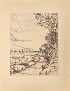
- The River By Meadow - Original Etching by Amadée Feau - 1921Located in Roma, ITThe River By Meadow is an original etching artwork on creamy-colored paper realized by French artist Amadée Feau (1872-1952) in 1921. Signed on the plate on the lower right and date...Category
1920s Modern Landscape Prints
MaterialsEtching
- Landscape with Trees - Original Etching by George-Henri Tribout - 1930sBy Georges-Henri TriboutLocated in Roma, ITLandscape with Trees is an original etching on paper artwork realized by Georges Henri Tribout. Good Conditions. Georges Henri Tribout (1884-19...Category
1930s Modern Landscape Prints
MaterialsEtching
- The River By Meadow - Original Etching by Amadée Feau - 1921Located in Roma, ITThe River By Meadow is an original etching artwork on creamy-colored paper realized by French artist Amadée Feau (1872-1952) in 1921. Signed on the plate on the lower right and date...Category
1920s Modern Landscape Prints
MaterialsEtching
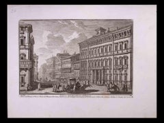
- Palazzo dell'Accademia di Francia - Etching by G. Vasi - Late 18th Gordon LesterBy Giuseppe VasiLocated in Roma, ITPalazzo dell'Accademia di Francia is an original black and white etching of the Late 18th century realized by Giuseppe Vasi. Signed and titled on plate lower margin. Good conditio...Category
Late 18th Century Modern Figurative Prints
MaterialsEtching
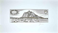
- Radicofani - Original Etching by Bettino Craxi - 1980sBy Bettino CraxiLocated in Roma, ITRadicofani is an original contemporary artwork realized by Bettino Craxi in the first years of the 1980s. Original Etching. Very Good conditions. Beautiful etching depicting th...Category
1980s Modern Landscape Prints
MaterialsEtching
- Porta del Popolo - Etching by Giuseppe Vasi - 18th centuryBy Giuseppe VasiLocated in Roma, ITPorta del Popolo is an original etching of the Late 18th century realized by Giuseppe Vasi. Signed and titled on plate lower margin. Good conditions and aged margins with some fox...Category
18th Century Modern Figurative Prints
MaterialsEtching
You May Also Like
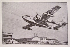
- Kent Hagerman, (US Air Force Fairchild C-119, the 'Flying Boxcar')By Kent HagermanLocated in New York, NYWhile this is probably a military airport, Kent Hagerman still shows it at its futuristic best. Hagerman was an amazing draftsman who managed to get fantastic detail into his work. This is really a portrait of a plane -- the Fairchild C-119. The words 'United States Air Force' on the side of the plane date it to 1947 or later, after the Air Force split from the Army. The design featured the 'twin boom' clearly showing in this etching. Thanks to this feature it was called the Flying Boxcar. About 1100 were built and used until 1955. It was also used by the Chinese Air...Category
Mid-20th Century American Modern Figurative Prints
MaterialsEtching
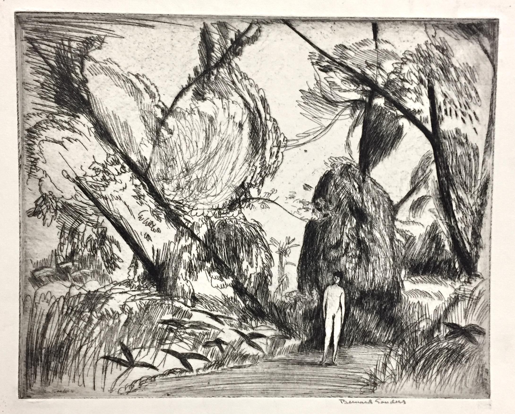
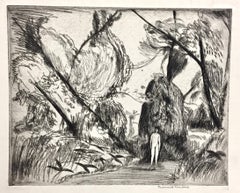
- Bernard Sanders, Boy in the woodsLocated in New York, NYThere's so often a mysterious or evocative atmosphere that permeates Sander's work. Signed in pencil; titled in lower margin in pencil.Category
Early 20th Century American Modern Landscape Prints
MaterialsEtching
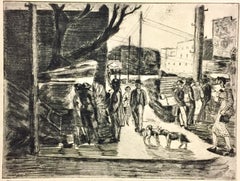
- Irving Guyer, Christmas Trees on Second Street (NYC)By Irving GuyerLocated in New York, NYPhiladelphia-born Irving Guyer attended the Art Students League and worked in New York City before moving to California. This print is signed and titled i...Category
1930s American Modern Figurative Prints
MaterialsEtching, Drypoint
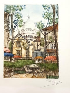
- Dufza - Paris - Montmartre - Original Handsigned EtchingLocated in Collonge Bellerive, Geneve, CHDufza - Paris - Montmartre - Original Handsigned Etching Circa 1940 Handsigned in pencil Dimensions: 20 x 25 cmCategory
1940s Modern Landscape Prints
MaterialsEtching
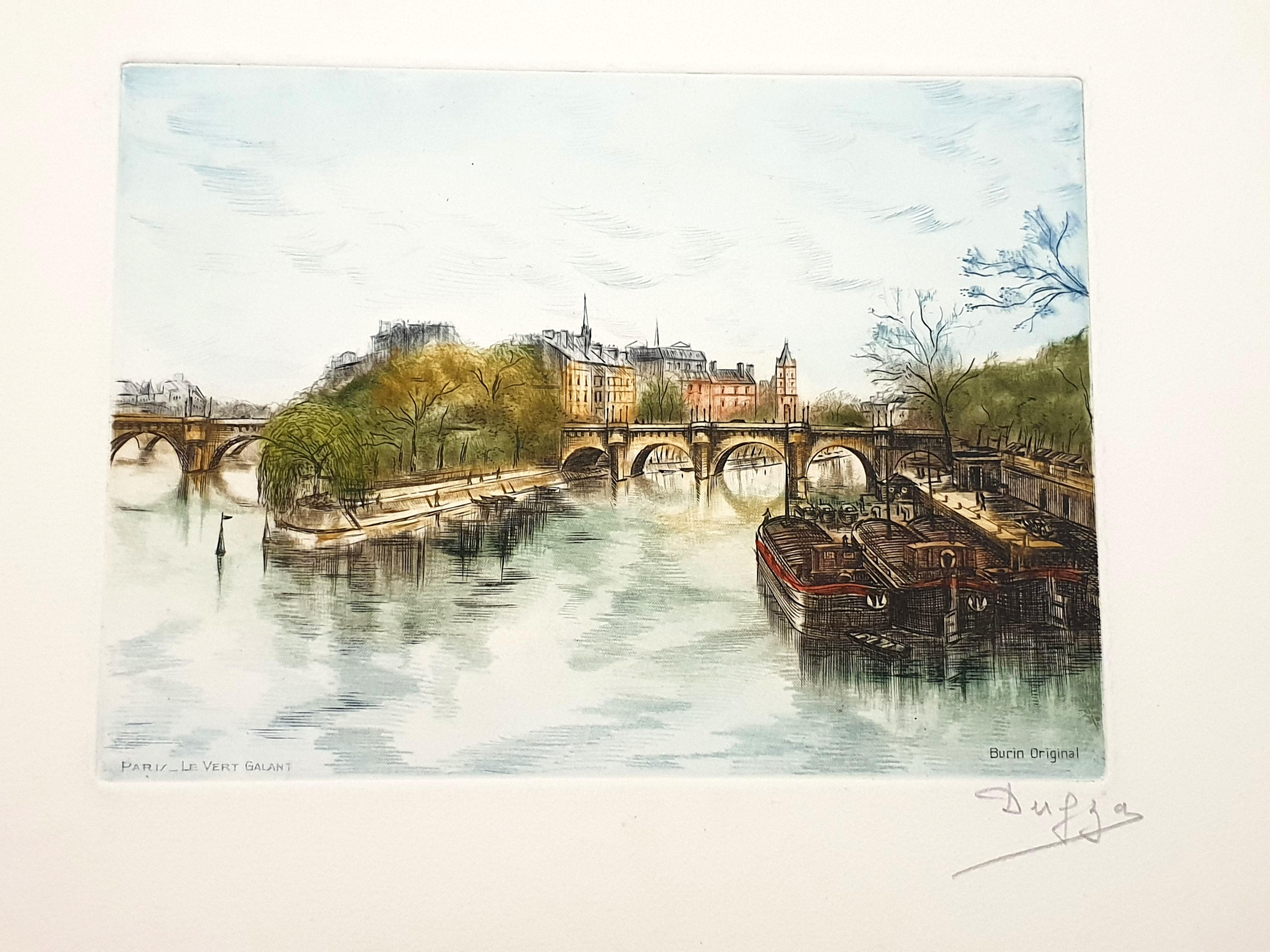
- Dufza - Paris - Le Vert Galant - Original Handsigned EtchingLocated in Collonge Bellerive, Geneve, CHDufza - Paris - Le Vert Galant - Original Handsigned Etching Circa 1940 Handsigned in pencil Dimensions: 20 x 25 cmCategory
1940s Modern Landscape Prints
MaterialsEtching
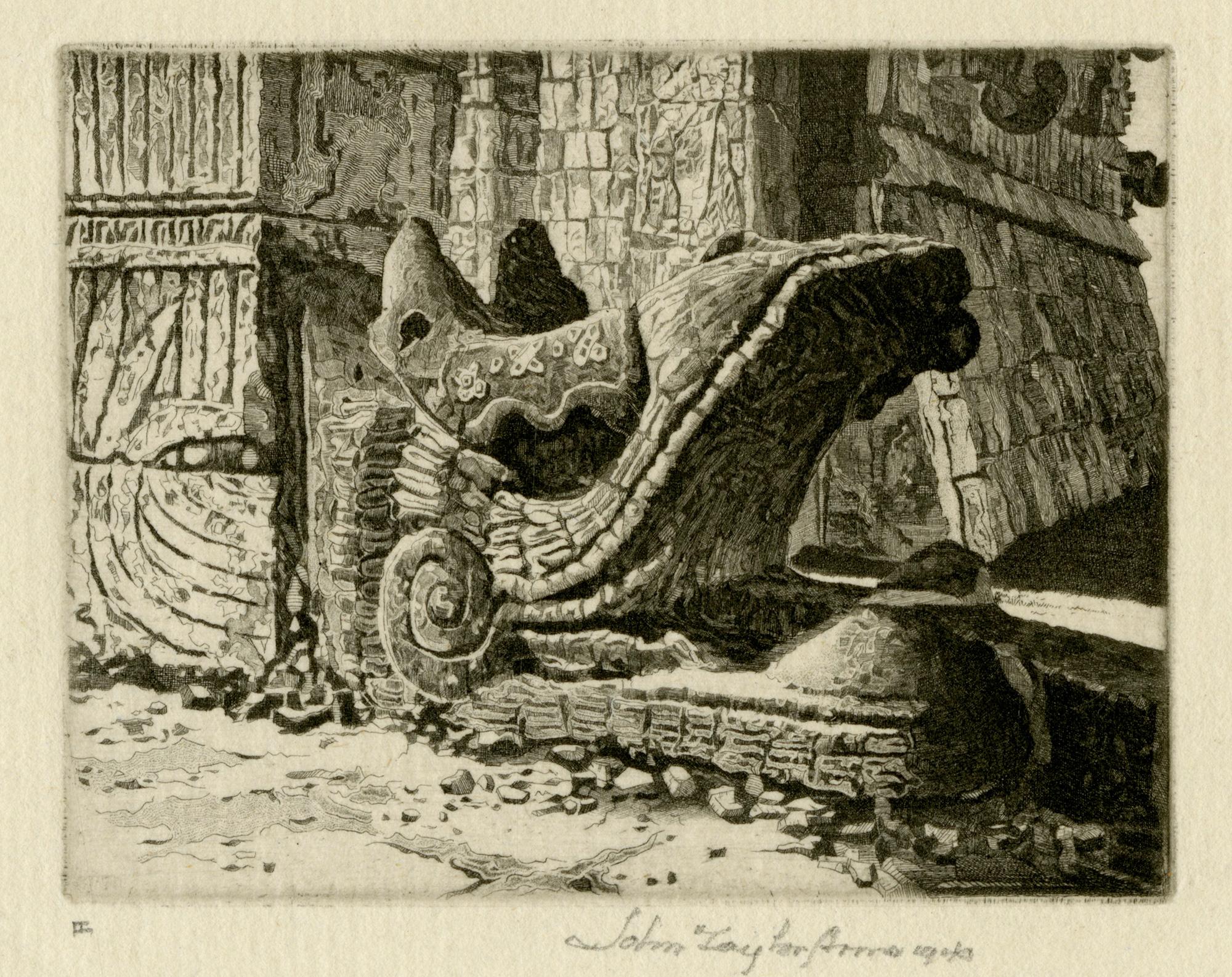
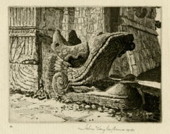
- Plumed Serpent, Chichén ItzáBy John Taylor ArmsLocated in Middletown, NYA masterful rendering of Kukulkan at the base of the west face of the northern stairway of El Castillo, Chichen Itza. Eching on antique cream laid paper with a partial herladic wate...Category
Mid-20th Century American Modern Landscape Prints
MaterialsLaid Paper, Handmade Paper, Etching

Recently Viewed
View AllMore Ways To Browse
Danish Antique Armchairs
Shield Pins
Man In Blue Picasso
Il Vecchio
Wooden Key Keep
Flower Wood Cut Print
Japanese Song Painting
Pow Art
Vintage Art Picasso Poster
Fragrance Of Park City
Huge Pencil Drawing
Printmakers Desk
Japanese Sea Glass
Kananginak Inuit Art
Green Man Clock
Argentina Paper Money
Robe De Bal
Hiroshima My Love