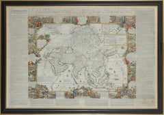
Important giant Map of Asia, for the King of France, 1696
View Similar Items


Want more images or videos?
Request additional images or videos from the seller
1 of 4
Nicolas de FerImportant giant Map of Asia, for the King of France, 16961698
1698
About the Item
- Creator:Nicolas de Fer (1646 - 1720, French)
- Creation Year:1698
- Dimensions:Height: 43.12 in (109.5 cm)Width: 64.18 in (163 cm)
- Medium:
- Movement & Style:
- Period:Late 17th Century
- Framing:Frame IncludedFraming Options Available
- Condition:
- Gallery Location:Amsterdam, NL
- Reference Number:1stDibs: LU147128029142
About the Seller
No Reviews Yet
Vetted Seller
These experienced sellers undergo a comprehensive evaluation by our team of in-house experts.
1stDibs seller since 2021
Typical response time: 9 hours
More From This SellerView All
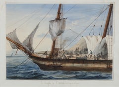
- Portrait of a Slave Ship: 'Le Negrito à l’ancre. Dans le port de la havanne'Located in Amsterdam, NLFRANÇOIS MATHURIN ADALBERT, BARON DE COURCY (1805-1839) 'Le Negrito à l’ancre. Dans le port de la havanne' Indistinctly signed lower left Titled on the mount Pencil and watercolour, heightened with white, on paper, 24.8 x 34.6 cm Literature: The present watercolour will be illustrated in: - Prof. Manuel Garcia’s projected book on the disease and the slave trade provisionally titled “Fighting the Yellow Demon of Fever: The Struggle against Disease in the Illegal Slave Trade”. - Prof. Micael Zeuske’s forthcoming Global history of slave trade. Exhibited: Mexico City, 1998, Palacio Virreinal, El Barón de Courcy, illustrationes de un viaje, 1831-1833, no. 108 Note: Baron de Courcy was in the Caribbean in late 1832 and early 1833, following his tour of Mexico in 1832, on the last leg of his “Grand Voyage...Category
Mid-19th Century Old Masters Figurative Drawings and Watercolors
MaterialsWatercolor, Paper, Gouache, Pencil
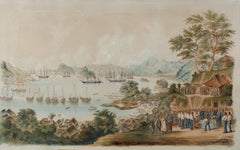
- 1854 Funeral of R. Williams at Gyokusen-ji Temple, Shimoda, with Commodore PerryLocated in Amsterdam, NLWilhelm Heine (Dresden 30 January 1827-Löbnitz 5 October 1885) ‘Funeral of Robert Williams in the cemetery of the Temple Gyokusen-ji at Shimoda in April 1854’ With a sticker on the reverse of the frame by Coupil & Co. 1855 Watercolour on paper, H. 57 x W. 92 cm Depicted is the Bay of Shimoda with seven American ships including the two paddle-wheel warships USS Mississippi and Susquehanna. On the Gyokus- en-ji temple grounds on the right is the coffin in the middle with the remains of US marine Robert Williams, ready to be lowered into the grave. Looking on from the left are the Buddhist monks and Japanese officials who joined the first Christian funeral on Japanese soil. Around the grave are US marines, Commodore Perry...Category
Mid-19th Century Figurative Drawings and Watercolors
MaterialsPaper, Ink, Watercolor, Gouache
 Price Upon RequestFree Shipping
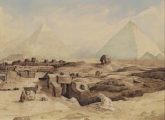
 - Devotion in the Dessert near the pyramids of Gizeh, circa 1919By Marius BauerLocated in Amsterdam, NLMarius Bauer (1867-1932) ‘Devotie in de Woestijn’ (Devotion in the Dessert near the pyramids of Gizeh, circa 1919) Signed lower right and titled lower left Watercolour on paper, H...Category
Early 20th Century Impressionist Landscape Drawings and Watercolors
MaterialsPaper, Pencil, Watercolor, Ink
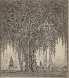
- Entrance to the temple at Klungkung, Bali, 1925Located in Amsterdam, NLEntrance to the temple at Klungkung, Bali, 1925 With studio seal at the reverse, dated and described, bottom left Black chalk on paper, 53 x 46.5 cm In ebonized frame with white mount Willem Otto Wijnand Nieuwenkamp (1874-1950) Nieuwenkamp was born on July 27th 1874 in Amsterdam. His father owned sailing ships sailing to Indonesia and hearing the stories of the returning captains evoked in the young Nieuwenkamp an obsession for distant lands and adventure. After a failed attempt by his father to have his son make a career in his business, Nieuwenkamp attended the Academy for Decorative Art in Amsterdam. However, he left within one year to go his own way. He was an autodidact and a great experimenter with new techniques, particularly in the art of etching. Nieuwenkamp was a very focused man with the discipline of a scientist tempered by the sensitivity of an artist, a lust for adventure, a natural appreciation for ethnic arts and an enormous ambition to tread new paths. In 1898 he visited Indonesia for the first time and on his second visit in 1903-1904 he went on to Bali and became the first foreign artist to love Bali and the Balinese with a passion. Having secured agreements with several museums in the Netherlands to obtain Balinese art...Category
1920s Art Nouveau Landscape Drawings and Watercolors
MaterialsPaper, Chalk
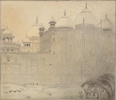
- Part of the ring-wall of the Taj Mahal, Agra, India, 1914Located in Amsterdam, NLPart of the ring-wall of the Taj Mahal, Agra, India, 1914 Signed with initials and dated bottom right Black chalk on paper, 45.5 x 53 cm Literature: Ernst Braches en J.F. Heijbro...Category
1910s Art Nouveau Landscape Drawings and Watercolors
MaterialsChalk, Paper
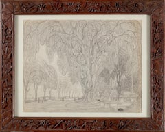
- Weltevreden, Kebon Sirih, & Vlucht voor de bui (Fleeing the rain)Located in Amsterdam, NLWeltevreden, Kebon Sirih, & Vlucht voor de bui (Fleeing the rain) Executed between February 20 and March 2, 1918 Double sided drawing in graphite pencil on paper Images: c. 33 x 5...Category
1910s Art Nouveau Landscape Drawings and Watercolors
MaterialsGraphite, Paper
You May Also Like
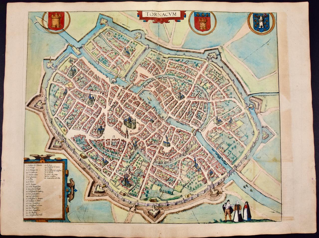
- Cartusia Bruxellensis Monastery in Brussels: A 17th C. Hand-colored EngravingBy Lucas Vorsterman the YoungerLocated in Alamo, CAThis is a 17th century hand-colored copperplate engraving entitled "Cartusia Bruxellensis" by Lucas Vorsterman, the Younger, after a drawing by Jacob van Werden or Jacques van Weerden, published in 1659 in Antonius Sanderus' book 'Chorographia sacra Brabantiae sive celebrium aliquot in ea provincia ecclesiarum et coenobiorum descriptio . . . Brussel' (A sacred chorography of Brabant, or a description of several famous churches and convents in that province). It also appeared in other publications by Sanderus. In the 17th century, Brussels was within the Duchy of Brabant. This engraving depicts a bird's-eye view of the Scheut Carthusian Monastery in Brussels. Scheut is a district of Anderlecht, a municipality of Brussels, Belgium. The monastery housed monks, who took a vow of silence, in 20 rooms. There is a central courtyard with trees and shrubs. Monks are depicted strolling along its pathways. The cells for the friars are in the middle the cloister. There are people along the streets in the foreground and to the right of the large, imposing monastery. Some are on horseback, others are walking. In the lower right, what appears to be a dog pulls a small cart containing barrels, possibly of beer or wine. Districts and neighborhoods are labelled in the background, including Scheut, Anderlecht and Ransfort. A very ornate cartouche in the lower left contains Latin and the artist's attribution. Another decorative cartouche in the upper central area contains the title. This beautifully hand-colored and detailed engraving is printed on laid, chain-linked paper with wide, full margins. The sheet measures 17.25" high and 21.25" wide. It has Latin text on the verso. It has a central vertical fold, as issued, which is reinforced on the verso. Two small spots in the lower margin may actually represent drops of watercolor paint used to color the engraving. It is otherwise in very good condition. Antonius Sanderus (1586-1664) was a Flemish Catholic cleric and historian. He was born "Antoon Sanders", but Latinized his name like many writers and scholars of his time. He was the author of several books, including 'Chorographia Sacra Brabantiae', which was illustrated with this engraving. Lucas Vorsterman the Younger (1624-between 1666 & 1676) was a Flemish Baroque engraver and draughtsman. He produced engravings after the work of contemporary painters and for books by Antwerp publishers. Jacob van Werden or Jacques van Weerden (active 1643-1669), was a Flemish draughtsman, cartographer, military engineer and archer who was active in the Habsburg Netherlands. His drawings were used as designs for prints executed by various printmakers. He worked on maps, topographical views, historical scenes, portraits and book illustrations. He had a career as a military engineer and a member of the guard of the Spanish King. He advised on various military engineering projects and was an engineer of the Spanish army...Category
Mid-17th Century Old Masters Landscape Prints
MaterialsEngraving
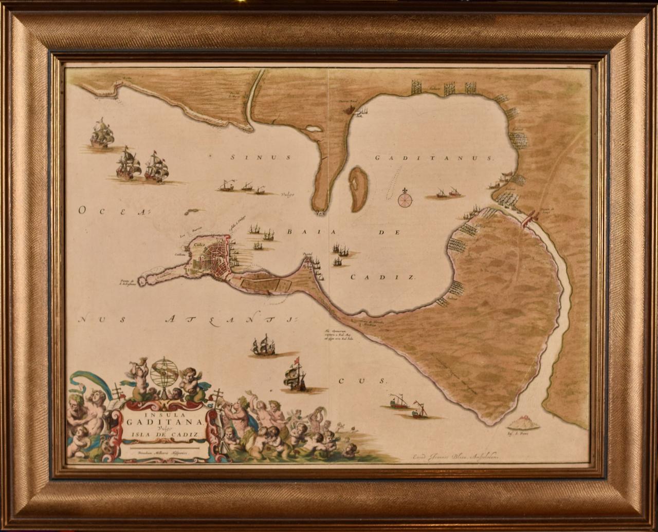
- L'Isle de France: A Hand-colored 17th Century Map by De WitBy Frederick de WitLocated in Alamo, CAThis colorful and detailed 17th century hand-colored copperplate map by Frederick De Wit was published in Amsterdam between 1666 and 1760. The map depicts the Île-de-France, which is one of the ancient provinces of France. Paris is located in the center of the map, with Versailles to the southwest The map extends from Rouen in the west to Reims in the east. The area around Paris, the Véxin Français, was the original domain of the king of France. Other areas were ruled by French feudal lords. For example, the Véxin Normand area was the domain of the Duke of Normandy...Category
Early 18th Century Old Masters More Prints
MaterialsEngraving
- View of Emden, Germany: A 16th Century Hand-colored Map by Braun & HogenbergBy Franz HogenbergLocated in Alamo, CAThis is a 16th century original hand-colored copperplate engraved map of a bird's-eye View of Embden, Germany entitled " Emuda, vulgo Embden vrbs Frisia orientalis primaria" by Georg Braun & Franz Hogenberg, in volume II of their famous city atlas "Civitates Orbis Terrarum", published in Cologne, Germany in 1575. This is a beautifully colored and detailed map of Emden, a seaport in northwestern Germany, along the Ems River and perhaps portions of over Dollart Bay, near the border with the Netherland. The map depicts a bird's-eye view of the city from the southwest, as well as a view of the harbor and an extensive system of canals. Numerous ships of various sizes, as well as two rowboats containing numerous occupants are seen in the main waterway in the foreground and additional boats line two canals in the center of the city. Two men and two women are shown on a hill in the foreground on the right, dressed in the 16th century style of nobility. Two ornate crests are included in each corner. A title strap-work cartouche is in the upper center with the title in Latin. The crest on the right including Engelke up de Muer (The Little Angel on the Wall) was granted by Emperor Maximilian I in 1495. This is an English translation of an excerpt of Braun's description of Embden: "In Emden, the capital of East Frisia, rich merchants live in very fine houses. The city has a broad and well-situated harbour, which in my opinion is unique in Holland. Frisia and the whole of the Netherlands, for the ships can anchor here right under the city walls. They have also extended the harbour as far as the New Town, so that up to 400 ships can now find shelter here when the sea is rough." The emphasis on the harbor and waterways within the city highlights the importance of Emden's place as a seaport at this time. Embden developed from a Dutch/Flemish trading settlement in the 7th-8th centuries into a city as late as late 14th century. In 1494 it was granted staple rights, and in 1536 the harbour was extended. In the mid-16th century Emden's port was thought to have the most ships in Europe. Its population then was about 5,000, rising to 15,000 by the end of the 16th century. The Ems River flowed directly under the city walls, but its course was changed in the 17th century by the construction of a canal. Emden has canals within its city limits, a typical feature of Dutch towns, which also enabled the extension of the harbor. In 1744 Emden was annexed by Prussia and is now part of Germany. It was captured by French forces in 1757 during the Seven Years' War, but recaptured by Anglo-German forces in 1758. During the Napoleonic French era, Emden and the surrounding lands of East Frisia were part of the short-lived Kingdom of Holland. References:Van der Krogt 4, 1230, State 2; Taschen, Braun and Hogenberg...Category
16th Century Old Masters Landscape Prints
MaterialsEngraving
- Ireland: A Framed 17th Century Hand-colored Map by Jan JannsonBy Johannes JanssoniusLocated in Alamo, CAThis is a 17th century hand-colored map entitled "Hibernia Regnum Vulgo Ireland" by Johannes Janssonius's (Jan Jansson), published in Amsterdam in 1640. This highly detailed map depicts the Emerald Isle with an extensive display of towns, roads, mountains, rivers, lakes and county borders, etc. It includes two decorative cartouches on the left. The title cartouche includes the Irish harp and the second, in the upper left, includes a lion wearing a crown on the left, a unicorn on the right and a coat-of-arms in the middle, which includes another Irish harp. A distance scale is seen in the lower right, augmented with two putti. The map is embellished with three sailing ships and a sea monster. Western portions of Scotland and England...Category
Mid-17th Century Old Masters Landscape Prints
MaterialsEngraving
- View of Seravalle, Italy: A 16th Century Hand-colored Map by Braun & HogenbergBy Franz HogenbergLocated in Alamo, CAThis is an original 16th century copperplate originally hand-colored engraved map of View of Seravalle, Italy entitled "Seravallum Celeberrimum Marchiae Tarvisiniae in Agro Foro Juliensi Opp. - Seravalli, quam vides, Spectator, iconem, operi huic nostro suis sumptib. . . ." by Georg Braun & Franz Hogenberg, from their famous city atlas "Civitates Orbis Terrarum", published in Augsberg, Germany in 1575. The map depicts a view of Seravalle, now Vittorio Veneto, in San Marino, Italy, north of Venice, in a topographically accurate bird's-eye view from the south. A water-filled moat is seen to the south of the city walls and farmland to the east. Two men are depicted standing on a hill in the lower right in conversation next to grain sacks and a grazing horse, while a younger man behind them to the right herds a mule carrying presumably pigs. A very colorful and ornate title cartouche is in the upper center and coat-of-arms are in the right and left upper corners. Serravalle lies in an idyllic setting in the foothills and surrounded by orchards. St Mary's Cathedral with its tall bell tower is prominent in the center of the town. The marketplace and town hall with a bell tower in the square are depicted. Houses and shops are around the main square. Serravalle's importance as an agricultural centre is emphasized by the figures in the foreground. In 1337 Serravalle was conquered by the Republic of Venice. In 1866 the town was united with neighbouring Ceneda to form the town of Vittorio Veneto. The following is an English translation of an excerpt from the French description of the city on the back of the map: "Serravalle, a market town renowned for cloth, wine and grain, is in such a beautiful situation that the number of its inhabitants, attracted by the loveliness of the place, has grown so much at times that the wall encircling it has had to be enlarged for the third time. The city with the surrounding town once belonged to the Church in Ceneda as an imperial fief. It subsequently became the seat of the Da Camino family (a princely house that at that time was one of the five most noble in all Italy). Now the city is under the sway of the Venetians but is prudently governed by them. For they send only one city councillor with instructions to ensure that justice prevails and to collect duties. In all else, power lies in the hands of the noble families." This is a translation of the Latin in the title cartouche on the front: "The picture of the town of Serravalle, which you see, viewer, has been contributed to our work entirely at his own expense by Minutius, son of Hieronymus Minutius, a noble gentleman and one renowned for the far-reaching competence of his jurisdiction. We saw him sojourning in Cologne, where he was on business for Gregory XIII; while our good wishes accompany him, we should also like to accompany him on his way with this remembrance, even though it might be against his will, so that even those who have not seen him may learn of his excellence. However, those who do not yet know him will also see his excellence if God the Almighthy does not summon erring souls too soon back to the eternal seat of the Blessed." References: Van der Krogt 4, 4728, State 1; Taschen, Braun and Hogenberg, p.331; Fauser, #14960 This striking hand-colored city view is printed on laid, chain-linked paper with wide margins. The sheet measures 16" high by 21" wide. There is a central vertical fold as issued and French text on the verso, with Latin on the front. There is some discoloration in the upper and right margins which may represent some watercolor paint from the time of the original hand-coloring of the map. There is a small hole to the right of the upper portion of the vertical fold, which is only visible when held up to light and an area of reinforcement on the verso of the lower vertical fold. The map is otherwise in very good to excellent condition. Braun and Hogenberg's 'The Civitates Orbis Terrarum' was the second atlas of maps ever published and the first atlas of cities and towns of the world. It is one of the most important books published in the 16th century. Most of the maps in the atlas were engraved by Franz Hogenberg and the text, with its descriptions of the history and additional factual information of the cities, was written by a team of writers and edited by Georg Braun. The work contained 546 bird-eye views and map views of cities and towns from all over the world. It gave graphic representation of the main features of the illustrated cities and towns, including the buildings and streets. Although the ordinary buildings are stylized, the principal buildings are reproduced from actual drawings created on location. The principal landmarks and streets can still be recognized today. In addition, the maps often include the heraldic arms of the city, the nature of the surrounding countryside, the important rivers, streams and harbors, even depicting stone bridges, wooden pontoons, flat-bottomed ferries, ships and working boats, wharves and jetties, as well as land-based activities, including horsemen, pedestrians, wagons, coaches, and palanquins. Small vignettes are often included which illustrate the trade, occupations and habits of the local inhabitants, such as agriculture, paper-making and textiles, as well as local forms of punishment, such as gibbets, wheels, floggings etc. Large figures dressed in their local costume are often presented out of proportion in the foreground. The aim of the authors was to give as much information as possible in a pleasing visual form. They succeeded in creating maps that were both informative and decorative works of art. The atlas is a wonderful glimpse of life in medieval Europe. Georg Braun (1541-1622) was German Catholic...Category
16th Century Old Masters Landscape Prints
MaterialsEngraving
- China: An Original 18th Century Hand-colored Map by E. BowenLocated in Alamo, CAThis is an original 18th century hand-colored map entitled "A New & Accurate Map of China, Drawn from Surveys made by the Jesuit Missionaries, by order of the Emperor. The whole bein...Category
Mid-18th Century Old Masters Landscape Prints
MaterialsEngraving


