Antique Compass France
5
to
12
100
32
74
62
31
27
23
20
15
12
10
9
6
6
6
5
5
4
3
3
3
3
2
2
2
2
2
1
1
1
1
1
1
1
1
1
1
1
1
1
1
1
1
1
1
1
1
1
1
1
1
1
1
1
Sort By
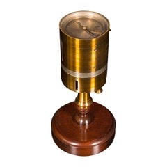
Antique Vineyard Setter's Compass, French, Brass, Surveyor's Instrument, C.1900
Located in Hele, Devon, GB
This is an antique vineyard setter's compass. A French, brass surveyor's instrument with mahogany
Category
Antique Late 19th Century French Scientific Instruments
Materials
Brass
H 4.14 in W 8.08 in D 4.14 in
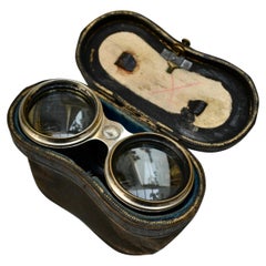
Antique "Le Jockey Club" 1930's Horse Racing Binoculars with Compass
Located in Vancouver, British Columbia
A French silvered brass and brown leather Horse Racing binoculars stamped "Le Jockey Club Paris
Category
Early 20th Century French Mid-Century Modern Scientific Instruments
Materials
Brass
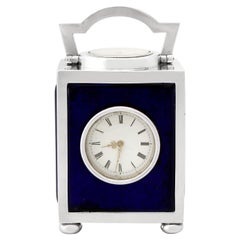
Victorian Sterling Silver Travelling Clock or Compass
Located in Jesmond, Newcastle Upon Tyne
clock or compass; an addition to our silver timepiece collection.
This exceptional antique Victorian
Category
Antique 1890s English Victorian Carriage Clocks and Travel Clocks
Materials
Silver, Sterling Silver
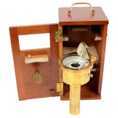
Nautical Brass Magnetic Compass with Original Box by E. Vion Paris, Early 1900
Located in Milan, IT
Antique and rare magnetic surveying compass, brass with original wooden box, signed E. Vion Paris
Category
Early 20th Century French Scientific Instruments
Materials
Brass
No Reserve
H 12.61 in W 4 in D 4 in
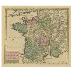
Antique Map of France by Tirion, c.1740
Located in Langweer, NL
Antique map titled 'Nieuwe Kaart van Frankryk.' - Attractive detailed map showing France. Title in
Category
Antique 18th Century Maps
Materials
Paper
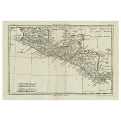
Antique French Engraving of Mexico with Lots of Details, c.1780
Located in Langweer, NL
Antique map titled 'Partie Meridionale, de L'Ancien Mexique ou de la Nouvelle Espagne
Category
Antique 18th Century Maps
Materials
Paper
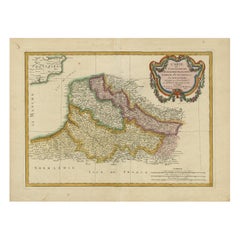
Antique Map of Picardy, Aroits and French Flanders by Bonne, c.1780
Located in Langweer, NL
Antique map titled 'Carte des Gouvernements de Flandre Francoise, d'Artois, de Picardie et du
Category
Antique 18th Century Maps
Materials
Paper
Antique Blue Mid 19th Century French Aubusson Carpet. Size: 15 ft 3 in x 17 ft
Located in New York, NY
Magnificent Mid 19th Century French Aubusson Carpet, Country of Origin / Rug Type: French Rug
Category
Antique Mid-19th Century French Aubusson Western European Rugs
Materials
Wool
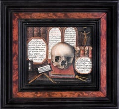
Skull with Sacred Writings and Tablets of the Law - Tempera on Cardboard
Located in Roma, IT
, realized in 1766 by an anonymous artist of the French School of XVIII century.
On the back of the frame
Category
18th Century Old Masters Figurative Paintings
Materials
Tempera
H 9.77 in W 10.48 in D 0.48 in
19th Century, French Wood Travel Desk
Located in IT
19th Century, French Wood Travel Desk
Measures: cm H 103 x W 52 x closed D 9. Open D 59 cm
This
Category
Antique Early 19th Century French Empire Desks and Writing Tables
Materials
Wood
19th Century Mantel Clock "Astronomy", France circa 1830
Located in Greven, DE
Antique mantel clock on the theme of astronomy
France
Bronze
Charles X around 1830
Dimensions: H
Category
Antique 19th Century French Charles X Table Clocks and Desk Clocks
Materials
Bronze
19thc French Napoleon III Serving/ Nesting Tables with Bone Inlayset of 4
Located in Opa Locka, FL
Rare Set of 4 Inlaid Nesting/ Serving Trays. 19thc French Napoleon Antique Trays with Inlaid Bone
Category
Antique 1890s French Napoleon III Serving Pieces
Materials
Wood
Decorative Map of the French Regions of Picardy, Artois & French Flanders, c1780
Located in Langweer, NL
Antique map titled 'Carte des Gouvernements de Flandre Francoise, d'Artois, de Picardie et du
Category
Antique 1780s Maps
Materials
Paper
H 14.57 in W 19.49 in D 0 in
Antique Malachite, Gilt and Patinated Spelter Mantel Clock
Located in London, GB
This beautiful clock was crafted in France in the late 19th century. The clock is a monument to
Category
Antique Late 19th Century French Neoclassical Mantel Clocks
Materials
Malachite, Spelter
Antique Map of the North Sea and Dunkirk
Located in Langweer, NL
Untitled map of the North Sea, top left a large compass rose, bottom right Dunkirk (Duinkerke
Category
Antique Early 18th Century Maps
Materials
Paper
French Quarterdeck Automaton Helmsman Clock by Guilmet, Retailed by Sewill, 1881
Located in Nantucket, MA
Antique French Quarterdeck Automaton Helmsman Clock by Andre Guilmet (Paris), Retailed by J. Sewill
Category
Antique 1880s French Victorian Table Clocks and Desk Clocks
Materials
Bronze, Silver Plate
H 12.25 in W 11.38 in D 8.5 in
Decorative Rare Map of the French Regions of Isle De France and Orleans, ca.1780
Located in Langweer, NL
Antique map titled 'Carte du Gouvernment de L'Isle de France et de edlui de L'Orleanois
Category
Antique 1780s Maps
Materials
Paper
H 19.3 in W 14.57 in D 0 in
19th Century French Patinated Copper Rooster Weather Vane with Cardinal Points
Located in Dallas, TX
This elegant antique weather vane was created in Normandy, France, circa 1860. The traditional
Category
Antique Mid-19th Century French Country Animal Sculptures
Materials
Copper
H 30 in W 23 in D 17.5 in
Antique Map of Normandy by Janssonius, 1657
Located in Langweer, NL
Antique map of France titled 'Normandia Ducatus'. Decorative map of the Normandy region, including
Category
Antique 17th Century Maps
Materials
Paper
Antique Map of Trincomalee and Tambalagam Bay, 1758
Located in Langweer, NL
Antique map titled 'Bay de Trinquemale'. Map of Trincomalee and Tambalagam Bay in Sri Lanka. While
Category
Antique 18th Century Maps
Materials
Paper
Original Antique Map of England, Ireland, Scotland and Wales
Located in Langweer, NL
Antique map titled 'Les Isles Britanniques, ou sont les Royaumes d Angleterre (..)'. Detailed map
Category
Antique Early 18th Century Maps
Materials
Paper
Antique Map of part of Central and Southern Asia
Located in Langweer, NL
Antique map titled 'Carte de la Partie Superieure de l'Inde en deca du Gange. Comprise entre la
Category
Antique Late 18th Century Maps
Materials
Paper
Original Antique Map of the Cape Verde Islands, 1746
Located in Langweer, NL
Antique map titled 'Carte Des Isles Du Cap Verd.' Original antique map of the Cape Verde Islands
Category
Antique 18th Century Maps
Materials
Paper
Antique Map of Northern Brazil by Bonne, c.1780
Located in Langweer, NL
Antique map titled 'Carte de la Partie Septentrionale du Bresil.' Detailed map of the northern
Category
Antique 18th Century Maps
Materials
Paper
Antique Map of Switzerland by N. Visscher, circa 1690
Located in Langweer, NL
Beautifully detailed map of Switzerland and surrounding regions in present-day France, Germany, and
Category
Antique Late 17th Century Maps
Materials
Paper
Antique Map of Northern Europe by Bonne, c.1780
Located in Langweer, NL
Antique map titled 'Le Nord de L'Europe, Contenant Le Danemark, La Norwege; La Suede et La Laponie
Category
Antique 18th Century Maps
Materials
Paper
Beautiful Antique Map of Madagascar, The Comoros Islands & Reunion Island, 1667
Located in Langweer, NL
Antique map titled 'Isle d'Auphine, communement Nommée par les Europeens Madagascar, et St. Laurens
Category
Antique 1660s Maps
Materials
Paper
H 22.64 in W 18 in D 0 in
Antique Map of Italy, Corsica, Sardinia and Sicily, ca.1780
Located in Langweer, NL
Description: Antique map titled 'L'Italie.'
Map of Italy, Corsica, Sardinia and Sicily. Highly
Category
Antique 1780s Maps
Materials
Paper
Antique Map of Northern Europe and European Russia, ca.1780
Located in Langweer, NL
Antique map titled 'Le Nord de L'Europe, Contenant Le Danemark, La Norwege; La Suede et La Laponie
Category
Antique 1780s Maps
Materials
Paper
Antique Map of the Maluku Islands by Van der Aa, 1714
By Pieter Van Der Aa
Located in Langweer, NL
Antique Map Moluccas titled 'Les Isles Moluques'. Rare map of the Spice Islands made after a map
Category
Antique 18th Century Maps
Materials
Paper
Stunning Large Scale Antique Map of Martinique, Rare, Published 1758
Located in Langweer, NL
Antique map titled 'Carte Reduite de l'Isle de la Martinique Dressee au Depost des Cartes Plans et
Category
Antique 18th Century Maps
Materials
Paper
Antique Print of the Fortress Cranganor near Kodungallur in India, 1757
Located in Langweer, NL
Antique print of the Fortress Cranganor, nowadays known by the name Kodungallor. French and Dutch
Category
Antique Mid-18th Century Prints
Materials
Paper
Free Shipping
H 13.39 in W 16.54 in D 0 in
Antique Map of Part of Southern Asia by Bonne, c.1780
Located in Langweer, NL
Antique map titled 'Carte de la Partie Superieure de l'Inde en deca du Gange. Comprise entre la
Category
Antique 18th Century Maps
Materials
Paper
Antique Map of the Empire of China by Bonne, c.1780
By Rigobert Bonne
Located in Langweer, NL
Antique map titled 'Carte de L'Empire de la Chine.' Decorative map of the Empire of China
Category
Antique 18th Century Maps
Materials
Paper
Antique Map of Southern Brazil and Uruguay by Bonne, c.1780
Located in Langweer, NL
"Antique map titled 'Carte de la Partie Meridional du Bresil avec les Possessions Espagnoles
Category
Antique 18th Century Maps
Materials
Paper
Original Antique Engrving of Chinese Tartary in the 18th Century, 1737
Located in Langweer, NL
The antique map titled " Ozieme feuille particuls de la Tartarie Chinoise, qui contient un pays
Category
Antique 1730s Maps
Materials
Paper
No Reserve
H 11.42 in W 18.9 in D 0 in
Antique Plan of Batavia in the Dutch East Indies or Indonesia, circa 1695
Located in Langweer, NL
the lower right by a simple compass rose. French title and key cartouche in drape form.
Artists
Category
Antique 17th Century Maps
Materials
Paper
Original Antique Map of Martinique Island In The West Indies by Bonne, circa1780
Located in Langweer, NL
Antique map titled 'Carte de l'Isle de la Martinique Colonie Francoise dans les Isles Antilles
Category
Antique 18th Century Maps
Materials
Paper
H 13.59 in W 10.04 in D 0 in
Antique Engraving of Malaysia, Brunei, Singapore, Java, Borneo, Sumatra, c.1750
Located in Langweer, NL
and Roy de Siam. Large compass rose and nice cartouche.
Title: Carte des Isles de Java Sumatra
Category
Antique Mid-18th Century Maps
Materials
Paper
H 10.3 in W 12 in D 0.002 in
Authentic 1644 Janssonius Map of the Champagne Region (Campania) in France
Located in Langweer, NL
"1644 Janssonius Map of Champagne, France"
This meticulously detailed original antique map
Category
Antique 1640s Maps
Materials
Paper
Free Shipping
H 21.86 in W 25.99 in D 0 in
Antique Map of the Passage Between the Atlantic and Pacific Oceans, circa 1753
Located in Langweer, NL
Antique print, titled: 'Carte du Detroit de le Maire (…)' - This chart illustrates the important
Category
Antique 18th Century Maps
Materials
Paper
H 9.61 in W 12.8 in D 0 in
Antique Map of Asia, Showing Tradewinds, Silke Route Cities Etc, c.1780
Located in Langweer, NL
Antique map titled 'L'Asie.' Map of Asia. Offers considerable detail considering the size, showing
Category
Antique 18th Century Maps
Materials
Paper
Antique Map of Africa with Ocean Currents and Other Details, C.1780
Located in Langweer, NL
Antique map titled 'Afrique.' Detailed map of Africa, showing towns, rivers, some topographical
Category
Antique 18th Century Maps
Materials
Paper
Antique Map of Dutch & Belgium Provinces Limburg, Namen and Ardennes, ca.1635
Located in Langweer, NL
cartouche featuring two adorable putti and the coat of arms, a scale of miles, and a compass rose. French
Category
Antique 1630s Maps
Materials
Paper
H 19.97 in W 23.51 in D 0 in
Detailed Antique Map of Santa Domingo, Puerto Rico, Eastern Bahamas, ca. 1780
Located in Langweer, NL
Description: Antique map titled 'L'Isle De St. Domingue, et celle De Porto-Rico.'
Detailed map
Category
Antique 1780s Maps
Materials
Paper
H 11.42 in W 15.12 in D 0 in
Rare Antique Copper Engraving of a Map of Pegu and Arakan, Burma (Myanmar), 1714
Located in Langweer, NL
Antique map Myanmar (Birma) titled 'Les Royaumes de Pegu et d'Aracan'.
Rare map of Pegu and
Category
Antique 1710s Maps
Materials
Paper
H 7.29 in W 9.06 in D 0 in
London 1744 Published Watercolour Antique Map of East Africa by Eman Bowen
Located in GB
This is a decorative antique engraved map of East Africa, colored by kingdoms and provinces.
The map
Category
Antique 1740s English George III Maps
Materials
Paper
H 17.52 in W 21.07 in D 0.79 in
Excellent Antique Map of America with Unusual Northwest Coast of America, c.1754
Located in Langweer, NL
Description: Antique map titled 'Nieuwe Kaart Van het Westelykste Deel Der Weereld, dienende tot
Category
Antique 1750s Maps
Materials
Paper
No Reserve
H 13.98 in W 15.75 in D 0 in
Antique Map of Mozambique Channel with Madagascar and Inset of Cape Region, 1780
Located in Langweer, NL
Antique map titled 'Carte du canal de Mosambique, contenant l'Isle de Madagascar avec les Cotes
Category
Antique 18th Century Maps
Materials
Paper
H 14.97 in W 10.24 in D 0 in
Antique Map of South American, The West Indies & Most of Africa, Ca.1775
Located in Langweer, NL
Antique map titled 'Carte pour Servir a l' Histoire Philosophique et Politique des Etablissemens et
Category
Antique 1770s Maps
Materials
Paper
H 15.04 in W 19.77 in D 0 in
Antique Map of Guadeloupe with Les Saintes, Grand Bourg and La Désirade, c.1780
Located in Langweer, NL
Antique map titled 'Les Isles de la Guadeloupe (..).'
Map of the Caribbean Island of Guadeloupe
Category
Antique 18th Century Maps
Materials
Paper
Free Shipping
H 10.24 in W 14.97 in D 0 in
Antique Map of Greece, Albania, Macedonia and Parts of Turkey and Cyprus, c.1745
Located in Langweer, NL
Antique map titled 'Accurata Totius Archipelagi Et Graeciae Universae Tabula'.
Detailed map of
Category
Antique 18th Century Maps
Materials
Paper
H 21.86 in W 25.79 in D 0 in
Antique Map of Mozambique and Cape of Good Hope with Kingdom Monomotapa, 1780
Located in Langweer, NL
Antique map titled 'Carte Du Canal De Mozambique.' The main map, on the right, covers from the Cape
Category
Antique 18th Century Maps
Materials
Paper
H 14.69 in W 10.44 in D 0 in
Antique Detailed Map of Papua New Guinea and the Regions to the West, ca.1780
Located in Langweer, NL
Antique map titled 'Carte des Decouvertes du Capite. Carteret dans La Nlle. Bretagne avec une parte
Category
Antique 1780s Maps
Materials
Paper
H 11.46 in W 15.24 in D 0 in
Regency Period Gentlman Painting
Located in Cheltenham, GB
Hutton-Clarke Antiques is delighted to present a captivating artwork from the Regency period, circa
Category
Antique Early 19th Century French Empire Paintings
Materials
Canvas
Vintage Backgammon Box Game Set in Large Briefcase with Nautical Theme 1980s
Located in North Hollywood, CA
Hermes and Gucci. It features nods to Christophe Colomb America discovery, compass motifs, intricately
Category
Late 20th Century French Games
Materials
Fabric
H 2 in W 15 in D 9.75 in
Automaton Industrial series Quarterdeck, Helmsman mantel clock by Guilmet
Located in London, GB
Antique French, "Ship's Quarter Deck" Automata clock from the Industrial Series. The bronze and
Category
Antique 1890s French Mantel Clocks
Materials
Marble, Bronze, Copper
Old Engraving of Batavia 'Jakarta, Indonesia' with Map and Harbour View, 1750
Located in Langweer, NL
Antique map titled 'Carte des environs de Batavia '. French map of the Batavia area (Jakarta) in
Category
Antique 1750s Maps
Materials
Paper
H 11.82 in W 15.75 in D 0 in
Beautiful Original Copper Engraved Map of Lake Geneva in Switzerland, 1613
Located in Langweer, NL
Description: Antique map titled 'Lacus Lemanus'.
Old map of Lake Geneva with good detail of
Category
Antique 1610s Maps
Materials
Paper
Old Map of the Kingdom of Tonga, Also Known as the Friendly Islands, ca.1780
Located in Langweer, NL
Antique print, titled: 'Carte des Isles des Amis.'
Map of the Kingdom of Tonga, also known as
Category
Antique 1780s Maps
Materials
Paper
H 11.42 in W 15.24 in D 0 in
- 1
Get Updated with New Arrivals
Save "Antique Compass France", and we’ll notify you when there are new listings in this category.
Antique Compass France For Sale on 1stDibs
Find many varieties of an authentic antique compass France available at 1stDibs. Frequently made of paper, metal and wood, every antique compass France was constructed with great care. You’ve searched high and low for the perfect antique compass France — we have versions that date back to the 18th Century alongside those produced as recently as the 20th Century are available. An antique compass France, designed in the Louis XVI, neoclassical or Empire style, is generally a popular piece of furniture. Many designers have produced at least one well-made antique compass France over the years, but those crafted by E. Vion Paris, George Louis Le Rouge and Hermès are often thought to be among the most beautiful.
How Much is a Antique Compass France?
Prices for an antique compass France start at $135 and top out at $133,498 with the average selling for $835.
Questions About Antique Compass France
- How do antique compasses work?1 Answer1stDibs ExpertApril 5, 2022Antique compasses work with the use of magnets. Compasses use a magnetized needle that can rotate to line up with the Earth’s magnetic field, pointing towards the magnetic north. The basic concept of how compasses work has not changed over several centuries and magnetic compasses continue to work well today. Shop a variety of antique compasses on 1stDibs.
More Ways To Browse
Masonic Jewel
Tune Clock
Hermes Pigskin
Hermes Silver Box Cigarette
Gucci 1980 Briefcase
Antique Wooden And Brass Boxes
Vintage Military Wrist Watch
Gucci With Wooden Handle
Automated Clocks
Porthole Clock
Old French Map
Compass France
Used Office Furniture Winnipeg
Drum Head Long Case Clock
Hermes Sailing
Antique Sprocket
Vintage Singer Tin
Hermes Shaker
