Antique Maps Perth
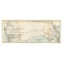
Antique Exploration Map of Australia from Beltana to Perth, 1876
Located in Langweer, NL
Antique map titled 'Thomas Elders' Expedition durch Inner-Australien von Beltana im Osten bis Perth
Category
19th Century Antique Maps Perth
Materials
Paper
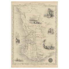
Map of Western Australia & Swan River, insets of Perth, Aboriginals, Sheep, 1851
Located in Langweer, NL
Antique map titled 'Western Australia, Swan River'. Map of Western Australia and Swan River
Category
1850s Antique Maps Perth
Materials
Paper
H 14.57 in W 10.63 in D 0 in
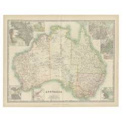
Antique Map of Australia by Johnston '1909'
Located in Langweer, NL
, Port Phillip, Adelaide, Perth, Sydney, Brisbane, Port Jackson and Hobart . This map originates from the
Category
Early 20th Century Antique Maps Perth
Materials
Paper
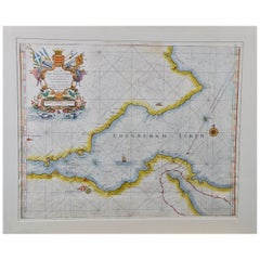
Edinburgh, Scotland Coast: A 17th Century Hand-Colored Sea Chart by Collins
By Captain Greenvile Collins
Located in Alamo, CA
. It includes a dedication to James Earle of Perth, Lord Chancellor of Scotland.
These sea charts by
Category
Late 17th Century English Antique Maps Perth
Materials
Paper
H 23 in W 27.75 in D 0.5 in
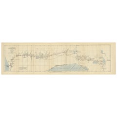
The 4000km Exploration of Ernest Giles from Beltena to Perth, Australia in 1875
Located in Langweer, NL
The map shows the route of the 1875 exploration led by Ernest Giles from Beltana Station in South
Category
1870s Antique Maps Perth
Materials
Paper
Free Shipping
H 8.27 in W 29.34 in D 0 in
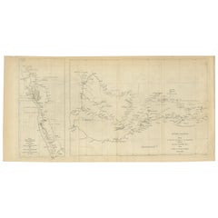
Charting the West: Surveyor General Roe’s Western Australian Expedition , 1852
Located in Langweer, NL
This map is a historical document, focused on Western Australia. It illustrates the route of an
Category
1850s Antique Maps Perth
Materials
Paper
Free Shipping
H 8.47 in W 16.93 in D 0 in
People Also Browsed
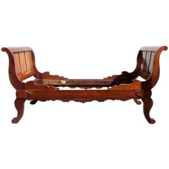
Rare Labeled Early 19th C Haitian French Colonial Day Bed from the West Indies
Located in Charleston, SC
An exceptionally rare 19th century Haitian French Colonial Cedrela day bed, circa 1830, featuring original label and hand-carved Regence style head and foot boards. This is one of th...
Category
19th Century Caribbean French Provincial Antique Maps Perth
Materials
Cedar
H 43 in W 88 in D 49.5 in
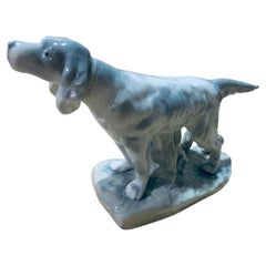
Rex Valencia Porcelain Figurine Of An English Setter Dog
Located in Guaynabo, PR
This is a Rex Valencia porcelain figurine of a dog. It depicts a hand painted grey and white color astute English Setter dog standing up over a base adorned with a cut trunk and soil...
Category
20th Century Spanish Antique Maps Perth
Materials
Porcelain
Dual Portraiture of a Woman from Port Francais, 1807
Located in Langweer, NL
This image is an original historical print showcasing two representations of a woman from Port Francais, a locale associated with the explorations of Jean-François de Galaup, comte d...
Category
Early 19th Century Antique Maps Perth
Materials
Paper
Set of 8 Partially Early 19th German Biedermeier Saxe-Coburg Provenance Chairs
Located in Berlin, DE
Set of 8 partially Early 19th German Biedermeier Saxe-Coburg provenance chairs: 3 chairs with inventory stamp of Ehrenburg Palace in Coburg (soth Germany)/House of Saxe-Coburg and Go...
Category
Early 19th Century German Biedermeier Antique Maps Perth
Materials
Cherry
H 36.23 in W 18.51 in D 16.93 in
Pair of Wood Donkey Bookends
Located in Los Angeles, CA
A pair of solid wood bookends hand carved into the shape of donkey heads. Each donkey has ears that stand at attention and a dark walnut finish. Marked Made in Haiti -1953.
Dimensio...
Category
Early 20th Century Haitian Mid-Century Modern Antique Maps Perth
Materials
Wood
Original Antique Map of the West Indies by J. Arrowsmith, 1842
Located in Langweer, NL
Title: "J. Arrowsmith's 19th Century Map of the West Indies"
This original antique map, crafted by J. Arrowsmith, details the West Indies with a focus on the Caribbean Sea and its s...
Category
Early 19th Century Antique Maps Perth
Materials
Paper
Free Shipping
H 20.87 in W 27.17 in D 0 in
Ornate Cartography of Colonial Grandeur: The West India Islands around 1851
Located in Langweer, NL
This map is a part of John Tallis's series of maps, known for their detailed and ornamental style. John Tallis & Company, mentioned in the caption, was an English cartographic publis...
Category
1850s Antique Maps Perth
Materials
Paper
No Reserve
H 10.71 in W 14.26 in D 0 in
Antique Map with Hand Coloring of the United States and the Caribbean
Located in Langweer, NL
Antique map titled 'Verein-Staaten von Nord-America, Mexico, Yucatan u.a.'. Very detailed map of the United States of America showing the Caribbean. With an inset map of the surround...
Category
Late 19th Century Antique Maps Perth
Materials
Paper
H 15.08 in W 18.71 in D 0.02 in
Rex Valencia Porcelain Figurine Of A Hummelwerk Dog
Located in Guaynabo, PR
This is a Rex Valencia porcelain figurine of a dog. It depicts a hand painted adorable Hummelwerk dog standing up with a blue belt in his neck and full of white and brown hair. The R...
Category
20th Century Spanish Antique Maps Perth
Materials
Porcelain
Colored wall map of the WORLD
By Chambon
Located in ZWIJNDRECHT, NL
“Mappe Monde, contenant les Parties Connues du Globe Terrestre”
CHAMBON, Gobert-Denis (France, 17.. - 1781)
Paris, Longchamps et Janvier, 1754
Size H. 115 x W. 145 cm.
Gobert-Denis...
Category
Mid-18th Century French French Provincial Antique Maps Perth
Materials
Wood, Paper
Original Steel Engraved Map of French Colonies in America, 1854
Located in Langweer, NL
Antique map titled 'Colonies Francaises (en Amerique)'. Detailed map bordered by vignettes showing local animals, produce and activities of the various French Colonies in America. Th...
Category
Mid-19th Century Antique Maps Perth
Materials
Paper
Free Shipping
H 13.12 in W 18.71 in D 0.02 in
Old Map the United States and Central America, Including Mexico, ca.1860
Located in Langweer, NL
Antique map titled 'Vereinigte Staaten von Nord America und Mexico'.
Old map the United States and Central America, including Mexico. This print originates from 'Stieler's Schul-...
Category
1860s Antique Maps Perth
Materials
Paper
Dramatic Hurtado Valencia Spain Swan Carved Armchair
Located in Hopewell, NJ
Dramatic carved wood armchair in mahogany, ebonized wood and gilded elements having elegant swan motif with arms that are the sinous necks of the birds. Incredible flourishes in gol...
Category
21st Century and Contemporary Spanish Hollywood Regency Antique Maps Perth
Materials
Velvet, Wood
19th Century Regency George III Pembroke Table Gillows
Located in London, GB
This wonderful antique pembroke dining table is unmistakable in sophistication and style dating from the Regency period, circa 1820, and attributed to Gillows, the famous furniture m...
Category
1820s English Regency Antique Maps Perth
Materials
Mahogany
Decorative Original Antique Map of Valencia in Southern Spain, circa 1601
Located in Langweer, NL
This is an original antique map titled 'Valentiae Regni olim Contestanorum Si Ptolemaeo, Edentanorum Si Plinio Credimus Typus'. This is a historical map of the Kingdom of Valencia in...
Category
Early 17th Century Antique Maps Perth
Materials
Paper
Free Shipping
H 17.52 in W 22.45 in D 0.02 in
Antique Map of the United States of America, also showing the Caribbean
Located in Langweer, NL
Antique map titled 'Verein-Staaten von Nord-America, Mexico, Yucatan u.a.'. Very detailed map of the United States of America showing the Caribbean. With an inset map of the surround...
Category
Mid-19th Century Antique Maps Perth
Materials
Paper
H 14.38 in W 17.88 in D 0.02 in
Get Updated with New Arrivals
Save "Antique Maps Perth", and we’ll notify you when there are new listings in this category.
More Ways To Browse
Antique Office Furniture Perth
Antique Brisbane
Maltese Falcon
Antique Map Sydney
Antique Maps Sydney
Antique Furniture Brisbane
Antique Furniture Bunbury
Antique Furniture Perth Australia
Vintage Schoolroom
Antique Jamaica Map
Antique Map Of Jamaica
Huge Vintage Map
Croatia Map
Map Of Puerto Rico
Washington Dc Map
Washington Dc Maps
Vietnam Map
Antique Illinois Map
