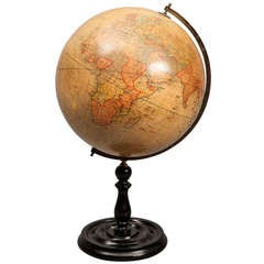
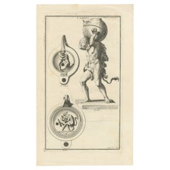
Atlas Bearing Globe
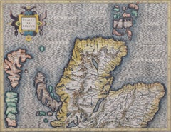
Map of the North of Scotland 17th century hand-coloured map by Gerardus Mercator
Located in London, GB
1683 French edition of Gerardus Mercator's Atlas Major, which was first published in 1585.
Gerardus
Category
1680s Prints and Multiples
Materials
Engraving
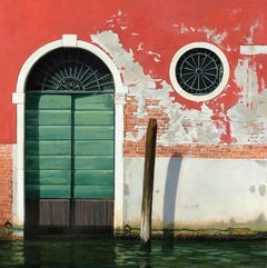
Acqua in Aumento (Rising Water) - Architectural Venetian Water Scene, Original
By Carol Pylant
Located in Chicago, IL
the work are through many applications of paint with fine brushes, each bearing the smallest amount of
Category
21st Century and Contemporary Contemporary Landscape Paintings
Materials
Oil, Panel
People Also Browsed
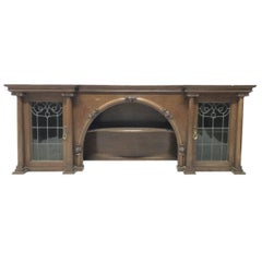
John Ednie Arts & Crafts Glasgow Oak over Mantle, Carved Cherubs and Stain Glass
By John Ednie, Wylie & Lochhead
Located in London, GB
John Ednie for Wylie and Lochhead.
A rare Arts & Crafts Glasgow School Oak cupboard or overmantel with carved Cherubs to the centre and stain glass panels to the cupboard doors, bes...
Category
Early 20th Century Scottish Arts and Crafts Fireplaces and Mantels
Materials
Stained Glass, Oak
H 26 in W 72 in D 14.5 in
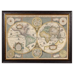
Framed World Map print showing double hemisphere dating to 1642 originally, New
Located in Lincoln, Lincolnshire
This is a digitally remastered World Map Conjuring up the golden age of exploration, from an original 1642 double hemisphere map of the world. It includes pictorial relief illustrat...
Category
2010s British Charles II Prints
Materials
Glass, Wood, Paper
H 19.69 in W 27.56 in D 1.58 in
C R Mackintosh Guthrie & Wells, Glasgow School Stained Green Cypress Wardrobe
By Guthrie and Wells, Charles Rennie Mackintosh
Located in London, GB
Charles Rennie Mackintosh (1868-1928), made by Guthrie and Wells.
A Glasgow School Arts and Crafts stained green cypress wood wardrobe, with white opaque textured square glass detai...
Category
Antique Late 19th Century Scottish Arts and Crafts Wardrobes and Armoires
Materials
Brass
H 75 in W 58 in D 20.75 in
Baillie Scott attri Arts & Crafts Glasgow School Oak Settle with Original Fabric
By Wylie & Lochhead, Mackay Hugh Baillie Scott
Located in London, GB
An Arts and Crafts Glasgow School oak settle in the style of M H Baillie Scott. Made by Wylie and Lochhead with sweeping curvaceous ends and a lower slatted detail, retaining it’s or...
Category
Antique Early 1900s Scottish Arts and Crafts Benches
Materials
Fabric, Oak
H 53 in W 76 in D 17 in
Antique Detailed World Map Drawn on Mercator's Projection, 1700
Located in Langweer, NL
Antique world map titled 'Carte generale du monde, ou description du monde terrestre & Aquatique - Generale Waereld kaart, of beschryving van de land en water waereld'. This is Pierr...
Category
Antique 17th Century Maps
Materials
Paper
Etchings of D.Y. Cameron and a Catalogue of His Etched Work First Edition
By David Young Cameron 2
Located in valatie, NY
Etchings of D.Y. Cameron and a catalogue of his etched work by David Young Cameron, Intro by Frank Rinder. Otto Schulze and Company, Edinburgh, 1908. Hardcover. First trade edition S...
Category
Antique Early 1900s Scottish Books
Materials
Paper
Scarce Antique Map of Greece, the Aegean, Crete and part of Asia Minor
Located in Langweer, NL
Original antique map titled 'Exactissima totius Archipelagi nec non Graeciae Tabula'. Visscher's scarce map of the Greek Islands, the Aegean, Crete and part of Asia Minor. Published ...
Category
Antique Late 17th Century Maps
Materials
Paper
H 21.15 in W 24.49 in D 0.02 in
1625 Mercator Map of the Provenience of Quercy, "Quercy Cadvrcivm Ric.0013
Located in Norton, MA
1625 Mercator map of the provenience of Quercy, entitled
"Quercy Cadvrcivm,"
Ric.0013
" Authentic" - Map of the provenience of Quercy Cadvrcivm
Description: Antique map titl...
Category
Antique 17th Century French Maps
Materials
Paper
H 18.9 in W 22.45 in D 0.4 in
Antique Map of the Southern Lorraine Region by Mercator, c.1625
By Gerard Mercator
Located in Langweer, NL
Antique map titled 'Lotharingiae Ducatus'. Old map of the southern portion of the Lorraine region, France. Lorraine is a cultural and historical region in north-eastern France, now l...
Category
Antique 17th Century Maps
Materials
Paper
Antique Map of the French Province of Quercy, ca.1625
Located in Langweer, NL
Antique map titled 'Quercy Cadurcium'. Old map of the region of Quercy, France. Quercy is a former province of France, the present-day department of Lot, the northern half of the dep...
Category
Antique 17th Century Maps
Materials
Paper
Antique Map of Artois in the North of France by Famous Mapmaker Blaeu, c.1640
Located in Langweer, NL
Antique map titled 'Artesia Comitatus Artois'. Map of Artois or Artesia, France. Artois is former province located in the northwestern part of France, boarding Belgium (Flanders) on ...
Category
Antique 17th Century Maps
Materials
Paper
No Reserve
H 19.69 in W 23.43 in D 0 in
Antique Map of Guinea in West Africa by Blaeu, c.1638
Located in Langweer, NL
Antique map titled 'Guinea'.
Decorative map of West Africa, including numerous animals in the interior, sailing ships and several elegant cartouches. Both the map and the sea are s...
Category
Antique 17th Century Maps
Materials
Paper
1633 Map Entitled "Beauvaisis Comitatus Belova Cium, Ric.0002
Located in Norton, MA
1633 map entitled
"Beauvaisis Comitatus Belova Cium,"
Hand Colored
Ric.0002
Description: Cartographer : - Hondius, Henricus 1587-1638
Artists and Engravers:Jodocus Hon...
Category
Antique 17th Century Dutch Maps
Materials
Paper
Antique Map of Macedonia by the Famous Mapmaker Blaeu, c.1650
Located in Langweer, NL
Antique map titled 'Macedonia, Epirus et Achaia'.
Ornated with a nice allegoric cartouche, one ship and a milage scale. Macedonia is shown in the centre of the map. With many detai...
Category
Antique 17th Century Maps
Materials
Paper
Original Antique Map of Utrecht in the Netherlands by Blaeu, C.1645
Located in Langweer, NL
Antique map titled 'Ultraiectum Dominium'. Old map of the province of Utrecht, the Netherlands. This map originates from 'Theatrum Orbis Terrarum (..)'.
Artists and Engravers: Wi...
Category
Antique 17th Century Maps
Materials
Paper
Original Antique Map of Zuid-Holland in the Netherlands by Blaeu, C.1645
Located in Langweer, NL
Antique map titled 'Zuydhollandia stricte sumta'. Old map of the province of Zuid-Holland, the Netherlands. This map originates from 'Theatrum Orbis Terrarum (..)'.
Artists and E...
Category
Antique 17th Century Maps
Materials
Paper
H 20.48 in W 24.81 in D 0 in
Recent Sales
A Desk Top Terrestrial Globe by Geographica Ltd
Located in London, GB
The revolving 12 inch globe, mounted on a dished turned wood stand, and bearing the markers mark
Category
Early 20th Century English Globes
Materials
Wood, Paper
Atlas Lamp Engraving: Strength and Mythology, 1722
Located in Langweer, NL
is captured in the act of bearing a globe upon his shoulders, which is intricately adorned, possibly
Category
Antique 1720s Prints
Materials
Paper
Large Bronze Atlas
Located in London, GB
Broze Statue of Atlas bearing a globe, attributed to Chiurazzi.
Category
Early 20th Century Italian More Furniture and Collectibles
Get Updated with New Arrivals
Save "Atlas Bearing Globe", and we’ll notify you when there are new listings in this category.
