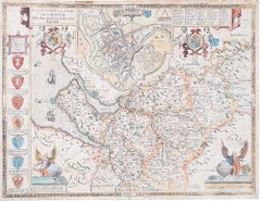
Items Similar to Map of the North of Scotland 17th century hand-coloured map by Gerardus Mercator
Want more images or videos?
Request additional images or videos from the seller
1 of 10
Gerardus MercatorMap of the North of Scotland 17th century hand-coloured map by Gerardus MercatorLate 16th / early 17th century
Late 16th / early 17th century
About the Item
Gerardus Mercator (1512 - 1594)
Map of the North of Scotland (1683)
Engraving with later hand colouring
35 x 45 cm
A fantastically characterful and detailed map engraving of the North of Scotland from 1683. The highly detailed and beautifully coloured map is inscribed to the reverse with a description of the parts of Scotland illustrated, called the 'Troisieme Table d'Escosse'. The map comes from the 1683 French edition of Gerardus Mercator's Atlas Major, which was first published in 1585.
Gerardus Mercator was the Flemish father of mapmaking. He was a skilled geographer, cosmographer and cartographer and is most renowned for creating the 1569 world map based on a new projection which represented sailing courses of constant bearing (rhumb lines) as straight lines - an innovation that is still employed in today's nautical charts.
Mercator was a highly influential pioneer in the history of cartography and is generally considered one of the founders of the Netherlandish school of cartography and geography. He is also widely considered the most notable figure of the school. In his own day, he was a notable maker of globes and scientific instruments. In addition, he had interests in theology, philosophy, history, mathematics and geomagnetism. He was also an accomplished engraver and calligrapher. Unlike other great scholars of the age, he travelled little and his knowledge of geography came from his library of over a thousand books and maps, from his visitors and from his vast correspondence (in six languages) with other scholars, statesmen, travellers, merchants and seamen. Mercator's early maps were in large formats suitable for wall mounting but in the second half of his life, he produced over 100 new regional maps in a smaller format suitable for binding into his Atlas of 1595. This was the first appearance of the word Atlas in reference to a book of maps. However, Mercator used it as a neologism for a treatise (Cosmologia) on the creation, history and description of the universe, not simply a collection of maps. He chose the word as a commemoration of the Titan Atlas, "King of Mauretania", whom he considered to be the first great geographer. Mercator wrote on geography, philosophy, chronology and theology. All of the wall maps were engraved with copious text on the region concerned. As an example, the famous world map of 1569 is inscribed with over five thousand words in fifteen legends.
- Creator:Gerardus Mercator (1512 - 1594, Flemish)
- Creation Year:Late 16th / early 17th century
- Dimensions:Height: 13.78 in (35 cm)Width: 17.72 in (45 cm)
- Medium:
- Period:1680-1689
- Condition:A little gentle spotting, primarily to margins.
- Gallery Location:London, GB
- Reference Number:1stDibs: LU795311533462
About the Seller
4.8
Platinum Seller
These expertly vetted sellers are 1stDibs' most experienced sellers and are rated highest by our customers.
Established in 2014
1stDibs seller since 2017
285 sales on 1stDibs
Typical response time: <1 hour
- ShippingRetrieving quote...Ships From: London, United Kingdom
- Return PolicyA return for this item may be initiated within 14 days of delivery.
More From This SellerView All
- John Speede Map The Countye Palatine of Chester with that most ancient citieBy John SpeedLocated in London, GBTo see our other views and maps of England - including London, Oxford and Cambridge, scroll down to "More from this Seller" and below it click on "See all from this Seller" - or send...Category
17th Century Realist Landscape Prints
MaterialsEngraving
- John Speede Map The Countye of MonmouthBy John SpeedLocated in London, GBTo see our other views and maps of England - including London, Oxford and Cambridge, scroll down to "More from this Seller" and below it click on "See all from this Seller" - or send...Category
17th Century Realist Landscape Prints
MaterialsEngraving
- 1782 View of Windsor Castle by James Fittler RA George Robertson John BoydellBy James FittlerLocated in London, GBTo see our other Architectural Prints and Drawings including other views of Windsor, scroll down to "More from this Seller" and below it click on "See all from this Seller." James Fittler (1758-1835) after George Robertson...Category
Mid-18th Century Realist Landscape Prints
MaterialsEngraving
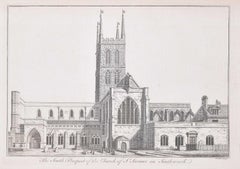
- Southwark Cathedral engraving c. 1753 for Stow's Survey of LondonLocated in London, GBTo see our other views and maps of England - including London, Oxford and Cambridge, scroll down to "More from this Seller" and below it click on "See all from this Seller" - or send...Category
1750s Realist Landscape Prints
MaterialsEngraving
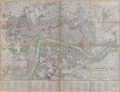
- 1800 'Map of London, Southwark, and parts adjacent' by Darton and HarveyLocated in London, GBDarton and Harvey (publisher) Map of London, Southwark, and parts adjacent (1800) Engraving 42 x 56 cm Original price "1 shilling".Category
Early 1800s Prints and Multiples
MaterialsEngraving, Paper
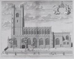
- David Loggan: Great St Mary's Church Cambridge University engraving 1690By David LogganLocated in London, GBTo see our other views of Oxford and Cambridge, scroll down to "More from this Seller" and below it click on "See all from this Seller" - or send us a message if you cannot find the ...Category
1690s Realist Prints and Multiples
MaterialsEngraving

You May Also Like
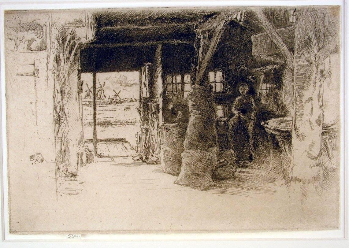
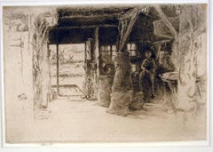
- The Mill, Amsterdam, 1889By James Abbott McNeill WhistlerLocated in New York, NYJames Whistler (1834-1903), The Mill, 1889, etching and drypoint, signed in pencil with the butterfly on the tab and inscribed “imp”, and inscribed “first state” (twice) and annotated “Wunderlich” and signed again with the butterfly verso. Reference: Kennedy 413, first state (of 5). Glasgow 457, second state (of 6; see discussion below) (cf. Margaret F. MacDonald, Grischka Petri, Meg Hausberg, and Joanna Meacock, James McNeill Whistler: The Etchings, a catalogue raisonné, University of Glasgow, 2011) On laid paper, in very good condition, trimmed just outside of the platemark all around except for the tab by the artist, 6 1/4 x 9 3/8 inches. A very fine impression of this great rarity, printed in black/brown ink with a slight veil of plate tone. provenance: H. Wunderlich & Co., New York Louis B. Dailey, New York (Lugt 4500) sale, Sotheby’s, New York, October 31, 2003, lot 69 literature; Neue Lagerliste 122: James McNeill Whistler – Etchings...Category
1880s Impressionist Landscape Prints
MaterialsDrypoint, Etching
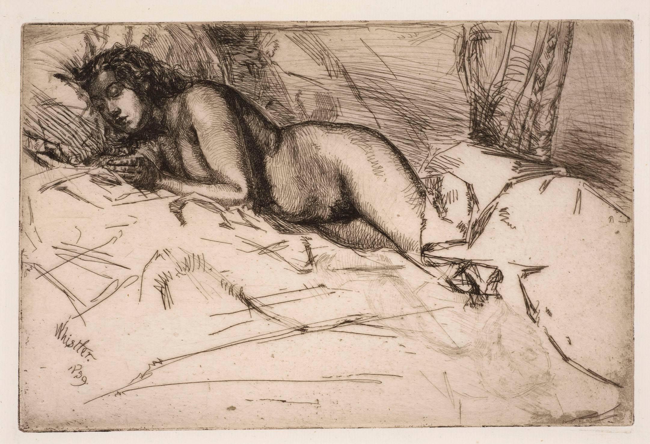
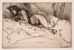
- VenusBy James Abbott McNeill WhistlerLocated in New York, NYJames Whistler (1834-1903), Venus, 1859. Etching and drypoint, printed in black ink on laid paper, an impression in the second (final) state: there was no published edition. 6 x 9 inches (15 x 22.6 cm) sheet 73/8 x 117/8 inches (18.8 x 30.3 cm) Reference: Kennedy 59; Glasgow 60 A very fine impression. A study of Héloïse, ‘Fumette’, asleep in bed, her head pressed into the pillow and the bedclothes covering her lower legs. This is one of three portraits Whistler made of Fumette in 1859: one of the others shows her standing and in the third only her head and shoulders are depicted. Venus is a work in the Realist tradition, and may be compared with Courbet’s nudes of the same period. The artist may also have had in mind Rembrandt’s study of Antiope in his etching Jupiter and Antiope. Venus was never published and there is no record of it being shown until 1898 when it was included in an Exhibition of Etchings, Drypoints and Lithographs by Whistler at H. Wunderlich & Co., New York. To have been overlooked for exhibition until so late in Whistler’s life might suggest that the subject was considered improper. Frederick Wedmore, whose catalogue of Whistler’s etchings...Category
1850s Impressionist Nude Prints
MaterialsDrypoint, Etching
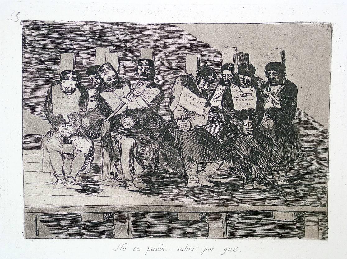
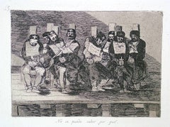
- One Can't Tell Why - Proof from the Disasters of WarBy Francisco GoyaLocated in New York, NYFrancisco José de Goya y Lucientes (1746 Fuendetodos – Bordeaux 1828), No se puede saber por qué – One can’t tell why ca. 1808–1814, etching, burnished aquatint, drypoint, an...Category
1810s Old Masters Figurative Prints
MaterialsDrypoint, Etching, Aquatint
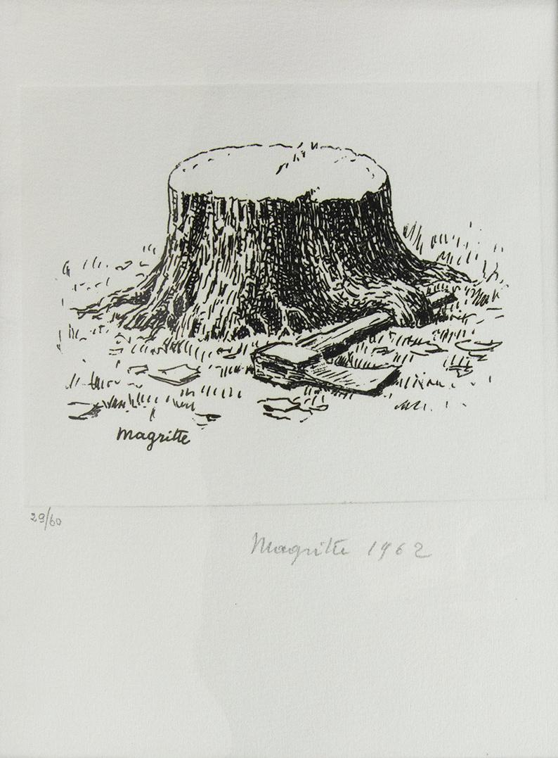
- Surrealism between two wars, International Anthology of Contemporary EngravingBy Marcel DuchampLocated in London, GBThe complete set of eleven engravings by Jean Arp, Hans Bellmer, Victor Brauner, Paul Delvaux, Marcel Duchamp, Wilhelm Freddie, Wifredo Lam, René Magritte, André Masson, Roberto Matt...Category
1960s Surrealist Figurative Prints
MaterialsEngraving
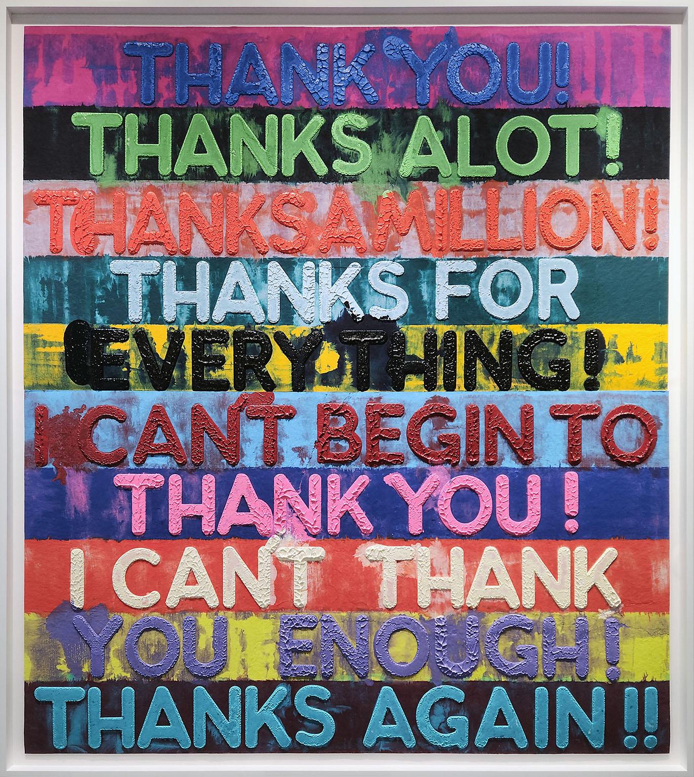
- 8-foot "Thank You" monoprint in oil with collage, engraving and embossmentBy Mel BochnerLocated in Boca Raton, FL8-foot "Thank You" monoprint in oil with collage, engraving and embossment on handmade paper by artist Mel Bochner from Two Palms Publishing . Signed and dated in graphite on front l...Category
2010s Contemporary More Prints
MaterialsOil, Handmade Paper, Engraving, Monoprint
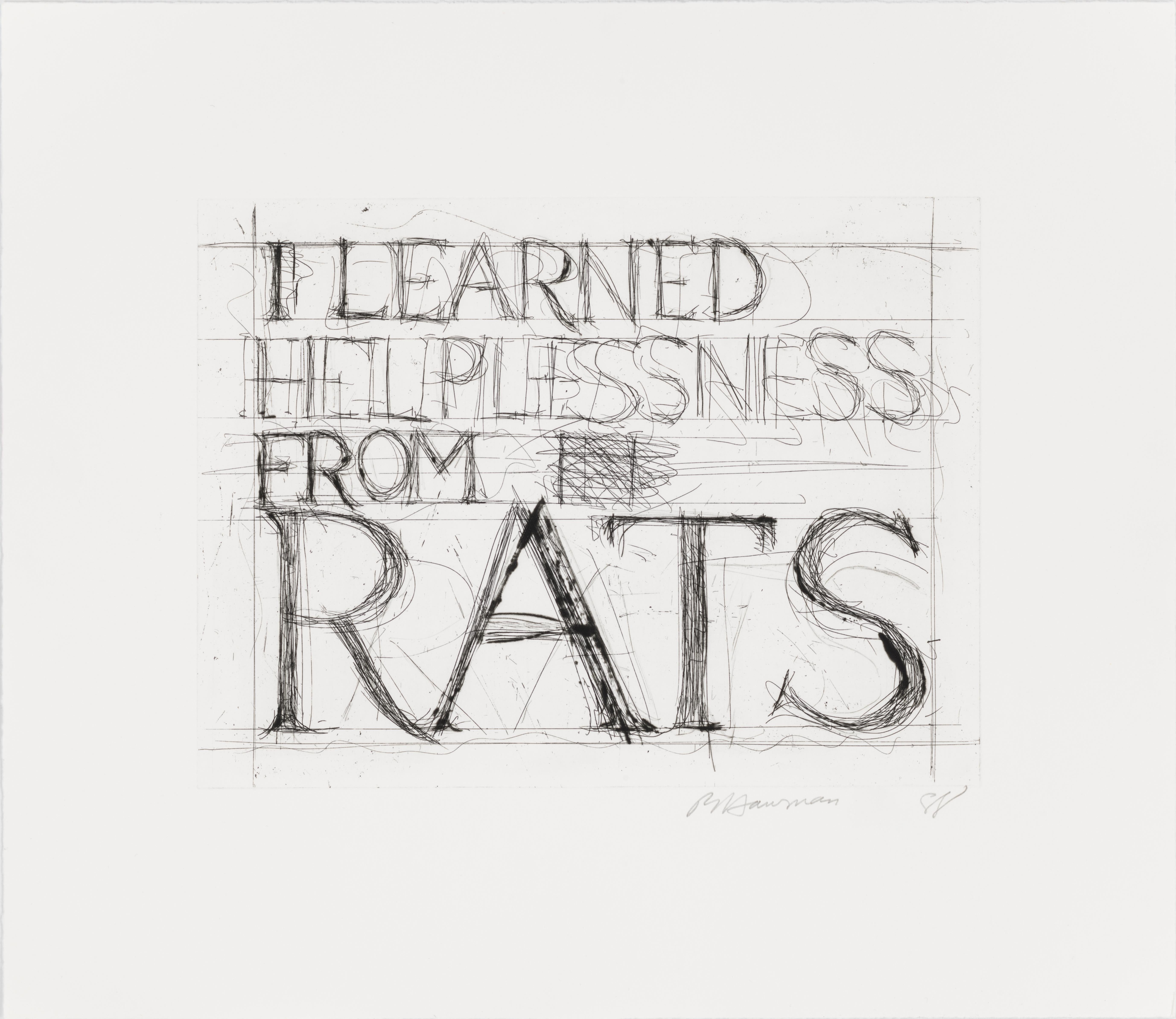
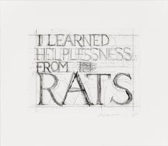
- I Learned Helplessness from RatsBy Bruce NaumanLocated in New York, NYFrame size: 23 x 25 3/8 inches Catalogue Raisonne: Cordes 61 Edition size: 35, plus proofs Signed, dated, and numbered in pencil, lower marginCategory
1980s More Prints
MaterialsDrypoint, Etching


Recently Viewed
View AllMore Ways To Browse
The Word Antique
Map Print
Book Of Knowledge
Antique Map Art
Antique Geography
Scotland Book
The Book Of The Thousand
Antique Cartography
The Little King
Flemish 16th Century
Antique Philosophy
Antique Prints Scotland
Antique Scottish Prints
Scottish Engraving
Engraving Scotland
16th Century Engraving
Hand Coloured Engravings
Antique World Globe