Constantinople Map
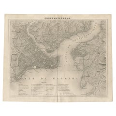
Antique Map of Constantinople and Surroundings by Balbi '1847'
Located in Langweer, NL
Antique map titled 'Constantinople'. Original antique map of Constantinople and surroundings. This
Category
Antique Mid-19th Century Maps
Materials
Paper
Cartographic Tapestry: Antique Map of Asia Minor, circa 1640
Located in Langweer, NL
Antioch, Troy, and Constantinople.
- **Historical Significance**: The region portrayed on this map holds
Category
Antique Mid-17th Century Maps
Materials
Paper
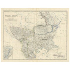
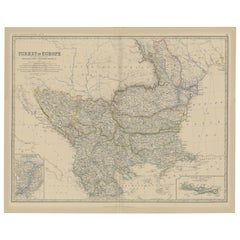
Antique Map of Turkey in Europe by A.K. Johnston
Located in Langweer, NL
Antique map titled 'Turkey in Europe'. With an inset map of Crete, the Bosporus and Constantinople
Category
Antique Mid-19th Century Maps
Materials
Paper
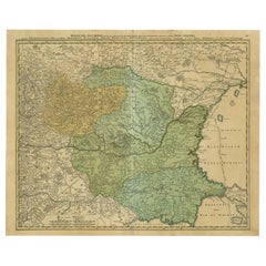
Antique Map of the Danube River by Homann, c.1720
By Homann Heirs
Located in Langweer, NL
Antique map titled 'Danubii Fluminis (..)'. Regional map of the Donau river, Shows the Danube river
Category
Antique 18th Century Maps
Materials
Paper
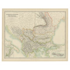
Antique Map of Turkey in Europe with Bulgaria by Johnston '1909'
Located in Langweer, NL
Bulgaria. With inset maps of The Bosporus & Constantinople, and Crete (or Candia). This map originates from
Category
Early 20th Century Maps
Materials
Paper
Antique Map of Ukraine, Bulgaria, Romania, Servia & Surroundings by N. Visscher
Located in Langweer, NL
, extending from Belgrade to the Black Sea. The map extends to Constantinople and the Bosphorus Straits in the
Category
Antique Early 18th Century Maps
Materials
Paper
H 20.4 in W 24.02 in D 0.02 in
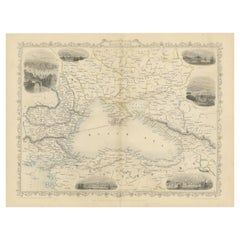
Mid 19th Century Map of the Black Sea with Decorative Vignettes, 1851
Located in Langweer, NL
(Bulgaria) and Constantinople.
Antique steel engraved map with original outline hand colour
The London
Category
Antique Mid-19th Century Maps
Materials
Paper
Original Copper Engraving of a Map of Syria and Lebanon, 1698
Located in Langweer, NL
Antique map titled 'Syriae, sive Soriae, Nova et Accurata Descriptio.'
Map of Syria and Lebanon
Category
Antique 1690s Maps
Materials
Paper
Free Shipping
H 12.41 in W 14.45 in D 0 in
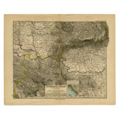
Old Map of Turkey in Europe, incl Romania, Servia, Montenegro & Bulgaria, 1882
Located in Langweer, NL
Romania, Servia, Montenegro and Bulgaria. With inset maps of the Bosphorus, Constantinople and Crete
Category
Antique 1880s Maps
Materials
Paper
H 19.53 in W 24.14 in D 0 in
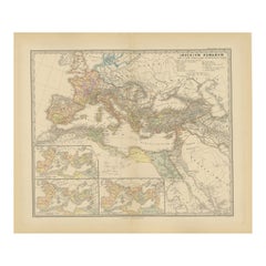
Imperium Romanum: A Detailed Map of the Roman Empire in its Zenith, 1880
Located in Langweer, NL
This original antique map, titled "IMPERIVM ROMANVM", is a detailed depiction of the Roman Empire
Category
Antique 1880s Maps
Materials
Paper
Free Shipping
H 15.56 in W 18.51 in D 0 in
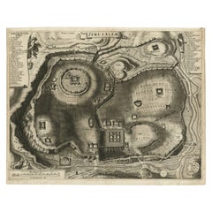
Antique Detailed Map of Jerusalem in Israël with Extensive Key and Scale, 1698
Located in Langweer, NL
Antique map titled 'Jerusalem.'
Plan of the ancient city of Jerusalem. With extensive key and
Category
Antique 17th Century Maps
Materials
Paper
H 15.16 in W 12.01 in D 0 in
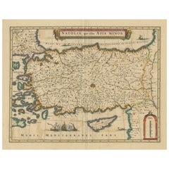
Antique Map of Asia Minor, showing Turkey, Cyprus and the Islands in the Aegean
Located in Langweer, NL
Antique map titled 'Natolia, quae olim Asia Minor'. Decorative map of Asia Minor, showing Turkey
Category
Antique Mid-17th Century Maps
Materials
Paper
H 20.99 in W 24.81 in D 0.02 in
The Roman Empire from the Time of Constantine the Great, Published in 1880
Located in Langweer, NL
Antique map titled: "IMPERIUM ROMANORUM inde a Constantini Magni tempore," which translates to "The
Category
Antique 1880s Maps
Materials
Paper
No Reserve
H 15.56 in W 18.51 in D 0 in
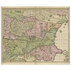
Danube River Incl Serbia, Moldavia, Transylvania, Romania, Bulgaria Etc, ca.1720
Located in Langweer, NL
Antique map titled 'Danubii Fluminis (..)'.
Regional map of the Donau river, Shows the Danube
Category
Antique 1720s Maps
Materials
Paper
H 20.08 in W 24.41 in D 0 in
1720 Panoramic Vista of Istanbul and the Bosphorus - with Column of Pompey
Located in Langweer, NL
smaller illustrations: the Aqueduct of Constantinople and the Column of Pompeii. The plate is adorned with
Category
Antique 1720s Maps
Materials
Paper
Free Shipping
H 14.38 in W 16.74 in D 0 in
Panoramic Antique View of Bandar-Abbas 'Formerly Gamron, Persia' in Iran, 1714
Located in Langweer, NL
to Smyrna, Constantinople, Egypt, Jerusalem, Syria, Lebanon, and Turkey. Everywhere he went Le Bruyn
Category
Antique 1710s Maps
Materials
Paper
H 6.7 in W 15.16 in D 0 in
Istanbul, Turkey. Antique Map City Plan Chromolithograph, circa 1895
Located in Melbourne, Victoria
lithograph plan of Constantinople (istanbul), Turkey.
Category
Late 19th Century Victorian More Prints
Materials
Lithograph
Original Antique Poster Norvege Norway Midnight Sun Stavkirke Church Travel Map
Located in London, GB
and the building reflected in the calm water next to a route map marking travel over the Atlantic
Category
Antique 1610s Norwegian Posters
Materials
Paper
H 38.98 in W 25.6 in D 0.04 in
Antique Print of Agatopoli or nowadays Ahtopol in Bulgaria, 1818
Located in Langweer, NL
Constantinople and was suffragan of the Archdiocese of Adrianople.
Today Agatopoli survives as the titular
Category
Antique 19th Century Prints
Materials
Paper
Antique Plan of the City of Jerusalem
Located in Langweer, NL
Antique map titled 'Jerusalem.' Plan of the ancient city of Jerusalem. With extensive key and scale
Category
Antique Late 17th Century Prints
Materials
Paper
Europe recens deseripta a Guilielmo Blaeuw
By Willem Janszoon Bleau
Located in Mount Vernon, NY
Hand-colored engraved map by map publisher and engraver Willem Janszoon Blaeu (1571-1638), offical
Category
Early 18th Century Landscape Prints
Materials
Engraving
Original Antique Poster Norvege Norway Midnight Sun Stavkirke Church Travel Map
Located in London, GB
and the building reflected in the calm water next to a route map marking travel over the Atlantic
Category
Early 1900s More Prints
Materials
Paper
People Also Browsed
Antique Map of Eastern Europe by Stieler, 1890
Located in Langweer, NL
Antique map titled 'Osterreich-Ungarn in 4 Blattern, Blatt 4.' Map of Eastern Europe, with Montenegro in the lower left corner, the southern edge of Hungary (area Baja and Szeged) an...
Category
Antique 19th Century Maps
Materials
Paper
19th Century Dutch Copper and Brass Doofpot
Located in Amerongen, NL
A Dutch 'doofpot' was a pot to store the not yet burned wood or other fuel. Because the jar was sealed airtight, the burning would soon stop due to lack of oxygen. The remaining resi...
Category
Antique 19th Century Dutch Victorian Fireplace Tools and Chimney Pots
Materials
Brass, Copper
19th Century Brass and Gold Watch-Key with Citrine stone
Located in Delft, NL
19th century Brass and Gold Watch-Key with Citrine stone
A brass watch key , gold-plated with yellow Citrine stone. The Citrine stone is cut in diamond facet shaped pattern. This gi...
Category
Antique 19th Century Dutch Collectible Jewelry
Materials
Gold, Brass
Italian Medieval / Renaissance Style Suit of Armor
Located in New York, NY
Italian Medieval / Renaissance-style (19th Century) small metal suit of armor with two Roman figures on the breast plate and an antique rolling stand.
Category
Antique 19th Century Italian Medieval Arms, Armor and Weapons
Materials
Metal
Medieval English Alabaster Statue
Located in Wormelow, Herefordshire
A medieval English alabaster statue, possibly dating as far back as the late 14th / early 15th century, mounted on one of our exclusive large display plinths. Well weathered over the...
Category
Antique 15th Century and Earlier English Medieval Figurative Sculptures
Materials
Alabaster
18th Century Map of the Southern Balkans by Giovanni Maria Cassini
By Giovanni Maria Cassini
Located in Hamilton, Ontario
18th century map by Italian engraver Giovanni Maria Cassini (Italy 1745-1824).
Map of the Southern Balkans: Rome. Hand colored and copper engraved print done in the year 1788. It in...
Category
Antique 18th Century Italian Maps
Materials
Paper
The Illustrated Map of the Var Department from the Atlas National Illustré, 1856
Located in Langweer, NL
This original hand-colored map is from the "Atlas National Illustré," a work by Victor Levasseur, a French geographer and cartographer known for his richly illustrated maps.
The map...
Category
Antique 1850s Maps
Materials
Paper
H 14.18 in W 20.87 in D 0 in
Medieval Style Antique Stained Glass Window
Located in Wormelow, Herefordshire
An excellent condition and finely made late 19th century medieval style stained glass window depicting the Hunt of St. Eustace from the workshop of German stained glass artist, Franz...
Category
Antique Late 19th Century German Medieval Windows
Materials
Lead
English Medieval Style Leaded Glass Window
Located in Wormelow, Herefordshire
An antique English medieval style leaded glass window circa 1850 in Tudor revival style depicting an armoured knight holding a banner beside a priest as if standing at the edge of a ...
Category
Antique Mid-19th Century English Medieval Windows
Materials
Lead
Antique Map of Eastern Europe, Incl Montenegro & Serbia & a Budapest Map, 1890
Located in Langweer, NL
Antique map titled 'Osterreich-Ungarn in 4 Blattern, Blatt 4.'
Map of Eastern Europe, with Montenegro in the lower left corner, the southern edge of Hungary (area Baja and Szeged...
Category
Antique 1890s Maps
Materials
Paper
H 15.63 in W 19.22 in D 0 in
Old Map of the Balkans Incl Greece, Turkey, Serbia, Montenegro, Bulgaria, C.1900
Located in Langweer, NL
Antique map titled 'Carte de la presqu-île du Balcan - Karte der Balkan Halbinsel'.
Original antique map of the Balkans including Greece, Turkey, Serbia, Montenegro, Bulgaria and...
Category
Antique Early 1900s Maps
Materials
Paper
H 45 in W 49 in D 0.002 in
Medieval Style Hall Chairs, France, 19th Century
Located in Isle Sur La Sorgue, Vaucluse
Imposing pair of medieval / Gothic style armchairs, in carved oak, with leather seats and backs. Ornate brass trim.
Category
Antique 19th Century French Medieval Armchairs
Materials
Leather, Oak
Old Eastern Balkans Map, with Dalmatia, Croatia, Slavonia, Bosnia, Serbia, 1633
Located in Langweer, NL
Antique map titled 'Sclavonia, Croatia, Bosnia cum Dalmatiae Parte'. Old map of the Eastern Balkans with the geographical & political divisions of Dalmatia, Croatia, Slavonia, Bosnia...
Category
Antique 1630s Maps
Materials
Paper
H 16.15 in W 20.87 in D 0 in
Antique Map of Moldova to Thessaly and from the Adriatic to the Black Sea, 1880
Located in Langweer, NL
Antique map titled 'Turquie d'Europe'.
Map of the european parts of Turkey. The map covers from Moldova to Thessaly and from the Adriatic to the Black Sea. Greece and the island ...
Category
Antique 1880s Maps
Materials
Paper
H 18.71 in W 13.59 in D 0 in
Original Antique World War One Poster Hark The Dogs Do Bark WWI Dogs Of War
Located in London, GB
Original Antique World War One poster - Hark! Hark! The dogs do bark! With note by Walter Emanuel - featuring a serio-comic map of Europe at war with military soldier caricature port...
Category
Vintage 1910s British Posters
Materials
Paper
H 22.05 in W 29.93 in D 0.04 in
Southern & Eastern Europe: A Large 17th C. Hand-colored Map by Sanson & Jaillot
By Nicolas Sanson
Located in Alamo, CA
This large hand-colored map entitled "Estats de L'Empire des Turqs en Europe, ou sont les Beglerbeglicz our Gouvernements" was originally created by Nicholas Sanson d'Abbeville and t...
Category
Antique 1690s French Maps
Materials
Paper
H 24.88 in W 38 in D 0.13 in
Recent Sales
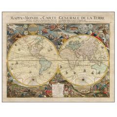
Mappe-Monde Ou Carte Generale De La Terre Divisee En Deux Hemispheres
By Louis Charles Desnos
Located in La Jolla, CA
A remarkable wall map of the world by Densos, in an unrecorded variant state, with an unusual
Category
Antique 1770s French Baroque Prints
Materials
Paper
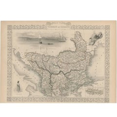
Antique Map of Turkey in Europe by J. Tallis, circa 1851
Located in Langweer, NL
A highly decorative and detailed mid-19th century map of 'Turkey in Europe' (The Balkans: northern
Category
Antique Mid-19th Century Maps
Materials
Paper
Antique Map of Danube River 'Lower Part, Former Yugoslavia' by N. Visscher
Located in Langweer, NL
Danube, extending from Belgrade to the Black Sea. The map extends to Constantinople and the Bosphorus
Category
Antique Late 17th Century Maps
Materials
Paper
H 20.79 in W 25.28 in D 0.02 in
Old Engraving with Views of the Bosphorus and the Black Sea, Turkey, c.1700
Located in Langweer, NL
to Vienna, on to Rome then to Smyrna, Constantinople, Egypt, Jerusalem, Syria, Lebanon, and Turkey
Category
Antique Early 1700s Maps
Materials
Paper
H 12.8 in W 15.95 in D 0 in
Antique Print of Eutyches, a Presbyter and Archimandrite at Constantinople, 1701
By Romeyn de Hooghe
Located in Langweer, NL
archimandrite at Constantinople. He first came to notice in 431 at the First Council of Ephesus, for his
Category
Antique 18th Century Prints
Materials
Paper
H 12.8 in W 7.49 in D 0 in
Antique Print of a Lady from Constantinople 'Istanbul' in Turkey, 1698
Located in Langweer, NL
Untitled print of a Lady from Constantinople, Turkey. This print originates from 'Reizen van
Category
Antique 17th Century Prints
Materials
Paper
Byzantium, Antique Map from "Civitates Orbis Terrarum" - 1572-1617
By Franz Hogenberg
Located in Roma, IT
of Istanbul, the antique Byzantium or Constantinople. The title is on plate at the top center. On the
Category
16th Century Landscape Prints
Materials
Etching
H 16.54 in W 21.26 in D 0.04 in
19th Century Table Top Globe by George Philip & Son, London, circa 1890
By George Philip & Son
Located in Lichtenberg, AT
identified by the political borders and cities displayed: Persia, Congo Free State, Constantinople, and St
Category
Antique Late 19th Century British Globes
Materials
Brass
Extraordinary Byzantine Gold Coin of Emperor Phocas, 603 AD
Located in London, GB
ever seen.
A gold solidus issued under Emperor Phocas (or Focas), at the Constantinople mint, in 603
Category
Antique 15th Century and Earlier Medieval Antiquities
Materials
Gold
Pair of Monumental Louis Revival Ormolu and Porphyry Candelabra 19th Century
Located in London, GB
the columns of Hagia Sophia (in Constantinople, now Istanbul) and in the "Porphyra", the official
Category
Antique 1860s Candelabras
Materials
Porphyry, Ormolu
H 35.04 in W 13 in D 13 in
Antique Map of Constantinople 'Istanbul' by J. Lodge, 1770
Located in Langweer, NL
Antique map titled 'A Plan of Constantinople, places adjacent and Canal of the Black Sea'. Map of
Category
Antique Mid-18th Century English Maps
Materials
Paper
Balkan Convergence: A Map of Turkey and Greece with the Balkan States, 1882
Located in Langweer, NL
This map, "TURKEY AND GREECE including ROUMANIA, SERVIA, BULGARIA, BOSNIA & MONTENEGRO," extracted
Category
Antique 1880s Maps
Materials
Paper
H 22.45 in W 14.97 in D 0 in
Old Original Engraving with Coastal Views of Arabia, 1711
Located in Langweer, NL
to Smyrna, Constantinople, Egypt, Jerusalem, Syria, Lebanon, and Turkey. Everywhere he went Le Bruyn
Category
Antique 1710s Maps
Materials
Paper
CONSTANTINOPLE - BRAUN and HOGENBERG
Located in Santa Monica, CA
IMPORTANT VIEW - ISTANBUL -- CONSTANTINOPLE - VERY EARLY. c. 1572
BRAUN and HOGENBERG
Category
16th Century Old Masters Landscape Prints
Materials
Engraving
Original Antique Poster Norway The Land Of The Midnight Sun Stavkirke Travel Art
Located in London, GB
map marking travel over the Atlantic Ocean from America and Canada, Europe, Scandinavia and North
Category
Antique Early 1900s Norwegian Posters
Materials
Paper
H 38.98 in W 25.99 in D 0.04 in
British Empire Educational Globe, circa 1890
By Charles Smith & Son
Located in London, GB
State, Constantinople, and St. Petersburg are all visible. This nicely aged, richly detailed globe
Category
Antique 1890s English Globes
Materials
Wood, Paper
Original Antique Poster Norway The Land Of The Midnight Sun Stavkirke Travel Art
Located in London, GB
map marking travel over the Atlantic Ocean from America and Canada, Europe, Scandinavia and North
Category
Early 1900s More Prints
Materials
Paper
Antique map of Constantinople
Located in Los Angeles, CA
Hand tinted map of Constantinople dated 1786 by Kauffer and Lechevalier in 19th Century oak frame
Category
Antique 18th Century and Earlier French Decorative Art
Materials
Paper, Wood
Art Deco Terrestrial Globe 'England, 1938'
Located in Beaconsfield, GB
Pakistan or Israel), but is still showing Constantinople (that changed in 1930 to Istanbul). It has a
Category
Vintage 1930s English Art Deco Maps
Materials
Wood
Get Updated with New Arrivals
Save "Constantinople Map", and we’ll notify you when there are new listings in this category.
Constantinople Map For Sale on 1stDibs
At 1stDibs, there are many versions of the ideal constantinople map for your home. Each constantinople map for sale was constructed with extraordinary care, often using paper. Whether you’re looking for an older or newer constantinople map, there are earlier versions available from the 18th Century and newer variations made as recently as the 20th Century. Romeyn de Hooghe and Homann Heirs each produced at least one beautiful constantinople map that is worth considering.
How Much is a Constantinople Map?
A constantinople map can differ in price owing to various characteristics — the average selling price 1stDibs is $525, while the lowest priced sells for $153 and the highest can go for as much as $1,475.
