Detroit Map
1
to
7
69
21
39
25
20
17
13
10
8
7
7
7
6
6
4
3
3
2
2
2
2
2
2
2
2
2
1
1
1
1
1
19
9
8
3
3
Sort By
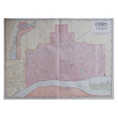
Large Original Antique City Plan of Detroit, USA, 1894
By Rand McNally & Co.
Located in St Annes, Lancashire
Fabulous colorful map of Detroit
Original color
By Rand, McNally & Co.
Published, 1894
Category
Antique 1890s American Maps
Materials
Paper
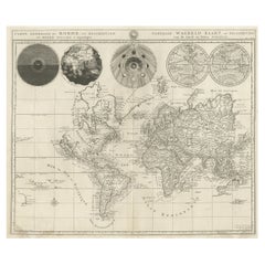
Antique Detailed World Map Drawn on Mercator's Projection, 1700
Located in Langweer, NL
Antique world map titled 'Carte generale du monde, ou description du monde terrestre & Aquatique
Category
Antique 17th Century Maps
Materials
Paper
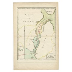
Antique Map of the Buton Strait by Philippe, 1787
Located in Langweer, NL
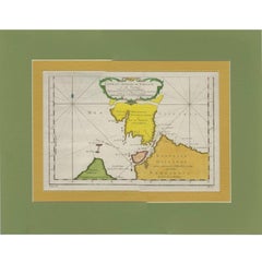
Antique map titled 'Carte du Détroit de Bouton'. Map of the Buton Strait between Paula Buton and
Category
Antique 18th Century Maps
Materials
Paper
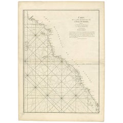
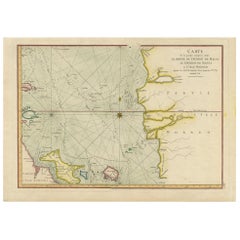
Antique Coastal Map of West Sumatra 'Indonesia' by J. Mannevillette, 1745
Located in Langweer, NL
jusqu'au détroit de la Sonde'. Beautiful coastal map of West Sumatra, an island in Western Indonesia. This
Category
Antique Mid-18th Century Maps
Materials
Paper
H 30.32 in W 21.86 in D 0.02 in
Antique Map of the Malacca and Bangka Strait by De Mannevillette '1775'
Located in Langweer, NL
Antique map titled 'Carte de la Partie Comprise entre la Sortie du Detroit de Malac Le Detroit de
Category
Antique Late 18th Century Maps
Materials
Paper
H 15.56 in W 21.66 in D 0.02 in
Map of the Russian Islands of Novaya Zemlya and Pechorskaya Guba, 1758
Located in Langweer, NL
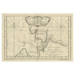
Antique map titled 'Carte du detroit de Waeigats ou de Nassau.'
Map of the Russian islands of
Category
Antique 1750s Maps
Materials
Paper
Detailed Map of the Madura Strait, between Java & Madura Island, Indonesia, 1825
Located in Langweer, NL
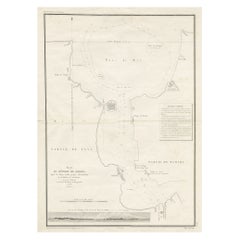
Antique map titled 'Plan du Détroit de Madura'.
Detailed map of the Madura Strait in Indonesia
Category
Antique 1820s Maps
Materials
Paper
Free Shipping
H 26.78 in W 19.89 in D 0 in
California, Alaska and Mexico: 18th Century Hand-Colored Map by de Vaugondy
By Didier Robert de Vaugondy
Located in Alamo, CA
This an 18th century hand-colored map of the western portions of North America entitled "Carte de
Category
Antique 1770s French Maps
Materials
Paper
H 13.75 in W 16.63 in D 0.13 in
Antique Map of the Strait Between Nova Zembla and the Mainland of Russia
Located in Langweer, NL
Antique map titled 'Carte du Detroit de Waeigats ou de Nassau'. Detailed regional map of the Strait
Category
Antique Mid-18th Century Maps
Materials
Paper
H 14.85 in W 18.98 in D 0.2 in
Antique Map of the Passage Between the Atlantic and Pacific Oceans, circa 1753
Located in Langweer, NL
Antique print, titled: 'Carte du Detroit de le Maire (…)' - This chart illustrates the important
Category
Antique 18th Century Maps
Materials
Paper
H 9.61 in W 12.8 in D 0 in
Old Map of the Great Lakes and Upper Mississippi Valley, Northern America, c1780
Located in Langweer, NL
many others. Chicago (Chicagou) and Detroit both appear as forts. The Great Lakes are mapped with a
Category
Antique 1780s Maps
Materials
Paper
H 10.32 in W 14.85 in D 0 in
Antique Detailed Map of Papua New Guinea and the Regions to the West, ca.1780
Located in Langweer, NL
Antique map titled 'Carte des Decouvertes du Capite. Carteret dans La Nlle. Bretagne avec une parte
Category
Antique 1780s Maps
Materials
Paper
H 11.46 in W 15.24 in D 0 in
Large Antique Sea Chart of the South-Eastern Coast of Sumatra, Indonesia
Located in Langweer, NL
Antique map titled 'Carte pour aller du Détroit de la Sonde ou de Batavia, au Détroit de Banca
Category
Antique Late 18th Century Maps
Materials
Paper
H 30.2 in W 20.87 in D 0.02 in
Antique Engraving of Malaysia, Brunei, Singapore, Java, Borneo, Sumatra, c.1750
Located in Langweer, NL
Nice decorative and detailed map from the Gulf of Siam and Mindoro to Timo, Java and Sumatra Borneo
Category
Antique Mid-18th Century Maps
Materials
Paper
H 10.3 in W 12 in D 0.002 in
Serene Vista of Messina and its Strait: An Engraved Jewel, circa 1800
Located in Langweer, NL
Title: "Vue de Messine & de Son Détroit"
This evocative print titled "Vue de Messine & de Son
Category
Antique Early 19th Century Maps
Materials
Paper
"The Story Map Of The West Indies" 1936
Located in Bristol, CT
Framed colour map of the West Indies published 1936 w/ border design motif adapted from native West
Category
1930s More Prints
Materials
Paper
California: 18th Century Hand-colored Map by de Vaugondy
By Didier Robert de Vaugondy
Located in Alamo, CA
This is an 18th century hand-colored map of the western portions of North America entitled "Carte
Category
1770s Landscape Prints
Materials
Engraving
New France and Labrador - Graphite Drawing, Landscape, On Antiqued Map
By Don Pollack
Located in Chicago, IL
Coeur d’Alenes trail in Northern Idaho. It is a place of rugged and stark beauty barely on the old maps
Category
21st Century and Contemporary Contemporary Landscape Paintings
Materials
Canvas, Oil
Contemporary Assemblage Map License Plate Art American Flag by Design Turnpike
Located in Keego Harbor, MI
and maps under the name Design Turnpike. As a boy, he loved keeping track of license plates. Road
Category
21st Century and Contemporary Contemporary Art
Materials
Metal
H 32.5 in W 48 in D 1 in
Contemporary Assemblage License Plate Art Map of the USA by Design Turnpike
Located in Keego Harbor, MI
Another recently finished unique and impressive map on Very Black wood planks that will be the
Category
21st Century and Contemporary Contemporary Art
Materials
Metal
Tom Lollar and Jane Manus "Map of Rome" Rectangular Coffee Table, 2010
By Thomas W. Lollar, Jane Manus
Located in New York, NY
Contemporary artists Tom Lollar and Jane Manus' "Map of Rome" Rectangular Coffee Table. Hand-carved
Category
21st Century and Contemporary American Modern Coffee and Cocktail Tables
Materials
Marble, Aluminum
Tom Lollar and Jane Manus "Map of Manhattan" Rectangular Coffee Table, 2010
By Thomas W. Lollar, Jane Manus
Located in New York, NY
Contemporary artists Tom Lollar and Jane Manus' "Map of Manhattan" Rectangular Coffee Table. Hand
Category
21st Century and Contemporary American Modern Coffee and Cocktail Tables
Materials
Marble, Aluminum
On the Map: Large scale color monotype, Western mountain landscape with blue sky
By Michele Zalopany
Located in New York, NY
. The imagery of On the Map is taken from an old picture book.
Born in 1955 in Detroit Michigan
Category
1980s Contemporary Landscape Prints
Materials
Monotype
"Chart Of The Aintree Race Course" 1930 Hand-Coloured & Signed By The Artist
Located in Bristol, CT
thereafter, in 1836. This map, published nearly 100 years later, shows little has changed in the intervening
Category
1930s Prints and Multiples
Materials
Paper, Lithograph
Contemporary Assemblage John F Kennedy License Plate Art by Design Turnpike
Located in Keego Harbor, MI
Fitzgerald Kennedy's suit lapel.
David Bowman creates handmade license plate art and maps under the name
Category
21st Century and Contemporary Contemporary Art
Materials
Metal
Wharf-side
By Richard Florsheim
Located in New York, NY
, Florsheim was commissioned as an Ensign in the United States Navy and served in a map-making detail
Category
1960s American Modern Abstract Prints
Materials
Lithograph
Incandescent City
By Richard Florsheim
Located in New York, NY
Ensign in the United States Navy and served in a map-making detail. Following his time of service, he
Category
1960s American Modern Landscape Prints
Materials
Lithograph
Section 30 - Landscape Painting, Original Oil on Canvas
By Don Pollack
Located in Chicago, IL
via bicycle following Lewis and Clark. His work has utilized maps, documents, photography, painting
Category
21st Century and Contemporary Contemporary Landscape Paintings
Materials
Canvas, Oil
Thunderheads
By Richard Florsheim
Located in New York, NY
and served in a map-making detail. Following his time of service, he gained national attention for
Category
1970s American Modern Landscape Prints
Materials
Lithograph
Carnival
By Richard Florsheim
Located in New York, NY
and served in a map-making detail. Following his time of service, he gained national attention for
Category
1970s American Modern Abstract Prints
Materials
Lithograph
Glowing City
By Richard Florsheim
Located in New York, NY
the United States Navy and served in a map-making detail. Following his time of service, he gained
Category
1960s American Modern Landscape Prints
Materials
Lithograph
Approaching Storm
By Richard Florsheim
Located in New York, NY
commissioned as an Ensign in the United States Navy and served in a map-making detail. Following his time of
Category
1960s American Modern Landscape Prints
Materials
Lithograph
Waves
By Richard Florsheim
Located in New York, NY
and served in a map-making detail. Following his time of service, he gained national attention for
Category
1970s American Modern Abstract Prints
Materials
Lithograph
Light and Water
By Richard Florsheim
Located in New York, NY
Ensign in the United States Navy and served in a map-making detail. Following his time of service, he
Category
1970s American Modern Landscape Prints
Materials
Lithograph
Ballistic Mist
By Elliott Green
Located in New York, NY
between Green’s masterful technique in oil paint.
Elliott Green (b. 1960, Detroit, MI) lives and works
Category
2010s Abstract Paintings
Materials
Oil
Crown of Fog
By Elliott Green
Located in New York, NY
masterful technique in oil paint.
Elliott Green (b. 1960, Detroit, MI) lives and works in Athens, NY
Category
2010s Abstract Paintings
Materials
Oil
Terroir
By Elliott Green
Located in New York, NY
masterful technique in oil paint.
Elliott Green (b. 1960, Detroit, MI) lives and works in Athens, NY
Category
2010s Abstract Paintings
Materials
Oil
Living Dangerously, Original Oil Painting, Large Scale Fictional Book Cover
By Don Pollack
Located in Chicago, IL
work has utilized maps, documents, photography, painting, and installation.This work was routed in a
Category
21st Century and Contemporary Contemporary Figurative Paintings
Materials
Canvas, Oil
Section 35
By Don Pollack
Located in Chicago, IL
via bicycle following Lewis and Clark. His work has utilized maps, documents, photography, painting
Category
21st Century and Contemporary Contemporary Landscape Paintings
Materials
Canvas, Oil
"The Banicor" Mixed Media, African-American, Abstract, Free Floating, Colorful
By Al Loving
Located in Detroit, MI
known as Al Loving, was an African-American abstract expressionist painter from Detroit, Michigan. His
Category
Late 20th Century Abstract Expressionist Mixed Media
Materials
Lucite, Acrylic, Cardboard
Near and Far Acuity, Mid Century Modern Op Art painting from historic exhibition
By Richard Anuszkiewicz
Located in New York, NY
and author James Michener. Anuszkiewicz's first one-man show put him on the map. "These first
Category
1950s Op Art Abstract Drawings and Watercolors
Materials
Watercolor, Gouache, Mixed Media
Battle For Yellowstone, Original Oil Painting of Oversized Fictional Bookcover
By Don Pollack
Located in Chicago, IL
,– such as a 3000 mile journey via bicycle following Lewis and Clark. His work has utilized maps
Category
21st Century and Contemporary Contemporary Figurative Paintings
Materials
Canvas, Oil
Silent Running
By Don Pollack
Located in Chicago, IL
via bicycle following Lewis and Clark. His work has utilized maps, documents, photography, painting
Category
21st Century and Contemporary Contemporary Figurative Paintings
Materials
Canvas, Oil
I'm Witnessing a Forest Fire-Oil Painting, Fictional Penguin Classic Book Cover
By Don Pollack
Located in Chicago, IL
bicycle following Lewis and Clark. His work has utilized maps, documents, photography, painting, and
Category
21st Century and Contemporary Contemporary Landscape Paintings
Materials
Canvas, Oil
H 31 in W 19 in D 1.5 in
"Pod", Decorative Tatooed Sculptural Ceramic with Transparent Glaze
By Michele Oka Doner
Located in Detroit, MI
work today. She participated in a Manupelli experimental film, a "Map Read" performance with art
Category
1960s Still-life Sculptures
Materials
Ceramic, Glaze
H 6 in W 11.5 in D 8.5 in
Chicago Portage - Serene Wooded Landscape with Stormy Skies, Oil on Canvas
By Don Pollack
Located in Chicago, IL
Coeur d’Alenes trail in Northern Idaho. It is a place of rugged and stark beauty barely on the old maps
Category
21st Century and Contemporary Contemporary Landscape Paintings
Materials
Canvas, Oil
Dracula
By Don Pollack
Located in Chicago, IL
via bicycle following Lewis and Clark. His work has utilized maps, documents, photography, painting
Category
21st Century and Contemporary Contemporary Figurative Paintings
Materials
Canvas, Oil
Original Drawing Painting Abstract Biomorphic Art Phoenix Bird Michele Oka Doner
By Michele Oka Doner
Located in Surfside, FL
Manupelli experimental film, a "Map Read" performance with art drawing instructor Al Loving and Judsonite
Category
Early 2000s Abstract Abstract Drawings and Watercolors
Materials
Gold Leaf
Original Drawing Painting Abstract Biomorphic Art Gold Leaf Michele Oka Doner
By Michele Oka Doner
Located in Surfside, FL
today. Oka Doner participated in a Manupelli experimental film, a "Map Read" performance with art
Category
Early 2000s Abstract Abstract Drawings and Watercolors
Materials
Gold Leaf
Antique City Maps, Detroit, gold leaf, unframed
Located in Los Angeles, CA
different city or state. We can customize any map. Printed on a gold leaf paper and framed in acrylic box
Category
2010s Contemporary More Prints
Materials
Gold Leaf
Antique City Maps, Detroit, gold leaf, acrylic box frame
Located in Los Angeles, CA
different city or state. We can customize any map. Printed on a gold leaf paper and framed in acrylic box
Category
2010s Contemporary More Prints
Materials
Gold Leaf
Carte du detroit du Sond contenant les costes de l'Isle de Zelande [...].
By Alexis Hubert Jaillot
Located in Zeeland, Noord-Brabant
Carte du detroit du Sond contenant les costes de l'Isle de Zelande comprises entre Nicopen et
Category
Late 17th Century More Prints
Materials
Engraving
Carte reduite des costes d'Espagne et de Portugal [...].
By Jacques-Nicolas Bellin
Located in Zeeland, Noord-Brabant
Carte reduite des costes d'Espagne et de Portugal depuis le Cap Pinas jusqu'au Detroit de Gibraltar
Category
Mid-18th Century More Prints
Materials
Engraving
H 23.82 in W 35.83 in
Carte generale des costes de l'Europe sur l'ocean [...].
By Alexis Hubert Jaillot
Located in Zeeland, Noord-Brabant
Detroit de Gibraltar.' - (General coastal map of Europe and the oceans from Dronthem in Norway to the
Category
Late 17th Century More Prints
Materials
Engraving
H 24.41 in W 36.03 in
Sea chart of Gulf of Saint Laurence and Belle Isle - Engraving - 18th century
Located in Zeeland, Noord-Brabant
Costes de Labrador depuis Mecatina jusqu'a la Baye des Esquimaux Le Detroit de Belle-Isle Et Partie des
Category
1750s Old Masters More Prints
Materials
Engraving
After Grant Wood (American Gothic) 1
By Devorah Sperber
Located in Greenwich, CT
of spools of thread, chenille pipe cleaners and map tacks that act as optical illusions. Some of her
Category
2010s Op Art Mixed Media
Materials
Thread, Mixed Media
After Warhol 8
By Devorah Sperber
Located in Greenwich, CT
of spools of thread, chenille pipe cleaners and map tacks that act as optical illusions. Some of her
Category
2010s Op Art Mixed Media
Materials
Thread, Mixed Media
1846 "Traveller's Guide and Map of the United States" Antique Wall Map by Ensign
Located in Colorado Springs, CO
Ensign's Traveller's Guide and map of the United States, containing the roads, distances, Steam
Category
Antique 1840s American Maps
Materials
Paper
H 42.25 in W 53 in D 3.75 in
1845 United States Hanging Wall Map by T & E. H. Ensign
Located in Colorado Springs, CO
"Ensign's Traveller's Guide and Map of the United States, Containing the Roads, Distances, Steam
Category
Antique 1840s American Maps
Materials
Paper
Detailed Original Antique Map of the Strait of Magellan, Argentina, ca.1780
Located in Langweer, NL
Antique map titled 'Detroit De Magellan avec les Plans des principaux Ports, Bayes, & c. de ce
Category
Antique 1780s Maps
Materials
Paper
H 11.58 in W 16.46 in D 0 in
- 1
Get Updated with New Arrivals
Save "Detroit Map", and we’ll notify you when there are new listings in this category.
Detroit Map For Sale on 1stDibs
Find the exact detroit map you’re shopping for in the variety available on 1stDibs. There are many contemporary, abstract and Old Masters versions of these works for sale. You’re likely to find the perfect detroit map among the distinctive items we have available, which includes versions made as long ago as the 18th Century as well as those made as recently as the 21st Century. On 1stDibs, the right detroit map is waiting for you and the choices span a range of colors that includes gray, beige, black and brown. There have been many interesting detroit map examples over the years, but those made by Don Pollack, Elliott Green, Michele Oka Doner, Nassos Daphnis and Alexis Hubert Jaillot are often thought to be among the most thought-provoking. These artworks were handmade with extraordinary care, with artists most often working in paint, oil paint and canvas.
How Much is a Detroit Map?
The average selling price for a detroit map we offer is $3,448, while they’re typically $0 on the low end and $68,000 for the highest priced.
More Ways To Browse
Classic Automobile
Vintage Design Speakers
Vintage Speaker Design
Josef Frank Fabric Light
Vintage Map Picture
Poetry Antique Book
John Abbott White
Marble Parsons
Vintage National Park Map
Vintage Poker Glasses
Mother Of Pea
David Hanna
Male Penis
Ann Morris Inc
John Severson
Patricks Antiques And Auctions
Framed Map North Carolina
Alexandra Kohl
