Map Of Southern States
to
16
125
84
99
88
67
60
33
33
26
20
16
13
10
10
10
10
8
7
6
4
4
4
3
3
3
3
3
3
2
2
2
1
1
1
1
1
42
42
19
16
11
Sort By
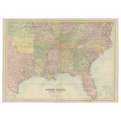
Antique Map of The United States Southern Section by A & C. Black, 1870
Located in Langweer, NL
Antique map titled 'United States Southern Section'. Original antique map of Map of The United
Category
Antique Late 19th Century Maps
Materials
Paper
H 17.52 in W 23.63 in D 0.02 in
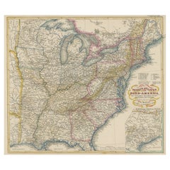
Antique Map of the Eastern United States with Inset Map of Texas
Located in Langweer, NL
. Inset map of the "southern principal part of Texas." Shows states, major cities, railroads, topography
Category
Antique Mid-19th Century Maps
Materials
Paper
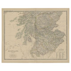
Antique Map of Southern Scotland by Johnston, 1882
Located in Langweer, NL
"Antique map titled 'Scotland'. Old map of Southern Scotland. This map originates from 'The Royal
Category
Antique 19th Century Maps
Materials
Paper
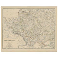
Antique Map of Southern Russia by Johnston, 1882
Located in Langweer, NL
"Antique map titled 'South-West Russia'. Old map of southern Russia, also showing the extent of the
Category
Antique 19th Century Maps
Materials
Paper
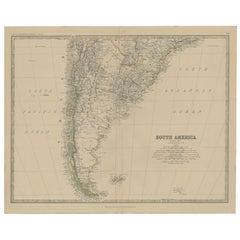
Antique Map of South America, Southern Part, 1882
Located in Langweer, NL
Antique map titled 'South America'. Old map of South America. This map originates from 'The Royal
Category
Antique 19th Century Maps
Materials
Paper
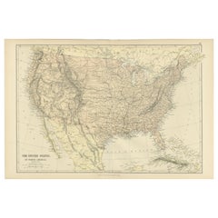
Antique Map of The United States of North America, 1882
Located in Langweer, NL
This is a historical map titled "The United States of North America, Central Part" from the 1882
Category
Antique 1880s Maps
Materials
Paper
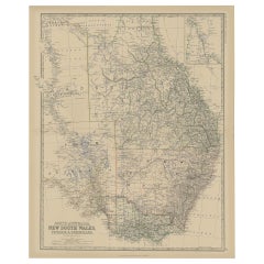
Old Map of Southern Australia, with an Inset Map of Cape York Peninsula, 1882
Located in Langweer, NL
Southern Australia, with an inset map of Cape York Peninsula. This map originates from 'The Royal Atlas of
Category
Antique 1880s Maps
Materials
Paper
H 24.22 in W 19.53 in D 0 in
1859 "Map of the United States of America..." by J. H. Colton
By J.H. Colton
Located in Colorado Springs, CO
Presented is an 1859 “Map of the United States of America, the British Provinces, Mexico, the West
Category
Antique 1850s American Maps
Materials
Paper
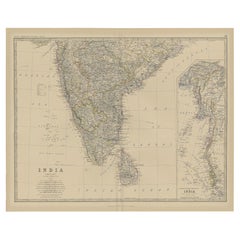
Old Map of Southern India and Ceylon 'Sri Lanka', 1882
Located in Langweer, NL
Antique map titled 'India (Southern Sheet)'.
Old map of Southern India and Ceylon (Sri Lanka
Category
Antique 1880s Maps
Materials
Paper
Antique Map of Southern Italy and Sardinia by Johnston, 1882
Located in Langweer, NL
"Antique map titled 'South Italy and the Island of Sardinia'. Old map of Southern Italy and the
Category
Antique 19th Century Maps
Materials
Paper
Antique Map of the 'Southern' German Empire by Johnston, 1882
Located in Langweer, NL
Antique map titled 'Empire of Germany'. Old map of the southern portion of the German Empire. This
Category
Antique 19th Century Maps
Materials
Paper
Old Map of Southern Russia, Incl the Extent of the Kingdom of Poland, 1882
Located in Langweer, NL
Antique map titled 'South-West Russia'.
Old map of southern Russia, also showing the extent of
Category
Antique 1880s Maps
Materials
Paper
H 19.53 in W 24.1 in D 0 in
1863 "Lloyd's New Map of the United States, the Canadas, and New Brunswick"
Located in Colorado Springs, CO
Presented is “Lloyd's New Map of the United States, the Canadas and New Brunswick, From the latest
Category
Antique 1860s American Maps
Materials
Linen, Wood, Paper
H 37 in W 49.5 in D 1 in
Antique Map of the Eastern United States with Only the Northern Part of Florida
Located in Langweer, NL
. Inset map of the "southern principal part of Texas." Shows states, major cities, railroads, topography
Category
Antique Mid-19th Century Maps
Materials
Paper
H 14.45 in W 17.92 in D 0.02 in
Map of Southern Italy inlcluding Sardinia and Inset of the Bay of Naples, c.1860
Located in Langweer, NL
Antique map titled 'South Italy and the Island of Sardinia'.
Old map of Southern Italy and the
Category
Antique 1860s Maps
Materials
Paper
H 19.3 in W 24.41 in D 0 in
Antique Map of the Region of Georgia with Inset Maps of Florida and Texas
Located in Langweer, NL
southern part of Texas. This map was part of a set of six individual sheets with maps of the United States
Category
Antique Late 19th Century Maps
Materials
Paper
H 15.04 in W 18.63 in D 0.02 in
Colored wall map of the WORLD
By Chambon
Located in ZWIJNDRECHT, NL
, this map shows an early copy of a Buache type 1 Mer de l'Ouest.
Four states of this map were found
Category
Antique Mid-18th Century French French Provincial Maps
Materials
Wood, Paper
Antique Map of South Australia by Johnston, 1882
By Thomas Kitchin
Located in Langweer, NL
Antique map titled 'South Australia, New South Wales, Victoria & Queensland'. Old map of Southern
Category
Antique 19th Century Maps
Materials
Paper
Antique Map of Tennessee, Kentucky, Virginia, Alabama, Georgia and Surroundings
Located in Langweer, NL
southern part of Texas. This map was part of a set of six individual sheets with maps of the United States
Category
Antique Mid-19th Century Maps
Materials
Paper
Free Shipping
H 15.16 in W 18.71 in D 0.02 in
Antique Map of Scandinavia by Van der Aa 'circa 1710'
Located in Langweer, NL
. The lower map depicts the Baltic Sea and Southern Scandinavia, with Eastern Prussia and the Baltic
Category
Antique Early 18th Century Maps
Materials
Paper
Antique Map of Borneo (Largely Kalimantan), the Largest Island of Asia, 1726
Located in Langweer, NL
Antique map Indonesia titled 'Kaart van het Eyland Borneo'. Early map of the Island of Borneo. This
Category
Antique 18th Century Maps
Materials
Paper
H 18.51 in W 22.64 in D 0 in
Antique Map of North and South Africa by Johnston, 1882
Located in Langweer, NL
Two antique maps on one sheet titled 'N.W. Africa, Marocco, Algeria & Tunis' and 'Southern Africa
Category
Antique 19th Century Maps
Materials
Paper
Antique Map of the Gulf of Mexico and all the islands of the West Indies
Located in Langweer, NL
all the islands of the West Indies. It also includes nice detail of the southern United States
Category
Antique Early 19th Century Maps
Materials
Paper
H 17.41 in W 23.63 in D 0.02 in
1847 Antique Map of Mexico, Texas and California by Samuel Augustus Mitchell
By Samuel Augustus Mitchell 1
Located in Colorado Springs, CO
Presented is the second edition of Samuel Augustus Mitchell's Map of Mexico, Including Yucatan
Category
Antique 1840s American Maps
Materials
Paper
H 32 in W 23.63 in D 0.5 in
Old Steel Engraved Map of the Western Part of the Madras Presidency, 1831
Located in Langweer, NL
, the presidency included most of southern India, including the whole of the Indian states of Tamil Nadu
Category
Antique 1830s Maps
Materials
Paper
H 13.78 in W 16.15 in D 0 in
Mediterranean Tapestry: A 19th Century Map of the Mediterranean Shores, 1882
Located in Langweer, NL
This map, titled "The Shores of the Mediterranean," is part of the 1882 atlas by Blackie & Son, and
Category
Antique 1880s Maps
Materials
Paper
H 11.03 in W 14.97 in D 0 in
Original Old Composite of Several Maps of the Ancient World on One Sheet, 1880
Located in Langweer, NL
This original antique map is from Karl Spruner von Merz's "Atlas Antiquus", later edited by
Category
Antique 1880s Maps
Materials
Paper
Free Shipping
H 15.56 in W 18.51 in D 0 in
1865 "Johnson's California, Utah, Nevada, Colorado, New Mexico, Arizona" Map
Located in Colorado Springs, CO
timely snapshot of the United States just after the Civil War. In addition to the maps, the atlas had
Category
Antique Mid-19th Century Maps
Materials
Paper
H 22.5 in W 30.5 in D 0.75 in
Antique Map the Windward or South Caribbean Islands and Guiana, 1859
Located in Langweer, NL
Antique map titled 'The Windward or South Caribbean Islands'. Original antique map of South
Category
Antique Mid-19th Century Maps
Materials
Paper
Original Antique Sea Chart of the Northern Part of Hispaniola, Western Cuba
Located in Langweer, NL
northern part of Hispaniola, western Cuba. The map includes the Turks & Caicos Islands and southern part of
Category
Antique Late 17th Century Maps
Materials
Paper
H 21.26 in W 24.02 in D 0.02 in
Vintage Cartographic Collection Set of India Explored - W. G. Blackie's 1859
Located in Langweer, NL
landmarks of the era.
2. **Map Two** covers the southern part of India, featuring the peninsular region
Category
Antique Mid-19th Century Maps
Materials
Paper
H 14.57 in W 21.26 in D 0.02 in
Cartographic Elegance: The British Raj's India, 1882 Atlas by Blackie and Son
Located in Langweer, NL
'Turkestan,' reflecting the interest and influence of the British Empire in the region.
The southern map
Category
Antique 1880s Maps
Materials
Paper
H 14.97 in W 22.45 in D 0 in
Vintage Rollable Map Wall Chart South America Brasilia and Neighbour States
Located in Berghuelen, DE
A classical pull-down school map showing South America with Brasilia and its neighbor states
Category
Mid-20th Century German Country Prints
Materials
Canvas, Wood, Paper
H 84.65 in W 77.56 in D 0.79 in
Vintage Mural Map United States Development in the 19th and 20th centuries
Located in Berghuelen, DE
A fantastic pull-down wall chart depicting a map of the development of the United States in the
Category
Vintage 1970s German Country Prints
Materials
Canvas, Wood, Paper
H 52.76 in W 76.38 in D 0.79 in
Travelers Mind Map
Located in New Orleans, LA
painters producing in the South today” by Bradley Sumrall, curator of the Ogden Museum of Southern Art
Category
2010s Contemporary Paintings
Materials
Fabric, Oil, Acrylic
Antique Engraved Hand Colored Colton & Co. Pocket Book Map of South Carolina
By G.W. & C.B. Colton
Located in Charleston, SC
clerks office of the district court
of the United States for the Southern District of New York.
Title
Category
Antique Late 19th Century American Prints
Materials
Paper
H 13.75 in W 16.5 in D 0.25 in
Vintage Map Wall Chart Countries of North America Rollable Mural Poster
Located in Berghuelen, DE
The vintage pull-down school map illustrates the countries / states of North America. Published by
Category
Late 20th Century German Country Prints
Materials
Canvas, Wood, Paper
H 51.19 in W 39.38 in D 0.79 in
Geobond - Colorful Authentic Urban Map Currency Painting
By Fabio Coruzzi
Located in Los Angeles, CA
Foggia, Italy in 1975, and now resides in Southern California, USA. Remarking on his work in conjunction
Category
21st Century and Contemporary Pop Art Figurative Paintings
Materials
Canvas, Oil Pastel, Mixed Media, Acrylic, Ink, Graphite
Broke - Mixed Media Credit Card Map Original Artwork
By Fabio Coruzzi
Located in Los Angeles, CA
1975, and now resides in Southern California, USA. Remarking on his work in conjunction with his
Category
21st Century and Contemporary Pop Art Mixed Media
Materials
Mixed Media, Spray Paint, Panel
Broke 2 - Mixed Media Credit Card Map Original Artwork
By Fabio Coruzzi
Located in Los Angeles, CA
1975, and now resides in Southern California, USA. Remarking on his work in conjunction with his
Category
21st Century and Contemporary Pop Art Mixed Media
Materials
Mixed Media, Spray Paint, Panel
New France and Labrador - Graphite Drawing, Landscape, On Antiqued Map
By Don Pollack
Located in Chicago, IL
Coeur d’Alenes trail in Northern Idaho. It is a place of rugged and stark beauty barely on the old maps
Category
21st Century and Contemporary Contemporary Landscape Paintings
Materials
Canvas, Oil
"Michigan, Ports of Indiana (Great Lakes)" by Patrick Fitzgerald
Located in Chicago, IL
the Great Lakes, specifically the southern coast of Lake Michigan. Like all of Fitzgerald's works, the
Category
21st Century and Contemporary American Industrial Contemporary Art
Materials
Wood
Signs of disorientation
By Patrick Beaulieu
Located in Montreal, Quebec
neighborhood. A series of artworks (installations, video, photographs, geopoetic maps and writings) emerged
Category
2010s Contemporary Figurative Photography
Materials
Digital
Signs of disorientation
By Patrick Beaulieu
Located in Montreal, Quebec
neighborhood. A series of artworks (installations, video, photographs, geopoetic maps and writings) emerged
Category
2010s Contemporary Figurative Photography
Materials
Digital
Signs of disorientation
By Patrick Beaulieu
Located in Montreal, Quebec
neighborhood. A series of artworks (installations, video, photographs, geopoetic maps and writings) emerged
Category
2010s Contemporary Figurative Photography
Materials
Digital
Signs of disorientation
By Patrick Beaulieu
Located in Montreal, Quebec
neighborhood. A series of artworks (installations, video, photographs, geopoetic maps and writings) emerged
Category
2010s Contemporary Figurative Photography
Materials
Digital
Signs of disorientation
By Patrick Beaulieu
Located in Montreal, Quebec
neighborhood. A series of artworks (installations, video, photographs, geopoetic maps and writings) emerged
Category
2010s Contemporary Figurative Photography
Materials
Digital
Signs of disorientation
By Patrick Beaulieu
Located in Montreal, Quebec
neighborhood. A series of artworks (installations, video, photographs, geopoetic maps and writings) emerged
Category
2010s Contemporary Figurative Photography
Materials
Digital
Signs of disorientation
By Patrick Beaulieu
Located in Montreal, Quebec
neighborhood. A series of artworks (installations, video, photographs, geopoetic maps and writings) emerged
Category
2010s Contemporary Figurative Photography
Materials
Digital
Signs of disorientation
By Patrick Beaulieu
Located in Montreal, Quebec
neighborhood. A series of artworks (installations, video, photographs, geopoetic maps and writings) emerged
Category
2010s Contemporary Figurative Photography
Materials
Digital
Signs of disorientation
By Patrick Beaulieu
Located in Montreal, Quebec
neighborhood. A series of artworks (installations, video, photographs, geopoetic maps and writings) emerged
Category
2010s Contemporary Figurative Photography
Materials
Digital
Signs of disorientation
By Patrick Beaulieu
Located in Montreal, Quebec
neighborhood. A series of artworks (installations, video, photographs, geopoetic maps and writings) emerged
Category
2010s Contemporary Figurative Photography
Materials
Digital
Signs of disorientation
By Patrick Beaulieu
Located in Montreal, Quebec
neighborhood. A series of artworks (installations, video, photographs, geopoetic maps and writings) emerged
Category
2010s Contemporary Figurative Photography
Materials
Digital
Signs of disorientation
By Patrick Beaulieu
Located in Montreal, Quebec
neighborhood. A series of artworks (installations, video, photographs, geopoetic maps and writings) emerged
Category
2010s Contemporary Figurative Photography
Materials
Digital
Signs of disorientation
By Patrick Beaulieu
Located in Montreal, Quebec
neighborhood. A series of artworks (installations, video, photographs, geopoetic maps and writings) emerged
Category
2010s Contemporary Figurative Photography
Materials
Digital
Signs of disorientation
By Patrick Beaulieu
Located in Montreal, Quebec
neighborhood. A series of artworks (installations, video, photographs, geopoetic maps and writings) emerged
Category
2010s Contemporary Figurative Photography
Materials
Digital
Signs of disorientation
By Patrick Beaulieu
Located in Montreal, Quebec
neighborhood. A series of artworks (installations, video, photographs, geopoetic maps and writings) emerged
Category
2010s Contemporary Figurative Photography
Materials
Digital
Signs of disorientation
By Patrick Beaulieu
Located in Montreal, Quebec
neighborhood. A series of artworks (installations, video, photographs, geopoetic maps and writings) emerged
Category
2010s Contemporary Figurative Photography
Materials
Digital
An exceptional pair of BLAEU table globes
By Willem Blaeu
Located in ZWIJNDRECHT, NL
maps, atlases and instruments. Blaeu’s globes were luxury items for wealthy and intellectual merchants
Category
Antique 17th Century European Dutch Colonial Globes
Materials
Other
Story of a Global Nomad (The End)
By Jinny Yu
Located in Montreal, Quebec
influence, western in construction, southern in flavor, or northerly contained they represent a systematic
Category
Early 2000s Abstract Abstract Paintings
Materials
Metal
- 1
Get Updated with New Arrivals
Save "Map Of Southern States", and we’ll notify you when there are new listings in this category.
Map Of Southern States For Sale on 1stDibs
Find a variety of map of southern states available on 1stDibs. Frequently made of paper, animal skin and shagreen, all map of southern states available were constructed with great care. Map of southern states have been made for many years, and versions that date back to the 18th Century alongside those produced as recently as the 21st Century. Map of southern states made by Georgian designers — are very popular at 1stDibs. Many map of southern states are appealing in their simplicity, but G.W. & C.B. Colton, Herman Moll and J.H. Colton produced popular map of southern states that are worth a look.
How Much are Map Of Southern States?
Map of southern states can differ in price owing to various characteristics — the average selling price at 1stDibs is $1,629, while the lowest priced sells for $108 and the highest can go for as much as $135,000.
More Ways To Browse
Grizzly Bear Painting
19 Th C Portrait
Portraits 18th 19 Th Century
19th Century Painting19th Century Portraits
17 Th And 18th Century Oil Paintings
Large 19 Th Century Oil Painting
Santos 1564
Small Mid19th
Vintage Travel Postcard
Jason Lewis
Map Of Quebec
Robert Madden
19 Th Century American Landscape Paintings
Paintings 18 And19 Th Century
Elk Garden
16 Th C Century Paintings
19 Th Century American Landscapes
Antique Map Scandinavia
