Map On Plate
17
to
106
793
379
657
302
283
238
209
122
117
81
59
56
51
48
46
44
43
41
39
38
38
33
28
26
25
22
17
15
15
13
13
13
12
12
12
12
11
11
11
11
10
10
10
9
9
9
9
8
8
8
7
7
6
6
5
5
4
4
3
3
2
1
1
42
42
31
31
21
Sort By
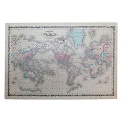
1864 Johnson's Map of the World on Mercator's Projection, Ric.B009
Located in Norton, MA
"This antique map came from Johnson's New Illustrated (Steel Plate) Family Atlas, published in 1867, by
Category
Antique 19th Century Dutch Maps
Materials
Paper
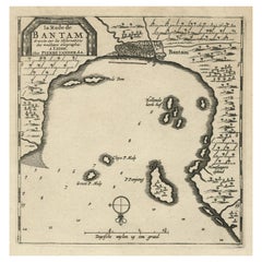
Antique Map of Banten Bay on Java Island, Indonesia, c.1720
Located in Langweer, NL
Antique map titled 'La Rade de Bantam'. A small early 18th century black and white map of Banten
Category
Antique 18th Century Maps
Materials
Paper
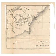
Antique Map of the Bolaang Mongondow District on Sulawesi by Stemler, c.1875
Located in Langweer, NL
Antique map titled 'Schets van Bolaang-Mongondow.' This map shows the Bolaang Mongondow district on
Category
Antique 19th Century Maps
Materials
Paper
H 14.97 in W 15.36 in D 0 in
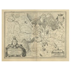
Lovely Antique Map Centered on Sedan and Doncheri and the Meuze River, ca.1650
Located in Langweer, NL
Original antique map with title: 'La Souveraineté de Sedan et de Raucourt, et la prevosté de
Category
Antique 1650s Maps
Materials
Paper
H 19.69 in W 23.23 in D 0 in
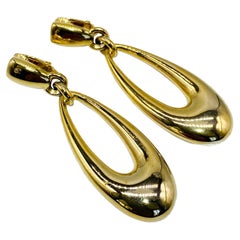
Vintage Anne Klein Gold Plated Clip On Earrings 1980s
By Anne Klein
Located in London, GB
-Crafted from gold plated metal
-Long tear drop shaped drops
Size & Fit
-Length - 2.5 inches
-Clip on
Category
Vintage 1980s American Clip-on Earrings
Materials
Gold Plate
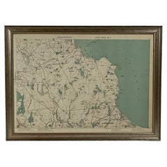
1891 Map of Plymouth County Mass
Located in Norwell, MA
Original 1891 map showing Sandwich, Bourne, Plymouth Carver, Middleborough, Plympton and Kingston
Category
Antique 1890s North American Maps
Materials
Paper
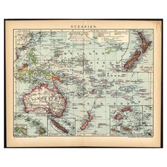
German Antique Map of Oceania, 1895
Located in Langweer, NL
Antique map titled 'Oceanie.' Map of Oceania. This attractive original old antique print / plate
Category
Antique 19th Century Maps
Materials
Paper
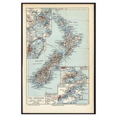
Antique Map of New Zealand, 1895
Located in Langweer, NL
attractive original old antique print / plate / map originates from 1885-1907 editions of a famous German
Category
Antique 19th Century Maps
Materials
Paper
Old Map Focusing on the Wine Region of Metz, the Moselle Region of France, 1657
Located in Langweer, NL
Antique map of France titled 'Territorium Metense'.
Old map focusing on the wine region
Category
Antique 1650s Maps
Materials
Paper
H 19.69 in W 23.63 in D 0 in
1875 "North America" Map by J. Bartholomew
Located in Colorado Springs, CO
"Encyclopædia Britannica, Ninth Edition" Along the right side margin, "Vol I. North America. Plate X. " Map
Category
Antique 1870s Scottish Maps
Materials
Paper
Antique Map of Sweden by Delamarche, 1806
Located in Langweer, NL
of Robert de Vaugondy's map plates and copyrights and later addes many plates from other sources as
Category
Antique 19th Century Maps
Materials
Paper
Antique Map of Asia by Delamarche, 1826
Located in Langweer, NL
Vaugondy's map plates and copyrights and later addes many plates from other sources as well
Category
Antique 19th Century Maps
Materials
Paper
Antique Map of Buckinghamshire in England, 1743
Located in Langweer, NL
never possessed a complete set of county map plates and made up their atlases in the early Dutch
Category
Antique 18th Century Maps
Materials
Paper
Antique Map of Africa by Delamarche, 1806
Located in Langweer, NL
from Jean-Baptiste Fortin of Robert de Vaugondy's map plates and copyrights and later addes many plates
Category
Antique 19th Century Maps
Materials
Paper
German Antique Map of Australia, Meyers, 1885
Located in Langweer, NL
original old antique print / plate / map originates from 1885-1907 editions of a famous German encyclopedia
Category
Antique 19th Century Maps
Materials
Paper
Antique Map of Normandy by Janssonius, 1657
Located in Langweer, NL
maps. Many of his plates have been acquired by Pieter Schenk and Gerard Valk.
Artist: Johannes
Category
Antique 17th Century Maps
Materials
Paper
Antique Map of Switzerland by Janssonius, 1657
Located in Langweer, NL
atlas. After his death his heirs still have published several maps. Many of his plates have been
Category
Antique 17th Century Maps
Materials
Paper
Antique Map of Smallingerland by Kuyper, 1868
Located in Langweer, NL
Antique map titled 'Provincie Friesland - Gemeente Smallingerland'. Map of the township of
Category
Antique 19th Century Maps
Materials
Paper
Antique Map of Ooststellingwerf by Kuyper, 1868
Located in Langweer, NL
Antique map titled 'Provincie Friesland - Gemeente Oost-Stellingwerf'. Map of the township of
Category
Antique 19th Century Maps
Materials
Paper
Antique Map of Oostdongeradeel by Kuyper, 1868
Located in Langweer, NL
Antique map titled 'Provincie Friesland - Gemeente Oost Dongeradeel'. Map of the township of
Category
Antique 19th Century Maps
Materials
Paper
Antique Map of Siberia by Reclus, 1881
Located in Langweer, NL
Antique map titled 'Itineraires en Siberie.' This map shows the itineraries of famous explorers in
Category
Antique 19th Century Maps
Materials
Paper
Antique Map of Friesland by Guicciardini, 1613
Located in Langweer, NL
Antique map titled 'Frisia Occidenta.' (Map of the province of Friesland, the Netherlands.) This
Category
Antique 17th Century Maps
Materials
Paper
Antique Map of the Barradeel Township, 1718
Located in Langweer, NL
Antique map Friesland titled 'De Grietenije van Barra Deel (..)'. Old map of Friesland, the
Category
Antique 18th Century Maps
Materials
Paper
Antique Map of the Baarderadeel Township, 1718
Located in Langweer, NL
Antique map Friesland titled 'Baardera Deel de Vierde Grietenije van Wester Goo (..)'. Old map of
Category
Antique 18th Century Maps
Materials
Paper
Antique Map of Nottinghamshire by Speed, 1676
Located in Langweer, NL
Antique map titled 'The Countie of Nottingham (..)'. Map of Nottinghamshire, England. Includes an
Category
Antique 17th Century Maps
Materials
Paper
Antique Map of Surrey by Speed, 1676
Located in Langweer, NL
Antique map titled 'Surrey described and divided into hundreds'. Map of Surrey, England. Includes
Category
Antique 17th Century Maps
Materials
Paper
Antique Map of China by Larousse, 1897
By Pierre Larousse
Located in Langweer, NL
Sheet: Front: 'Chine.' (China map). Verso: 'China.' (China views, nature, animals, costume). This
Category
Antique 19th Century Maps
Materials
Paper
Antique Map of Oceania by Johnston, 1882
Located in Langweer, NL
Antique map titled 'Oceania'. Old map of Oceania with inset maps of Western Australia, Tasmania and
Category
Antique 19th Century Maps
Materials
Paper
German Antique Map of Southeastern Australia, 1904
Located in Langweer, NL
chromolithography, rather than copper plate engraving, but reproducing the maps from zinc plates that were etched in
Category
20th Century Maps
Materials
Paper
Antique Map of Sumatra by Bellin, 1764
Located in Langweer, NL
Antique map Sumatra titled 'Carte de l'Isle de Sumatra'. Old map of Sumatra, Malaysia and the
Category
Antique 18th Century Maps
Materials
Paper
Antique Map of Overijssel by Visscher, 1632
Located in Langweer, NL
Antique map titled 'De Heerlyckheyt van Over-IJssel'. Old map of the province of Overijssel, the
Category
Antique 17th Century Maps
Materials
Paper
Antique Map of Stavoren by Priorato, 1673
Located in Langweer, NL
Antique map titled 'Staveren'. Original antique map of the city of Stavoren, Friesland, the
Category
Antique 17th Century Maps
Materials
Paper
Antique Map of Stavoren by Priorato, 1673
Located in Langweer, NL
Antique map titled 'Staveren'. Original antique map of the city of Stavoren, Friesland, the
Category
Antique 17th Century Maps
Materials
Paper
Antique Map of Stavoren by Blaeu, 1649
Located in Langweer, NL
Antique map titled 'Staveren'. Original antique map of the city of Stavoren, Friesland, The
Category
Antique 17th Century Maps
Materials
Paper
Antique Map of Oceania by Hérisson, 1816
Located in Langweer, NL
Antique map titled "Océanie ou cinquième partie du monde". This is an original antique map of
Category
Antique 19th Century Maps
Materials
Paper
Antique Map of Siberia by Bellin, 1754
Located in Langweer, NL
Antique map titled 'Carte de la Siberie'. Detailed map of Siberia, extending from the White Sea and
Category
Antique 18th Century Maps
Materials
Paper
Antique Map of Stavoren by Blaeu, 1649
Located in Langweer, NL
Antique map titled 'Staveren'. Original antique map of the city of Stavoren, Friesland, The
Category
Antique 17th Century Maps
Materials
Paper
Antique Map of Stavoren by Blaeu, 1649
Located in Langweer, NL
Antique map titled 'Staveren'. Original antique map of the city of Stavoren, Friesland, The
Category
Antique 17th Century Maps
Materials
Paper
Antique Map of Stavoren by Blaeu, 1649
Located in Langweer, NL
Antique map titled 'Staveren'. Original antique map of the city of Stavoren, Friesland, The
Category
Antique 17th Century Maps
Materials
Paper
Antique Map of Deventer in the Netherlands, 1691
Located in Langweer, NL
Plate 'Devendr.' (Plan of the fortified city of Deventer, The Netherlands.) This attractive
Category
Antique 17th Century Maps
Materials
Paper
Antique Map of Coevorden in the Netherlands, 1691
Located in Langweer, NL
Plate 'Covorden.' (Plan of the fortified city of Coevorden, The Netherlands.) This attractive
Category
Antique 17th Century Maps
Materials
Paper
Antique Map of Southeast Asia by Dussy, 1778
Located in Langweer, NL
"Antique map titled 'Indostan presqu'isles de l'Inde, Chine, Tartarie Independante.' - A map of
Category
Antique 18th Century Maps
Materials
Paper
Antique Map of Central Asia and India, 1904
Located in Langweer, NL
plate engraving, but reproducing the maps from zinc plates that were etched in relief (just like
Category
20th Century Maps
Materials
Paper
1858 Colton's Map of New York, Ric.B011
Located in Norton, MA
An 1858 Colton's map of New York
Ric.b011
Colton’s New York, 1858 - A large original color
Category
Antique 19th Century Unknown Maps
Materials
Paper
Antique Map of Southern Sulawesi by Stemfoort, 1885
Located in Langweer, NL
"Antique map titled 'Kaart van Zuid West Celebes'. Old map of the southern tip of the southwestern
Category
Antique 19th Century Maps
Materials
Paper
Antique Map of Oostergo, Friesland by Tirion, 1785
Located in Langweer, NL
Antique map Friesland titled 'Oostergo'. Antique map of part of Friesland depicting the 'Oostergo
Category
Antique 18th Century Maps
Materials
Paper
Interesting Original Antique Map of South America, 1822
Located in Langweer, NL
Antique map titled 'South America'.
Map of South America with attractive topography, surrounded
Category
Antique 19th Century Maps
Materials
Paper
Antique Map of New Zealand and Tasmania, 1904
Located in Langweer, NL
chromolithography, rather than copper plate engraving, but reproducing the maps from zinc plates that were etched in
Category
20th Century Maps
Materials
Paper
Antique Map of Stavoren by Merian, c.1650
Located in Langweer, NL
Antique map titled 'Stavera'. Map of the city of Stavoren, Friesland. With German legend. Trimmed
Category
Antique 17th Century Maps
Materials
Paper
Antique Map of Oostergo, Friesland by Tirion, 1785
Located in Langweer, NL
Antique map Friesland titled 'Oostergo'. Antique map of part of Friesland depicting the 'Oostergo
Category
Antique 18th Century Maps
Materials
Paper
Antique Map of Stavoren by Merian, c.1650
Located in Langweer, NL
Antique map titled 'Stavera'. Map of the city of Stavoren, Friesland. With German legend. Trimmed
Category
Antique 17th Century Maps
Materials
Paper
Antique Map of France by Janssonius, c.1650
Located in Langweer, NL
Antique map titled 'Gallia Vetus'. Beautiful map of France based on Caesar's De Bello Gallico. In
Category
Antique 17th Century Maps
Materials
Paper
Antique Map of France by Janssonius, c.1650
Located in Langweer, NL
Antique map titled 'Gallia Vetus'. Beautiful map of France based on Caesar's De Bello Gallico. In
Category
Antique 17th Century Maps
Materials
Paper
Antique Map of Southern India by Andree, 1904
Located in Langweer, NL
engraving, but reproducing the maps from zinc plates that were etched in relief (just like letterpress
Category
20th Century Maps
Materials
Paper
Antique Map of North and East Asia, 1751
Located in Langweer, NL
as an peninsular. This map originates from the plate section. This old antique print originates from
Category
Antique 18th Century Maps
Materials
Paper
Antique Map of Oostergo, Friesland by Tirion, 1785
Located in Langweer, NL
Antique map Friesland titled 'Oostergo'. Antique map of part of Friesland depicting the 'Oostergo
Category
Antique 18th Century Maps
Materials
Paper
Antique Map of Portugal by Placide, c.1700
Located in Langweer, NL
Antique map titled 'Le Portugal dedié au Roy (..)'. Large and detailed map of Portugal. With a
Category
Antique 18th Century Maps
Materials
Paper
Antique Map of France with Decorative Border, 1766
Located in Langweer, NL
Antique map titled 'La France, divisée en ses quarante Gouvernemens Généraux.' Attractive map of
Category
Antique 18th Century Maps
Materials
Paper
Antique Map of South Australia by Johnston, 1882
By Thomas Kitchin
Located in Langweer, NL
Antique map titled 'South Australia, New South Wales, Victoria & Queensland'. Old map of Southern
Category
Antique 19th Century Maps
Materials
Paper
Antique Map of South Australia by Tallis, 1851
By Thomas Kitchin
Located in Langweer, NL
Antique map Australia titled 'Part of South Australia'. Decorative map of part of South Australia
Category
Antique 19th Century Maps
Materials
Paper
- 1
- ...
Get Updated with New Arrivals
Save "Map On Plate", and we’ll notify you when there are new listings in this category.
Map On Plate For Sale on 1stDibs
At 1stDibs, there are many versions of the ideal map on plate for your home. A map on plate — often made from paper, metal and ceramic — can elevate any home. Find 749 options for an antique or vintage map on plate now, or shop our selection of 33 modern versions for a more contemporary example of this long-cherished piece. Your living room may not be complete without a map on plate — find older editions for sale from the 18th Century and newer versions made as recently as the 21st Century. A map on plate, designed in the Hollywood Regency, Georgian or mid-century modern style, is generally a popular piece of furniture. Johannes Janssonius, Pieter Van Der Aa and Jacques-Nicolas Bellin each produced at least one beautiful map on plate that is worth considering.
How Much is a Map On Plate?
The average selling price for a map on plate at 1stDibs is $772, while they’re typically $1 on the low end and $968,768 for the highest priced.
Questions About Map On Plate
- What is a service plate?1 Answer1stDibs ExpertOctober 12, 2021A service plate is a large plate used for serving a multi-course meal. A service plate is never used to serve or eat food directly from; it is used as a base plate for appetizers, soup, and salad. Shop a variety of antique and vintage service plates on 1stDibs.
- What is Sheffield plate?1 Answer1stDibs ExpertSeptember 25, 2019
Sheffield plate is a layered combination of silver and copper.
- What are Imari plates?1 Answer1stDibs ExpertApril 5, 2022Imari is the Western term for Arita ware, or Japanese porcelain made at the Arita kilns. Imari porcelain was very popular in the 17th and 18th century and was produced in large quantities. Typically these items were made with an underglaze of blue, with additional colors added in an overglaze style. On 1stDibs, find a variety of original artwork from top artists.
- What is an Imari plate?1 Answer1stDibs ExpertOctober 19, 2021An Imari plate is crafted from a style of Japanese porcelain made in the region now known as Arita. These plates and other Imari ware are brightly colored. Find a collection of antique and vintage Imari plates on 1stDibs today.
- What is an armorial plate?1 Answer1stDibs ExpertApril 5, 2022An armorial plate, also known as heraldic china, is a ceramic plate decorated with the coat of arms of either a family or an institution, typically European. You’ll find a variety of armorial plates from some of the world’s top sellers on 1stDibs.
- What is a canape plate?1 Answer1stDibs ExpertFebruary 22, 2021A canape plate is also known as an appetizer plate. It's generally smaller than a salad plate, making it just big enough for a few hors d'oeuvres.
- What is a plate rack?1 Answer1stDibs ExpertApril 5, 2022A plate rack is a piece of storage furniture with vertical or horizontal rods designed to hold dishes. Most mount on the wall, but you can also find freestanding racks. On 1stDibs, shop a range of antique and vintage plate racks.
- What is a majolica plate?1 Answer1stDibs ExpertApril 5, 2022A majolica plate is a decorative piece of pottery that has a round flat shape. It is a heavy clay vessel that features a painted and glazed enamel finish. It emerged from 15th-century Italy but quickly became popular in Spain. Later examples come from Victorian England. On 1stDibs, shop a selection of majolica plates.
- What is a melamine plate?1 Answer1stDibs ExpertApril 5, 2022Melamine plates, and dinnerware as a whole, are crafted with an organic-based material that makes it shatter-resistant and more durable than standard plastic. On 1stDibs, find a collection of melamine dinnerware from some of the world’s top sellers.
- What are cloisonne plates?1 Answer1stDibs ExpertApril 5, 2022Cloisonne plates are decorative enamel plates. Cloisonne refers to a type of enameling technique where wires are soldered in place on the plate to be decorated and filled with a single color of enamel. Shop a range of antique cloisonne plates on 1stDibs.
- What is a Wedgwood plate?1 Answer1stDibs ExpertApril 5, 2022A Wedgwood plate is a flat round dish produced by Wedgwood, a manufacturer based in Stoke-on-Trent, UK, that opened in 1759. Depending on the design, the plates may function purely as decorative objects or be suitable for serving food. On 1stDibs, shop a variety of Wedgwood plates.
- What is a porcelain plate?1 Answer1stDibs ExpertApril 22, 2024A porcelain plate is a dish made out of a material called porcelain. A type of ceramic, porcelain is made out of highly refined clay that gets fired at high temperatures. Porcelain plates have an appealing translucent appearance and are harder and less porous than other types of ceramic dinnerware. On 1stDibs, explore a selection of porcelain plates.
- 1stDibs ExpertApril 16, 2024The mark for silver plating varies. In the U.S., the most common markings are EP, EPNS, A1 and B1. A UK silver plate may feature a wide range of markings. You can find pictures of these identifying marks on trusted online resources and use them to determine if a particular piece is silver-plated. Alternatively, a certified appraiser or knowledgeable dealer can assist with identification. On 1stDibs, shop a collection of silver wares.
- Does gold plating tarnish?1 Answer1stDibs ExpertApril 26, 2024Yes, gold plating does tarnish in some cases. Compounds in the air, sweat, beauty products and cleaning products can react with metals and cause discoloration. To keep your gold-plated jewelry looking great, follow the maker's care and storage instructions and remove it before swimming, showering, applying skin care products and cosmetics and working with household chemicals. Shop a variety of gold jewelry on 1stDibs.
- What is a Blue Willow plate?1 Answer1stDibs ExpertApril 5, 2022A Blue Willow plate is a flat transferware pottery dish that features a particular Chinoiserie landscape pattern called Blue Willow. Thomas Turner introduced the pattern in 1779. Traditional Chinese blue and white porcelain served as his inspiration. On 1stDibs, shop a selection of Blue Willow ceramics.
- What is a cake plate called?1 Answer1stDibs ExpertOctober 12, 2021A cake plate is called a cake stand. It’s a pedestal-like structure with a plate on top on which pastries and cakes are decorated or served. A cake stand can be with a single plate or multiple plates and can be arranged with spinning support in the middle. A cake stand comes in varied materials like wood, plastic, glass or metal. On 1stDibs, find a variety of antique and vintage cake stands.
- 1stDibs ExpertOctober 19, 2021Bread and butter are separated from the sauce, gravy, and fluids from other items on the dish using the bread-and-butter plate. When a plate isn't available, a slice of bread or a roll is placed on the tablecloth or the rim of the dinner plate, which also holds the butter. Find a collection of antique and vintage bread and butter plates on 1stDibs today.
- What is an antique silver plate?2 Answers1stDibs ExpertApril 5, 2022Silver-plating refers to the process of applying a thin layer of silver overtop of a base metal, such as copper, nickel or pewter. An antique silver-plated item would have gone through this same process. Shop a collection of expertly vetted antique silver plate items from some of the world’s top sellers on 1stDibs.1stDibs ExpertApril 5, 2022Antique silver plates are antique plates made from either pure silver or have been silver-plated. Silver is a timeless material that’s been popular for centuries, and antique silver is always highly regarded. Shop a collection of antique silver plates from some of the world’s top sellers on 1stDibs.
- What is a fireplace back plate?1 Answer1stDibs ExpertApril 5, 2022A fireplace back plate is a piece of metal that goes on the wall in the back of the fireplace. While most are highly decorative, the plates actually serve the functional purpose of protecting the fireplace from soot and heat. Find a variety of antique fireplace back plates on 1stDibs.
- 1stDibs ExpertMarch 22, 2022To hang Fornasetti plates, thread a length of string through the two small holes found on the tops of their backs. Tie the string in a secure knot and then hang from a nail, screw or hook. Avoid using plate hanger hardware, as it could crack or damage the plates. You'll find a collection of Fornasetti plates on 1stDibs.
