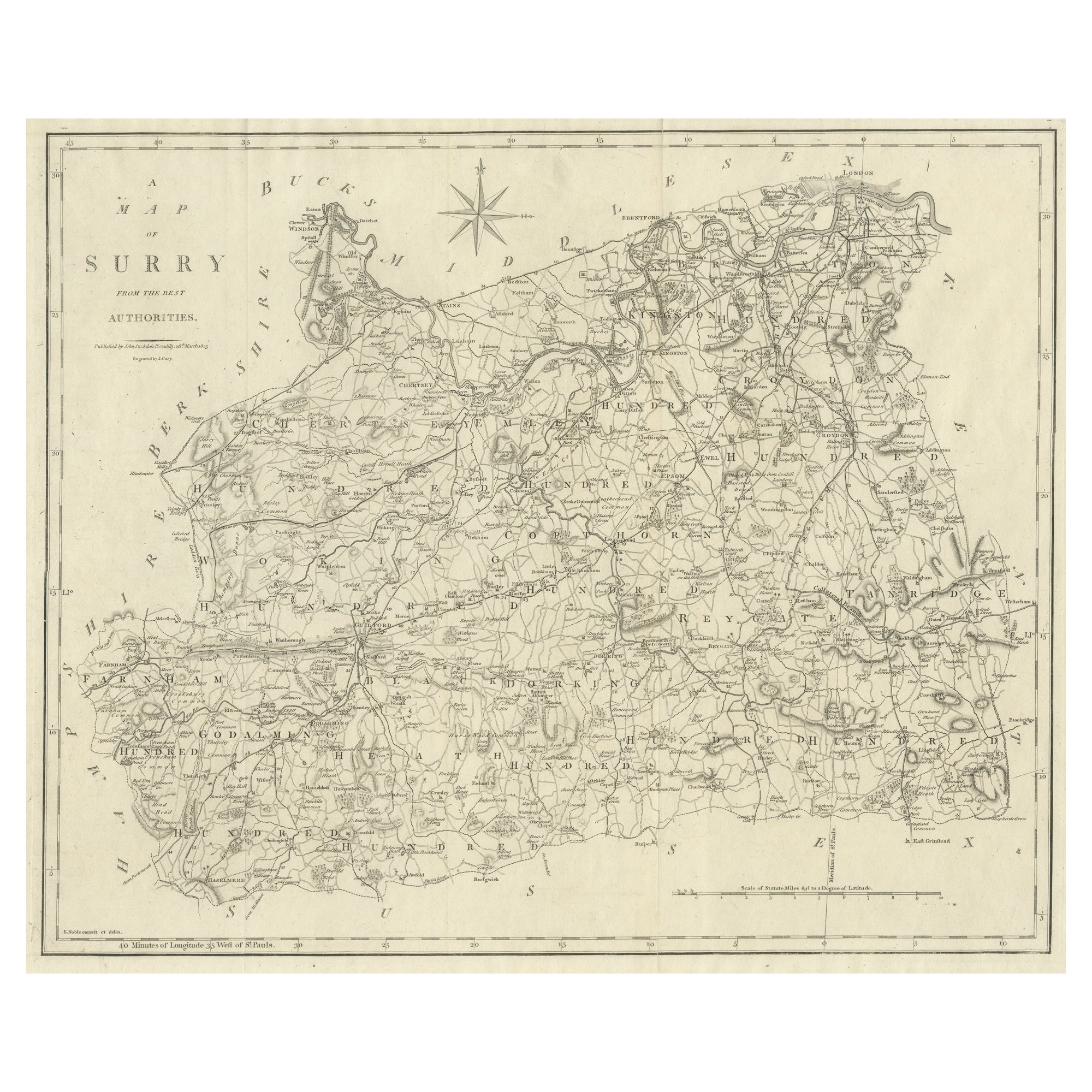
Items Similar to Antique Map of Surrey by Speed, 1676

Want more images or videos?
Request additional images or videos from the seller
1 of 5
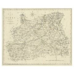
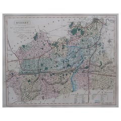
Antique Map of Surrey by Speed, 1676
About the Item
Antique map titled 'Surrey described and divided into hundreds'. Map of Surrey, England. Includes inset elevations of Richmond and Nonsuch Palaces. This map originates from 'Theatre of Great Britaine' by John Speed. Artists and Engravers: John Speed (1551 or 1552 ? 28 July 1629) was an English cartographer and historian. He is, alongside Christopher Saxton, one of the best known English mapmakers of the early modern period.
Artist: John Speed (1551 or 1552 ? 28 July 1629) was an English cartographer and historian. He is, alongside Christopher Saxton, one of the best known English mapmakers of the early modern period.
Condition: Fair, general age-related toning. Repair on folding line. Few tears (slightly affecting image). Minor wear, English text on verso. Please study image carefully.
Date: 1676
Overall size: 54 x 41.5 cm.
Image size: 0.001 x 51 x 38.5 cm.
Antique prints have long been appreciated for both their aesthetic and investment value. They were the product of engraved, etched or lithographed plates. These plates were handmade out of wood or metal, which required an incredible level of skill, patience and craftsmanship. Whether you have a house with Victorian furniture or more contemporary decor an old engraving can enhance your living space. We offer a wide range of authentic antique prints for any budget.
- Dimensions:Height: 16.34 in (41.5 cm)Width: 21.26 in (54 cm)Depth: 0 in (0.01 mm)
- Materials and Techniques:
- Period:
- Date of Manufacture:1676
- Condition:
- Seller Location:Langweer, NL
- Reference Number:
About the Seller
5.0
Platinum Seller
These expertly vetted sellers are 1stDibs' most experienced sellers and are rated highest by our customers.
Established in 2009
1stDibs seller since 2017
1,928 sales on 1stDibs
Typical response time: <1 hour
- ShippingRetrieving quote...Ships From: Langweer, Netherlands
- Return PolicyA return for this item may be initiated within 14 days of delivery.
More From This SellerView All
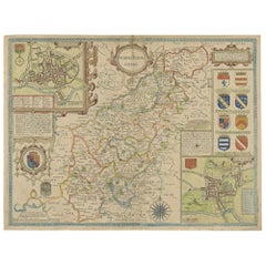
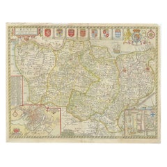
- Antique Map of Northamptonshire by Speed, 1676Located in Langweer, NLAntique map titled 'Norhamtonshire'. Map of Norhamptonshire, England. Includes inset town plans of Peterborough and Northampton. This map originates from 'Theatre of Great Britaine' ...Category
Antique 17th Century Maps
MaterialsPaper
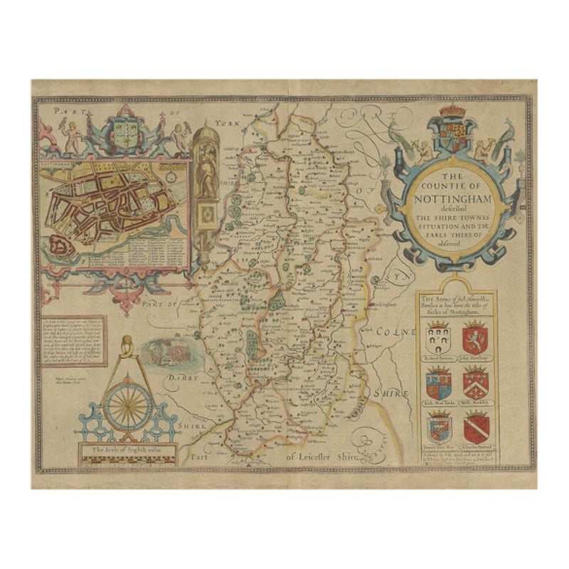
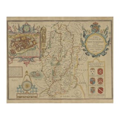
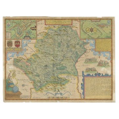
- Antique Map of Nottinghamshire by Speed, 1676Located in Langweer, NLAntique map titled 'The Countie of Nottingham (..)'. Map of Nottinghamshire, England. Includes an inset town plan of Nottingham. This map originates from 'Theatre of Great Britaine' ...Category
Antique 17th Century Maps
MaterialsPaper
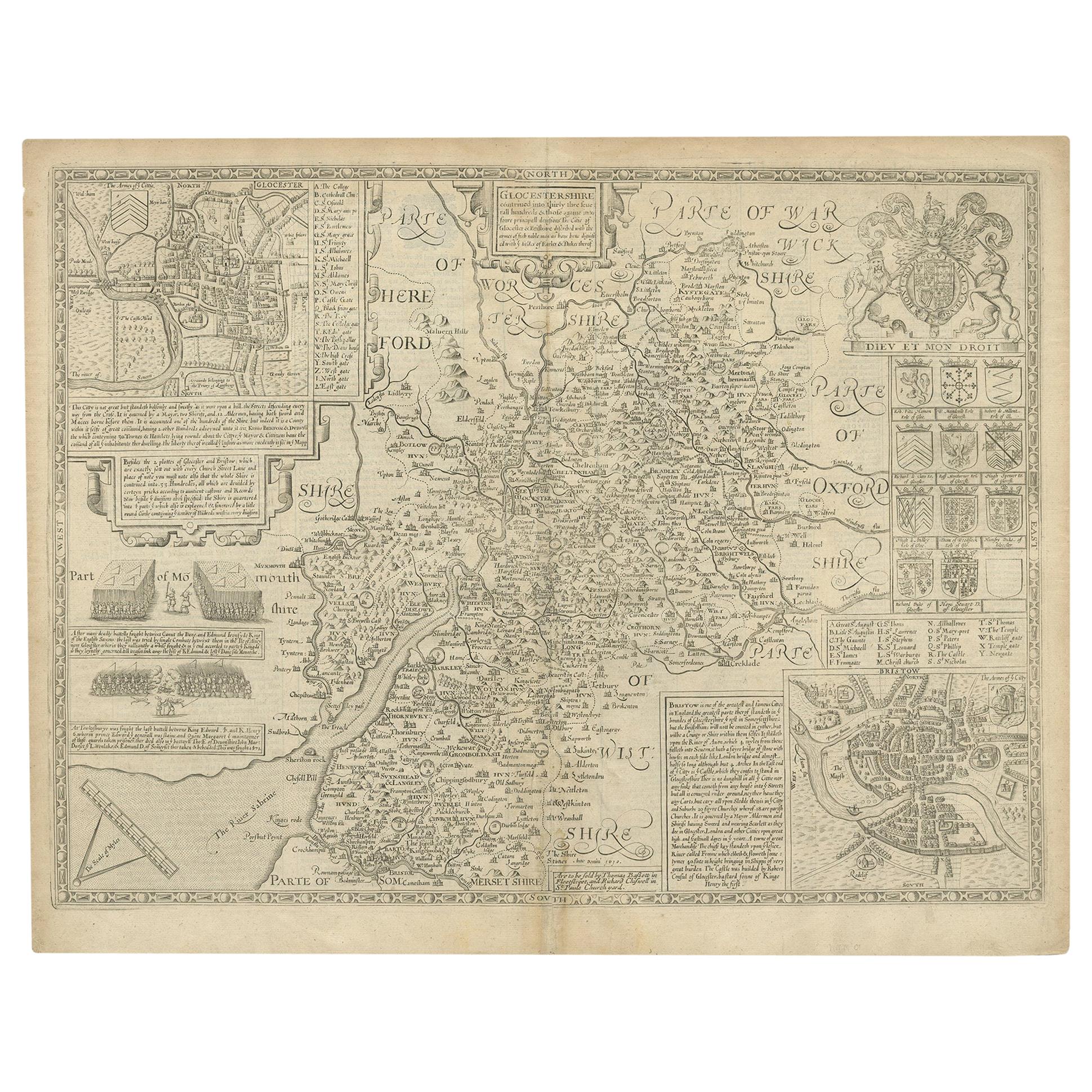
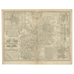
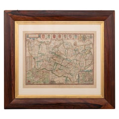
- Antique Map of Gloucestershire by John Speed, '1676'Located in Langweer, NLAntique map titled 'Glocestershire'. Original 17th century map of Gloucestershire, South West England, by John Speed. With inset town plans of G...Category
Antique Mid-17th Century Maps
MaterialsPaper
- Large Antique County Map of Surrey, EnglandLocated in Langweer, NLAntique map titled 'A Map of Surry from the best Authorities'. Original old county map of Surrey, England. Engraved by John Cary. Originates from 'New British Atlas' by John Stockdal...Category
Antique Early 19th Century Maps
MaterialsPaper
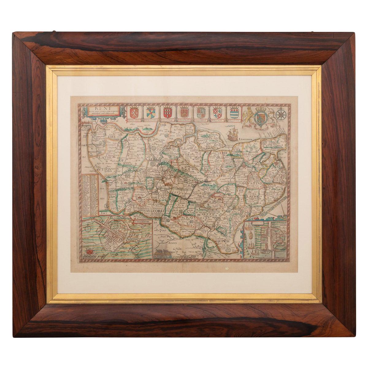
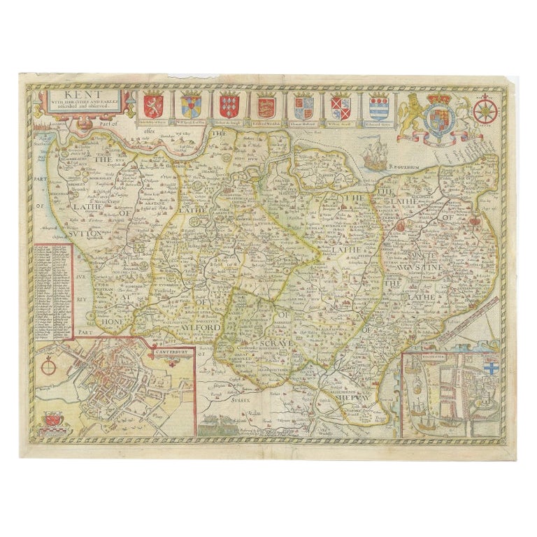
- Antique Map of Kent with Inset Plans of Rochester & Canterbury, England, 1676Located in Langweer, NLAntique map titled 'Kent with her Cities and Earles described and observed'. Map of Kent, England. Includes inset town plans of Rochester and Canterbury....Category
Antique 17th Century Maps
MaterialsPaper
- Antique Map of Hertfordshire in England by Speed, 1627Located in Langweer, NLAntique map titled 'Hartfordshire described the sittuations of Hartford (..)'. Map of Hertfordshire, England. Includes inset maps of Hertford and the Roman settlement of Verolani...Category
Antique 17th Century Maps
MaterialsPaper
You May Also Like
- 17th Century John Speed Map of Kent with Her Cities & Earles Described, C.1676By John SpeedLocated in Royal Tunbridge Wells, KentAntique 17th century British very rare and original John Speed (1551-1629) map of Kent with her Cities and Earles described and observed, Thomas Bassett & ...Category
Antique 17th Century British Maps
MaterialsPaper
- Original Antique English County Map - Surrey. J & C Walker. 1851Located in St Annes, LancashireGreat map of Surrey Original colour By J & C Walker Published by Longman, Rees, Orme, Brown & Co. 1851 Unframed.Category
Antique 1850s English Other Maps
MaterialsPaper
- 17th Century John Speed Map of Denbighshire, c.1610By John SpeedLocated in Royal Tunbridge Wells, KentAntique early 17th century British very rare and original John Speed, hand coloured map of Denbighshire, dated 1610, by John Sunbury and George Humble. John...Category
Antique 17th Century British Maps
MaterialsWood, Paper
- 1861 Topographical Map of the District of Columbia, by Boschke, Antique MapLocated in Colorado Springs, COPresented is an original map of Albert Boschke's extremely sought-after "Topographical Map of the District of Columbia Surveyed in the Years 1856 ...Category
Antique 1860s American Historical Memorabilia
MaterialsPaper
- 17th Century John Speed Map of the Barkshire Described, c.1616By John SpeedLocated in Royal Tunbridge Wells, KentAntique 17th century British very rare and original John Speed (1551-1629) map of the Barkshire Described, J. Sud and Georg Humble, publication (1616 or lat...Category
Antique 17th Century British Maps
MaterialsPaper
- 1907 Map of Colorado, Antique Topographical Map, by Louis NellLocated in Colorado Springs, COThis highly detailed pocket map is a topographical map of the state of Colorado by Louis Nell from 1907. The map "has been complied from all availabl...Category
Antique Early 1900s American Maps
MaterialsPaper


Recently Viewed
View AllMore Ways To Browse
Antique English 17th Century
Used Furniture Surrey
Antique Richmond
John Speed
Antique Furniture Surrey
Speed Map
John Speed Map
John Speed Antique Maps
John Speed Maps
Speed Antique Map
Surrey Map
Richmond Map
Antique Maps Surrey
Antique 16th Century Plates
Antique Caribbean Furniture
17th Century Plate Set
Antique Rose Compass
Antique Map Paint