Items Similar to Antique Map of Hertfordshire in England by Speed, 1627

Want more images or videos?
Request additional images or videos from the seller
1 of 5
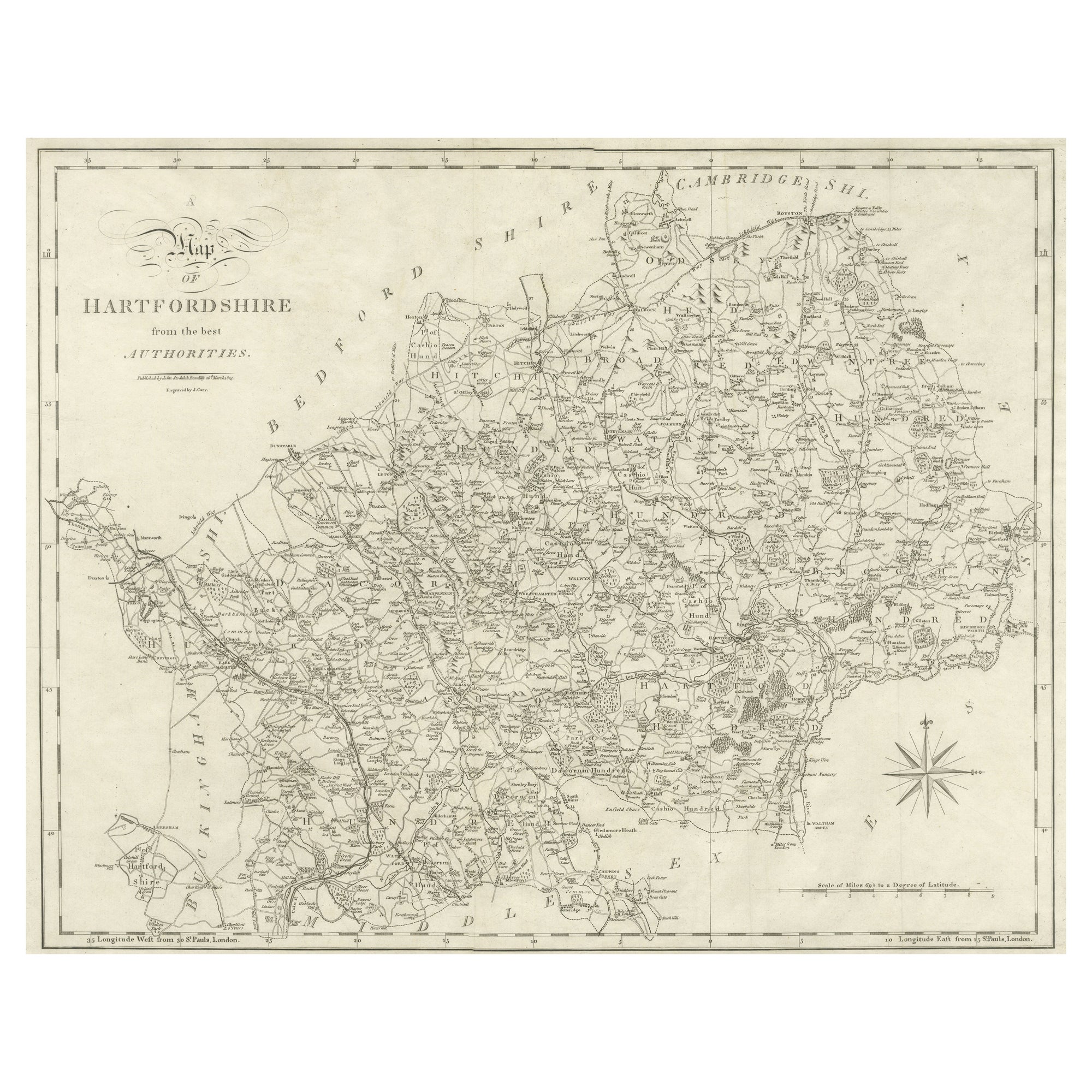
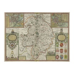
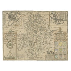
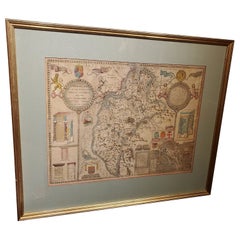
Antique Map of Hertfordshire in England by Speed, 1627
About the Item
Antique map titled 'Hartfordshire described the sittuations of Hartford (..)'.
Map of Hertfordshire, England. Includes inset maps of Hertford and the Roman settlement of Verolanium, now St. Albans. This map originates from 'Theatre of Great Britaine' by John Speed.
Artist: John Speed (1551 or 1552 ? 28 July 1629) was an English cartographer and historian. He is, alongside Christopher Saxton, one of the best known English mapmakers of the early modern period.
Condition: Fair, strong toning. Repair on folding line. Few tears (slightly affecting image). Minor wear, English text on verso. Please study image carefully.
Date: 1627
We sell original antique maps to collectors, historians, educators and interior decorators all over the world. Our collection includes a wide range of authentic antique maps from the 16th to the 20th centuries. Buying and collecting antique maps is a tradition that goes back hundreds of years. Antique maps have proved a richly rewarding investment over the past decade, thanks to a growing appreciation of their unique historical appeal. Today the decorative qualities of antique maps are widely recognized by interior designers who appreciate their beauty and design flexibility. Depending on the individual map, presentation, and context, a rare or antique map can be modern, traditional, abstract, figurative, serious or whimsical. We offer a wide range of authentic antique maps for any budget.
- Dimensions:Height: 20.48 in (52 cm)Width: 15.95 in (40.5 cm)Depth: 0 in (0.01 mm)
- Materials and Techniques:
- Period:
- Date of Manufacture:1627
- Condition:
- Seller Location:Langweer, NL
- Reference Number:
About the Seller
5.0
Platinum Seller
These expertly vetted sellers are 1stDibs' most experienced sellers and are rated highest by our customers.
Established in 2009
1stDibs seller since 2017
1,948 sales on 1stDibs
Typical response time: <1 hour
- ShippingRetrieving quote...Ships From: Langweer, Netherlands
- Return PolicyA return for this item may be initiated within 14 days of delivery.
More From This SellerView All
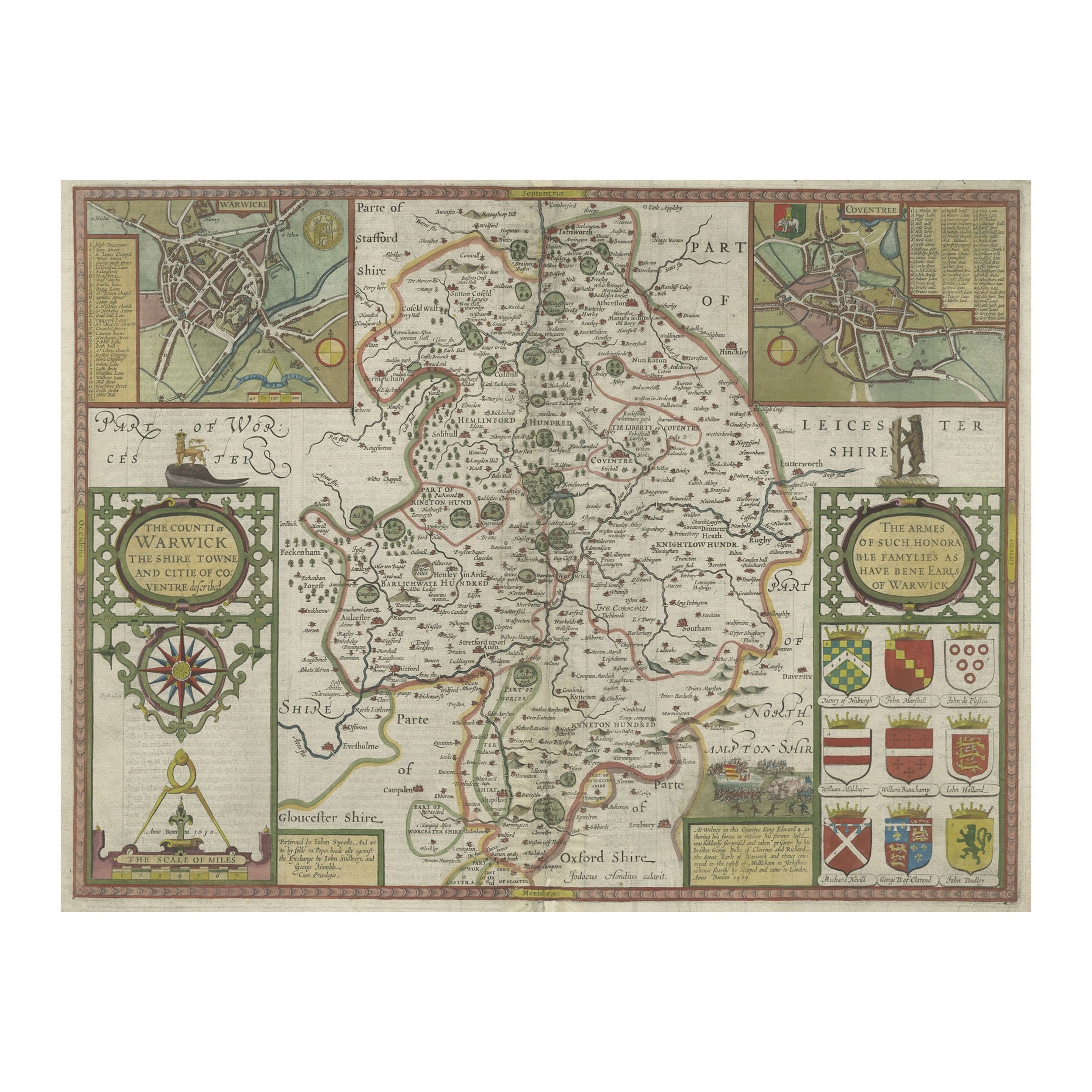
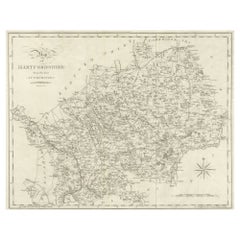
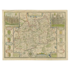
- Large Antique County Map of Hertfordshire, EnglandLocated in Langweer, NLAntique map titled 'A Map of Hartfordshire from the best Authorities'. Original old county map of Hertfordshire, England. Engraved by John Cary. Originates from 'New British Atlas' b...Category
Antique Early 19th Century Maps
MaterialsPaper
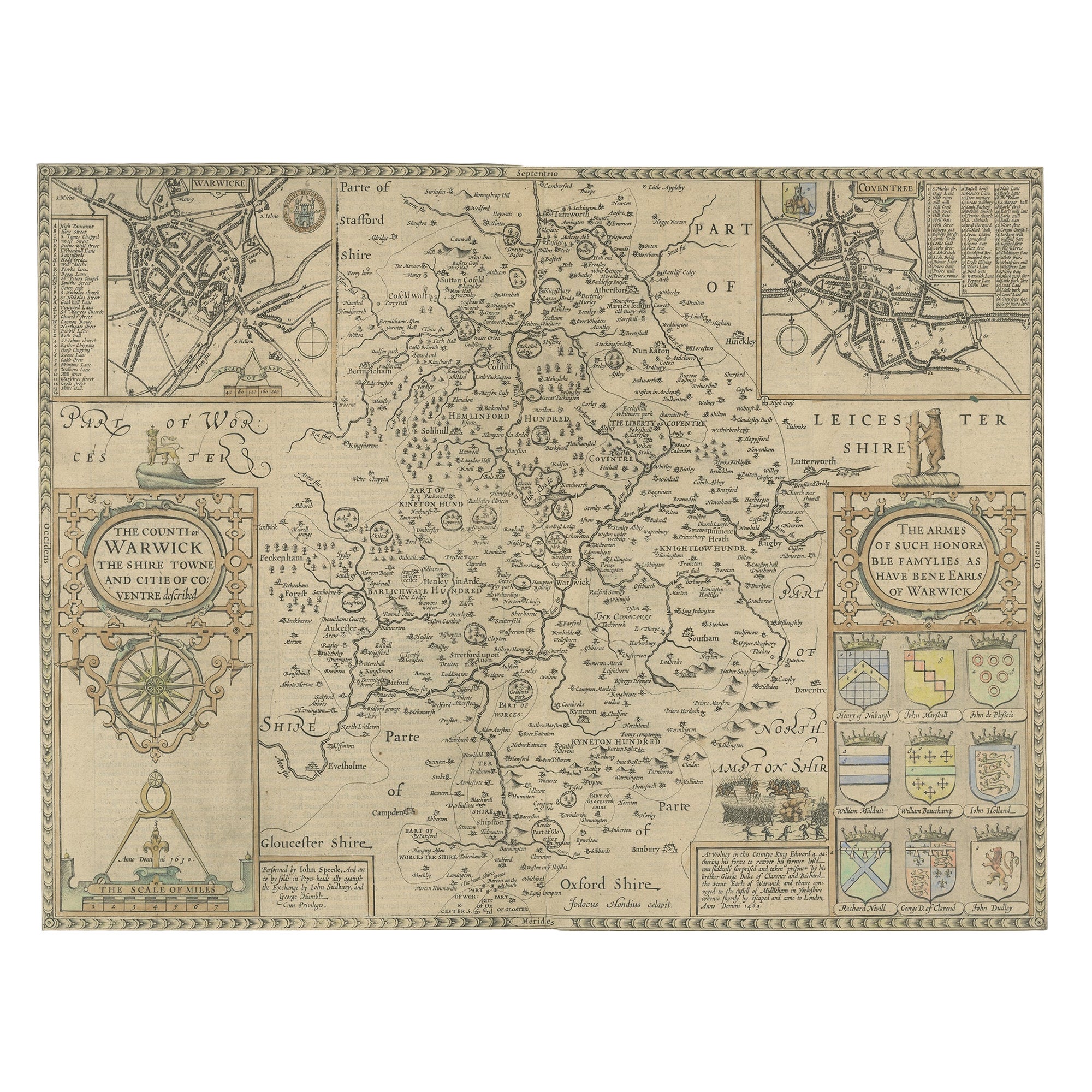
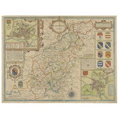
- Antique Map of Warwickshire in England by Speed, c.1614Located in Langweer, NLAntique map titled 'The Counti of Warwick the Shire Towne and Citie of Coventre described'. Map of Warwickshire, England. Includes inset town plans of Warwic...Category
Antique 17th Century Maps
MaterialsPaper
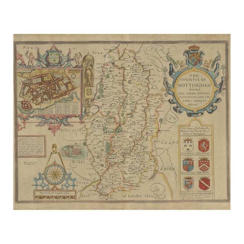
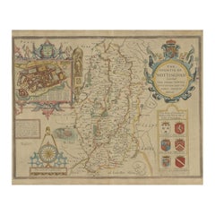
- Antique Map of Nottinghamshire by Speed, 1676Located in Langweer, NLAntique map titled 'The Countie of Nottingham (..)'. Map of Nottinghamshire, England. Includes an inset town plan of Nottingham. This map originates from 'Theatre of Great Britaine' ...Category
Antique 17th Century Maps
MaterialsPaper
- Antique Map of Warwickshire by Speed, c.1614Located in Langweer, NLAntique map titled 'The Counti of Warwick (..)'. Map of Warwickshire, England. Includes inset town plans of Warwick and Coventry. This map originates from 'Theatre of Great Britaine'...Category
Antique 17th Century Maps
MaterialsPaper
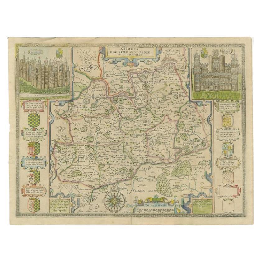
- Antique Map of Surrey by Speed, 1676Located in Langweer, NLAntique map titled 'Surrey described and divided into hundreds'. Map of Surrey, England. Includes inset elevations of Richmond and Nonsuch Palaces. This map originates from 'Theatre ...Category
Antique 17th Century Maps
MaterialsPaper
- Antique Map of Northamptonshire by Speed, 1676Located in Langweer, NLAntique map titled 'Norhamtonshire'. Map of Norhamptonshire, England. Includes inset town plans of Peterborough and Northampton. This map originates from 'Theatre of Great Britaine' ...Category
Antique 17th Century Maps
MaterialsPaper
You May Also Like
- Antique Lithography Map, Hertfordshire, English, Framed Engraving, CartographyLocated in Hele, Devon, GBThis is an antique lithography map of Hertfordshire. An English, framed atlas engraving of cartographic interest, dating to the mid 19th century an...Category
Antique Mid-19th Century British Victorian Maps
MaterialsWood
- Original Antique English County Map, Hertfordshire. J & C Walker, 1851Located in St Annes, LancashireGreat map of Hertfordshire Original colour By J & C Walker Published by Longman, Rees, Orme, Brown & Co. 1851 Unframed.Category
Antique 1850s English Other Maps
MaterialsPaper
- 17th Century Map of Cumberland County in Northwest England Printed by John SpeedBy John SpeedLocated in Middleburg, VARare extremely early map of the county of Cumberland in the Northwest of England. Printed by John Speed, hand colored. Excellent condition. English. Dated...Category
Antique Early 17th Century English Maps
MaterialsPaper
- Old Horizontal Map of EnglandBy TassoLocated in Alessandria, PiemonteST/520 - Old rare Italian map of England, dated 1826-1827 - by Girolamo Tasso, editor in Venise, for the atlas of M.r Le-Sage.Category
Antique Early 19th Century Italian Other Prints
MaterialsPaper
- 1627 Hendrik Hondius Map Entitled "Vltoniae Orientalis Pars, " Ric.a009Located in Norton, MA1627 Hendrik Hondius map entitled "Vltoniae orientalis pars," Ric.a009 Title: Vltoniae orientalis : pars Title (alt.) : Ultoniae orientalis pars Creator: Mercator, Gerh...Category
Antique 17th Century Dutch Maps
MaterialsPaper
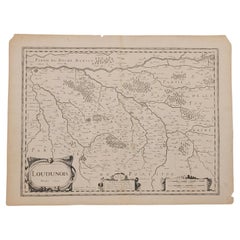
- 1627 Map Entitled "Loudunois, " Signed on the Back, Ric.a013Located in Norton, MA1627 map entitled "Loudunois," Signed on the Back Ric.a013 cartography close up double-page hand-colored elevated view no person print hand-tinted hilly close-up early 17th-...Category
Antique 17th Century Dutch Maps
MaterialsPaper


Recently Viewed
View AllMore Ways To Browse
England 16th
16th Century England
Antique Fairs England
Antique English 17th Century
16th Century English Antique
Antique English Maps
17th Century World Map
Antique 17th Century World Map
Antique Map Fair
John Speed
Antique St Christopher
St Albans
Antique Roman Map
Antique Hertfordshire
Roman Map
Antique Furniture Hertfordshire
Speed Map
Antique St Albans