Antique Map Paint
4
to
30
247
126
167
159
67
64
59
59
53
43
21
19
18
15
14
14
14
13
13
12
10
8
5
5
4
4
4
4
3
3
3
2
2
2
2
2
2
2
2
2
1
1
1
1
1
1
8
7
6
4
4
Sort By
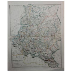
1849 Map of "Europaische Russland", 'Meyer Map of European Russia', Ric. R017
Located in Norton, MA
1849 Map of
"Europaische Russland"
( Meyer Map of European Russia)
Ric.r017
A lovely map of
Category
19th Century Unknown Antique Map Paint
Materials
Paper
H 11.82 in W 9.06 in D 0.4 in
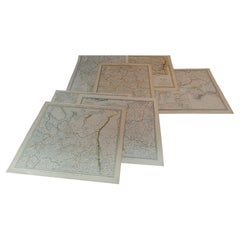
1844 Map "Russia in Eurpoe, Part II to Part VIII", 7 Maps Ric.r023
Located in Norton, MA
1844 Map "Russia in Eurpoe, Part II to Part VIII"
7 Maps
Ric.r023
Fine, original, steel
Category
19th Century Unknown Antique Map Paint
Materials
Paper
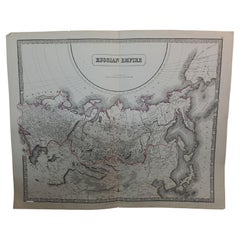
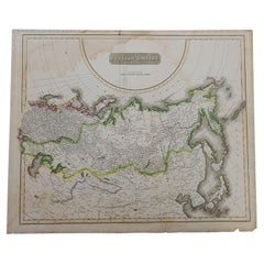
Large1852 Map "Russian Empire" Ric.r0011
Located in Norton, MA
Large
1852 map "Russian Empire"
George Phillips & Son 1852
Ric.r0011
Dimension: Paper: 67 cm
Category
19th Century Unknown Antique Map Paint
Materials
Paper
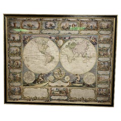
Colored wall map of the WORLD
By Chambon
Located in ZWIJNDRECHT, NL
huge wall map of the world in two hemispheres printed on two sheets, depicting the Eastern and Western
Category
Mid-18th Century French French Provincial Antique Map Paint
Materials
Wood, Paper
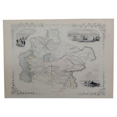
1851 Map of "Independent Tartary", Ric. R018
Located in Norton, MA
1851 Map of
Independent Tartary
"Russia"
Ric.r018
A highly decorative 1851 map of
Category
19th Century Unknown Antique Map Paint
Materials
Paper
1814 Map of "Russian Empire" Ric.r032
Located in Norton, MA
1814 Map of
"Russian Empire"
Ric.r032
Russian Empire. Description: This is an 1814 John
Category
19th Century Unknown Antique Map Paint
Materials
Paper
1832 Large Map "Russian & Poland" Ric. R0012
Located in Norton, MA
Large map 1832
"Russian & Poland"
Ric.r0012
Russia & Poland, by J. Arrowsmith. London, pubd
Category
19th Century Unknown Antique Map Paint
Materials
Paper
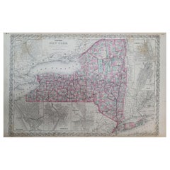
1858 Colton's Map of New York, Ric.B011
Located in Norton, MA
An 1858 Colton's map of New York
Ric.b011
Colton’s New York, 1858 - A large original color
Category
19th Century Unknown Antique Map Paint
Materials
Paper
1646 Jansson Map Entitled "Procinvia Connactiae, " Ric.a006
Located in Norton, MA
1646 Jansson map entitled
"Procinvia connactiae,"
Ric.a006
Description: The PROVINCE of
Category
17th Century Unknown Antique Map Paint
Materials
Paper
1633 Map Entitled "Beauvaisis Comitatus Belova Cium, Ric.0002
Located in Norton, MA
1633 map entitled
"Beauvaisis Comitatus Belova Cium,"
Hand Colored
Ric.0002
Description
Category
17th Century Dutch Antique Map Paint
Materials
Paper
1633 Map, Entitled "La Douche De Berry, " Ric.0005
Located in Norton, MA
1633 map, entitled
"La douche de Berry,"
Hand Colored
Ric.0005
Description:
1633 map
Category
17th Century Unknown Antique Map Paint
Materials
Paper
1590 Mercator Map Entitled "France Picardie Champaigne, Ric.0001
Located in Norton, MA
Engravers: Map : 'France Picardie Champaigne cum regionibus adiacentibus'. (Map of the french provinces of
Category
16th Century Dutch Antique Map Paint
Materials
Paper
1866 Ensign & Bridgman's Rail Road Map of the United States
Located in Colorado Springs, CO
Presented is an 1866 issue of “Ensign & Bridgeman’s Rail Road Map of the United States, showing
Category
1860s American Late Victorian Antique Map Paint
Materials
Paper
1790 Thomas Stackhouse Map, Entitled "Russia in Europe, " , Ric.a004
Located in Norton, MA
1790 Thomas Stackhouse map, entitled
"Russia in Europe"
Ric.a004
Stackhouse, Thomas
Russia
Category
17th Century Unknown Antique Map Paint
Materials
Paper
1657 Janssonius Map of Vermandois and Cappelle, Ric. A-004
Located in Norton, MA
1657 Janssonius map of
Vermandois and Cappelle
Ric.a004
Description: Antique map of France
Category
17th Century Unknown Antique Map Paint
Materials
Paper
1592 Abraham Ortelius Map "Lorraine: Lotharingiae Nova Descripti, Ric.A005
Located in Norton, MA
1592 Abraham Ortelius map entitled
"Lorraine: Lotharingiae Nova Descripti
Ric.a005
Category
16th Century Dutch Antique Map Paint
Materials
Paper
H 17.01 in W 21.54 in D 0.4 in
1627 Map Entitled "Loudunois, " Signed on the Back, Ric.a013
Located in Norton, MA
1627 map entitled
"Loudunois,"
Signed on the Back
Ric.a013
cartography close up double
Category
17th Century Dutch Antique Map Paint
Materials
Paper
1571-1638 Willem Blaeu map entitled, "Ilcadorino, " Hand Colored Ric0009
Located in Norton, MA
Willem Blaeu map entitled,
"Ilcadorino,".
Hand colored.
Description: large, unusual, and
Category
16th Century Dutch Antique Map Paint
Materials
Paper
H 20.28 in W 23.63 in D 0.4 in
1627 Hendrik Hondius Map Entitled "Vltoniae Orientalis Pars, " Ric.a009
Located in Norton, MA
1627 Hendrik Hondius map entitled
"Vltoniae orientalis pars,"
Ric.a009
Title:
Vltoniae
Category
17th Century Dutch Antique Map Paint
Materials
Paper
H 19.49 in W 23.04 in D 0.4 in
1636 Jansson Map of Ireland Entitled "Comitatus Lageniae, " Ric.a007
Located in Norton, MA
1646 Jansson map entitled
"Procinvia connactiae,"
Ric.a006
Description: The PROVINCE of
Category
17th Century Unknown Antique Map Paint
Materials
Paper
1654 Joan Blaeu Map the Sutherland, Scotland, Entitled "Southerlandia, "Ric0007
Located in Norton, MA
1654 Joan Blaeu map of the
Sutherland, Scotland, entitled
"Southerlandia,"
Hand Colored
Category
17th Century Dutch Antique Map Paint
Materials
Paper
H 20.36 in W 23.23 in D 0.4 in
1594 Maurice Bouguereau Map of the Region Limoges, France, Ric0015
Located in Norton, MA
1594 Maurice Bouguereau map of the region Limoges, France, entitled
"Totivs Lemovici et Confinium
Category
16th Century Dutch Antique Map Paint
Materials
Paper
Four 18th Century Engraved and Hand-Colored Maps by Weigel
By Christoph Weigel
Located in Copenhagen, K
Small collection of four engraved maps of Italy, Balkan and of Central Asia.
Two are of Italy
Category
18th Century German Antique Map Paint
Materials
Paper
1635 Willem Blaeu Map of Northern France"Comitatvs Bellovacvm" Ric.a08
Located in Norton, MA
1635 Willem Blaeu map of northern France, entitled.
"Comitatvs Bellovacvm Vernacule Beavvais
Category
17th Century Unknown Antique Map Paint
Materials
Paper
H 18.12 in W 22.25 in D 0.4 in
1597 Abraham Ortelius Map Burgundy, France Entitled "Bvrgvndiae dvcatvs Ric.a010
Located in Norton, MA
1597 Abraham Ortelius map of Burgundy, France entitled
"Bvrgvndiae dvcatvs
Ric.a010
Category
16th Century Dutch Antique Map Paint
Materials
Paper
H 13.98 in W 15.24 in D 0.4 in
1864 Johnson's Map of the World on Mercator's Projection, Ric.B009
Located in Norton, MA
An 1864 Johnson's map of
the World on Mercator's Projection
Ric.b009
About this Item
Category
19th Century Dutch Antique Map Paint
Materials
Paper
1656 Jansson Map Metz Region of France Entitled "Territorium Metense" Ric0014
Located in Norton, MA
1656 Jansson map Metz Region of France entitled "Territorium Metense."
Ric0014
" Authentic
Category
17th Century Dutch Antique Map Paint
Materials
Paper
H 18.31 in W 22.96 in D 0.4 in
1585 Mercator Map of Ireland, Entitled "Irlandiae Regnvm, " Hand Colored Ric0006
Located in Norton, MA
1585 Mercator map of Ireland, entitled
"Irlandiae Regnvm."
Hand Colored
Description
Category
16th Century Dutch Antique Map Paint
Materials
Paper
H 18.51 in W 22.84 in D 0.4 in
1643 Willem&Joan Blaeu Map NW Flanders "Flandriae Teutonicae Pars Prientalior
Located in Norton, MA
1643 Willem and Joan Blaeu map of northwest Flanders, entitled
"Flandriae Teutonicae Pars
Category
17th Century Dutch Antique Map Paint
Materials
Paper
H 19.3 in W 22.45 in D 0.4 in
1853 Map of "Russia in Europe Including Poland" Ric.r016
Located in Norton, MA
Description
Russia in Europe incl. Poland by J Wyld c.1853
Hand coloured steel engraving
Dimension: Paper: 25 cm W x 33 cm H ; Sight: 22 cm W x 28 cm H
Condition: Good ...
Category
19th Century Unknown Antique Map Paint
Materials
Paper
French Framed Copper Engraved Hand Colored Map of Carolina & Georgia, Circa 1757
Located in Hollywood, SC
French copper engraved hand colored map of Carolina & Georgia matted under glass with a painted
Category
1750s French Louis XV Antique Map Paint
Materials
Paper, Paint, Wood, Glass
H 14.5 in W 16.75 in D 1 in
1771 Bonne Map of Poitou, Touraine and Anjou, France, Ric.a015
Located in Norton, MA
1771 Bonne Map of Poitou,
Touraine and Anjou, France
Ric.a015
1771 Bonne map of Potiou
Category
17th Century Unknown Antique Map Paint
Materials
Paper
17th Century Map of Denmark by French Cartographer Sanson, Dated 1658
By Nicolas Sanson
Located in Copenhagen, K
17th century map of Denmark by French cartographer Sanson.
Nicolas Sanson (20 December 1600-7 July
Category
17th Century French Antique Map Paint
Materials
Paper
1856 U.S. Coast Survey Map of Chesapeake Bay and Delaware Bay
Located in Colorado Springs, CO
Presented is U.S. Coast Survey nautical chart or maritime map of Chesapeake Bay and Delaware Bay
Category
1850s American Antique Map Paint
Materials
Paper
1590 Ortelius Map of Calais and Vermandois, France and Vicinity Ric.a014
Located in Norton, MA
1590 Ortelius map of
Calais and Vermandois, France and Vicinity
Ric.a014
Two rare regional
Category
16th Century Dutch Antique Map Paint
Materials
Paper
H 20.08 in W 15.48 in D 0.4 in
1860 Large Map "Carte De La Siberie Russie D'asie, " Ric.R0001
Located in Norton, MA
Large 1860 map "Carte De La Siberie Russie D'Asie," R-0001
" Authentic" - 1860 map "Carte De La
Category
19th Century Unknown Antique Map Paint
Materials
Paper
1752 Vaugoundy Map of Flanders : Belgium, France, and the Netherlands, Ric.a002
Located in Norton, MA
Large Vaugoundy Map of Flanders:
Belgium, France, and the Netherlands
Colored -1752
Ric.a002
Category
17th Century Unknown Antique Map Paint
Materials
Paper
H 51.5 in W 66 in D 1 in
1625 Mercator Map of the Provenience of Quercy, "Quercy Cadvrcivm Ric.0013
Located in Norton, MA
1625 Mercator map of the provenience of Quercy, entitled
"Quercy Cadvrcivm,"
Ric.0013
Category
17th Century French Antique Map Paint
Materials
Paper
H 18.9 in W 22.45 in D 0.4 in
1630 Pierre Petit map "Description du Gouvernement de la Capelle" Ric0010
Located in Norton, MA
1630 Pierre Petit map entitled
"Description du Gouvernement de la Capelle,"
Ric0010
Pierre
Category
17th Century Dutch Antique Map Paint
Materials
Paper
H 18.9 in W 22.45 in D 0.4 in
1633 map, entitled "La douche de Berry, " Original Hand Colored Ric.0005
Located in Norton, MA
1633 map, entitled
"La douche de Berry,"
Hand Colored
Ric.0005
Description:
1633 map, entitled
Category
17th Century Dutch Antique Map Paint
Materials
Paper
H 15.67 in W 19.69 in D 0.4 in
1633 Map, Entitled "La Douche De Berry, " Original Hand Colored Ric.0005
Located in Norton, MA
1633 map, entitled.
"La douche de Berry,"
Hand Colored
Ric.0005
Description:
1633 map
Category
17th Century Unknown Antique Map Paint
Materials
Paper
H 15.67 in W 19.69 in D 0.4 in
1620 Map of Artois Entitled "Artesia Comitatvs Artois, " by Bleau, Ric.a012
Located in Norton, MA
1640 map of Artois entitled
"Artesia Comitatvs Artois,"
by Bleau
Colored
A-012.
Detailed
Category
17th Century Dutch Antique Map Paint
Materials
Paper
H 14.97 in W 19.69 in D 0.4 in
1751 Map of Spain Castilla Robert De Vaugondy 1st Edition, Ric.a001
Located in Norton, MA
, Gilles Robert de Vaugondy makes himself known by his maps of the French provinces.
He published an
Category
18th Century Unknown Antique Map Paint
Materials
Paper
Mid-18th Century Hand Drawn English Farm Map on Vellum, circa 1740s
Located in San Francisco, CA
Mid-18th century hand drawn English farm map on Vellum circa 1740s
Henry Maxted & Isaac Terry
Category
Mid-18th Century English Antique Map Paint
Materials
Lambskin
Extremely Large Hand-Drawn Manuscript Map of Surinam, 1830, History of Slavery
Located in Amsterdam, NL
A unique large hand-drawn map of Surinam by Albrecht Helmut Hiemcke (German, 1760-1839
Category
Mid-19th Century Surinamer Antique Map Paint
Materials
Paper
Free Shipping
H 34.85 in W 97.05 in D 0.08 in
English Engraved Hand Colored Map of the North Eastern United States, circa 1817
Located in Hollywood, SC
English copper engraved hand colored map of the North Eastern United States matted under glass in a
Category
1810s English George III Antique Map Paint
Materials
Paper, Paint, Giltwood, Glass
H 22 in W 25.75 in D 1 in
1863 "Lloyd's New Map of the United States, the Canadas, and New Brunswick"
Located in Colorado Springs, CO
Presented is “Lloyd's New Map of the United States, the Canadas and New Brunswick, From the latest
Category
1860s American Antique Map Paint
Materials
Linen, Wood, Paper
H 37 in W 49.5 in D 1 in
1633 Map "La Souverainete De Sedan Et De Raucourt, Et La Prevoste Ric0011
Located in Norton, MA
1653 map entitled
"La Souverainete de Sedan et de Raucourt, et la Prevoste de Doncheri,"
Ric0011
Category
17th Century Dutch Antique Map Paint
Materials
Paper
H 18.9 in W 22.45 in D 0.4 in
1839 Map of Karte Des "Russischen Reiches in Europa Und Asien" Ric.R0013
Located in Norton, MA
1839 map of Karte Des
"Russischen Reiches in Europa and Asien"
Ric.r013
Map of the European
Category
19th Century Unknown Antique Map Paint
Materials
Paper
H 16.54 in W 21.26 in D 0.4 in
1837 Mitchell's "Tourist's Pocket Map of the State of Virginia" by J.H. Young
Located in Colorado Springs, CO
This is J. H. Young's pocket map of the Virginia, which shows county development current to 1835
Category
1830s American Antique Map Paint
Materials
Paper
H 24.25 in W 25.75 in D 1.75 in
1627 Hondius Map "La Principaute d'Orange et Comtat de Ve", Ric.0003
Located in Norton, MA
1627 Hondius map entitled
"La Principaute d'Orange et Comtat de Venaissin,"
Original Hand
Category
17th Century Unknown Antique Map Paint
Materials
Paper
1640 Willem Blaeu Map Entitled "Contado di molise et principato vltra, " Ric.a003
By Willem Blaeu
Located in Norton, MA
1640 Willem Blaeu map entitled
"Contado di molise et principato vltra,"
Colored
Ric. a003
Category
17th Century Dutch Antique Map Paint
Materials
Paper
H 14.97 in W 19.69 in D 0.4 in
Original Antique Hand-Colored Map of Friesland by C. Merian, 1659
Located in Langweer, NL
map indicates that it was individually painted by hand after printing, which was a common practice to
Category
Mid-17th Century Antique Map Paint
Materials
Paper
Free Shipping
H 11.74 in W 14.3 in D 0.02 in
1640 Joan Bleau Map Entitled"Diocecese de rheims et le pais de rethel, " Eic.a011
Located in Norton, MA
1640 Joan Bleau map entitled
"Diocecese de rheims et le pais de rethel,"
Ric.a011
OAN
Category
17th Century Dutch Antique Map Paint
Materials
Paper
H 19.3 in W 23.63 in D 0.4 in
1718 Ides & Witsen Map "Route D'amsterdam a Moscow Et De La Ispahan Et Gamron
Located in Norton, MA
1718 Ides & Witsen map, entitled
"Route D'Amsterdam A Moscow Et De La Ispahan Et Gamron
Category
Early 18th Century Dutch Antique Map Paint
Materials
Paper
H 11.11 in W 14.81 in D 0.4 in
Road Map John Ogilby London St David's Britannia No 15 Abingdon Monmouth Framed
By John Ogilby
Located in BUNGAY, SUFFOLK
John Ogilby (British 1600-1676) Cosmographer and Geographick Printer to Charles II. A road map from
Category
1670s English Baroque Antique Map Paint
Materials
Paper
H 20.48 in W 24.41 in D 0.6 in
Road Map Britannia No 15 London to St Davids John Ogilby Brown Gilt Frame
By John Ogilby
Located in BUNGAY, SUFFOLK
Lechlade, to Fairford, to Barnsley to Gloucester showing Monmouth as the destination. A road map from
Category
Late 17th Century British Charles II Antique Map Paint
Materials
Paper
H 22.05 in W 26.19 in D 0.6 in
Road Map Britannia No 25 London to the Lands End, John Ogilby Brown Gilded Frame
By John Ogilby
Located in BUNGAY, SUFFOLK
Senan in Cornwall. By John Ogilby His Majesties Cosmographer. A road map from Britannia, 1675/6. No 25
Category
Late 17th Century British Charles II Antique Map Paint
Materials
Paper
H 22.05 in W 26.19 in D 0.6 in
Road Map Britannia 1675/6 No 5 Road London to Barwick, London Stilton Grey Frame
By John Ogilby
Located in BUNGAY, SUFFOLK
John Ogilby (British 1600-1676) cosmographer and geographick printer to Charles II.
A road map from
Category
Late 17th Century British Charles II Antique Map Paint
Materials
Paper
H 22.84 in W 25.99 in D 0.4 in
1656 "La Souverainete de Sedan et de Raucourt, et la Prevoste de Doncheri Ric004
Located in Norton, MA
1656 map entitled
"La Souverainete de Sedan et de Raucourt, et la Prevoste de Doncheri,"
Hand
Category
17th Century Dutch Antique Map Paint
Materials
Paper
H 20.36 in W 23.23 in D 0.4 in
- 1
Get Updated with New Arrivals
Save "Antique Map Paint", and we’ll notify you when there are new listings in this category.
Antique Map Paint For Sale on 1stDibs
Choose from an assortment of styles, material and more with respect to the antique map paint you’re looking for at 1stDibs. An antique map paint — often made from paper, fabric and wood — can elevate any home. There are many kinds of the antique map paint you’re looking for, from those produced as long ago as the 18th Century to those made as recently as the 20th Century. An antique map paint is a generally popular piece of furniture, but those created in Victorian, Folk Art and Louis XVI styles are sought with frequency. A well-made antique map paint has long been a part of the offerings for many furniture designers and manufacturers, but those produced by Arent Roggeveen, Choisy-le-Roi and Georg Braun and Frans Hogenberg are consistently popular.
How Much is a Antique Map Paint?
The average selling price for an antique map paint at 1stDibs is $1,391, while they’re typically $300 on the low end and $65,000 for the highest priced.
More Ways To Browse
Fairy Figurine
Cheval Watch
K L Clothing
Map Amazon
Map Of Alps
Map Alps
Hunt Pre Raphaelite
Ortelius Map Italy
Nippon Plates
Pro Patria
Antique South Carolina Maps
Chinese Wall Pocket
Nippon Plate
Antique Maps South Carolina
Antique South Carolina Map
Antique Map South Carolina
Framed Map India
Bassett Furniture Antique

