Map Print Set
5
190
18
2
to
16
110
99
207
197
206
9
5
4
3
3
3
2
1
1
84
53
52
20
16
23
5
4
1
4
7
5
6
1
1
1
143
23
16
14
11
87
48
45
35
24
9
9
4
2
2
Sort By
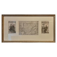
Set of 2 Costume Prints and a Map of Spain and Portugal, circa 1720
Located in Langweer, NL
Set of two costume prints and a map of Spain and Portugal. The costume prints show costumes of
Category
Antique Early 18th Century Maps
Materials
Paper
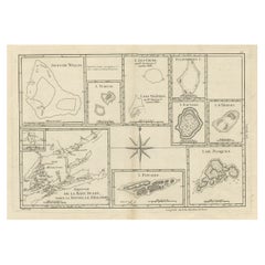
Print of Maps of Islands of the South Pacific, Incl. Pitcairn & Dusky Bay, 1788
Located in Langweer, NL
Pickersgill / I de Pasques.'
Detailed set of maps of the islands of the South Pacific, with a large compass
Category
Antique 1780s Maps
Materials
Paper
No Reserve
H 12.21 in W 18.31 in D 0 in
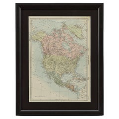
1875 "North America" Map by J. Bartholomew
Located in Colorado Springs, CO
the 9th edition there were thousands of quality illustrations and maps set into the text pages, in
Category
Antique 1870s Scottish Maps
Materials
Paper
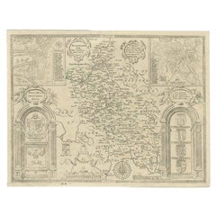
Antique Map of Buckinghamshire in England, 1743
Located in Langweer, NL
never possessed a complete set of county map plates and made up their atlases in the early Dutch
Category
Antique 18th Century Maps
Materials
Paper
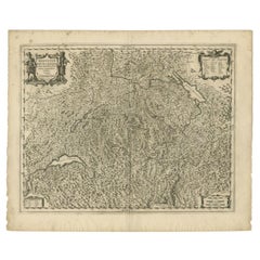
Antique Map of Switzerland by Janssonius, 1657
Located in Langweer, NL
business as book publisher in Amsterdam. His first map was published in 1616. Around 15 years later he set
Category
Antique 17th Century Maps
Materials
Paper
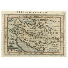
Original Antique Miniature Map of Persia, Published, ca.1601
Located in Langweer, NL
atlas. Theatrum Orbis Terrarum was the first systematically collated set of maps by different map makers
Category
Antique Early 1600s Maps
Materials
Paper
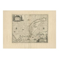
Antique Map of Nova Zembla by Janssonius, c.1650
Located in Langweer, NL
Hondius he also set up a business as book publisher in Amsterdam. His first map was published in 1616
Category
Antique 17th Century Maps
Materials
Paper
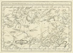
Antique Map of Tartary and Northeast Asia, c.1750
Located in Langweer, NL
events in the Americas. His maps and charts were finely engraved and produced, and set a high standard of
Category
Antique 18th Century Maps
Materials
Paper
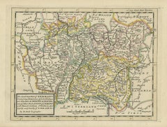
Decorative Original Antique Map of Southern Germany, c.1730
Located in Langweer, NL
"Antique map titled 'The South West Part of Germany. Containing ye Dominions of the Archbishops and
Category
Antique 18th Century Maps
Materials
Paper
Road Map, John Ogilby, No 54, London, Yarmouth, Britannia
By John Ogilby
Located in BUNGAY, SUFFOLK
& Maldon). Of the sixth volume, on London, only the general map appeared in print, and that after Ogilby's
Category
Antique 1670s English Baroque Maps
Materials
Paper
Very Large Vintage Map of Canada, German, Education, Institution, Cartography
Located in Hele, Devon, GB
This is a very large vintage map of Canada. A German, quality printed educational or institution
Category
Mid-20th Century German Maps
Materials
Paper
H 77.56 in W 85.04 in D 1.19 in
Antique Map of the County of Devon by Overton, 1713
Located in Langweer, NL
.1755. They never possessed a complete set of County map plates and made up their atlases in the early
Category
Antique 18th Century Maps
Materials
Paper
Antique Map of the City of Leeuwarden by Leti, 1690
Located in Langweer, NL
Amsterdam. His first map was published in 1616. Around 15 years later he set up a partnership with his
Category
Antique 17th Century Maps
Materials
Paper
Antique Map of the City of Enkhuizen by Tirion, 1743
Located in Langweer, NL
Antique map titled ?Grondtekening der Stad Enkhuisen?. Beautiful map of the City of Enkhuizen. With
Category
Antique 18th Century Maps
Materials
Paper
Antique Map of the Namen or Namur Region in Wallonia, Belgium
Located in Langweer, NL
Description: Antique map titled 'Namurcum Comitatus' A map of the Namen/Namur region in Wallonia
Category
Antique 1610s Maps
Materials
Paper
Original Antique Map of the Region of Picardy, France, ca.1602
Located in Langweer, NL
Antique map titled 'Picardiae Belgicae regionis descriptio'.
Original antique map of the region
Category
Antique Early 1600s Maps
Materials
Paper
Antique Map of the Burgundy-franche-Comté Region by Janssonius, 1657
Located in Langweer, NL
business as book publisher in Amsterdam. His first map was published in 1616. Around 15 years later he set
Category
Antique 17th Century Maps
Materials
Paper
Antique Map of the Bay of Terney by La Pérouse, 1797
Located in Langweer, NL
Antique map titled 'Plan de la Baie de Ternai'. Old map of the north eastern coast of Russia. This
Category
Antique 18th Century Maps
Materials
Paper
Two Sheet Map of the Principality of Wales Divided into Counties, 1804
Located in Langweer, NL
A well engraved and detailed large-scale map of Wales, printed on two sheets .
The map is
Category
Antique Early 1800s Maps
Materials
Paper
H 21.26 in W 25.2 in D 0.02 in
Antique Map of Cities of the Province of Shanxi in China, 1749
By Jacques-Nicolas Bellin
Located in Langweer, NL
Antique print titled: 'Lan-Tcheou ou Lan-Chew dan la province Chensi; Can Tcheou ou Kan-Chew dan la
Category
Antique 18th Century Maps
Materials
Paper
Antique Map of Cities in the Province of Shanxi in China, 1749
Located in Langweer, NL
Antique print titled 'Villes de la Province de Chensi - Steden van 't Landschap Shensi of Shansi
Category
Antique 18th Century Maps
Materials
Paper
Antique Map with Details of Berings' Expedition into Russians' Far East, 1737
Located in Langweer, NL
jusqua'a Kamtschatka'.
This is the first printed map to illustrate Vitus Bering's first voyage
Category
Antique 1730s Maps
Materials
Paper
H 12.96 in W 22.64 in D 0 in
Map Road Strip Britannia Sheet 2 John Ogilby London Aberistwith Islip Bramyard
By John Ogilby
Located in BUNGAY, SUFFOLK
framer, print seller, Oxford. Annotated.
The second of 100 sheets of strip maps made for John Ogilby
Category
Antique 17th Century English Baroque Maps
Materials
Paper
H 14.38 in W 19.3 in D 0.79 in
Road Map John Ogilby No 75 Kings Lyn Harwich, Britannia Framed Wallhanging
By John Ogilby
Located in BUNGAY, SUFFOLK
& Maldon). Of the sixth volume, on London, only the general map appeared in print, and that after Ogilby's
Category
Antique 1670s European Baroque Maps
Materials
Paper
H 15.75 in W 19.69 in D 0.6 in
Map Road John Ogilby Britannia No 74 Ipswich to Norwich Cromer Framed
By John Ogilby
Located in BUNGAY, SUFFOLK
the general map appeared in print, and that after Ogilby's death. In fact only one volume was actually
Category
Antique 1670s English Baroque Maps
Materials
Paper
Very Old Original Hand-Colored Map of the Basel Region, Switzerland, Ca.1578
Located in Langweer, NL
Antique print titled 'Basiliensis territorii descriptio nova'.
Old map of the Basel region
Category
Antique 16th Century Maps
Materials
Paper
H 39 in W 27.3 in D 0.002 in
Antique Map of the Region of Calais and The Vermandois Region by Ortelius
Located in Langweer, NL
atlas. 'Theatrum Orbis Terrarum' was the first systematically collated set of maps by different map
Category
Antique 17th Century Maps
Materials
Paper
H 17.33 in W 22.84 in D 0 in
Antique Map of 'African' Islands in the Mediterranean Sea and The Atlantic, 1747
Located in Langweer, NL
(..)'.
Detailed set of eight maps, including a large and detailed Malta, the Bay of Agoa de Saldanha, Tenerife
Category
Antique 18th Century Maps
Materials
Paper
H 19.49 in W 15.16 in D 0 in
Road Map No43 London to Kings Lynn, Royston to Downham, John Ogilby, Britannia
By John Ogilby
Located in BUNGAY, SUFFOLK
). Of the sixth volume, on London, only the general map appeared in print, and that after Ogilby's death
Category
Antique Late 17th Century British Charles II Maps
Materials
Paper
H 20.48 in W 24.41 in D 0.4 in
Road Map John Ogilby London St David's Britannia No 15 Abingdon Monmouth Framed
By John Ogilby
Located in BUNGAY, SUFFOLK
). Of the sixth volume, on London, only the general map appeared in print, and that after Ogilby's death
Category
Antique 1670s English Baroque Maps
Materials
Paper
H 20.48 in W 24.41 in D 0.6 in
Antique Hand-Coloured Map of Cities in the Province of Shanxi in China, 1749
Located in Langweer, NL
Antique print titled 'Villes de la Province de Chensi - Steden van 't Landschap Shensi of Shansi
Category
Antique 18th Century Maps
Materials
Paper
H 9.34 in W 12.29 in D 0 in
Road Map Britannia No 32 the Road from London to Barnstable John Ogilby Framed
By John Ogilby
Located in BUNGAY, SUFFOLK
& Maldon). Of the sixth volume, on London, only the general map appeared in print, and that after Ogilby's
Category
Antique Late 17th Century English Charles II Maps
Materials
Paper
H 20.48 in W 24.41 in D 0.6 in
Road Map Britannia No 15 London to St Davids John Ogilby Brown Gilt Frame
By John Ogilby
Located in BUNGAY, SUFFOLK
). Of the sixth volume, on London, only the general map appeared in print, and that after Ogilby's death
Category
Antique Late 17th Century British Charles II Maps
Materials
Paper
H 22.05 in W 26.19 in D 0.6 in
Road Map Britannia No 25 London to the Lands End, John Ogilby Brown Gilded Frame
By John Ogilby
Located in BUNGAY, SUFFOLK
). Of the sixth volume, on London, only the general map appeared in print, and that after Ogilby's death
Category
Antique Late 17th Century British Charles II Maps
Materials
Paper
H 22.05 in W 26.19 in D 0.6 in
Road Map Britannia 1675/6 No 5 Road London to Barwick, London Stilton Grey Frame
By John Ogilby
Located in BUNGAY, SUFFOLK
sixth volume, on London, only the general map appeared in print, and that after Ogilby's death. In fact
Category
Antique Late 17th Century British Charles II Maps
Materials
Paper
H 22.84 in W 25.99 in D 0.4 in
1842 Wall Map of the United States by J. H. Young, Published by S. A. Mitchell
Located in Colorado Springs, CO
.
Condition:
Very good condition, considering age and past use. Hanging wall map, engraved and printed onto 4
Category
Antique 1840s American Maps
Materials
Paper
H 45 in W 38 in D 1 in
Atlas of Fernão Vaz Dourado / One-Time Only Limited Edition Facsimile
Located in BARCELONA, ES
, sophisticated and valuable items, set well apart from mere printed works.
This sublime example of sumptuous
Category
2010s Portuguese Renaissance Maps
Materials
Leather
Free Shipping
H 23.23 in W 16.54 in D 2.37 in
Four Antique Battle Plans of Echmühl, Hohenlinden, Abensberg and Marengo, 1852
Located in Langweer, NL
Set of 4 antique battle plans. Included are:
1) Battle of Hohenlinden 3d. December 1800
2) Battle
Category
Antique Mid-19th Century Maps
Materials
Paper
Free Shipping
H 7.09 in W 8.98 in D 0.02 in
Rare Engraving of Dutch and Danish Forts on the West African Gold Coast, 1744
Located in Langweer, NL
Antique print, titled: 'The Dutch Fort Croevecoeur (…).'
A four panel plate showing forts on
Category
Antique 1740s Maps
Materials
Paper
H 15.36 in W 13.67 in D 0 in
Set of 2 Colored Antique Prints of Various Fishes and Crustaceans
By F. Valentijn
Located in Langweer, NL
Set of two antique prints of various fishes and crustaceans. These print originate from 'Oud en
Category
Antique Mid-18th Century Prints
Materials
Paper
Set of 4 Colored Antique Prints of Various Fishes and Crustaceans
By F. Valentijn
Located in Langweer, NL
Set of four antique prints of various fishes and crustaceans. These print originate from 'Oud en
Category
Antique Mid-18th Century Prints
Materials
Paper
Set of 8 Colored Antique Prints of Various Fishes and Crustaceans
By F. Valentijn
Located in Langweer, NL
Set of eight antique prints of various fishes and crustaceans. These print originate from 'Oud en
Category
Antique Mid-18th Century Prints
Materials
Paper
Set of 3 Colored Antique Prints of various Fishes and Crustaceans
By F. Valentijn
Located in Langweer, NL
Set of three antique prints of various fishes and crustaceans. These print originate from 'Oud en
Category
Antique Mid-18th Century Prints
Materials
Paper
Set of 12 Colored Antique Prints of Various Fishes and Crustaceans
By F. Valentijn
Located in Langweer, NL
Set of twelve antique prints of various fishes and crustaceans. These print originate from 'Oud en
Category
Antique Mid-18th Century Prints
Materials
Paper
Four Reproduction Vintage Panels of Air France World Map
Located in Los Angeles, CA
Reproduction of a beautiful green and blue mid-century Air France world map on four individual
Category
21st Century and Contemporary French Prints
Materials
Wood, Paper
Four Reproduction Vintage Panels of Air France World Map
Located in Los Angeles, CA
Reproduction of beautiful blue and green mid-century Air France world map on four individual panels
Category
21st Century and Contemporary French Prints
Materials
Paper, Wood
Large Vintage France Map, Continental, Historical Cartography, Late 20th Century
Located in Hele, Devon, GB
Displays a desirable aged patina throughout
Ebonised frame with textured border sets off the map nicely
In
Category
Late 20th Century European Mid-Century Modern Prints
Materials
Glass, Wood, Paper
H 36.62 in W 28.35 in D 1.38 in
Set of 2 Colored Antique Prints of various Sea Shells and Molluscs
By F. Valentijn
Located in Langweer, NL
Set of two antique prints of various sea shells and molluscs. These print originate from 'Oud en
Category
Antique Mid-18th Century Prints
Materials
Paper
Set of 3 Colored Antique Prints of various Sea Shells and Molluscs
By F. Valentijn
Located in Langweer, NL
Set of three antique prints of various sea shells and molluscs. These print originate from 'Oud en
Category
Antique Mid-18th Century Prints
Materials
Paper
Set of 6 Colored Antique Prints of various Sea Shells and Molluscs
By F. Valentijn
Located in Langweer, NL
Set of six antique prints of various sea shells and molluscs. These print originate from 'Oud en
Category
Antique Mid-18th Century Prints
Materials
Paper
Set of 4 Colored Antique Prints of various Sea Shells and Molluscs
By F. Valentijn
Located in Langweer, NL
Set of four antique prints of various sea shells and molluscs. These print originate from 'Oud en
Category
Antique Mid-18th Century Prints
Materials
Paper
Set of 21 Antique Prints Illustrating the Travels to Cenderawasih Bay, 1875
Located in Langweer, NL
Set of 21 antique prints illustrating the travels to Cenderawasih Bay, also known as Sarera Bay
Category
Antique Late 19th Century Prints
Materials
Paper
H 11.03 in W 8.86 in D 0.02 in
Set of 12 Colored Antique Prints of various Fish species and other Marine Life
Located in Langweer, NL
Set of twelve antique prints of various fish species and marine life. These print originate from
Category
Antique Mid-18th Century Prints
Materials
Paper
H 13.19 in W 8.08 in D 0.02 in
Antique Map of Italy Drawn & Engraved by R. Scott for Thomsons, Edinburgh 1814
Located in London, GB
is numbered '26'.
The map is very clean and is set in a beautiful ebonised and gilded frame.
Add
Category
Antique 1810s Scottish Prints
Materials
Other
H 30.52 in W 23.63 in D 0.79 in
Map of Vusihyen, Hu Chew Fu and Hou-Tcheou-Fou, Historical Chinese Cities, 1754
Located in Langweer, NL
Given these specific names—Vusihyen, Hu Chew Fu, and Hou-Tcheou-Fou—it appears that the map depicts
Category
Antique 1750s Prints
Materials
Paper
H 9.97 in W 7.05 in D 0 in
Antique Engravings of Japan incl a Map and the Arrival of the Dutch, 1732
Located in Langweer, NL
Original antique print titled 'Succession des Empereurs du Japon avec une Description de Meurtre de
Category
Antique 18th Century Prints
Materials
Paper
H 16.74 in W 18.71 in D 0 in
French 1930s Map of Paris à Vol d'Oiseau under Glass in Custom Iron Frame
Located in Atlanta, GA
weathered appearance, the map is set inside a new custom iron frame. With its nice age and great proportions
Category
Early 20th Century French Prints
Materials
Iron
H 28.75 in W 40.25 in D 1 in
Antique Print of Two Japanese Vessels, 1799
Located in Langweer, NL
Description: Antique print titled 'Japanese boat'. Two views of Japanes boats. This print
Category
Antique 1790s Prints
Materials
Paper
Antique Print of a Burial Ceremony, c.1730
Located in Langweer, NL
Two images on one sheet titled 'The Funeral Pomp of ye Royal Prince'. Two prints, one with a long
Category
Antique 18th Century Prints
Materials
Paper
Antique Print of Cape Espiritu Santo, Samar Island, 1749
Located in Langweer, NL
Antique print titled 'Gezigt van de Kaap Espiritu Santo, op Samal (..) - Vue du Cap Espiritu Santo
Category
Antique 18th Century Prints
Materials
Paper
- 1
Get Updated with New Arrivals
Save "Map Print Set", and we’ll notify you when there are new listings in this category.
Map Print Set For Sale on 1stDibs
Choose from an assortment of styles, material and more with respect to the map print set you’re looking for at 1stDibs. A map print set — often made from paper, glass and wood — can elevate any home. Your living room may not be complete without a map print set — find older editions for sale from the 18th Century and newer versions made as recently as the 20th Century. Each map print set bearing Baroque or Neoclassical hallmarks is very popular. You’ll likely find more than one map print set that is appealing in its simplicity, but Ignace Gaston Pardies produced versions that are worth a look.
How Much is a Map Print Set?
Prices for a map print set start at $276 and top out at $8,500 with the average selling for $2,175.
More Ways To Browse
Fetish Bird
Marc Chagall Two Hearts
Raffles Singapore
Richard Hull
Large Original Antique Map Of Chicago
Primitive Antique Heart
Cartoon Sex
Orkney Island
China Town Park
California As An Island Map
Story And Clark
Emanuel County
Wooden Drafting Table
17th Century English Fire
Map Of Singapore
Singapore Map
Vintage Tea Poster
Book Ends Ceramic
