Maps Cambridge England
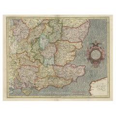
Original Old Map of South East England Incl London, Oxford, Cambridge, Etc, 1633
Located in Langweer, NL
'.
Old map of south east England. Includes London, Salisbury, Oxford, Cambridge, Leicester and Norwich
Category
Antique 1630s Maps
Materials
Paper
H 16.15 in W 21.26 in D 0 in
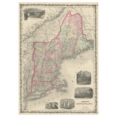
Large Antique Map of New England with decorative Vignettes
Located in Langweer, NL
Antique map titled 'Johnson's New England'. Large map of New England, comprising the states
Category
Antique Mid-19th Century Maps
Materials
Paper
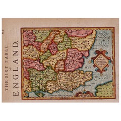
17th Century Hand-Colored Map of Southeastern England by Mercator and Hondius
By Gerard Mercator
Located in Alamo, CA
A 17th century copperplate hand-colored map entitled "The Sixt Table of England" by Gerard Mercator
Category
Antique Mid-17th Century Dutch Maps
Materials
Paper
H 12 in W 14 in D 0.13 in
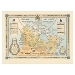
The History of the Royal Canadian Mounted Police, Published in 1966
Located in Langweer, NL
This rare pictorial map by Peter R. Furse celebrates the history of the Royal Canadian Mounted
Category
Vintage 1960s Maps
Materials
Paper
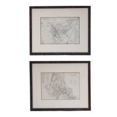
Mid 19th Century Pair of Framed English Maps of Oxford and Cambridge
Located in Los Angeles, CA
Pair of maps of Oxford and Cambridge in custom black wood frames. With beautiful hand-drawn
Category
Antique 19th Century English Victorian Prints
Materials
Paper, Wood
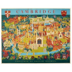
Original Vintage Poster Pictorial Map British Railways Cambridge University City
By Kerry Lee
Located in London, GB
Original vintage pictorial travel map poster for Cambridge published by British Railways Eastern
Category
Vintage 1960s British Posters
Materials
Paper
H 39.97 in W 50.01 in D 0.04 in
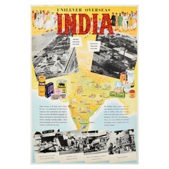
Original Vintage Advertising Poster Unilever Overseas India Illustrated Map
Located in London, GB
Original vintage advertising poster for Unilever Overseas India. Great illustrated map of India
Category
Vintage 1950s British Posters
Materials
Paper
H 29.53 in W 20.08 in D 0.04 in
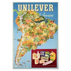
Original Vintage Advertising Poster Unilever South America Illustrated Map Art
Located in London, GB
map marking the factories - Lever & Atkinson Lima Peru / Atkinson Santiago Chile / Lever Atkinson
Category
Vintage 1950s British Posters
Materials
Paper
H 29.93 in W 20.48 in D 0.04 in
People Also Browsed
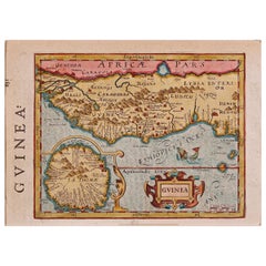
17th Century Hand-Colored Map of West Africa by Mercator/Hondius
Located in Alamo, CA
A 17th century hand-colored map entitled "Guineae Nova Descriptio" by Gerard Mercator and Jodocus Hondius, published in their 'Atlas Minor' in Amsterdam in 1635. It is focused on the...
Category
Antique Mid-17th Century Dutch Maps
Materials
Paper
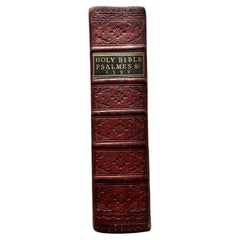
Geneva Bible, Christopher Barker, London, Dated 1599
Located in Southbury, CT
The Geneva Bible is one of the most historically significant translations of the Bible into English. Its name comes from the fact that its translation was undertaken in Geneva. The 1...
Category
Antique Early 17th Century English Books
Materials
Leather, Paper
18th C Hand Colored Engraving of The Rotunda at Ranleagh Gardens After Canaletto
By Giovanni Antonio Canal (Canaletto)
Located in Stamford, CT
An inside View of the Rotundo in Ranelagh Gardens, after Antonio Canaletto (1697 - 1768). Engraved by by Thomas Bowles, 1754.
Hand colored engraving, in original ebonized frame with...
Category
Antique Mid-18th Century English George II Prints
Materials
Paper
H 13.5 in W 19.5 in D 1 in
19th Century Botanical Engraving After Jane Webb Loudon
By William Smith & Co.
Located in Richmond, London
An exquisite engraving with vibrant original hand-colouring, from the rare first edition of British Wild Flowers, London: William Smith, 1849.
Why we like them
Exquisitely hand-col...
Category
Antique Mid-19th Century English Victorian Prints
Materials
Paper, Wood
Antique Map of North Africa by Ortelius, c.1580
Located in Langweer, NL
Antique map titled 'Barbariae et Biledulgerid Nova Descriptio'. Original antique map of North Africa. The map covers the regions of Barbaria and Biledulgerid, essentially the territo...
Category
Antique 16th Century Maps
Materials
Paper
Exploring Ancient Persia: Ptolemaic Map of Iran and Iraq by Ptolemy and Mercator
Located in Langweer, NL
Claudius Ptolemy was a mathematician, astronomer and geographer who worked in Alexandria, then a part of the Roman Empire, in the 2nd century AD. One of the most learned and influent...
Category
Antique 1610s Maps
Materials
Paper
H 13.71 in W 18.39 in D 0 in
Mercator's Ptolemaic map of Taprobana, (Ceylon) Sri Lanka
Located in Langweer, NL
Antique map titled 'Asiae XII Tab'. Mercator's Ptolemaic map of Taprobana. The map shows Ptolemy's erroneous location of the island of Sri Lanka near the equator, with a bit of India...
Category
Antique 16th Century Maps
Materials
Paper
William Penn's Treaty, Pennsylvania, Engraving, London, 1775
By John Boydell
Located in Ottawa, Ontario
John Hall (1739-1797) William Penn's Treaty With The Indians After Benjamin West, Published by John Boydell, 1775 London, Engraving 17"-inches x 22 1/2"-inches. William Pen...
Category
Antique Late 18th Century English American Empire Drawings
Materials
Paper
18th C. Colored Engraving, The Chinese House at Ranelagh Gardens After Canaletto
Located in Stamford, CT
A view of the floating Chinese House at Ranelagh Gardens with a masquerade, the Rotunda in the background, after Antonio Canaletto (1697 - 1768). Engraved by by Thomas Bowles, 1754....
Category
Antique Mid-18th Century English George II Prints
Materials
Paper
H 12.25 in W 18 in D 1 in
Hand Colored Copper Engraving "Ingleby Mannor" by Johannes Kip
By Johannes Kip
Located in New York, NY
Hand colored copper engraving "Ingleby Mannor the Seat of the Honble. Sr. Wm. Foulis Bartt.," by Johannes Kip. From Kip's most significant series, Britannia Illustrata.
Johannes K...
Category
Antique Early 1700s English Prints
Antique Map of North Africa by Ortelius, c.1600
Located in Langweer, NL
Antique map titled 'Barbariae et Biledulgerid nova descriptio'.
Old map of coastal North Africa and the Mediterranean. The map extends from Morocco and the Sahara to Libya and sh...
Category
Antique 17th Century Maps
Materials
Paper
18th Century Antique Georgian Ebonized Bracket Clock by William Scafe of London
By William Scafe
Located in Devon, GB
A good quality antique, ebonized brass dial bracket clock by this 18th century 'maker of repute'. The moulded and veneered case has an inverted bell top, which is surmounted by five ...
Category
Antique 18th Century English Georgian Mantel Clocks
Materials
Brass
H 20.48 in W 10.24 in D 6.7 in
Encounter at Lituya Bay: French Explorers Among the Tlingit, 1786
Located in Langweer, NL
The uploaded authentic engraving for sale portrays a scene of interaction between European explorers and indigenous peoples, identified by the caption as occurring at "Port des Franç...
Category
Antique Late 18th Century Prints
Materials
Paper
Free Shipping
H 8.08 in W 10.44 in D 0 in
Louis XVI Chest of Drawers, Southern Germany 1780
Located in Leimen, DE
Uncover the historical charm of our Antique Louis XVI Chest of Drawers, a masterpiece dating back to 1780 and hailing from Southern Germany. Crafted with precision from solid walnut,...
Category
Antique 1780s German Louis XVI Commodes and Chests of Drawers
Materials
Walnut
Very Fine Trefid Spoon Made in London in 1692 by Lawrence Coles
Located in London, GB
This very fine Spoon is modelled in the Trefid style and displays a reeded rat tail on the reverse of the bowl. The spoon is very well marked and is engraved, at the top of the stem,...
Category
Antique Late 17th Century English More Dining and Entertaining
Free Shipping
H 7.75 in W 0.1 in D 0.1 in
Pair of 18th Century Girandole Mirrors Attributed to Thomas Johnson
By Thomas Johnson, London 1
Located in Essex, MA
Pair of 18th century George III Gilt Chippendale mirror brackets
Attributed to the Master Carver, Thomas Johnson
Incredible carving of realistic flora and fauna. Seated Shepherdesse...
Category
Antique 18th Century English Chippendale Girandoles
Materials
Wood
Recent Sales
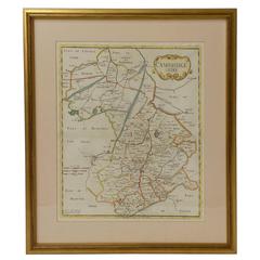
18th Century Map of Cambridgeshire
Located in Austin, TX
1722 - From an edition of Camden's Britannia (Map by Robert Morden)
Great as a gift for a Cambridge
Category
Antique 18th Century English Maps
Materials
Glass, Wood, Paper
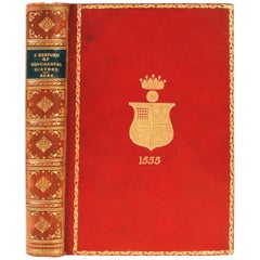
Century of Continental History 1780-1880 by J.H. Rose, M.A
Located in valatie, NY
of Christ's College, Cambridge University in modern history. Chapters include Causes of the French
Category
Antique Late 19th Century English Books
Materials
Leather, Paper
Original Vintage Advertising Poster Unilever Overseas Lever Brothers Company
Located in London, GB
pinpoints on a map of America with an image above of city skyscrapers and industrial factory buildings and
Category
Vintage 1950s American Posters
Materials
Paper
H 29.93 in W 20.08 in D 0.04 in
19th Century Coal Container by Henry Loveridge and Company
By Henry Loveridge & Co.
Located in Peterborough, Northamptonshire
there. Merridale Works shown on the Ordnance Survey map of 1903. Perhaps significantly the map adds the
Category
Antique 19th Century British Fireplace Tools and Chimney Pots
Materials
Wood
Get Updated with New Arrivals
Save "Maps Cambridge England", and we’ll notify you when there are new listings in this category.
More Ways To Browse
Farming Posters
Scottish Fireplace Surround
Green Fireplace Surround
Bombay Company
Soap Advertising
Bombay Company Furniture
Flat Map
G Plan Antique Furniture
G Plan Furniture Antique Furniture
Vintage Tiger Poster
Antique Copper Fireplace Tool Set
G Plan Antique Furniture Antique Furniture
Samuel Walters
Used Bombay Company Furniture
Map Of Massachusetts
Brazil Map
Antique German Compass
19th C Copper Pots
