Items Similar to The History of the Royal Canadian Mounted Police, Published in 1966
Want more images or videos?
Request additional images or videos from the seller
1 of 6
The History of the Royal Canadian Mounted Police, Published in 1966
About the Item
This rare pictorial map by Peter R. Furse celebrates the history of the Royal Canadian Mounted Police. It was produced with the cooperation of the RCMP, as acknowledged in an elegant cartouche at bottom right. The landscape is filled with charming illustrations of Mounties in action along with extensive notes on the history of the police force. At bottom left there is a legend surrounded by native flora that identifies forts, posts, detachments, air and marine division bases, and "whiskey forts." Important events in RCMP history are depicted in vignettes at left and right and along the border. The RCMP Musical Ride gallops across northern Quebec, and the Arctic Circle is imaginatively represented by chains of dog sled teams. The badge of the RCMP hovers at the top of the map. Published by the Maclean-Hunter Publishing Company Limited.
This map is from the estate of artist and cartographer Peter R. Furse (1901-70). Furse was born 1901 in Farnham, Surrey, England. During World War I, he enlisted in the Royal Navy. He worked as a cartographer and graduated from Emmanuel College, University of Cambridge, in 1922. He moved to Africa and was stationed in Cape Town, South Africa during World War II. It was during his time in Africa that Furse began to make pictorial maps. His family relocated to North America, eventually settling in New Brunswick, Canada in 1962. Once there, he became an active member of the "Hampton Group" artists' community and continued to work on his art until his death in 1970. Furse's terrific style mixes a 20th-century graphic sensibility with an uncommon elegance that hearkens back to the aesthetics of previous centuries of mapmaking.
- Dimensions:Height: 19.1 in (48.5 cm)Width: 27.29 in (69.3 cm)Depth: 0 in (0.02 mm)
- Materials and Techniques:
- Period:
- Date of Manufacture:1966
- Condition:Very good. There are a few tiny creases and minor spots in the blank margins, otherwise fine.
- Seller Location:Langweer, NL
- Reference Number:1stDibs: LU3054335458932
About the Seller
5.0
Platinum Seller
These expertly vetted sellers are 1stDibs' most experienced sellers and are rated highest by our customers.
Established in 2009
1stDibs seller since 2017
1,928 sales on 1stDibs
Typical response time: <1 hour
- ShippingRetrieving quote...Ships From: Langweer, Netherlands
- Return PolicyA return for this item may be initiated within 14 days of delivery.
More From This SellerView All
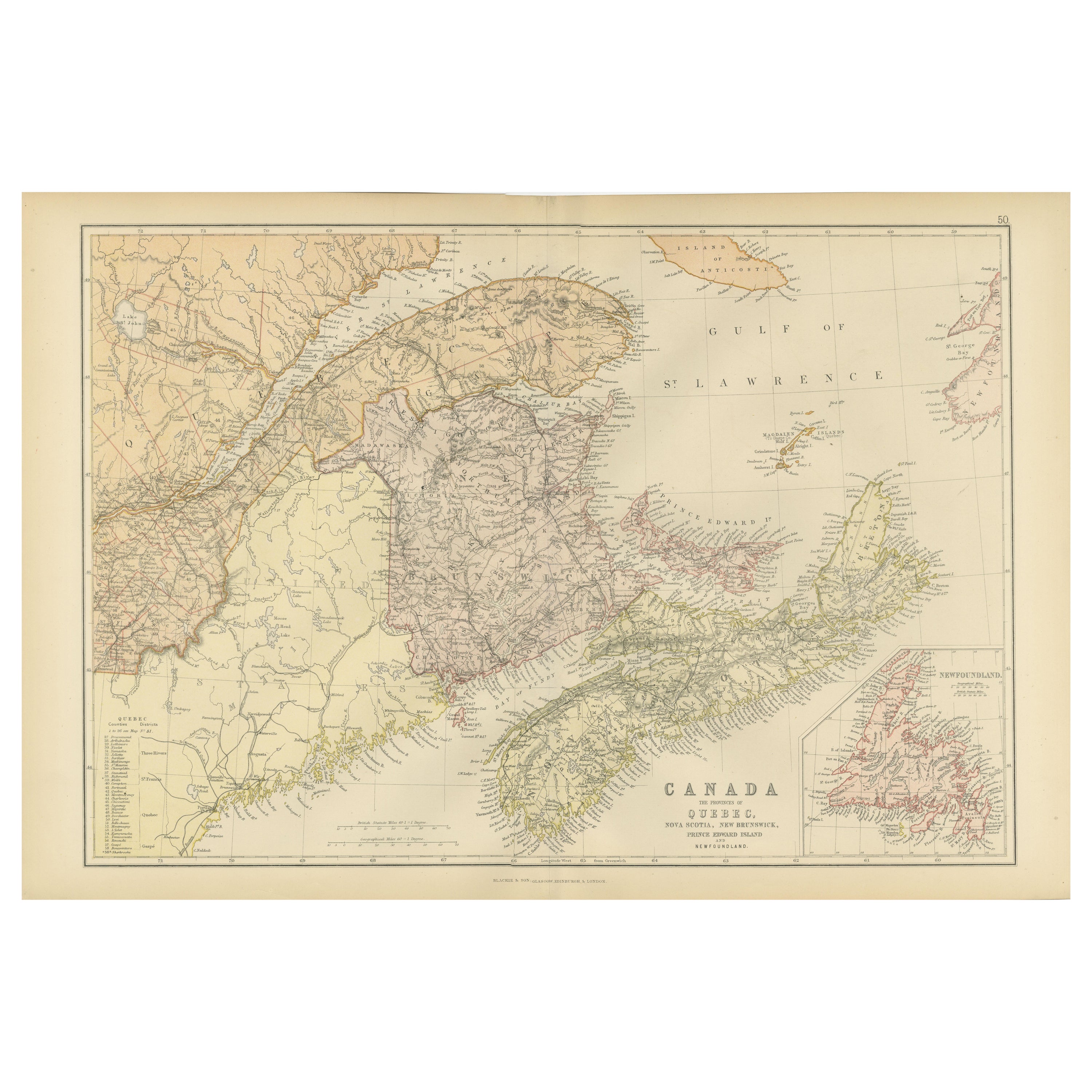
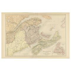
- Decorative Antique Map of Eastern Canada, Published in 1882Located in Langweer, NLThis is a historical map from the 1882 Blackie Atlas, focused on eastern Canada and the maritime provinces. The map is titled "Canada. No. 2. Provinces of Nova Scotia, New Brunswick,...Category
Antique 1880s Maps
MaterialsPaper
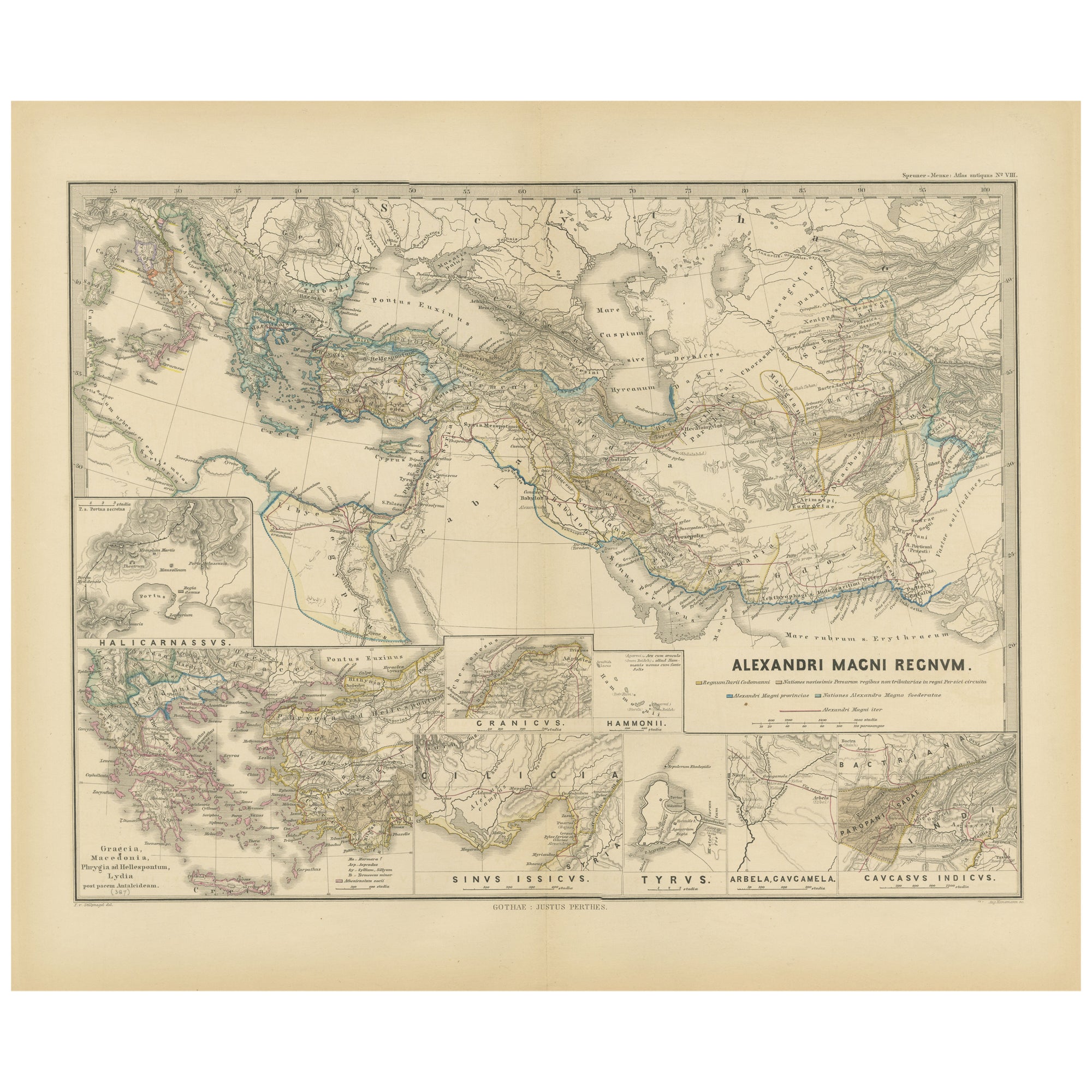
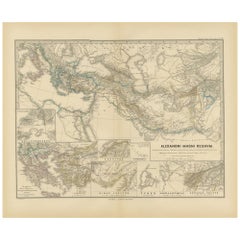
- Antique Map of The Kingdom of Alexander the Great, Published in 1880Located in Langweer, NLThe map is titled "ALEXANDRI MAGNI REGNUM," which translates to "The Kingdom of Alexander the Great." It depicts the vast territories conquered by Alexander the Great during his reig...Category
Antique 1880s Maps
MaterialsPaper
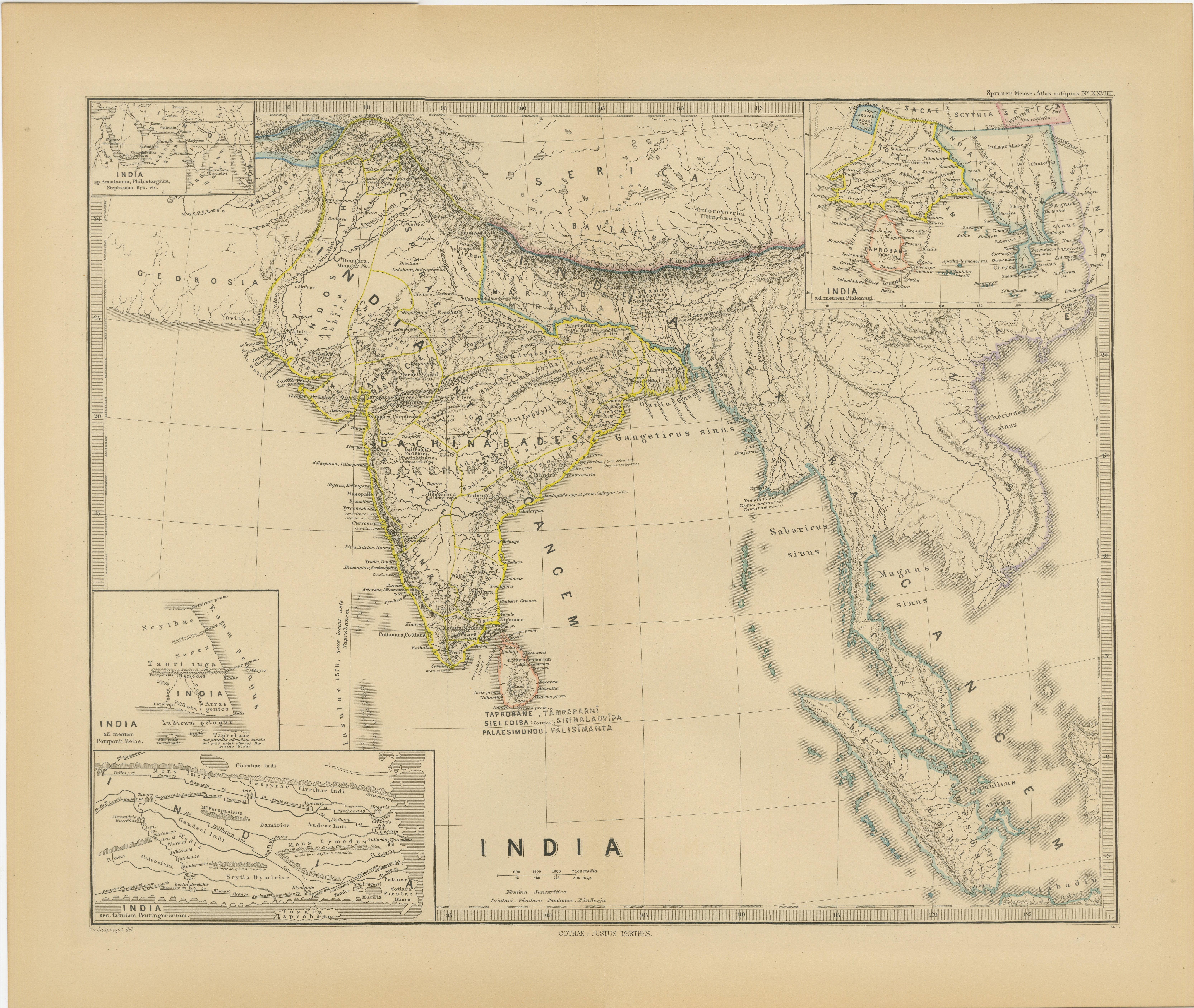
- Ancient Cartography of the Indian Subcontinent, Published in 1880Located in Langweer, NLThis map is titled "INDIA," and it provides a detailed view of the Indian subcontinent with various inset maps that offer additional historical and geographical context. The main ma...Category
Antique 1880s Maps
MaterialsPaper
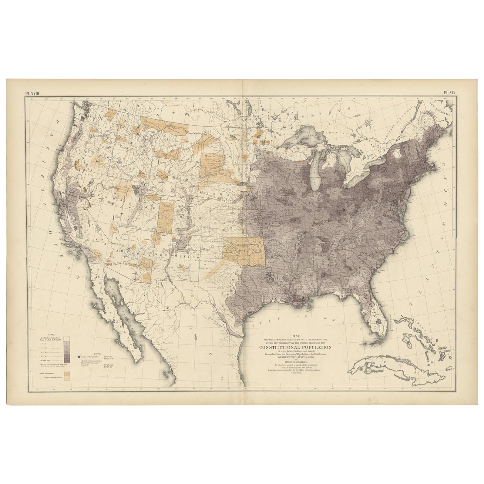
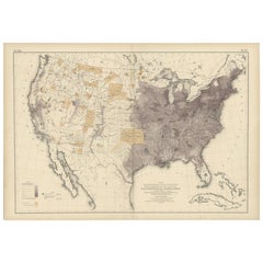
- Antique Chart of the US Population in 1870, published in 1874Located in Langweer, NLAntique chart titled 'Map showing, in five degrees of density, the distribution, within the territory of the United States, of the constitutional population, i.e., excluding Indians ...Category
Antique Late 19th Century Maps
MaterialsPaper
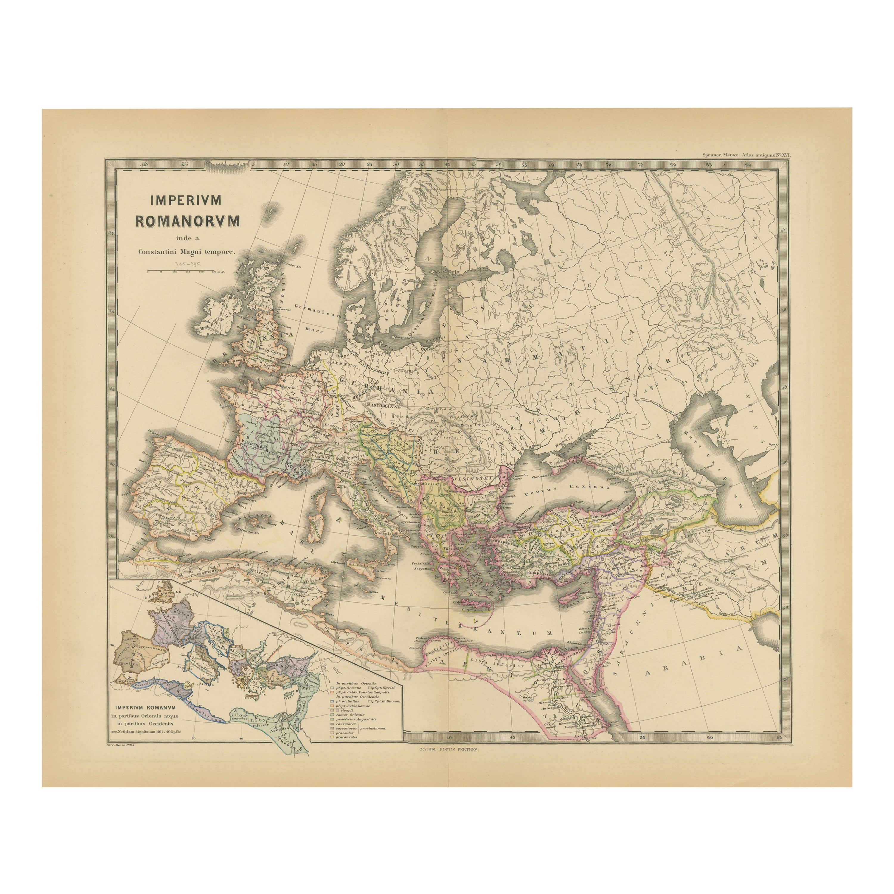
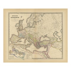
- The Roman Empire from the Time of Constantine the Great, Published in 1880Located in Langweer, NLAntique map titled: "IMPERIUM ROMANORUM inde a Constantini Magni tempore," which translates to "The Roman Empire from the time of Constantine the Great." This map is designed to re...Category
Antique 1880s Maps
MaterialsPaper
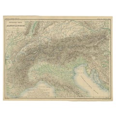
- Antique Map of the Alpine Countries, Published in Germany, c.1870Located in Langweer, NLAntique map titled 'Physische Karte der Alpenländer'. Old map of the Alpine countries. This map originates from 'H. Kiepert's Kleiner Atlas der Neueren Geographie für Schule und Haus...Category
Antique 19th Century Maps
MaterialsPaper

You May Also Like
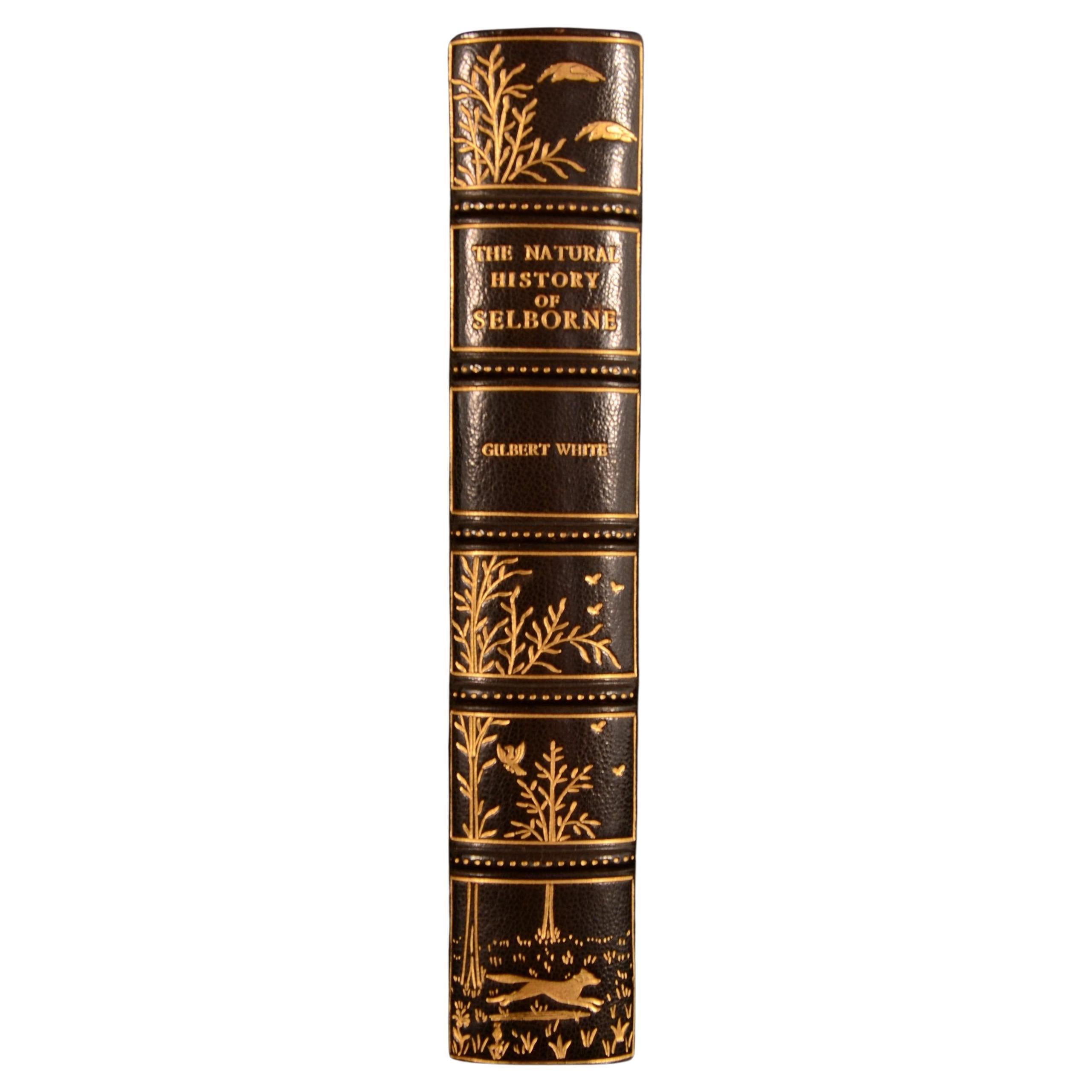
- 1908 The Natural History of SelborneBy Gilbert WhiteLocated in Bath, GBA beautiful Riviere bound copy of this popular natural history work by ornithologist Gilbert White. An exceptionally bound work, with natural history motifs gilt tooled to the spine....Category
Antique Early 1900s British Books
MaterialsPaper
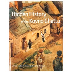
- Hidden History of the Kovno GhettoLocated in valatie, NYHidden History of the Kovno Ghetto. New York: Little, Brown and Company, 1998. Second printing hardcover with dust jacket. 255 pp. An important book published by the United States Ho...Category
20th Century American Books
MaterialsPaper
- The Works of Francis Rabelais in 4 Leatherbound Volumes Published In London 1784Located in San Francisco, CAThe works of Francis Rabelais, translated from the French in 4 full original calf bindings with gilt tooled spines published in London by T. Evans in the Strand in 1784. Rabelais was...Category
Antique Mid-18th Century English Georgian Books
MaterialsLeather, Paper
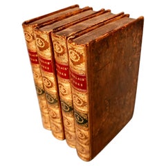
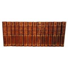
- The Works of Turgenev in 15 Leatherbound Volumes Published London: 1916Located in San Francisco, CAThe Works of Ivan Turgenev (1818-1883) in 15 volumes, the large type fine paper edition, bound in 3/4 leather, published by William Heinemann, London 1916. Includes the author's most...Category
Early 20th Century English Books
MaterialsLeather, Paper
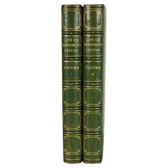
- The Life of Benvenuto Cellini in 2 volumes. Published: 1906 by Brentanos.Located in San Francisco, CAThe Life of Benvenuto Cellini in 2 volumes. Published: 1906 by Brentanos. Top edges gilt. Cellini (1500-1571) was an Italian Renaissance goldsmith, sculptor, and author whose most fa...Category
Antique Early 1900s Books
MaterialsLeather, Paper
- The Works of Edmund Burke in Eight Leatherbound Volumes Published 1808Located in San Francisco, CAThe Works of the Right Honorable Edmund Burke in 8 volumes published for F.C. and J. Rivington, St. Paul's Yard, England by Luke Hanfard and Sons, near Lincoln's-Inn Fields. This att...Category
Antique Early 19th Century English Books
MaterialsLeather, Paper
Recently Viewed
View AllMore Ways To Browse
Bolivian Antique
St Thomas Cross
Map Of Liverpool
Georgetown Antique
Map Of Gulf Of Mexico
Authentic Pirate
Historic Map Virginia
Map Of Indonesia
United States Antique Map
Antique Map Coats Of Arms
Antique Book Map France
Old Maps England
Map Sumatra
Scotland Coat Of Arms
Malaysia Antique
Map Of Siam
Antique Map Of Sri Lanka
Globes Antique Terrestre