1960s Maps
4
to
1
3
1
4
4
4
1
2,897
2,122
412
5
228
31
11
84
7
57
7
3
3
4
5
2
3
1
1
1
Period: 1960s
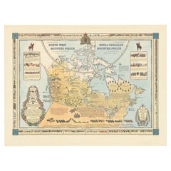
The History of the Royal Canadian Mounted Police, Published in 1966
Located in Langweer, NL
This rare pictorial map by Peter R. Furse celebrates the history of the Royal Canadian Mounted Police. It was produced with the cooperation of the RCMP, as acknowledged in an elegant...
Category
Vintage 1960s Maps
Materials
Paper
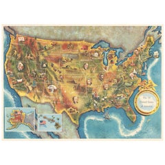
American Election Map and 1960 Presidential Fact Sheet, Published 1960
Located in Langweer, NL
Title: “The 50 United States of America”
Subject: United States, Presidential Elections
Date: 1960 (dated)
Color: Printed Color
Size: 24.9 x 17.9 inches (63.2 x 45.5 cm)
This colorful map of the United States was drawn by Lorin Thompson and published by the General Foods Corporation. The map has an unusual coloring style with symbols of American history including past presidents, Native Americans, important buildings (White House, Statue of Liberty, Alamo), agriculture, industry, and more. Includes inset maps of Hawaii and Alaska with small American flags...
Category
Vintage 1960s Maps
Materials
Paper
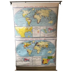
1967 World Exploration School Map
Located in Tarrytown, NY
Pull down world exploration map from 1967.
Category
Vintage 1960s Maps
Materials
Paper
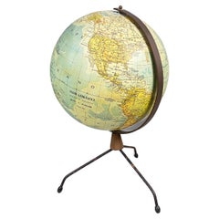
Italian modern Table globe map of the world in metal, 1960s
Located in MIlano, IT
Italian modern Table globe map of the world in metal, 1960s
Table map of the world with metal structure. The globe rotates thanks to the pins of the curved metal structure. The base ...
Category
Italian Modern Vintage 1960s Maps
Materials
Metal
Related Items
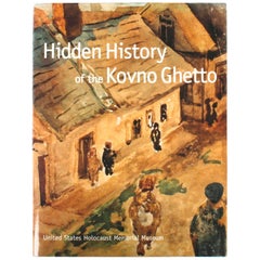
Hidden History of the Kovno Ghetto
Located in valatie, NY
Hidden History of the Kovno Ghetto. New York: Little, Brown and Company, 1998. Second printing hardcover with dust jacket. 255 pp. An important book published by the United States Ho...
Category
American 1960s Maps
Materials
Paper
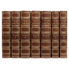
Rhodes, James Ford, History of the United States, 7 Vols, in a Fine Binding
Located in Hillsborough, NJ
AUTHOR: RHODES, James Ford.
TITLE: History Of The United States From The Compromise of 1850 To The Final Restoration Of Home Rule At The South In 1877.
PUBLISHER: NY: The Macm...
Category
American Vintage 1960s Maps
Materials
Leather
H 8.69 in W 6.25 in D 2 in
4 Volumes. J.A. Spencer, History of the United States.
Located in New York, NY
4 Volumes. J.A. Spencer, History of the United States. Bound in 3/4 brown morocco, bordered in gilt-tooling. Raised band spine with gilt-tooled detailing. All edges marbled with marb...
Category
American Antique 1960s Maps
Materials
Leather
Issues - A History of Photography in Fashion Magazines
Located in New York City, NY
A showcase of ground-breaking photography of fashion magazines over the last century
Acclaimed photography critic Vince Aletti has selected 100 significan...
Category
1960s Maps
Materials
Paper
Crime and Punishment / Raskolnikov
Located in London, GB
Original 1935 Swedish film poster.
This film was directed by Josef von Sternberg, whose illustrious career spanned the transition from the silent to the sound era. He is best known for his work with Marlene Dietrich in the 1930s. Crime and Punishment was adapted from the novel of the same name by Fyodor Dostoevsky. The film stars Peter Lorre...
Category
Swedish Vintage 1960s Maps
Large Original Vintage Map of The World, circa 1920
Located in St Annes, Lancashire
Great map of The World
Original color.
Good condition / minor foxing
Published by Alexander Gross
Unframed.
Category
English Vintage 1960s Maps
Materials
Paper
Designing History the Extraordinary Art & Style of the Obama White House
Located in New York, NY
The long-awaited insider's look at one of the design milestones of the twenty-first century: Michael S Smith's celebrated decoration of the Obama White House, featuring a foreword by Michelle Obama.
Created for design enthusiasts, political aficionados, and students of Americana, Designing History...
Category
American 1960s Maps
Materials
Paper
'Book Sets' 3 Volumes. W. F. P. Napier, History of the Peninsular War
Located in New York, NY
3 Volumes. W. F. P. Napier (Colonel H. P., 43rd Regiment. Member of the Royal Swedish Academy of Military Sciences). History of the Peninsular War and t...
Category
British Antique 1960s Maps
Materials
Leather
Map Exploring The World, Midi Format
Located in New York City, NY
A compelling exploration of the ways that humans have mapped the world throughout history - now in a compact new edition
Map: Exploring the World brings together more than 250...
Category
1960s Maps
Materials
Paper
Map, Exploring The World
Located in New York City, NY
300 stunning maps from all periods and from all around the world, exploring and revealing what maps tell us about history and ourselves.
Selected by an international panel of cartographers, academics, map dealers and collectors, the maps represent over 5,000 years of cartographic innovation drawing on a range of cultures and traditions.
Comprehensive in scope, this book features all types of map from navigation and surveys to astronomical maps, satellite and digital maps, as well as works of art inspired by cartography.
Unique curated sequence presents maps in thought-provoking juxtapositions for lively, stimulating reading.
Features some of the most influential mapmakers and institutions in history, including Gerardus Mercator, Abraham Ortelius, Phyllis Pearson, Heinrich Berann...
Category
Hong Kong 1960s Maps
Materials
Paper
8 Vols. Edward Gibbon, The History of the Decline and Fall of the Roman Empire
Located in New York, NY
8 Volumes. Edward Gibbon, The History of the Decline and Fall of the Roman Empire. Bound in full tan calf with the covers displaying a floral border and a central crest, both gilt-to...
Category
English Antique 1960s Maps
Materials
Leather
H 1.25 in W 8.25 in D 5.25 in
Antique World Map by P. Schenk '1706'
By Peter Schenk
Located in Langweer, NL
Antique map titled 'Diversa Orbis Terrae. Visu Incedente per Coluros Tropicorum, Ambos Ejus Polos, et Parciularis Sphaerae Zenith, in Planum Orthographica Projectio (..) Plat Ontwerp van verscheyde Aert-klooten (..)'. One of the earliest Dutch World Maps to focus on a more modern cartographic style, based on Carel Allard's map of 1696. This map represented a noteworthy shift from the traditional decorative Dutch 17th century maps where the margins would be full of classical mythological...
Category
Antique 1960s Maps
Materials
Paper
Previously Available Items
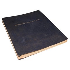
Large Vintage Half-Inch Map Folio, Great Britain, Cartography Atlas, Bartholomew
Located in Hele, Devon, GB
This is a large vintage half-inch map folio of Great Britain. A Scottish, paper on linen bound compendium of cartographical interest by Bartholomew of Edinburgh, dating to the mid 20th century, circa 1965.
Of great interest to the collector of maps, covering Great Britain in the mid 20th century in fine detail
Displaying a desirable aged patina and in good archival order
Professionally bound in a British made Twinlock Loose Leaf folio
Each map in fine condition, fully legible and free of loss
Comprehensive coverage of England, Wales and Scotland (and Scottish Isles)
In full colour and detail across half inch scale, each sheet detailing regions or counties
Annotated for places, major roads and amenities/attractions
Scale and key detail to each page provides relevant information
Whilst several sheets are undated, two maps are reprinted from OS detail in 1962 and 1963
Earlier maps feature the Royal warrant for King George V (1910 - 1935)
Coverage of the Shetland Isles bears their former name Zetland, the change taking place in 1975
Imprint to lower edge for John Bartholomew & Son Ltd, Edinburgh
This is a fascinating large vintage map...
Category
British Mid-Century Modern Vintage 1960s Maps
Materials
Linen, Paper
H 2.17 in W 19.3 in D 23.63 in
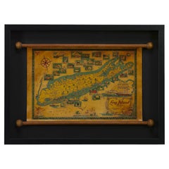
1964 Pictorial Map of Long Island by Catherine & E. Theodore Nelson
Located in Colorado Springs, CO
Presented is a colorful and whimsical pictorial map of Long Island. The map was illustrated and published by creative husband and wife duo Catherin...
Category
American Vintage 1960s Maps
Materials
Paper
Italian Faux Bamboo Shoehorn and Backscratcher, Italy circa 1960, Brown Color
Located in Auribeau sur Siagne, FR
Listed is a fabulous, 1960s Italian faux-bamboo shoehorn/backscratcher. The piece has a beautiful, 'burnt' bamboo look to the wood frame. Shoehorn and backscratcher are a heavy resin...
Category
Italian Modern Vintage 1960s Maps
Materials
Faux Bamboo, Resin
H 22.45 in W 1.58 in D 1.19 in
Mid-Century Modern Desktop Scholastic World Globe on Brass Stand
Located in San Jose, CA
Vintage desk or tabletop globe map with stand in brass by Scholastic. This piece rotates on a full swing meridian and displays plenty of vintage charm. The p...
Category
Mid-Century Modern Vintage 1960s Maps
Materials
Brass
Extra Large Midcentury School Map of Mexico by Haack Painke Kooyman
Located in Mexico City, CDMX
We offer this extra large midcentury school map of Mexico by Haack Painke Kooyman, circa 1960. This vintage item remains fully functional, but it shows si...
Category
German Mid-Century Modern Vintage 1960s Maps
Materials
Canvas
Rare Sterling Silver Desk Globe by Mappin and Webb, 1969
Located in London, GB
A wonderful and rare 3¾ inch silver desk globe by Mappin and Webb of London mounted on a silver and turned wood base. Hallmarked London 1969. The globe has lines of longitude and lat...
Category
British Vintage 1960s Maps
Materials
Sterling Silver
1967 School Map of England
Located in Tarrytown, NY
1967 Pull down school map of England.
Category
Vintage 1960s Maps
Materials
Paper
1968 Ancient World School Map
Located in Tarrytown, NY
Pull down school map of the ancient world made, in Chicago in the 1960s.
Category
Vintage 1960s Maps
Materials
Paper
Wall-School Chart "Sonnenblume" from Jung-Koch-Quentell, 1965
Located in Almelo, NL
Wall chart of the Sonneblume by Jung Koch Quentell
- Canvas backed
- On it's original wooden hangers
- German, circa 1965.
- Measures: 37 x 45 inch.
Jung Koch Quentell
Th...
Category
German Other Vintage 1960s Maps
Materials
Canvas
Wall-School Chart "Ohrenqualie" from Jung-Koch-Quentell, 1960s
Located in Almelo, NL
Wall chart of the Ohrenqualie by Jung Koch Quentell
- Canvas backed
- On it's original hangers
- German, 1960s.
- Measures: 37 x 45 inch.
Jung Koch Quentell
The name Jung...
Category
German Other Vintage 1960s Maps
Materials
Canvas
Wall-School Chart "Lobster" from Jung-Koch-Quentell, 1968
Located in Almelo, NL
Wall chart of the Lobster by Jung Koch Quentell
- Canvas backed
- On it's original hangers
- German, 1968
- Measures: 37 x 45 inch
Jung Koch Quentell
The name Jung Koch ...
Category
German Other Vintage 1960s Maps
Materials
Canvas
Floor World Globe Map, Germany, 1960s
Located in SAINT-OUEN, FR
Huge lightning world globe map or ground world map. Decorated brass structure. Datation before 1971, Democratic Rep. of Congo is on the globe after 71 it bec...
Category
German Mid-Century Modern Vintage 1960s Maps
Materials
Brass
Recently Viewed
View AllMore Ways To Browse
Antique Nautical Maps
Antique Mexican Maps
Antique Nautical Map
Antique Classroom
Antique Map Box
Sea Chart Map
Antique Nautical Charts
King Charles I Of England
17th Century Corpus
Mexican Antique Map
Antique Celestial Map
Celestial Maps Antique
Antique Celestial Maps
Middle East Antique Map
Topographical Plate
Central America Map
Antique Map Middle East
Vintage Wooden Roller
