Central America Map

4
107
14
1
to
10
73
49
122
122
122
4
3
3
3
2
2
1
1
33
49
25
15
7
12
4
1
3
5
2
2
1
1
1
84
16
16
4
4
50
31
29
17
13
14
3
3
2
1
Sort By
Original Antique Map of Central America / Florida, Arrowsmith, 1820
Located in St Annes, Lancashire
Great map of Central America. Drawn under the direction of Arrowsmith. Copper-plate engraving
Category

Antique 1820s English Maps

Materials

Paper

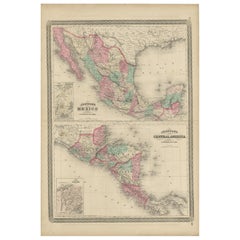
Antique Map of Mexico and Central America by Johnson '1872'
Located in Langweer, NL
Antique map titled 'Johnson's Mexico (..)'. Two maps one one sheet showing Mexico and Central
Category

Antique Late 19th Century Maps

Materials

Paper

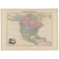
Antique Map of North and Central America by Migeon '1880'
By J. Migeon
Located in Langweer, NL
Antique map titled 'Amérique Septentrionale'. Old map of North and Central America. With a
Category

Antique Late 19th Century French Maps

Materials

Paper

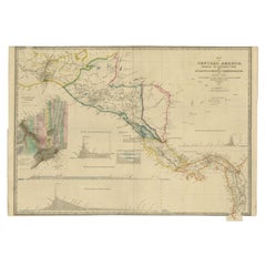
Antique Map of Central America Showing the Communication Lines, 1850
Located in Langweer, NL
Antique map titled 'Map of Central America Shewing the Different Lines of Atlantic & Pacific
Category

Antique 19th Century Maps

Materials

Paper

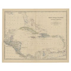
Antique Map of Central America and the West Indies, 1882
Located in Langweer, NL
Antique map titled 'West India Islands and Central America'. Old map of Central America and the
Category

Antique 19th Century Maps

Materials

Paper

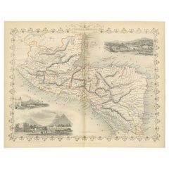
An Old Illustrated Tallis Map of Central America with Volcanic Vignettes, 1851
Located in Langweer, NL
This map of Central America, part of John Tallis & Company's series from "The British Colonies" by
Category

Antique 1850s Maps

Materials

Paper

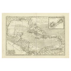
Authentic Antique Map of the Caribbean, Gulf Coast and Central America, 1787
Located in Langweer, NL
, Gulf Coast and Central America. With inset map of Bermuda. Originates from 'Histoire Philosopgique et
Category

Antique Late 18th Century Maps

Materials

Paper

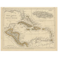
Antique Map of the West Indies and Central America by Lowry '1852'
Located in Langweer, NL
Antique map titled 'West Indies and Central America'. Original map of the West Indies and Central
Category

Antique Mid-19th Century Maps

Materials

Paper

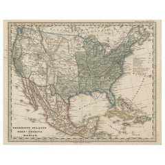
Old Map the United States and Central America, Including Mexico, ca.1860
Located in Langweer, NL
Antique map titled 'Vereinigte Staaten von Nord America und Mexico'. Old map the United States
Category

Antique 1860s Maps

Materials

Paper

Engraving of a Map of Florida, the Gulf Coast, Caribbean & Central America, 1728
Located in Langweer, NL
, the Gulf Coast, the Caribbean, and Central America. What sets it apart is its beautiful original, or
Category

Antique Mid-18th Century European Maps

Materials

Paper

Antique Map of Mexico, Central America and West Indies by A & C. Black, 1870
Located in Langweer, NL
Antique map titled 'Mexico, Central America and West Indies'. Original antique map of Mexico
Category

Antique Late 19th Century Maps

Materials

Paper

Antique Map of the West Indies and Central America by W. G. Blackie, 1859
Located in Langweer, NL
Antique map titled 'The West India Island & Central America'. Original antique map of the West
Category

Antique Mid-19th Century Maps

Materials

Paper

Old German Map of the United States, Central America and the West Indies, c.1870
Located in Langweer, NL
, Central America and the West Indies. This map originates from 'H. Kiepert's Kleiner Atlas der Neueren
Category

Antique 19th Century Maps

Materials

Paper

Vintage Reproduction 17th Century Map of Europe, American, Cartography, Blaeuw
Located in Hele, Devon, GB
This is a vintage reproduction map of Europe. An American, paper stock cartography print in frame
Category

Late 20th Century Central American Mid-Century Modern Maps

Materials

Glass, Wood, Paper

1875 "North America" Map by J. Bartholomew
Located in Colorado Springs, CO
Presented is an original 1875 map of “North America.” The map was issued in Volume 1 of the Ninth
Category

Antique 1870s Scottish Maps

Materials

Paper

1899 Poole Brothers Antique Railroad Map of the Illinois Central Railroad
Located in Colorado Springs, CO
This is an 1899 railroad map of the Illinois Central and Yazoo and Mississippi Valley Railroads
Category

Antique 1890s American Maps

Materials

Paper

Large Antique 1859 Map of North America
Located in Sag Harbor, NY
population of 1850 North America is included as well as details of all of North and Central America. The size
Category

Antique Mid-19th Century American Maps

Materials

Canvas, Paper

Large Antique 1859 Map of North America
Free Shipping
H 65 in W 65 in D 0.01 in
Sea Chart of Central America and the Northwest Coast of South America, ca.1745
Located in Langweer, NL
Central America and the northwest coast of South America, oriented to the east, by Reinier & Joshua Ottens
Category

Antique 1740s Maps

Materials

Paper

Antique Map of The United States of North America, 1882
Located in Langweer, NL
This is a historical map titled "The United States of North America, Central Part" from the 1882
Category

Antique 1880s Maps

Materials

Paper

Antique Map of The United States of North America, 1882
Free Shipping
H 14.97 in W 22.45 in D 0 in
America "Amérique Septentrionale": A 19th Century French Map by Delamarche
By Maison Delamarche 1
Located in Alamo, CA
et de Phil. Buache. The map includes Central America (labelled Guatimala), portions of Columbia in
Category

Antique Mid-19th Century American Other Maps

Materials

Paper

South America: Hand-colored 18th Century Framed Map by Thomas Jefferys
By Thomas Jefferys
Located in Alamo, CA
This detailed hand-colored map of South America by Thomas Jefferys was published in London in 1750
Category

Antique Mid-18th Century English Maps

Materials

Paper

1859 "Map of the United States of America..." by J. H. Colton
By J.H. Colton
Located in Colorado Springs, CO
Presented is an 1859 “Map of the United States of America, the British Provinces, Mexico, the West
Category

Antique 1850s American Maps

Materials

Paper

North & South America: A 17th Century Hand-colored Map by Jansson & Goos
By Johannes Janssonius
Located in Alamo, CA
A 17th century hand-colored map of North & South America entitled "Americae Descriptio" by the
Category

Antique 1620s Dutch Maps

Materials

Paper

Antique Map of South American, The West Indies & Most of Africa, Ca.1775
Located in Langweer, NL
du Commerce des Europeens dans les deux Indes'. This map is roughly centered on South America
Category

Antique 1770s Maps

Materials

Paper

Pictorial Map of Chicago, circa 1926
Located in Colorado Springs, CO
publisher: "This pictorial map, the first of its kind to be made of any American city, gives a comprehensive
Category

Vintage 1920s American Maps

Materials

Paper

Pictorial Map of Chicago, circa 1926
H 45 in W 33 in D 1.5 in
1865 "Johnson's California, Utah, Nevada, Colorado, New Mexico, Arizona" Map
Located in Colorado Springs, CO
, New Mexico, and Arizona” map. First published in 1864, this map was issued as pages 66 and 67 in the
Category

Antique Mid-19th Century Maps

Materials

Paper

Antique Map of the Eastside of Coiba Island 'Quibo', Panama, 1749
Located in Langweer, NL
spelled Quibo Island, Spanish Isla de Coiba or Quibo, Central American island of Panama in the Pacific
Category

Antique 18th Century Maps

Materials

Paper

1856 U.S. Coast Survey Map of Chesapeake Bay and Delaware Bay
Located in Colorado Springs, CO
Presented is U.S. Coast Survey nautical chart or maritime map of Chesapeake Bay and Delaware Bay
Category

Antique 1850s American Maps

Materials

Paper

West Africa Entitled "Guinea Propria": An 18th Century Hand Colored Homann Map
By Johann Baptist Homann
Located in Alamo, CA
This is a scarce richly hand colored copper plate engraved map of Africa entitled "Guinea Propria
Category

Antique Mid-18th Century German Maps

Materials

Paper

Captain Cook's Exploration of Tahiti 18th C. Hand-Colored Map by Bellin
By Jacques-Nicolas Bellin
Located in Alamo, CA
central extinct volcano creating a mountain range and a series of radiating rivers. The map also includes
Category

Antique Mid-18th Century French Maps

Materials

Paper

Africa: A Large 17th Century Hand-Colored Map by Sanson and Jaillot
By Nicolas Sanson
Located in Alamo, CA
This large original hand-colored copperplate engraved map of Africa entitled "L'Afrique divisee
Category

Antique 1690s French Maps

Materials

Paper

Map Road Strip Britannia Sheet 2 John Ogilby London Aberistwith Islip Bramyard
By John Ogilby
Located in BUNGAY, SUFFOLK
map also includes a miniature town plan of Worcester. Central cartouche inscribed ' The Continuation
Category

Antique 17th Century English Baroque Maps

Materials

Paper

West Coast of Africa, Guinea & Sierra Leone: An 18th Century Map by Bellin
By Jacques-Nicolas Bellin
Located in Alamo, CA
expansive work that mapped China, the East Indies, Asia, the Americas, early voyages to Australia, New
Category

Antique Mid-18th Century French Maps

Materials

Paper

Antique Map of the Gulf of Mexico and all the islands of the West Indies
Located in Langweer, NL
, Central America, and Northern South America. Place names, Indian tribes, rivers, lakes, bays, and more are
Category

Antique Early 19th Century Maps

Materials

Paper

Engraving by Tallis and Rapkin of Map of the West Indies in The Caribbean, 1851
Located in Langweer, NL
Central American coast are also identified. 3. **Vignettes:** The map is adorned with stunning vignettes
Category

Antique Mid-19th Century Maps

Materials

Paper

Map of The East Indies with the Route of Capt. William Dampier's Voyage, 1698
Located in Langweer, NL
. In the 1670s he crewed with buccaneers on the Spanish Main of Central America, which eventually led
Category

Antique 1690s Maps

Materials

Paper

Ornate Cartography of Colonial Grandeur: The West India Islands around 1851
Located in Langweer, NL
This map is a part of John Tallis's series of maps, known for their detailed and ornamental style
Category

Antique 1850s Maps

Materials

Paper

Antique French Engraving of Mexico with Lots of Details, c.1780
Located in Langweer, NL
.' Detailed map of Mexico, the Yucatan and Central America, prepared under the direction of Rigobert Bonne
Category

Antique 18th Century Maps

Materials

Paper

Large Rollable Map Central America Northern South America Wall Chart Poster
Located in Berghuelen, DE
A fantastic pull-down wall chart depicting a map of Central America and Northern South America
Category

Mid-20th Century German Country Prints

Materials

Canvas, Wood, Paper

Pair of Monumental National Air Map Company Manhattan Aerial Photo Maps, 1955
Located in San Francisco, CA
A monumental and rare circa 1955 framed two-piece aerial photographic map of the borough of
Category

Vintage 1950s American Mid-Century Modern Photography

Materials

Acrylic, Wood, Paper

The Travel Sale: Natural History and Maps. November 2001: Sotheby's London
By Sotheby's
Located in valatie, NY
-87; Pacific 88-91; America 92-122; Central America and the Caribbean 122-140; South America 141-162
Category

21st Century and Contemporary English Books

Materials

Paper

American Hepplewhite Virginian Secretary Chest with Civil War Provenance
By George Hepplewhite
Located in Dallas, TX
PRESENTING a FANTASTIC and HISTORIC Early 19C American Hepplewhite Virginian Secretary Chest with
Category

Antique Early 19th Century American American Classical Historical Memora...

Materials

Brass

Christo and Jeanne-Claude and Christo Signed in Christo in Crayon Lithograph
By Christo and Jeanne-Claude
Located in Chicago, IL
-central Colorado. Fabric panels will be suspended at eight distinct areas of the river that were selected
Category

1990s North American Organic Modern Contemporary Art

Materials

Paper

Antique Mycology Print of the Lactifluus Volemus by Fries, c.1860
By Elias Magnus Fries
Located in Langweer, NL
well as some subtropical and tropical regions of Central America and Asia. This print originates from
Category

Antique 19th Century Prints

Materials

Paper

Wonderful and extremely rare Dutch pocketglobe
By Dementz Family DEUR Art Company
Located in ZWIJNDRECHT, NL
given between Japan and America (“Terra Esonis”); Central America is simply named ‘Hispania Nova’; Japan
Category

Antique Early 18th Century Dutch Dutch Colonial Globes

Materials

Hardwood, Paper

Wonderful and extremely rare Dutch pocketglobe
Free Shipping
H 2.5 in Dm 2.5 in
Pocket Globe, Nicholas Lane, London, post 1779
By Nicholas Lane
Located in Milano, IT
cartouche, there is: 1776 Prockter fc. On the terrestrial globe, a large part of southern and central
Category

Antique 1780s English Other Models and Miniatures

Materials

Leather, Wood, Paper

English Pocket Globe, London, Circa 1775-1798
By Herman Moll
Located in Milano, IT
region in his 1727 map. (Encyclopaedia Britannica, ed. 1902, under "States of Central Africa"); Tartary
Category

Antique Late 18th Century English George III Globes

Materials

Shagreen, Paper

Pocket Globe by Nathaniel Hill, London 1754
Located in Milano, IT
globe much of central and southern Africa is empty. North America bears only the name of some British
Category

Antique 1750s English George II Globes

Materials

Shagreen, Paper

A truly delightful miniature terrestrial pocket globe
By Nathaniel Mills
Located in ZWIJNDRECHT, NL
. There is some attempt at border delineation. Central America and the Caribbean are well represented with
Category

Antique Mid-18th Century British Dutch Colonial Globes

Materials

Other

The World of ISLAM. Faith, People, Culture Book
Located in North Hollywood, CA
drawings and maps. A concise, illustrated history of Islam which considers all aspects of its remarkably
Category

Late 20th Century British Islamic Books

Materials

Paper

Plaquet, Original Air France Poster, Capital Airlines, USA, Aviation, Plane 1952
Located in SAINT-OUEN-SUR-SEINE, FR
, 1933-1975) as well as the logo of Capital Airlines (A stylized bird and 5 stars). A world map is
Category

20th Century French Mid-Century Modern Posters

Materials

Paper

An exceptional pair of BLAEU table globes
By Willem Blaeu
Located in ZWIJNDRECHT, NL
by two crossbeams which support a circular base plate with central support for the meridian ring. The
Category

Antique 17th Century European Dutch Colonial Globes

Materials

Other

        An exceptional pair of BLAEU table globes
        An exceptional pair of BLAEU table globes
Free Shipping
H 15 in Dm 9 in
Pair of Armchairs by Carlo Ratti, 1960s
By Carlo Ratti
Located in Roma, IT
America" by Fast Company[1] and highlighted in Wired magazine's "Smart List: 50 people who will change the
Category

Vintage 1960s Italian Armchairs

Materials

Fabric, Wood

Pair of Armchairs by Carlo Ratti, 1960s
H 31.5 in W 17.33 in D 17.33 in
1940s Painting by Colorado Artist Herndon Davis of Industrial Interior
By Herndon Davis
Located in Topeka, KS
the infamous artist of the Face on the Barroom Floor at the Teller House in Central City, Colorado
Category

Mid-20th Century American Industrial Paintings

Materials

Wood, Paint

French 18th-19th Century Copper Overlaid Relief Medallion of Antoine Lavoisier
Located in Los Angeles, CA
and chemist central to the 18th-century chemical revolution and a large influence on both the history
Category

Antique Early 1800s French Directoire Figurative Sculptures

Materials

Copper

Sakura TRP 22006, nl
By Maarten Vrolijk
Located in New York, NY
, delicacy, strength, transparency, ephemerality, that provide a map to the fascinations we gravitate to when
Category

2010s Dutch Modern Vases

Materials

Blown Glass

Sakura TRP 22006, nl
H 20.87 in W 18.9 in D 18.51 in
Sakura TRP23009, Nl
By Maarten Vrolijk
Located in New York, NY
, delicacy, strength, transparency, ephemerality, that provide a map to the fascinations we gravitate to when
Category

2010s Dutch Modern Vases

Materials

Blown Glass

Sakura TRP23009, Nl
Sakura TRP23009, Nl
H 36 in Dm 27 in
Maarten Vrolijk, Sakura TRP 16014, NL
By Maarten Vrolijk
Located in New York, NY
, delicacy, strength, transparency, ephemerality, that provide a map to the fascinations we gravitate to when
Category

2010s Dutch Vases

Materials

Glass

Maarten Vrolijk, Sakura TRP 16014, NL
H 18.9 in W 14.17 in D 14.17 in
Large Late 1800's Raised Relief Map Of South America
Located in Chicago, IL
Large Late 1800's raised Relief Map of South America by Central School Supply House in Chicago
Category

Antique 19th Century American Maps

Materials

Paper, Wood

Herbert List Trattoria on Capri, Italy, 1935
By Herbert List
Located in Austin, TX
plantations throughout the Caribbean, Central and South America, he began to take photographs. In 1930, List
Category

Vintage 1930s German Photography

  • 1
Get Updated with New Arrivals
Save "Central America Map", and we’ll notify you when there are new listings in this category.

Central America Map For Sale on 1stDibs

Find many varieties of an authentic central america map available at 1stDibs. A central america map — often made from paper, fabric and wood — can elevate any home. Whether you’re looking for an older or newer central america map, there are earlier versions available from the 18th Century and newer variations made as recently as the 20th Century. Each central america map bearing hallmarks is very popular.

How Much is a Central America Map?

Prices for a central america map start at $115 and top out at $12,963 with the average selling for $307.

Read More

Pamela Shamshiri Shares the Secrets behind Her First-Ever Book and Its Effortlessly Cool Interiors

The sought-after designer worked with the team at Hoffman Creative to produce a monograph that beautifully showcases some of Studio Shamshiri's most inspiring projects.

Moroccan Artworks and Objects Take Center Stage in an Extraordinary Villa in Tangier

Italian writer and collector Umberto Pasti opens the doors to his remarkable cave of wonders in North Africa.

Montecito Has Drawn Royalty and Celebrities, and These Homes Are Proof of Its Allure

Hollywood A-listers, ex-pat aristocrats and art collectors and style setters of all stripes appreciate the allure of the coastal California hamlet — much on our minds after recent winter floods.

Whaam! Blam! Pow! — a New Book on Pop Art Packs a Punch

Publishing house Assouline and writer Julie Belcove have teamed up to trace the history of the genre, from Roy Lichtenstein, Andy Warhol and Yayoi Kusama to Mickalene Thomas and Jeff Koons.

The Sparkling Legacy of Tiffany & Co. Explained, One Jewel at a Time

A gorgeous new book celebrates — and memorializes — the iconic jeweler’s rich heritage.

What Makes a Gem-Encrusted Chess Set Worth $4 Million?

The world’s most opulent chess set, weighing in at 513 carats, is literally fit for a king and queen.

Tauba Auerbach’s Geometric Pop-Up Book Is Mighty Rare, Thanks to a Hurricane

This sculptural art book has an epic backstory of its own.

Step inside the Storied Mansions of Palm Beach’s Most Effervescent Architect

From Spanish-style courtyards to fanciful fountains, these acclaimed structures abound in surprising and elegant details.