Antique Navigation
19
to
42
321
174
210
153
153
139
92
71
60
50
39
33
32
31
28
24
22
22
21
16
14
13
10
9
8
8
7
7
7
5
5
5
4
4
4
3
3
3
3
3
3
2
2
2
1
1
1
1
1
1
12
11
9
8
7
Sort By
Une Navigation Difficile
By Honoré Daumier
Located in New York, NY
Honore Daumier (1808-1879), Une Navigation Difficile, lithograph, 1843, plate 6 from the series Les
Category
1840s Realist Antique Navigation
Materials
Lithograph
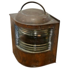
Well Weathered Ships Copper Navigation Light.
Located in Chillerton, Isle of Wight
Well Weathered Ships Copper Navigation Light.
The lamp is flat sided with original bowed and
Category
Early 1900s Industrial Antique Navigation
Materials
Copper
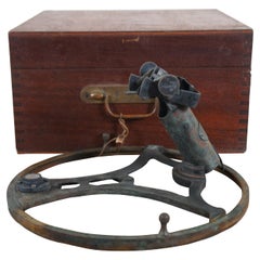
Antique Lord Kelvins Azimuth Mirror Nautical Navigation Prism Circle & Case
By Kelvin Bottomley & Baird 1
Located in Dayton, OH
navigation instrument in the form of a brass ring with sights that attaches to the top of a compass to enable
Category
Early 20th Century Antique Navigation
Materials
Metal
H 6.5 in W 12 in D 12 in
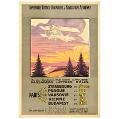
Original Antique Travel Poster Compagnie Franco Roumaine De Navigation Aerienne
Located in London, GB
Original antique travel advertising poster for the Compagnie Franco Roumaine de Navigation Aerienne
Category
1920s French Antique Navigation
Materials
Paper
H 41.74 in W 29.14 in D 0.04 in
Engravings in Gold Wood Frame, representing French navigation ports, France 19th
Located in Auribeau sur Siagne, FR
wood. They are reprensenting French navigation ports.
Category
19th Century French American Classical Antique Navigation
Materials
Wood, Paper
H 1.19 in W 16.15 in D 12.21 in
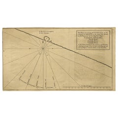
Navigational Chart of Mexico's Coast, with Acapulco and Port Marquis, 1748
Located in Langweer, NL
Prize.' -
A navigational chart of the coast of Mexico, with the harbours Acapulco and Port Marquis
Category
1740s Antique Navigation
Materials
Paper
H 9.81 in W 17.52 in D 0.01 in
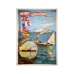
Original poster by Hugo d'Alésia for the Compagnie de Navigation mixte Touache
Located in PARIS, FR
Nice poster by Hugo d'Alésia for the Compagnie de Navigation mixte, the Touche company.
The
Category
Early 20th Century Antique Navigation
Materials
Linen, Lithograph, Paper
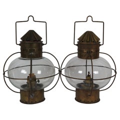
Antique Sherwood & Wedge British Nautical Maritime Brass Onion Ship Oil Lanterns
Located in Dayton, OH
Pair of two antique Sherwood & Wedge "onion" navigational lamps featuring a cylindrical brass base
Category
Late 19th Century British Colonial Antique Navigation
Materials
Brass
H 12 in W 9.25 in D 9.25 in
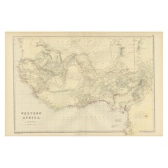
Original Antique Coloured Map of Western Africa, Published in 1882
Located in Langweer, NL
navigation and exploration.
4. **Trade and Exploration**: The map might indicate key ports, trade routes
Category
1880s Antique Navigation
Materials
Paper
No Reserve
H 14.97 in W 22.45 in D 0 in
Antique Map of Canada, The Province of Ontario and Part of Quebec, 1882
Located in Langweer, NL
River, a key navigational route, reflects its importance for trade and movement between the Great Lakes
Category
1880s Antique Navigation
Materials
Paper
Free Shipping
H 14.97 in W 22.45 in D 0 in
Colorful Detailed Antique Map of The World on Mercators Projection, 1882
Located in Langweer, NL
maritime navigation from an era steeped in exploration and discovery. With meticulous detail and precision
Category
1880s Antique Navigation
Materials
Paper
H 14.97 in W 22.45 in D 0 in
Terrestrial Globe By G. Thomas Paris
Located in Brussels, Brussels
can find the maritime currents, navigation lines, depth of the seas and heights of the mountains
The
Category
19th Century French Napoleon III Antique Navigation
Materials
Wood
Hendrik Brouwer: Eminent Navigator and Governor-General of the VOC, 1724
Located in Langweer, NL
East India Company (VOC) and his contributions to maritime navigation. Here's a summary of his life:
1
Category
1720s Antique Navigation
Materials
Paper
Free Shipping
H 13.19 in W 8.08 in D 0 in
Large Antique Plan of St. Philiou Bay or Sant Feliu Catalonia Spain, circa 1746
Located in Langweer, NL
precise portrayal of the harbor and its surroundings, showcasing navigational elements and geographical
Category
Mid-18th Century Antique Navigation
Materials
Paper
Free Shipping
H 13.59 in W 20.75 in D 0.02 in
Map of Vusihyen, Hu Chew Fu and Hou-Tcheou-Fou, Historical Chinese Cities, 1754
Located in Langweer, NL
the scientific rigor of the time but also the French government's commitment to navigation
Category
1750s Antique Navigation
Materials
Paper
H 9.97 in W 7.05 in D 0 in
Late 18th Century French Giltwood Barometer
Located in Essex, MA
navigation instruments. Foliate and neoclassical motifs. Maker signed.
Category
Late 18th Century French Louis XVI Antique Navigation
Materials
Giltwood
1726 Valentyn's Map of Bali and Lombok, Original Engraving
Located in Langweer, NL
, mountainous regions. It also features depth soundings around the coast, suggesting it was used for navigation
Category
Early 18th Century Antique Navigation
Materials
Paper
Charting the West: Surveyor General Roe’s Western Australian Expedition , 1852
Located in Langweer, NL
animal species, and insights into the navigation and surveying techniques of the time.
Roe's work was
Category
1850s Antique Navigation
Materials
Paper
Free Shipping
H 8.47 in W 16.93 in D 0 in
English River landscape, with Swans on the Thames at Temple Lock near London UK
By Alfred de Breanski Jnr.
Located in Woodbury, CT
far from Hurley, Berkshire. It was first built by the Thames Navigation Commissioners in 1773Many of
Category
1920s Impressionist Antique Navigation
Materials
Canvas, Oil
Free Shipping
H 19 in W 25 in
Original 1882 Map of Arabia, Red Sea & Persian Gulf
Located in Langweer, NL
significant for navigation and commerce. The map includes nautical lines indicating sea depths and shipping
Category
1880s Antique Navigation
Materials
Paper
Arctic Exploration: An Original Map of the North Circumpolar Regions, 1882
Located in Langweer, NL
and navigational, capturing the extent of polar exploration at the time. Names of seas, straits, and
Category
1880s Antique Navigation
Materials
Paper
H 11.03 in W 14.97 in D 0 in
Large Sea Chart of the British Islands, 1918
Located in Langweer, NL
of the coastlines, inlets, bays, and capes, providing valuable information for navigation and
Category
1910s Antique Navigation
Materials
Paper
Antique 19th Century Map of China by Blackie & Son, 1882
Located in Langweer, NL
navigation and location. Various cities and towns are marked and labeled throughout, suggesting a
Category
1880s Antique Navigation
Materials
Paper
Nathaniel Bowditch American Federal Giltwood Convex Mirror of Monumental Size
Located in Essex, MA
mathematician remembered for his work on ocean navigation. He is often credited as the founder of modern
Category
Early 19th Century American Federal Antique Navigation
Materials
Giltwood
H 76 in W 42 in D 11 in
Antique Decorative Coloured Map Marocco, Algeria and Tunis, 1882
Located in Langweer, NL
vast expanse of the Sahara Desert. Such detail would have been critical for navigation, trade, and
Category
1880s Antique Navigation
Materials
Paper
Free Shipping
H 14.97 in W 22.45 in D 0 in
Antique Ravesteijn Delft Tile of Turkish Figure
By Delft
Located in Wormelow, Herefordshire
the Dutch translation of the book Navigations et pérégrinations orientales by Nicolas de Nicolay
Category
Late 19th Century Dutch Antique Navigation
Materials
Clay
Antique Rolling Parallel Rule, English, Brass, Scientific Instrument, Edwardian
Located in Hele, Devon, GB
This is an antique rolling parallel rule. An English, brass scientific instrument to aid navigation
Category
Early 20th Century British Antique Navigation
Materials
Brass
H 2.56 in W 13 in D 4.14 in
Antique Map Depicting Sydney and Surrounding Areas, Known as Port Jackson, c1889
Located in Langweer, NL
was made for both navigational purposes and to provide a comprehensive overview of the Sydney region
Category
1880s Antique Navigation
Materials
Paper
Free Shipping
H 10.16 in W 13.39 in D 0 in
Antique Map of British North America, The Dominion of of Canada, 1882
Located in Langweer, NL
, possibly for navigation or educational purposes. The detail and scale of the map suggest it was a
Category
1880s Antique Navigation
Materials
Paper
No Reserve
H 14.97 in W 22.45 in D 0 in
Poster by Hugo d'Alésie Rocamadour et Montvalent Chemin de fer d'Orléans
Located in PARIS, FR
posters for navigation companies, automobile manufacturers, and even etchings capturing the essence of
Category
Early 1900s Antique Navigation
Materials
Linen, Lithograph, Paper
Art Nouveau French Black , wooden Telephone Bronze
By French Foundry Pierret-Depaix et Cie
Located in Valladolid, ES
equipment (starters),
the manufacture of navigation equipment (gyrocompass), etc.
At the height of its
Category
1920s French Art Nouveau Antique Navigation
Materials
Bronze, Wire
Navigating History: An Allegorical Frontispiece Honoring Captain Cook, ca.1788
Located in Langweer, NL
personifications could be the various peoples and cultures Cook encountered, and the tools of navigation and
Category
1780s Antique Navigation
Materials
Paper
No Reserve
H 15.36 in W 9.85 in D 0 in
Encounter at Lituya Bay: French Explorers Among the Tlingit, 1786
Located in Langweer, NL
shows a stark contrast in cultural attire and technology, with a juxtaposition of European navigational
Category
Late 18th Century Antique Navigation
Materials
Paper
Free Shipping
H 8.08 in W 10.44 in D 0 in
Mid-19th Century Decorative Map of Asia with Cultural and Natural Vignettes
Located in Langweer, NL
just as navigational tools but as works of art and historical documents. They represent a Victorian
Category
1850s Antique Navigation
Materials
Paper
H 10.71 in W 14.26 in D 0 in
1929 Original Poster - White star line Red star line Ideal Winter cruises
Located in PARIS, FR
Star Line is a former shipping company that chartered liners owned by the International Navigation
Category
1920s Antique Navigation
Materials
Paper, Lithograph
Ornate Cartography of Colonial Grandeur: The West India Islands around 1851
Located in Langweer, NL
time it was made. The presence of these artistic elements makes Tallis maps not just navigational tools
Category
1850s Antique Navigation
Materials
Paper
No Reserve
H 10.71 in W 14.26 in D 0 in
Decorative Antique Map of Eastern Canada, Published in 1882
Located in Langweer, NL
the geographical features all indicate that this map was a practical tool for education and navigation
Category
1880s Antique Navigation
Materials
Paper
Free Shipping
H 14.97 in W 22.45 in D 0 in
Antique Map Depicting Burma, Siam, Annam (Vietnam) and Japan, 1882
Located in Langweer, NL
used at the time for educational purposes, as well as for navigation and colonial administration
Category
1880s Antique Navigation
Materials
Paper
Free Shipping
H 14.97 in W 22.45 in D 0 in
Cased Ship’s Boardroom Model of Three Sister Ships
Located in Lymington, Hampshire
the Argentine Navigation Co. (Nicolas Mihanovich) Ltd. London & Buenos Aires,” the model finely
Category
1910s Scottish Antique Navigation
Materials
Glass, Wood
Seminal guide to the East and West Indies, with 42 coloured maps and plates
By Jan Huygen van Linschoten
Located in ZWIJNDRECHT, NL
la navigation ... aux Indes Orientales ... Avec annotations de B. Paludanus, ... Troixiesme edition
Category
Early 17th Century Dutch Dutch Colonial Antique Navigation
Materials
Paper
Free Shipping
H 12.6 in W 8.27 in D 1.58 in
View of the New Trinity House on Tower Hill
Located in Middletown, NY
responsible for the provision and maintenance of other navigational aids, such as light vessels, buoys, and
Category
Late 18th Century English School Antique Navigation
Materials
Engraving, Handmade Paper
Edwardian Sterling Silver Photograph Frame in Art Nouveau Style
By Charles S. Green & Co.
Located in Jesmond, Newcastle Upon Tyne
of the Onondaga tribe. He taught navigation, medicine, arts and agriculture and has been featured in
Category
Early 1900s English Art Nouveau Antique Navigation
Materials
Sterling Silver
Old Map of The Mughal Empire and the Indian Peninsula South of the Ganges, 1787
Located in Langweer, NL
been used for navigation and may have been included in Bonne's "Atlas Supplement" or other works such
Category
1780s Antique Navigation
Materials
Paper
Free Shipping
H 16.62 in W 11.42 in D 0 in
Hippolyte Ferrat, Sculpture of a Cherub Riding a Dolphin, France 19th Century
By Jean Joseph Hyppolite Romain Ferrat
Located in PARIS, FR
representing Commerce and Navigation that frame the clock on the pediment of this building.
He created three
Category
19th Century French Romantic Antique Navigation
Materials
Marble, Carrara Marble
H 14.97 in W 21.66 in D 9.85 in
Title: Mid-19th Century Map of Australasia by Carl Flemming - 1855
Located in Langweer, NL
purposes and by those with interests in geography, navigation, and colonial activities during that time. It
Category
1850s Antique Navigation
Materials
Paper
No Reserve
H 14.06 in W 17.52 in D 0 in
Original Antique Map of the Northern Part of Scotland, circa 1640
Located in Langweer, NL
map not only serves as a navigational aid but also provides a fascinating glimpse into the artistic
Category
Mid-17th Century Antique Navigation
Materials
Paper
Victorian Visions of the New World: A Detailed Tallis Map of North America, 1851
Located in Langweer, NL
-century maps that were not only tools for navigation but also for education and display, reflecting the
Category
1850s Antique Navigation
Materials
Paper
H 14.26 in W 10.71 in D 0 in
Map of Rhône: Culture and Commerce in Lyon's Silk and Wine Legacy, 1852
Located in Langweer, NL
only a tool for navigation but also an educational resource, providing insights into the department's
Category
1850s Antique Navigation
Materials
Paper
John Alden Yacht Blueprint
Located in Norwell, MA
backwards) was built for George W. Mixter, New York. Mixter was the author of "Primer of Navigation
Category
1920s American Antique Navigation
Materials
Paper
Antique Map of the City of Leuven, Belgium, with Original Coloring, 1609
Located in Langweer, NL
features would have made it not just a navigational tool but also a piece of artwork, capturing the essence
Category
Early 17th Century Antique Navigation
Materials
Paper
H 11.74 in W 13.94 in D 0.02 in
Natives from Pegu, the Moluccan Islands, Penequais Indians and St Thomas, c.1605
Located in Langweer, NL
Itinerario. This work informed Europeans of the 16th century Portuguese trade and navigation in southern Asia
Category
Early 1600s Antique Navigation
Materials
Paper
H 11.82 in W 13.98 in D 0 in
Original Antique Map of Arabia and the Red Sea
Located in Langweer, NL
coastlines and the interior is primarily left blank. The shoals and navigational hazards in the Red Sea and
Category
Mid-18th Century Antique Navigation
Materials
Paper
Repairing the Endeavour: Captain Cook's Maritime Ordeal at Hope Islands, ca.1770
Located in Langweer, NL
for his collection of navigational guides and compilations of voyages in the late 18th century, which
Category
Late 18th Century Antique Navigation
Materials
Paper
Free Shipping
H 7.68 in W 11.82 in D 0 in
Rare Chart of Indonesia Including Borneo, Java, Celebes, Ceram and More, 1779
Located in Langweer, NL
Antique map titled 'Carte de la Navigation de Batavia a Amboina'.
Rare chart of Indonesia
Category
1770s Antique Navigation
Materials
Paper
H 9.06 in W 29.34 in D 0 in
Print of a Dutch VOC Fort on the Peninsula Trincomalee, Ceylon (Sri Lanka), 1726
Located in Langweer, NL
compass rose, enhancing its navigational utility.
Historically, the Dutch maritime ventures in Sri Lanka
Category
1720s Antique Navigation
Materials
Paper
H 13.39 in W 8.27 in D 0 in
Map of The Italian Peninsula with the islands of Sicily, Sardinia, Corsica, 1880
Located in Langweer, NL
context.
5. **Navigation and Trade**: The map may detail ancient trade routes and ports, reflecting the
Category
1880s Antique Navigation
Materials
Paper
Free Shipping
H 15.56 in W 18.51 in D 0 in
Map of New Zealand Showing Maori Culture and Early Colonial Settlements, 1851
Located in Langweer, NL
practical navigation but also to educate and enthrall the British public with the exotic appeal of their
Category
1850s Antique Navigation
Materials
Paper
H 14.26 in W 10.71 in D 0 in
Crossroads of Empires: A John Tallis Map of the Isthmus of Panama, 1851
Located in Langweer, NL
, the area would be vital for global trade and navigation, hence its detailed cartography by the British
Category
1850s Antique Navigation
Materials
Paper
Antique Decorative Coloured Map of South Africa and Madagascar, 1882
Located in Langweer, NL
navigation and trade.
Maps from this era are valuable for the historical insights they provide and for
Category
1880s Antique Navigation
Materials
Paper
Free Shipping
H 14.97 in W 22.45 in D 0 in
World War I US Navy Ships Binnacle
Located in Norwell, MA
plate is marked type VII no 1200, Bureau of Navigation, US Navy and dated 1918. This is an outstanding
Category
1910s North American Antique Navigation
Materials
Brass
- 1
Get Updated with New Arrivals
Save "Antique Navigation", and we’ll notify you when there are new listings in this category.
Antique Navigation For Sale on 1stDibs
Choose from an assortment of styles, material and more with respect to the antique navigation you’re looking for at 1stDibs. Each antique navigation for sale was constructed with extraordinary care, often using metal, brass and glass. Your living room may not be complete without an antique navigation — find older editions for sale from the 18th Century and newer versions made as recently as the 20th Century. An antique navigation is a generally popular piece of furniture, but those created in Industrial, Mid-Century Modern and Victorian styles are sought with frequency. Honoré Daumier each produced at least one beautiful antique navigation that is worth considering.
How Much is a Antique Navigation?
The average selling price for an antique navigation at 1stDibs is $1,157, while they’re typically $156 on the low end and $108,004 for the highest priced.
More Ways To Browse
1940 Ceiling
Filigree Pendant
Glass Brass 1940 Light
Bed Metal Frame
Brass Antique Beds
Brass Antique Bed
Bed Antique Brass
Antique Brass Bed
Antique Brass Bed Furniture
Antique Signet Rings
Signet Rings Antique
Beam Lighting
Brass Ceiling Antique
Full Size Beding
Benches For Beds
Bench For Bed
Silver Pattern Ring
Metal Rings Pendant Light
