E. Stanford Furniture
1
to
1
1
1
1
1
1
1
1
1
5,317
4,007
2,454
2,235
Creator: E. Stanford
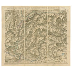
Antique Map of the North-West Frontier by Stanford, 1895
By E. Stanford
Located in Langweer, NL
Antique map titled 'Stanford's Sketch Map of the North West Frontier of India from Peshawar to the Pamirs'. Linen backed folding map of the North-West Frontier of India from Peshawar...
Category
Late 19th Century Antique E. Stanford Furniture
Materials
Linen, Paper
Related Items
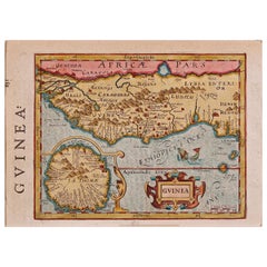
17th Century Hand-Colored Map of West Africa by Mercator/Hondius
Located in Alamo, CA
A 17th century hand-colored map entitled "Guineae Nova Descriptio" by Gerard Mercator and Jodocus Hondius, published in their 'Atlas Minor' in Amsterdam in 1635. It is focused on the...
Category
Mid-17th Century Dutch Antique E. Stanford Furniture
Materials
Paper
Original Antique Map of Hungary, Arrowsmith, 1820
Located in St Annes, Lancashire
Great map of Hungary
Drawn under the direction of Arrowsmith.
Copper-plate engraving.
Published by Longman, Hurst, Rees, Orme and Brown, 1820
Unframed.
Category
1820s English Antique E. Stanford Furniture
Materials
Paper
Original Antique Map of India. C.1780
Located in St Annes, Lancashire
Great map of India
Copper-plate engraving
Published C.1780
Three small worm holes to right side of map and one bottom left corner
Unframed.
Category
Early 1800s English Georgian Antique E. Stanford Furniture
Materials
Paper
Original Antique Map of Italy. C.1780
Located in St Annes, Lancashire
Great map of Italy
Copper-plate engraving
Published C.1780
Unframed.
Category
Early 1800s English Georgian Antique E. Stanford Furniture
Materials
Paper
Original Antique Map of Asia. C.1780
Located in St Annes, Lancashire
Great map of Asia
Copper-plate engraving
Published C.1780
Two small worm holes to right side of map
Unframed.
Category
Early 1800s English Georgian Antique E. Stanford Furniture
Materials
Paper
Antique 18th Century Map of the Province of Pensilvania 'Pennsylvania State'
Located in Philadelphia, PA
A fine antique of the colony of Pennsylvania.
Noted at the top of the sheet as a 'Map of the province of Pensilvania'.
This undated and anonymous map is thought to be from the Gentleman's Magazine, London, circa 1775, although the general appearance could date it to the 1760's.
The southern boundary reflects the Mason-Dixon survey (1768), the western boundary is placed just west of Pittsburgh, and the northern boundary is not marked.
The map has a number of reference points that likely refer to companion text and appear to be connected to boundaries. The western and southern boundaries are marked Q, R, S, for example. A diagonal line runs from the Susquehanna R to the Lake Erie P. A broken line marked by many letters A, B, N, O, etc., appears in the east.
There are no latitude or longitude markings, blank verso.
Framed in a shaped contemporary gilt wooden frame and matted under a cream colored matte.
Bearing an old Graham Arader Gallery...
Category
18th Century British American Colonial Antique E. Stanford Furniture
Materials
Paper
H 10.25 in W 13.25 in D 0.5 in
New Map of North America from the Latest Discoveries, 1763
Located in Philadelphia, PA
A fine antique 18th century map of the North American seaboard.
Entitled "A New Map of North America from the Latest Discoveries 1763".
By the Cartographer/Engraver - John Spil...
Category
Mid-18th Century English Georgian Antique E. Stanford Furniture
Materials
Paper
Large Antique 1859 Map of North America
Located in Sag Harbor, NY
This Map was made by Augustus Mitchell in 1859 It is in amazing condition for being 163 years old. This price is for the rolled up easy to ship version of this piece. I will be Frami...
Category
Mid-19th Century American Antique E. Stanford Furniture
Materials
Canvas, Paper
Antique Map of Principality of Monaco
By Antonio Vallardi Editore
Located in Alessandria, Piemonte
ST/619 - "Old Geographical Atlas of Italy - Topographic map of ex-Principality of Monaco" -
ediz Vallardi - Milano -
A somewhat special edition ---
Category
Late 19th Century Italian Other Antique E. Stanford Furniture
Materials
Paper
Original Antique Map of France, Arrowsmith, 1820
Located in St Annes, Lancashire
Great map of France
Drawn under the direction of Arrowsmith.
Copper-plate engraving.
Published by Longman, Hurst, Rees, Orme and Brown, 1820
Unframed.
Category
1820s English Antique E. Stanford Furniture
Materials
Paper
Original Antique Map of Switzerland, Engraved By Barlow, Dated 1807
Located in St Annes, Lancashire
Great map of Switzerland
Copper-plate engraving by Barlow
Published by Brightly & Kinnersly, Bungay, Suffolk.
Dated 1807
Unframed.
Category
Early 1800s English Antique E. Stanford Furniture
Materials
Paper
No Reserve
H 8 in W 10 in D 0.07 in
West Coast of Africa, Guinea & Sierra Leone: An 18th Century Map by Bellin
By Jacques-Nicolas Bellin
Located in Alamo, CA
Jacques Bellin's copper-plate map entitled "Partie de la Coste de Guinee Dupuis la Riviere de Sierra Leona Jusquau Cap das Palmas", depicting the coast of Guinea and Sierra Leone in ...
Category
Mid-18th Century French Antique E. Stanford Furniture
Materials
Paper
H 10 in W 14.25 in D 0.07 in
Previously Available Items
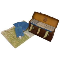
Leather Cased Set of Maps of England and Wales, circa 1920
By E. Stanford
Located in London, GB
A pigskin leather case with ‘fish-tail’ handle containing a complete series of Bartholomew's 2 miles to an inch scale, linen backed maps for England and Wales by Edward Stanford of L...
Category
1920s English Vintage E. Stanford Furniture
Materials
Metal
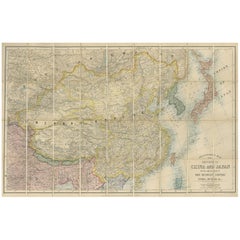
Antique Map of China and Japan by E. Stanford, 1900
By E. Stanford
Located in Langweer, NL
Antique map titled 'Stanford's Map of the Empires of China and Japan with the adjacent parts of the Russian Empire, India, Burma, &c.'. Large folding map of the Far East.
Category
Early 20th Century English E. Stanford Furniture
Materials
Linen, Paper
E. Stanford furniture for sale on 1stDibs.
E. Stanford furniture are available for sale on 1stDibs. These distinctive items are frequently made of paper and are designed with extraordinary care. There are many options to choose from in our collection of E. Stanford furniture, although beige editions of this piece are particularly popular. If you’re looking for additional options, many customers also consider furniture by John Cary, Eleazar Albin, and george brookshaw. Prices for E. Stanford furniture can differ depending upon size, time period and other attributes — on 1stDibs, these items begin at $970 and can go as high as $1,351, while a piece like these, on average, fetch $1,161.


