James Cook Maps
8
to
1
8
8
8
8
3
5
8
1
1
15
106
63
29
26
Creator: James Cook
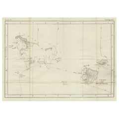
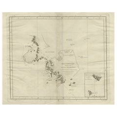
Antique Chart of the Friendly Islands or Nowadays Tonga, by Cook, 1784
By James Cook
Located in Langweer, NL
Antique print titled 'Chart of the Friendly Islands'. Antique map of the Friendly Islands depicting Rotterdam or Anamocka, Middelburg or Eaoowe and Amsterdam or Tongatabu. Originates...
Category
18th Century Antique James Cook Maps
Materials
Paper
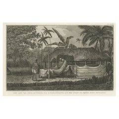
Antique Engraving of the Dead Chief of Tahiti Island in the Pacific, 1803
By James Cook
Located in Langweer, NL
Antique print titled 'Het Lijk van Thee, Opperste van O-Tahiti, zoodanig als men zulks na zijnen dood bewaarde'. Antique print depicting the remnents of Thee, Chief of Tahiti. Origin...
Category
19th Century Antique James Cook Maps
Materials
Paper
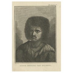
Original Antique Engraving of Otoo, King of Tahiti, by Cook, 1803
By James Cook
Located in Langweer, NL
Antique print titled 'Otoo Koning van Otahiti'. Antique print depiciting Otoo, King of Tahiti. Originates from 'Reizen Rondom de Waereld door James Cook (..)'.
Artists and Engrave...
Category
19th Century Antique James Cook Maps
Materials
Paper
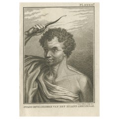
Original Antique Engraving of Otago by Cook, 1803
By James Cook
Located in Langweer, NL
Antique print titled 'Otago Bevelhebber van het Eiland Amsterdam'. Antique print depicting Otago, commander of the Island Amsterdam. Originates from 'Reizen Rondom de Waereld door James Cook...
Category
19th Century Antique James Cook Maps
Materials
Paper
Antique Map of Kerguelens Island Coast in the Indian Ocean by Cook, 1785
By James Cook
Located in Langweer, NL
Antique print titled 'Kerguelen's Land (..)'. Antique map of Kerguelens island coast, known today as the Desolation islands. Originates from 'Voyage to the Pacific Ocean, undertaken ...
Category
18th Century Antique James Cook Maps
Materials
Paper
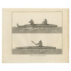
Antique Print of Canoes of Unalaska by Cook, 1803
By James Cook
Located in Langweer, NL
Antique print Alaska titled 'Kanos van Oonalashka'. Antique print depicting two canoes of Unalaska. Originates from 'Reizen Rondom de Waereld door James Cook (..)'.
Artists and E...
Category
19th Century Antique James Cook Maps
Materials
Paper
Antique Map of Kerguelens Island Coast by Cook, 1784
By James Cook
Located in Langweer, NL
Antique print titled 'Kerguelen's Land (..)'. Antique map of Kerguelens island coast, known today as the Desolation islands. Originates from 'A Voyage to the Pacific Ocean: Undertaken, by the Command of His Majesty, for Making Discoveries in the Northern Hemisphere (..)' published in Dublin.
Artists and Engravers: James Cook...
Category
18th Century Antique James Cook Maps
Materials
Paper
Antique Map of the Harbour of Taloo by J. Cook, 1803
By James Cook
Located in Langweer, NL
Antique map French Polynesia titled 'Schets van de Havenen aan de Noord Zijde van Eimeo'. Plan of the harbour of Taloo in the Island of Moorea, one of the Society Islands, French Polynesia. Originates from 'Reize rondom de Waereld door James Cook...
Category
Early 19th Century Dutch Antique James Cook Maps
Materials
Paper
Related Items
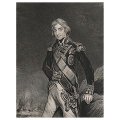
Original Antique Print, Portrait of Lord Nelson, circa 1850
Located in St Annes, Lancashire
Great image of Lord Nelson
Fine steel engraving by H.Robinson
After J.Hoppner
Published circa 1850
Unframed.
Category
1850s English Antique James Cook Maps
Materials
Paper
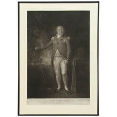
Antique Golf Engraving, Henry Callender ESQ, Golf Mezzotint
Located in Oxfordshire, GB
Golf mezzotint of 'Henry Callender Esq' (Captain of the society of Golfers at Blackheath) after Lemuel Francis Abbott (1760-1803).
Henry Callend...
Category
1810s British Sporting Art Antique James Cook Maps
Materials
Paper
Albrecht Dürer "The Small Horse, " 19th Century Copper Plate Engraving
By Albrecht Dürer
Located in Barcelona, ES
"The Small Horse" copper plate engraving by Albrecht Dürer, circa 1505.
This is a 19th century engraving, printed in black on laid paper, framed by a beautiful gilt and ebonized carv...
Category
Late 19th Century French Renaissance Antique James Cook Maps
Materials
Wood, Paper
H 19.3 in W 16.93 in D 3.15 in
Original Antique Map of Hungary, Arrowsmith, 1820
Located in St Annes, Lancashire
Great map of Hungary
Drawn under the direction of Arrowsmith.
Copper-plate engraving.
Published by Longman, Hurst, Rees, Orme and Brown, 1820
Unframed.
Category
1820s English Antique James Cook Maps
Materials
Paper
Framed Johann Elias Ridinger Engraving, 18th Stag Engraving
Located in Perth, GB
Fine 18th century engraving of a stag, after the hunt, with a magnificient dog at rest, in a country scene, beautifully depicted.
Category
18th Century Antique James Cook Maps
Materials
Paper
Original Antique Map of Italy. C.1780
Located in St Annes, Lancashire
Great map of Italy
Copper-plate engraving
Published C.1780
Unframed.
Category
Early 1800s English Georgian Antique James Cook Maps
Materials
Paper
Original Antique Map of India. C.1780
Located in St Annes, Lancashire
Great map of India
Copper-plate engraving
Published C.1780
Three small worm holes to right side of map and one bottom left corner
Unframed.
Category
Early 1800s English Georgian Antique James Cook Maps
Materials
Paper
Antique Rowing Print, Cambridge University
Located in Oxfordshire, GB
Cambridge preparing for the boat race.
A wonderful atmospheric rowing lithograph of the Cambridge crew getting into a rowing scull preparing for a race....
Category
1890s British Sporting Art Antique James Cook Maps
Materials
Paper
George Washington by Henry Sadd, Antique Engraving, circa 1844
Located in Colorado Springs, CO
This is an 1844 engraving of President George Washington. The print was issued by G. Stuart in Albion, New York and engraved by H. S. Sadd.
This standing portrait shows President George Washington in front of neoclassical columns. In his right hand, he holds a dress sword...
Category
1840s American Antique James Cook Maps
Materials
Paper
Rare Lynn Bogue Hunt Engraving of Ducks Unlimited, 1940
By Lynn Bogue Hunt
Located in Dallas, TX
Presenting a Rare Lynn Bogue Hunt engraving of ducks unlimited 1940.
This piece cam from a wealthy estate in Dallas, TX with the mansion being built...
Category
Mid-20th Century American Sporting Art James Cook Maps
Materials
Paper
Oleo-print "Mary Mother of God"
Located in Chorzów, PL
Dimensions:
Frame: height 71.5 cm / width 55 cm
Oleo printing: 63 cm high.
Category
1960s Polish Other Vintage James Cook Maps
Materials
Canvas, Beech
Original Antique Map of Asia. C.1780
Located in St Annes, Lancashire
Great map of Asia
Copper-plate engraving
Published C.1780
Two small worm holes to right side of map
Unframed.
Category
Early 1800s English Georgian Antique James Cook Maps
Materials
Paper
Previously Available Items
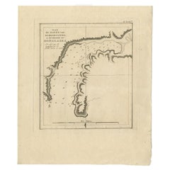
Antique Plan of the Harbour of Samganoodha by Cook, 1803
By James Cook
Located in Langweer, NL
Antique map Oonalaska titled 'Plan der Haven van Samganoodha in het Eiland van Oonalaska'. Antique map of the Harbour of Samganoodha, Oonalaska, North America. Originates from 'Reize...
Category
19th Century Antique James Cook Maps
Materials
Paper
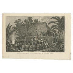
Antique Print of Offerings in Hawaii by Cook, 1803
By James Cook
Located in Langweer, NL
Antique print titled 'Eene Offerhande in Tegenswoordigheid van Kapitein Cook'. Antique print depicting offerings in Hawaii to Captain James Cook. Originates...
Category
19th Century Antique James Cook Maps
Materials
Paper
Antique Print of the Harbour of Taloo by Cook, c.1795
By James Cook
Located in Langweer, NL
Antique map French Polynesia titled 'Schets van de Havenen aan de Noord Zijde van Eimeo'. Plan of the harbour of Taloo in the Island of Moorea, one...
Category
18th Century Antique James Cook Maps
Materials
Paper
Antique Map of the Environs of Macao by Cook, c.1784
By James Cook
Located in Langweer, NL
Antique map titled 'Sketch of the Typa and Macao'. The environs of Macao, with a small plan of the town, as surveyed by William Bligh, who was Master of the 'Resolution' under Captain Cook. Having lost their captain in Hawaii in February 1779 his crew continued with their mission, attempting to find a North West Passage through the Bering Straits. Having been beaten by the Arctic ice wall...
Category
18th Century Antique James Cook Maps
Materials
Paper
Antique Map of South Pacific Islands by J. Cook, 1803
By James Cook
Located in Langweer, NL
Antique map South Pacific Islands, Polynesia. Islands titled 'Wanooa, Mangeea, Wateeoo and Toobouai'. Originates from 'Reizen Rondom de Waereld door James Cook...
Category
Early 19th Century Dutch Antique James Cook Maps
Materials
Paper
James Cook maps for sale on 1stDibs.
James Cook maps are available for sale on 1stDibs. These distinctive items are frequently made of paper and are designed with extraordinary care. There are many options to choose from in our collection of James Cook maps, although beige editions of this piece are particularly popular. If you’re looking for additional options, many customers also consider maps by Jakob van der Schley, Homann Heirs, and Johannes Nieuhof. Prices for James Cook maps can differ depending upon size, time period and other attributes — on 1stDibs, these items begin at $144 and can go as high as $488, while a piece like these, on average, fetch $266.
