Jakob van der Schley Maps
12
to
2
12
12
12
12
12
12
51
106
63
28
26
Creator: Jakob van der Schley
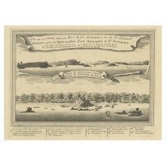
Antique Print of a Fort on the Ivory Coast and Axim, Africa, 1748
By Jakob van der Schley
Located in Langweer, NL
Antique print titled 'Vue de la Cote pres de Rio San Andero - Gezigt van de Kust van Rio San Andero' and 'Fort St. Antoine a Axim - Fort St. Antoni, te Axim'. View of the Ivory coast...
Category
18th Century Antique Jakob van der Schley Maps
Materials
Paper
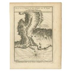
Antique Plan of Santiago, Chili, 1747
By Jakob van der Schley
Located in Langweer, NL
Antique print titled 'Plan de la Ville et des Forts de St. Yago, Grondtekening van de Stad en Forten van St. Iago'. Plan of the forts and town of Santiago, the largest island of Cape...
Category
18th Century Antique Jakob van der Schley Maps
Materials
Paper
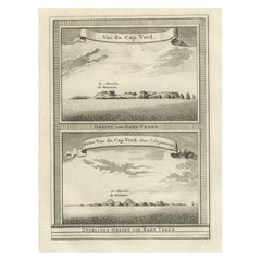
Antique Print of Cape or Cabo Verde, Africa, c.1750
By Jakob van der Schley
Located in Langweer, NL
Antique print titled 'Gezigt van Kabo Verde' and 'Zydelings Gezigt van Kabo Verde'. Old print of Cabo Verde with a double view of the island coast. Engraved...
Category
18th Century Antique Jakob van der Schley Maps
Materials
Paper
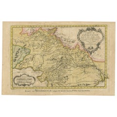
Original Antique Map of Northern India
By Jakob van der Schley
Located in Langweer, NL
Antique map titled 'Carte de l'Indoustan (..) - Kaart van Hindoestan (..)'. Original antique map of northern India. This map originates from 'His...
Category
Mid-18th Century Antique Jakob van der Schley Maps
Materials
Paper
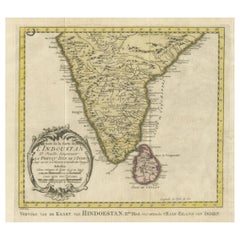
Original Antique Map of Southern India and Ceylon 'Present-Day Sri Lanka'
By Jakob van der Schley
Located in Langweer, NL
Antique map titled 'Suite de la Carte de l'Indoustan (..) - Vervolg van de Kaart van Hindoestan (..)'. Original antique map of Southern India and Ceylon (present-day Sri Lanka). This...
Category
Mid-18th Century Antique Jakob van der Schley Maps
Materials
Paper
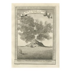
Old Engraving of Volcano Piton de la Fournaise on Reunion Island, c.1750
By Jakob van der Schley
Located in Langweer, NL
Antique print titled 'Eiland van St. Filippus, of van Fuego, met zyn vuurberg'. Old print of Piton de la Fournaise, a shield volcano on the eastern side of Reunion island...
Category
18th Century Antique Jakob van der Schley Maps
Materials
Paper
Antique Plan of the Forts and Town of St. Yago in the Cape Verde Islands, 1747
By Jakob van der Schley
Located in Langweer, NL
Antique map titled 'Plan de la Ville et des Forts de St. Yago - Grondtekening van de Stad en Forten van St. Iago'. Plan of the Forts and Town of St. Yago in the Cape Verde Islands. T...
Category
18th Century Antique Jakob van der Schley Maps
Materials
Paper
Antique Map of the Expedition of Govert Knol by Van Schley, 1765
By Jakob van der Schley
Located in Langweer, NL
Antique map titled 'Plan de l' expédition de Mr. le Commiss. re Govert Knol, forti de Soerabaja, pour aller recévoir Pangerang Depati Anom. / Aftékening der Expeditie van de H. r Commiss. is Govert Knol , uyt Soerabaya , tot afhaalinge van Pangerang Depati Anom'. Map showing the expedition...
Category
18th Century Antique Jakob van der Schley Maps
Materials
Paper
Antique Map of the Main Comoro Islands by Van Schley, 1749
By Jakob van der Schley
Located in Langweer, NL
Antique map titled ‘Carte des Isles de Comore (..) - Kaart van de Eilanden Komoro (..)’. Original antique map of the main Comoro Islands or Comoros including Comore, Mohéli, Anjouan ...
Category
18th Century Antique Jakob van der Schley Maps
Materials
Paper
Antique Map of Eastern Tartary and the Gobi Desert by Van Schley, 1758
By Jakob van der Schley
Located in Langweer, NL
Antique map titled 'Carte de la Tartarie occidentale.' Original antique map of Eastern Tartary and the Gobi desert showing the silk road and the Great Wall of China. While these maps...
Category
18th Century Antique Jakob van der Schley Maps
Materials
Paper
Antique Map of Eastern Tartary, now the Primorsky Krai Area, Russia, 1758
By Jakob van der Schley
Located in Langweer, NL
Antique map titled 'Carte de la Tartarie orientale.' A map of Eastern Tartary. East Tartary is an old names for the Manchu-inhabited territory extending from the River Amur to Sakhal...
Category
18th Century Antique Jakob van der Schley Maps
Materials
Paper
Antique Map of Java, Indonesia, circa 1770
By Jakob van der Schley
Located in Langweer, NL
Antique map Indonesia titled 'Nouvelle Carte de l'Isle de Java - Nieuwe kaart, van het Eiland Java'. Chart of the island of Java, depicting soun...
Category
Mid-18th Century Antique Jakob van der Schley Maps
Materials
Paper
Related Items
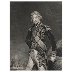
Original Antique Print, Portrait of Lord Nelson, circa 1850
Located in St Annes, Lancashire
Great image of Lord Nelson
Fine steel engraving by H.Robinson
After J.Hoppner
Published circa 1850
Unframed.
Category
1850s English Antique Jakob van der Schley Maps
Materials
Paper
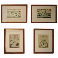
18th century Set Hand Colored Nautical Engravings
By M. Ogier
Located in Savannah, GA
Signed M. Ogier (Fecit:by), this set of four hand colored engravings is part of a larger edition of plates. These plates are numbered PL 16, 347, 365 and 386. The subject is probably...
Category
18th Century Unknown Elizabethan Antique Jakob van der Schley Maps
Materials
Glass, Wood, Paper
Original Antique Map of South East Asia, Arrowsmith, 1820
Located in St Annes, Lancashire
Great map of South East Asia
Drawn under the direction of Arrowsmith
Copper-plate engraving
Published by Longman, Hurst, Rees, Orme and Brown, 1820
Unframed.
Category
1820s English Antique Jakob van der Schley Maps
Materials
Paper
Manly P Hall, the Secret Teachings of All Ages, First Edition Book & 4 Prints
By TASCHEN
Located in Los Angeles, CA
The classic encyclopedia of the arcane in an expanded edition.
Renowned philosopher and lecturer Manly P. Hall’s masterful encyclopedia of ancient symbols, hidden rituals, and arcane practices has remained a classic since first published in 1928. Hall’s densely detailed writings explore topics ranging from Hermeticism to Tarot, Egyptian mythology to Pythagorean theory. Each chapter is accompanied by the vivid illustrations of artist J. Augustus Knapp, with additional images by Mihran Serailian found in the companion volume, each taking their own unique approach to nearly 60 artworks depicting occult subject matter.
The initial concept for what became known as Hall’s “Great Book”, first began in 1923 when the young Los Angeles-based orator began a months-long trip around the globe. Circumnavigating by ship, Hall visited Egypt, China and India, immersing himself in the philosophical and religious history of each country. Upon his return he spent the next five years penning his massive compendium of philosophy and myth.
Nearly a century after its release, this iconic masterwork has been reproduced for the first time from the rare and extravagant original edition. This meticulously-restored version of Hall’s “Great Book” is also accompanied by an expansive companion book, featuring condensed summaries of each chapter of The Secret Teachings, alongside newly-discovered artworks, rare photography...
Category
21st Century and Contemporary Jakob van der Schley Maps
Materials
Foil
H 18.7 in W 13.2 in D 3 in
Antique Golf Engraving, Henry Callender ESQ, Golf Mezzotint
Located in Oxfordshire, GB
Golf mezzotint of 'Henry Callender Esq' (Captain of the society of Golfers at Blackheath) after Lemuel Francis Abbott (1760-1803).
Henry Callend...
Category
1810s British Sporting Art Antique Jakob van der Schley Maps
Materials
Paper
17th Century Hand-Colored Map of West Africa by Mercator/Hondius
Located in Alamo, CA
A 17th century hand-colored map entitled "Guineae Nova Descriptio" by Gerard Mercator and Jodocus Hondius, published in their 'Atlas Minor' in Amsterdam in 1635. It is focused on the...
Category
Mid-17th Century Dutch Antique Jakob van der Schley Maps
Materials
Paper
Framed Johann Elias Ridinger Engraving, 18th Stag Engraving
Located in Perth, GB
Fine 18th century engraving of a stag, after the hunt, with a magnificient dog at rest, in a country scene, beautifully depicted.
Category
18th Century Antique Jakob van der Schley Maps
Materials
Paper
Original Antique Map of India. C.1780
Located in St Annes, Lancashire
Great map of India
Copper-plate engraving
Published C.1780
Three small worm holes to right side of map and one bottom left corner
Unframed.
Category
Early 1800s English Georgian Antique Jakob van der Schley Maps
Materials
Paper
Original Antique Map of Italy. C.1780
Located in St Annes, Lancashire
Great map of Italy
Copper-plate engraving
Published C.1780
Unframed.
Category
Early 1800s English Georgian Antique Jakob van der Schley Maps
Materials
Paper
Rare Lynn Bogue Hunt Engraving of Ducks Unlimited, 1940
By Lynn Bogue Hunt
Located in Dallas, TX
Presenting a Rare Lynn Bogue Hunt engraving of ducks unlimited 1940.
This piece cam from a wealthy estate in Dallas, TX with the mansion being built...
Category
Mid-20th Century American Sporting Art Jakob van der Schley Maps
Materials
Paper
Original Antique Map of Asia. C.1780
Located in St Annes, Lancashire
Great map of Asia
Copper-plate engraving
Published C.1780
Two small worm holes to right side of map
Unframed.
Category
Early 1800s English Georgian Antique Jakob van der Schley Maps
Materials
Paper
George Washington by Henry Sadd, Antique Engraving, circa 1844
Located in Colorado Springs, CO
This is an 1844 engraving of President George Washington. The print was issued by G. Stuart in Albion, New York and engraved by H. S. Sadd.
This standing portrait shows President George Washington in front of neoclassical columns. In his right hand, he holds a dress sword...
Category
1840s American Antique Jakob van der Schley Maps
Materials
Paper
Jakob Van Der Schley maps for sale on 1stDibs.
Jakob van der Schley maps are available for sale on 1stDibs. These distinctive items are frequently made of paper and are designed with extraordinary care. There are many options to choose from in our collection of Jakob van der Schley maps, although beige editions of this piece are particularly popular. If you’re looking for additional options, many customers also consider maps by Pieter Van Der Aa, Isaak Tirion, and Johannes Nieuhof. Prices for Jakob van der Schley maps can differ depending upon size, time period and other attributes — on 1stDibs, these items begin at $119 and can go as high as $932, while a piece like these, on average, fetch $267.
