


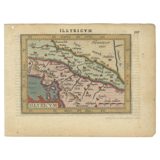
Antique Map of the Region of Mansfeld, Saxony-Anhalt, Germany
About the Item
- Creator:Abraham Ortelius (Artist)
- Dimensions:Height: 16.74 in (42.5 cm)Width: 22.45 in (57 cm)Depth: 0.02 in (0.5 mm)
- Materials and Techniques:
- Period:Early 17th Century
- Date of Manufacture:1601
- Condition:Original/contemporary hand coloring. Original folding line. General age-related toning, some wear and soiling. Latin text on verso. Please study image carefully.
- Seller Location:Langweer, NL
- Reference Number:
Abraham Ortelius
Abraham Ortelius is widely recognized as the inventor of the atlas and one of the most prominent geographers in history. He is one of the best known and most frequently collected of all sixteenth-century mapmakers, and today, hand-colored, copperplate-printed Abraham Ortelius maps continue to command avid interest.
Ortelius was the eldest of the three children of an Antwerp merchant. After his father's death when he was ten, he was raised by his uncle Jacob Van Meteren — a financier and printer of early English versions of the Bible. Ortelius entered the Guild of Saint Luke in 1547 to become a map copier and colorist, but his hobbies overshadowed his studies.
Ortelius was better known as a student of history and a collector of books and old coins than a cartographer — only initially garnering modest praise for his skills at mapmaking. Gleaning what he learned from his uncle, he became a dealer in books and prints. In 1554 he attended the annual Frankfurt Book Fair, where he met the highly respected cartographer Gerardus Mercator.
Ortelius refocused his work in mapmaking after that fateful encounter. He eventually published Theatrum Orbis Terrarum (Theater of the World) — a comprehensive collection of maps that he bound into a book. It was the first of its kind and is now recognized as the first modern-day atlas. While creating his atlas, Ortelius observed that the coast of America shared geometrical similarities with the shores of Europe and Africa. When he lined up maps of the coastlines of the continents, they matched — much like pieces in a jigsaw puzzle.
Some have argued that the concept of continental drift is at least partly rooted in Ortelius’s 16th-century-era suggestion that the continents had once been joined together as a single mass of land before the Americas were pulled away from Europe and Africa. Much later, in 1912, German meteorologist Alfred Wegener proposed in a lecture and an article that the continents had once been locked together based on data he collected. Wegener was widely ridiculed at the time, but the foundation of modern-day science of plate tectonics has its origins in his work.
On May 18, 2008, a Google Doodle celebrated the 300th anniversary of Ortelius’s atlas.
On 1stDibs, find original Abraham Ortelius prints, landscape prints and more.
- ShippingRetrieving quote...Ships From: Langweer, Netherlands
- Return PolicyA return for this item may be initiated within 14 days of delivery.
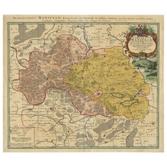
- Detailed Antique Map Showing Mansfeld in Saxony-Anhalt, Germany, ca.1750Located in Langweer, NLDescription: Antique map titled 'Die Grafschaft Mansfeld Konigl. Preuss. Churfurstl. Sachsischen Antheils mit allen darinnen befindlichen Stadten Dorfschaften.' Detailed map show...Category
Antique 1750s Maps
MaterialsPaper
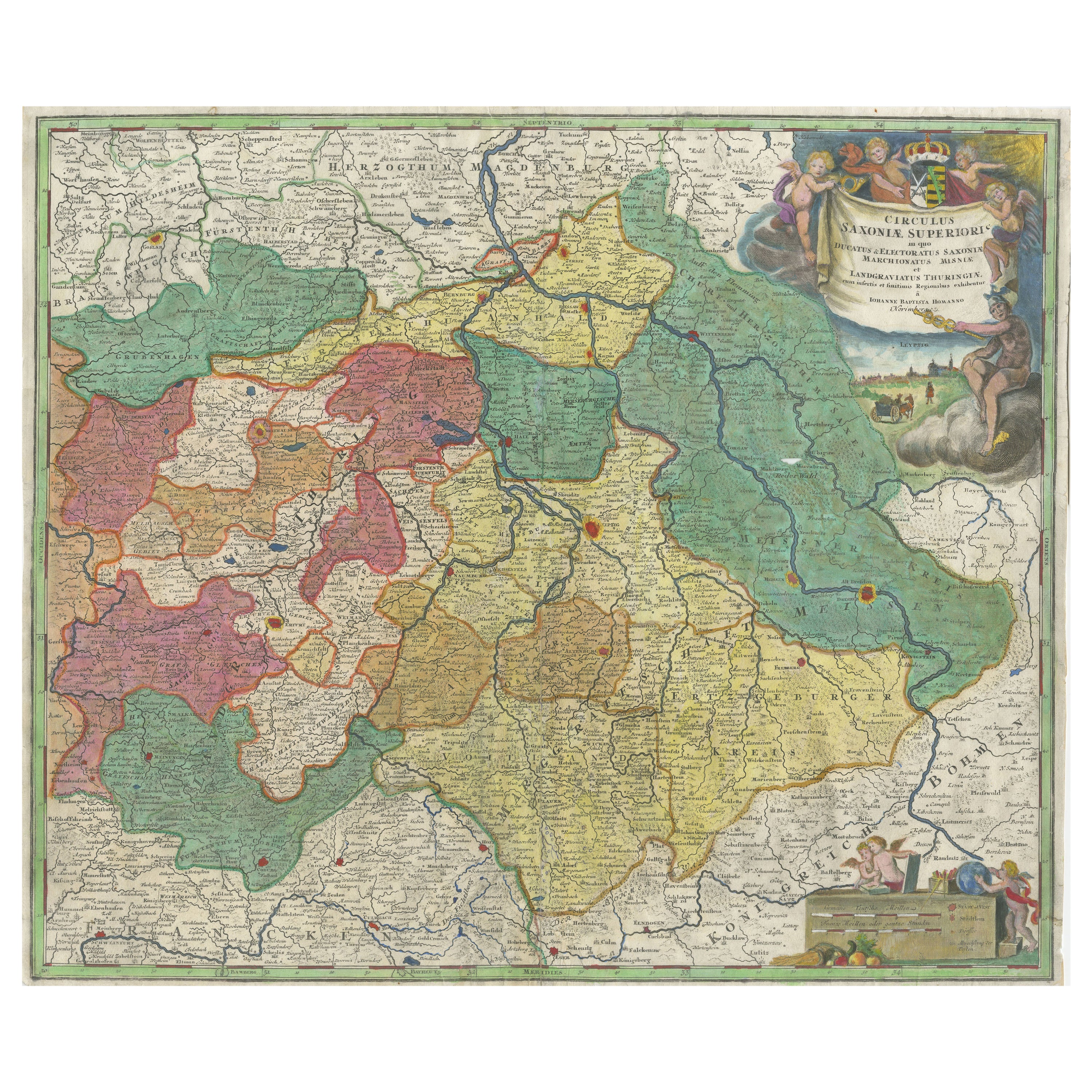
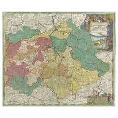
- Antique Map of Saxony, GermanyLocated in Langweer, NLOriginal antique map titled 'Circulus Saxoniae Superioris'. Original antique map of Saxony, Germany. The cities of Leipzig, Freiburg and many others are highlighted in gold. This map originates from 'Atlas Novus Terrarum Orbis...Category
Antique Early 18th Century Maps
MaterialsPaper
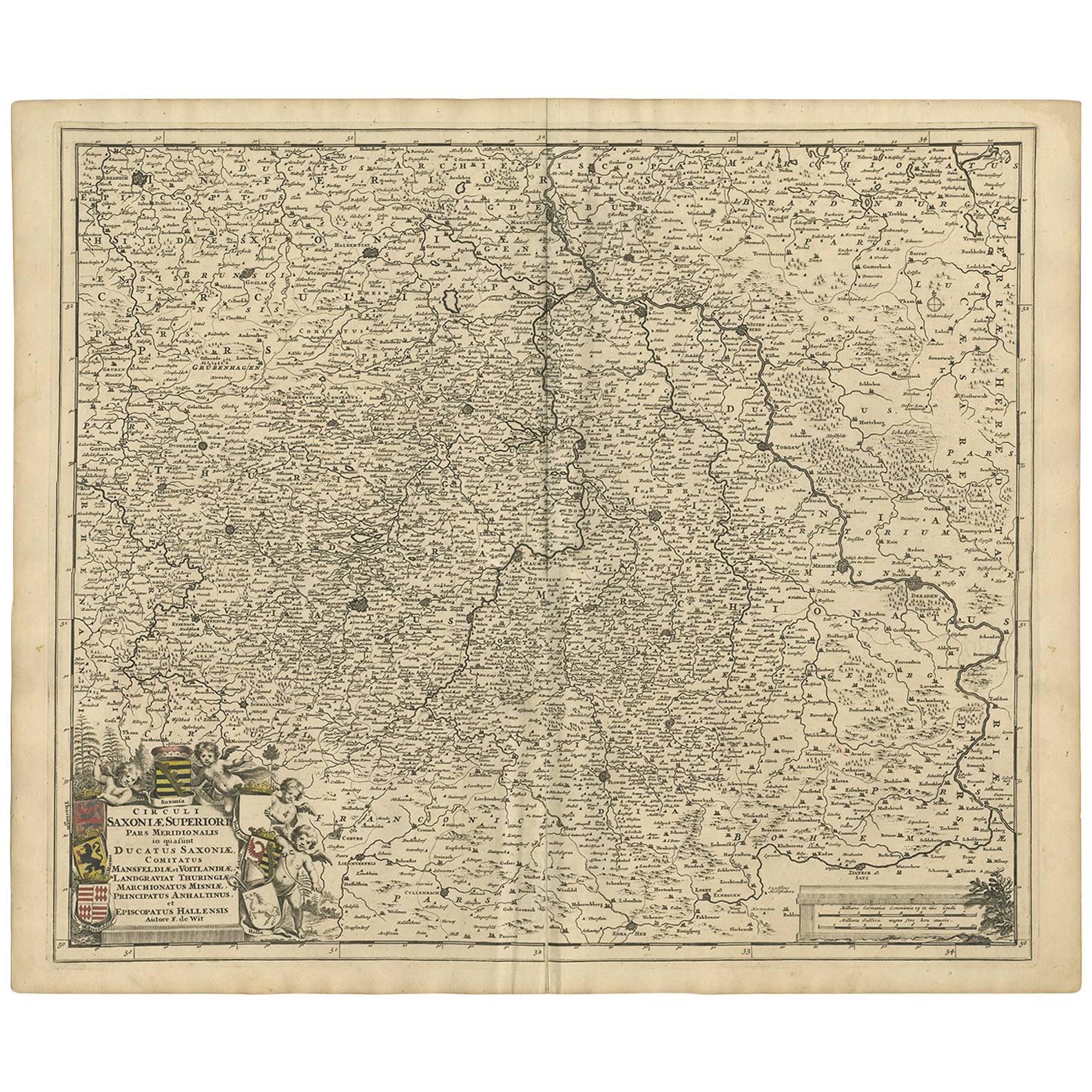
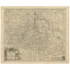
- Antique Map of the Saxony Region 'Germany' by F. de Wit, circa 1680Located in Langweer, NLA detailed map of a region in eastern Germany. Cartouches depict coat of arms surrounded by cherubs. The map is fully engraved with towns, political boundaries, rivers and forests. P...Category
Antique Late 17th Century Maps
MaterialsPaper
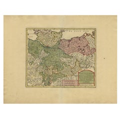
- Antique Map of the Region of Oldenburg, GermanyBy Willem BlaeuLocated in Langweer, NLAntique map titled 'Oldenburg Comitatus'. Detailed old map of Oldenburg, Germany. The map also shows Bremen and the Jade Bight. Published by W. Blaeu, circa 1640. Willem Jansz. Blaeu...Category
Antique Mid-17th Century Maps
MaterialsPaper
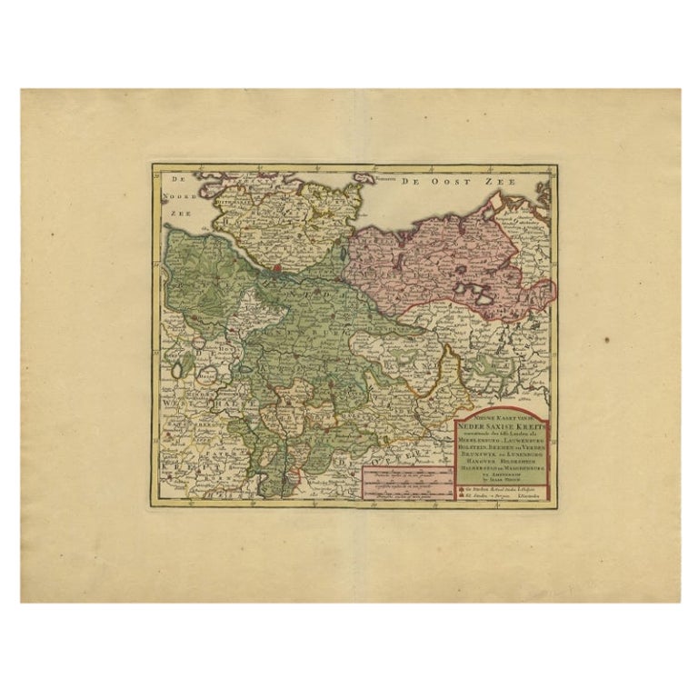
- Antique Map of Lower Saxony in Germany, c.1740Located in Langweer, NLAntique map titled 'Nieuwe Kaart van de Neder Saxise Kreits (..).' Attractive detailed map showing Lower Saxony, Germany, including Mekelenburg, Lauwenburg, Holstein, Bremen, Verden ...Category
Antique 18th Century Maps
MaterialsPaper
- Antique Map of the Region of Zeitz in Germany, 1749By SchreiberLocated in Langweer, NLAntique map titled 'Das Stifft Zeitz (..)'. Map of the region of Zeitz, Germany. Zeitz is a town in the Burgenlandkreis district, in Saxony-Anhalt, Germany. It is situated on the riv...Category
Antique 18th Century Maps
MaterialsPaper


- 17th Century Hand-Colored Map of a Region in West Germany by JanssoniusBy Johannes JanssoniusLocated in Alamo, CAThis attractive highly detailed 17th century original hand-colored map is entitled "Archiepiscopatus Maghdeburgensis et Anhaltinus Ducatus cum terris adjacentibus". It was published ...Category
Antique Mid-17th Century Dutch Maps
MaterialsPaper
- 17th Century Hand Colored Map of the Liege Region in Belgium by VisscherBy Nicolaes Visscher IILocated in Alamo, CAAn original 17th century map entitled "Leodiensis Episcopatus in omnes Subjacentes Provincias distincté divisusVisscher, Leodiensis Episcopatus" by Nicolaes Visscher II, published in Amsterdam in 1688. The map is centered on Liege, Belgium, includes the area between Antwerp, Turnhout, Roermond, Cologne, Trier and Dinant. This attractive map is presented in a cream-colored mat measuring 30" wide x 27.5" high. There is a central fold, as issued. There is minimal spotting in the upper margin and a tiny spot in the right lower margin, which are under the mat. The map is otherwise in excellent condition. The Visscher family were one of the great cartographic families of the 17th century. Begun by Claes Jansz Visscher...Category
Antique Late 17th Century Dutch Maps
MaterialsPaper
- The Normandy Region of France: A 17th C. Hand-colored Map by Sanson and JaillotBy Nicolas SansonLocated in Alamo, CAThis large hand-colored map entitled "Le Duché et Gouvernement de Normandie divisée en Haute et Basse Normandie en divers Pays; et par evêchez, avec le Gouvernement General du Havre ...Category
Antique 1690s French Maps
MaterialsPaper
- Map of the Republic of GenoaLocated in New York, NYFramed antique hand-coloured map of the Republic of Genoa including the duchies of Mantua, Modena, and Parma. Europe, late 18th century. Dimension: 25...Category
Antique Late 18th Century European Maps
- Antique Map of Principality of MonacoBy Antonio Vallardi EditoreLocated in Alessandria, PiemonteST/619 - "Old Geographical Atlas of Italy - Topographic map of ex-Principality of Monaco" - ediz Vallardi - Milano - A somewhat special edition ---Category
Antique Late 19th Century Italian Other Prints
MaterialsPaper
- Original Antique Map of The World by Thomas Clerk, 1817Located in St Annes, LancashireGreat map of The Eastern and Western Hemispheres On 2 sheets Copper-plate engraving Drawn and engraved by Thomas Clerk, Edinburgh. Published by Mackenzie And Dent, 1817 ...Category
Antique 1810s English Maps
MaterialsPaper


