Antique Map Bahamas
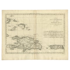
Detailed Antique Map of Santa Domingo, Puerto Rico, Eastern Bahamas, ca. 1780
Located in Langweer, NL
Bahamas. This map originates from 'Atlas de Toutes les Parties Connues du Globe Terrestre'.
Artists
Category
1780s Antique Map Bahamas
Materials
Paper
H 11.42 in W 15.12 in D 0 in
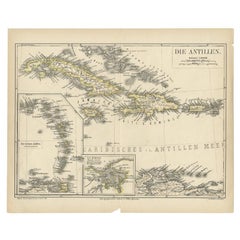
Antique Map of the Antilles by Meyer, 1878
Located in Langweer, NL
Bahamas and Cuba. With inset maps of the Lesser Antilles and Havana. This map originates from Meyer's
Category
19th Century Antique Map Bahamas
Materials
Paper
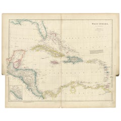
Antique Map of the West Indies by Wyld '1845'
Located in Langweer, NL
, including Cuba, the Bahamas, the Antilles and surrounding islands. This map originates from 'An Atlas of the
Category
Mid-19th Century Antique Map Bahamas
Materials
Paper
Original Antique Map of the West Indies by J. Arrowsmith, 1842
Located in Langweer, NL
Title: "J. Arrowsmith's 19th Century Map of the West Indies"
This original antique map, crafted by
Category
Early 19th Century Antique Map Bahamas
Materials
Paper
Free Shipping
H 20.87 in W 27.17 in D 0 in
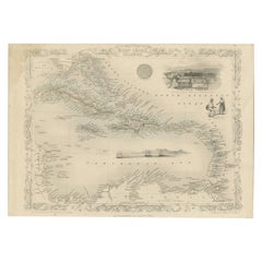
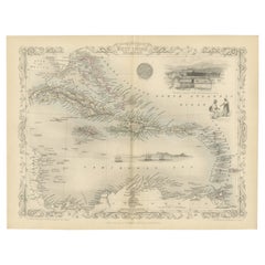
Engraving by Tallis and Rapkin of Map of the West Indies in The Caribbean, 1851
Located in Langweer, NL
John Tallis' 1851 map of the West Indies stands as a striking example of his renowned cartographic
Category
Mid-19th Century Antique Map Bahamas
Materials
Paper
H 10.44 in W 14.57 in D 0 in
Ornate Cartography of Colonial Grandeur: The West India Islands around 1851
Located in Langweer, NL
This map is a part of John Tallis's series of maps, known for their detailed and ornamental style
Category
1850s Antique Map Bahamas
Materials
Paper
No Reserve
H 10.71 in W 14.26 in D 0 in
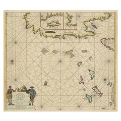
Original Antique Sea Chart of the Northern Part of Hispaniola, Western Cuba
Located in Langweer, NL
Antique map titled 'Pas kaart van de Noord Kust van Espaniola (..)'. Beautiful sea chart of the
Category
Late 17th Century Antique Map Bahamas
Materials
Paper
H 21.26 in W 24.02 in D 0.02 in
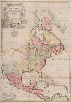
one of the earliest large-scale English maps of North America
By John Senex
Located in London, GB
Southern Bahamas is also noted. Senex also extended the map’s coverage to the Canadian Arctic and the Terra
Category
1710s Naturalistic Antique Map Bahamas
Materials
Watercolor, Engraving
People Also Browsed
Rare Labeled Early 19th C Haitian French Colonial Day Bed from the West Indies
Located in Charleston, SC
An exceptionally rare 19th century Haitian French Colonial Cedrela day bed, circa 1830, featuring original label and hand-carved Regence style head and foot boards. This is one of th...
Category
19th Century Caribbean French Provincial Antique Map Bahamas
Materials
Cedar
H 43 in W 88 in D 49.5 in
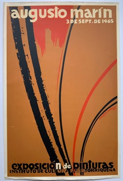
Augusto Marin exhibition poster (Puerto Rican artist)
By Rafael Tufino
Located in Wilton Manors, FL
Beautiful exhibition poster by Puerto rican artist, Rafael Tufino (1922-2008). Augusto Marin, Exposicion de Pinturas, 1965. Screen print on paper, 20 x 30 inches. Wear and creasing a...
Category
Mid-20th Century Abstract Expressionist Antique Map Bahamas
Materials
Screen
Antique American Empire Card/ Games Table in West Indies Mahogany with Pedestal
Located in Miami, FL
An American Empire games or card table with cylinder column resting on quatre-form base terminating with turned feet on casters. Swivel-top opens to a square with storage compartment...
Category
1830s American American Empire Antique Map Bahamas
Materials
Mahogany
H 30 in W 36 in D 17 in
Antonio Frasconi mid-century exhibition poster (Puerto Rican artist)
By Lorenzo Homar
Located in Wilton Manors, FL
Rare exhibition poster by Puerto Rican artist, Lorenzo Homar (1913-2004). Grabados de Antonio Frasconi, 1965. Screen print poster on paper. Minor wear and creasing as depicted in det...
Category
Mid-20th Century Abstract Antique Map Bahamas
Materials
Screen
Engraving of a Map of Florida, the Gulf Coast, Caribbean & Central America, 1728
Located in Langweer, NL
This exceptional antique map, titled "Nouvelle Carte Marine de Toute les Cotes de l´Amerique" and alternatively known as "Nieuwe groote en seer Curieuse Paskaart van Geheel-WestIndie...
Category
Mid-18th Century European Antique Map Bahamas
Materials
Paper
Free Shipping
H 24.61 in W 40.56 in D 0.02 in
Puerto Rico Institute of Culture poster (Puerto Rican artist)
By Lorenzo Homar
Located in Wilton Manors, FL
Rare promotional poster by Puerto Rican artist, Lorenzo Homar (1913-2004). Instituto de Cultura Puertorriquena San Juan, 1966. Sheet measures 18 x 24 inches. Screen print poster on ...
Category
Mid-20th Century Realist Antique Map Bahamas
Materials
Screen
19th C West Indies St. Croix Regency Tilt-Top Caribbean Table
Located in Charleston, SC
A 19th century mahogany Caribbean tilt-top center or dining table featuring a West Indies turned and carved pedestal and carved feet.
Category
19th Century Caribbean Dutch Colonial Antique Map Bahamas
Materials
Mahogany
American Federal Chest of Drawers in West Indies Mahogany, Baltimore, circa 1835
Located in Miami, FL
From the Federal period, a very beautiful American Neoclassical chest of drawers in fine West Indies mahogany with two overhanging small drawers supported by turned and reeded column...
Category
Early 19th Century American Federal Antique Map Bahamas
Materials
Mahogany
H 43 in W 49 in D 23 in
Novena Theater Festival mid-century exhibition poster (Puerto Rican artist)
By Lorenzo Homar
Located in Wilton Manors, FL
Rare exhibition poster by Puerto Rican artist, Lorenzo Homar (1913-2004). Noveno Festival de Theatro Puertorriqueno, 1966. Screen print poster on paper. Wear and creasing as depicted...
Category
Mid-20th Century Abstract Antique Map Bahamas
Materials
Screen
San Miguel, St. Michael, School of Cusco, Peru, Framed early 1900's
Located in Houston, TX
This is painting is from the School of Cusco depicting St. Michael the Archangel defeating the devil in battle. It is oil on canvas and is in very good condition. No crackling on th...
Category
Early 20th Century Folk Art Antique Map Bahamas
Materials
Canvas, Oil
Exhibition Poster Andy Warhol, Ladies and Gentlemen
By Andy Warhol
Located in Pasadena, CA
Ladies and Gentlemen Exhibition Poster (Portrait of Wilhelmina Ross) (1989)
Andy Warhol Vintage 1989 Pop Art Lithograph Print Framed Paris Exhibition Poster " Ladies and Gentlemen ( ...
Category
Late 20th Century Pop Art Antique Map Bahamas
Materials
Lithograph, Offset, Screen
A truly delightful miniature terrestrial pocket globe
By Nathaniel Mills
Located in ZWIJNDRECHT, NL
A truly delightful miniature terrestrial pocket globe in a celestial case, 3 inches / 6.8 cm. The globe consists of 12 wonderful varnished, engraved hand-coloured gores that stretch ...
Category
Mid-18th Century British Dutch Colonial Antique Map Bahamas
Materials
Other
Original Engraving of the West Indies, Gulf of Mexico, Antilles, Caribbean, 1780
Located in Langweer, NL
Rigobert Bonne and G. Raynal's 1780 map of the West Indies, Gulf of Mexico, Antilles, and the Caribbean stands as a remarkable cartographic piece, offering a detailed and expansive v...
Category
Late 18th Century Antique Map Bahamas
Materials
Paper
H 9.85 in W 15.16 in D 0 in
1817 Map of Puerto Rico and the Virgin Islands with Original Hand Coloring
Located in Langweer, NL
The title provided for this map is "Porto Rico and Virgin Isles," and it is an antique map from an early 19th century atlas, dated 1817, featuring original hand coloring. This histor...
Category
Early 19th Century Antique Map Bahamas
Materials
Paper
Free Shipping
H 25.99 in W 11.03 in D 0 in
American Federal Drop Leaf Dining Table in West Indies Mahogany New York, c 1820
Located in Miami, FL
A handsome American Federal or Empire Pembroke table in fine West Indies mahogany with two drop leaves. This period breakfast table is supported by a reeded, vase-turned column on a ...
Category
Early 19th Century American Federal Antique Map Bahamas
Materials
Brass
H 28.5 in W 42 in D 22.75 in
S.Juan de Puerto Rico - Etching by Johannes Janssonius - 1650s
By Johannes Janssonius
Located in Roma, IT
S.Juan de Puerto Rico is an ancient map realized in 1650 by Johannes Janssonius (1588-1664).
Good conditions.
From Atlantis majoris quinta pars, Orbem maritimum [Novus Atlas, volum...
Category
1650s Modern Antique Map Bahamas
Materials
Etching
H 18.71 in W 23.23 in D 0.04 in
Recent Sales
Sea chart of Santa Domingo and its surroundings - Engraving - 18th century
Located in Zeeland, Noord-Brabant
pour servir aux Vaisseaux du Roy [...]' - (Reduced map of the island of Santa Domingo and surroundings
Category
1750s Old Masters Antique Map Bahamas
Materials
Engraving
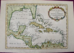
Gulf of Mexico, Florida, C. America, Cuba: 18th C. Hand-colored Map by Bellin
By Jacques-Nicolas Bellin
Located in Alamo, CA
This beautiful 18th century hand-colored map entitled "Carte du Golphe du Mexique et des Isles de
Category
1750s Antique Map Bahamas
Materials
Engraving
Oil Painting Portrait of Lord Edward Grenfell, 1st Baron St Just (1870-1941)
By Oswald Birley
Located in London, GB
Battle of the Somme). Birley focussed on making maps and models of positions to be assaulted by First
Category
Early 20th Century Victorian Antique Map Bahamas
Materials
Oil
Original Antique Map of Florida & The Caribbean, circa 1800
Located in St Annes, Lancashire
Great map of The Caribbean showing Florida, Bahamas etc.
Copper plate engraving
Published in
Category
Early 1800s English Other Antique Map Bahamas
Materials
Paper
Antique Map of the West Indies, with Frame Style Border
Located in Langweer, NL
Antique map titled 'Antilles ou Indes Occidentales'. Attractive map of the West Indies. Covers from
Category
Mid-19th Century Antique Map Bahamas
Materials
Paper
Antique Map of Florida, the Gulf Coast and Caribbean, 1771
Located in Langweer, NL
Antique map titled 'Carte Geo-Hydrographique Du Golfe Du Mexique Et Des Ses Isles'. Original
Category
18th Century Antique Map Bahamas
Materials
Paper
Gulf of Mexico, Florida, C. America, Cuba, etc.: 18th C. Hand-colored Bellin Map
By Jacques-Nicolas Bellin
Located in Alamo, CA
This beautiful 18th century hand-colored map entitled "Carte du Golphe du Mexique et des Isles de
Category
Mid-18th Century French Antique Map Bahamas
Materials
Paper
H 12.63 in W 18 in D 0.13 in
West-Indies Herman Moll William Paterson Spanish Trade Routes Gold
By Herman Moll
Located in BUNGAY, SUFFOLK
A rare map of the West-Indies or the islands of America in the North Sea with ye adjacent countries
Category
18th Century Central American Baroque Antique Map Bahamas
Materials
Paper
Map of the West Indies
By Thomas Conder
Located in Saint Augustine, FL
. c. 1768 - 1825), titled "An Accurate Map of the West Indies" published June 2nd, 1794. Engraved by
Category
18th Century and Earlier Other Art Style Antique Map Bahamas
Materials
Copper
The Atlantic Ocean, Americas, Africa and Europe: Hand-colored 18th C. Bowen Map
Located in Alamo, CA
This is an original 18th century hand-colored map entitled "A New & Accurate Chart of the The
Category
Mid-18th Century Old Masters Antique Map Bahamas
Materials
Engraving
Danckerts Map of Florida, the West Indies and the Caribbean.
Located in Coral Gables, FL
A stunning example of Cornelius Danckerts' important 1696 map of Florida, the West Indies, Central
Category
18th Century and Earlier Dutch Antique Map Bahamas
Nicolas Sanson's "Les Antilles &..le Lucayes" (Map of Bahamas)
By Nicolas Sanson
Located in New York, NY
Nicolas Sanson (1600-1667)
Les Antilles &..le Lucayes (Map of Bahamas)
Published, Pierre Mariette
Category
18th Century and Earlier Antique Map Bahamas
Colton's 1861 Map of United States Forts and Military Stations
Located in New York, NY
William St. New York. For "The Rebellion Record." New York, D. G. P. Putnam. 1861."
Rare pocket map of
Category
1860s Realist Antique Map Bahamas
Materials
Lithograph
Get Updated with New Arrivals
Save "Antique Map Bahamas", and we’ll notify you when there are new listings in this category.
