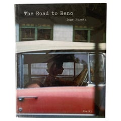
The Road to Reno by Robin Williams
View Similar Items

1 of 2
The Road to Reno by Robin Williams
About the Item
- Dimensions:Height: 8.5 in (21.59 cm)Width: 5.5 in (13.97 cm)
- Period:
- Date of Manufacture:December,.2011
- Condition:Perfect - new.
- Seller Location:Vancouver, CA
- Reference Number:1stDibs: U1112249008180
You May Also Like
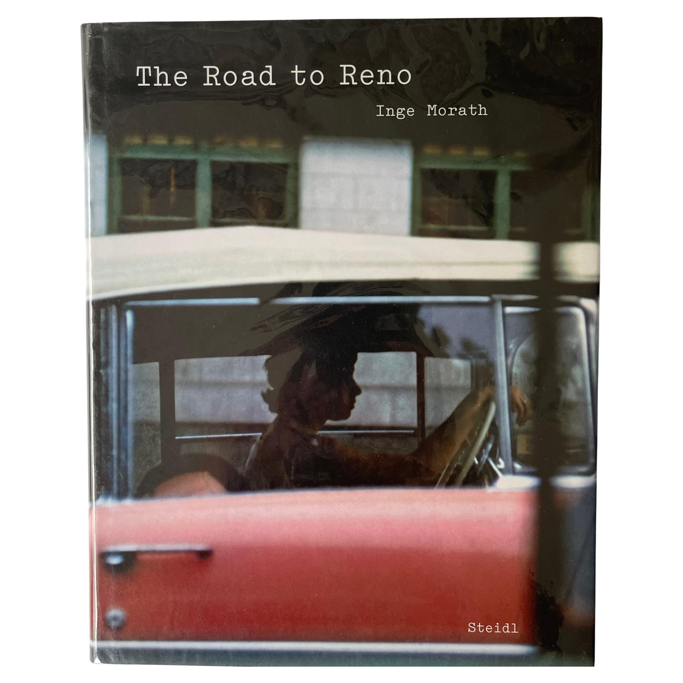
- The Road to Reno - Inge Morath - 1st Edition, Steidl, 2006Located in London, GBFirst Edition, published by Steidl, 2006. Essay by Lucy Raven, Afterword by Arthur Miller. Joining Magnum Photos in 1955, Inge Morath travelled and photographed extensively througho...Category
Early 2000s Books
MaterialsPaper
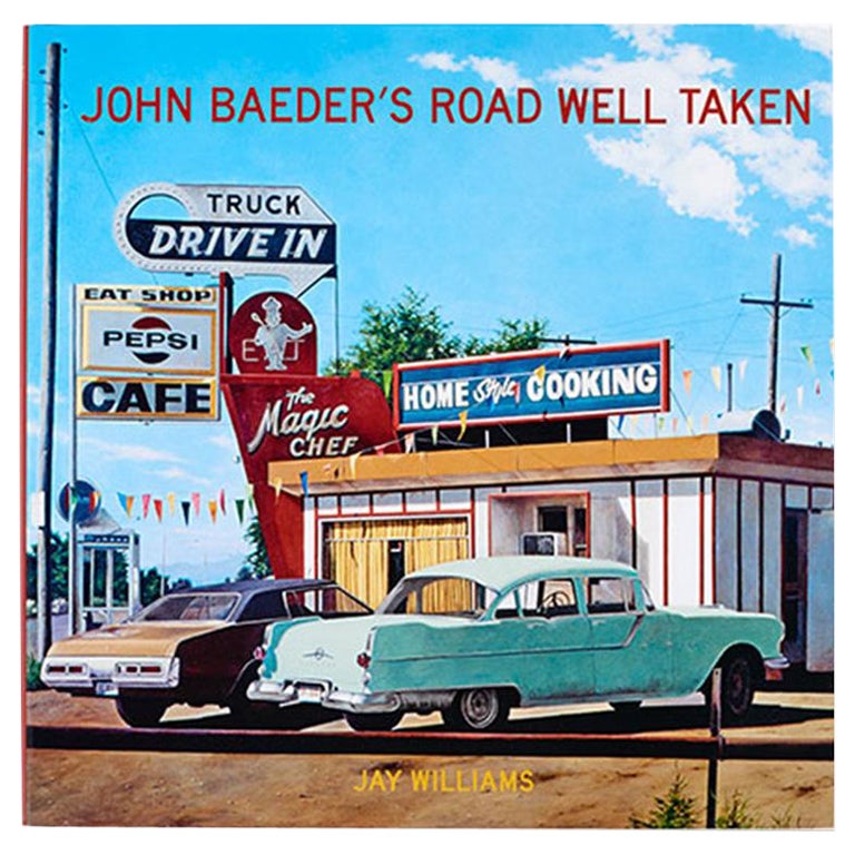
- John Baeder’s Road Well Taken Book by Jay WilliamsLocated in New York, NYJohn Baeder’s Road Well Taken By: Jay Williams Echoing Paul Gauguin’s momentous decision of a century earlier, John Baeder, in 1972, suddenly made up his mind to forgo the growing riches of a career on Madison Avenue to become a full-time painter. With little more to bank on than an offer by the legendary Ivan Karp of a future show at his New York gallery, Baeder bravely gambled his livelihood on Karp’s evaluation of his first four efforts at serious painting: a diner, a motel, a gas station, a tourist camp. “They were works of cultural consequence, . . . works of visual power.” Based on color-postcards in his growing collection of roadside memorabilia, John had made blow-ups of the cards “to see what they’d look like as paintings.” It was a bold, inventive move, but typical Baeder as he continued to lay the groundwork for what soon became known, through his efforts, as “Diner Culture.” And his masterful technique inevitably put him at the forefront of the growing photo-realist movement, along with Ralph Goings and Richard Estes. Baeder’s paintings, particularly of vintage diners...Category
21st Century and Contemporary Books
MaterialsPaper
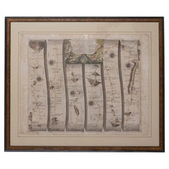
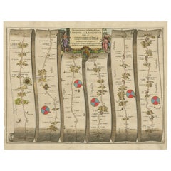
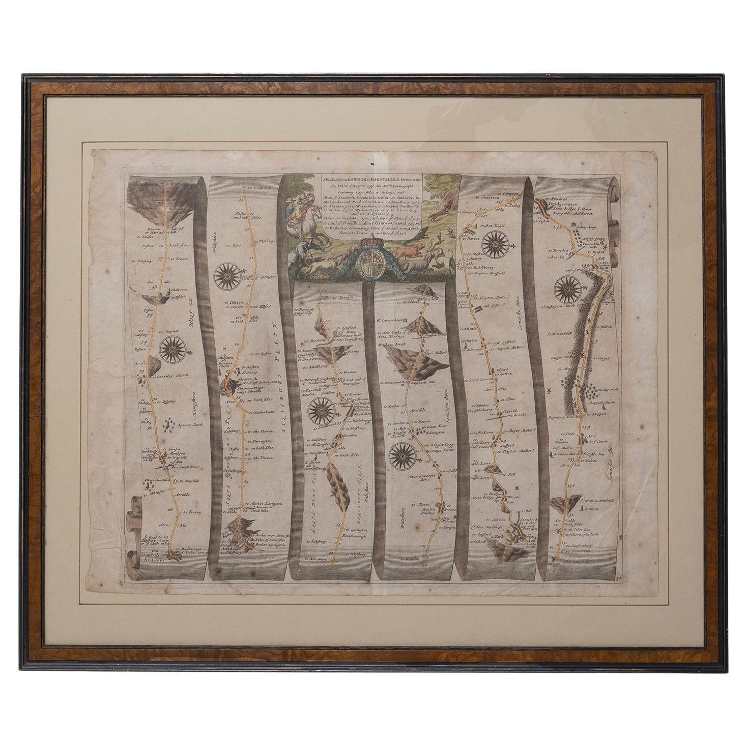
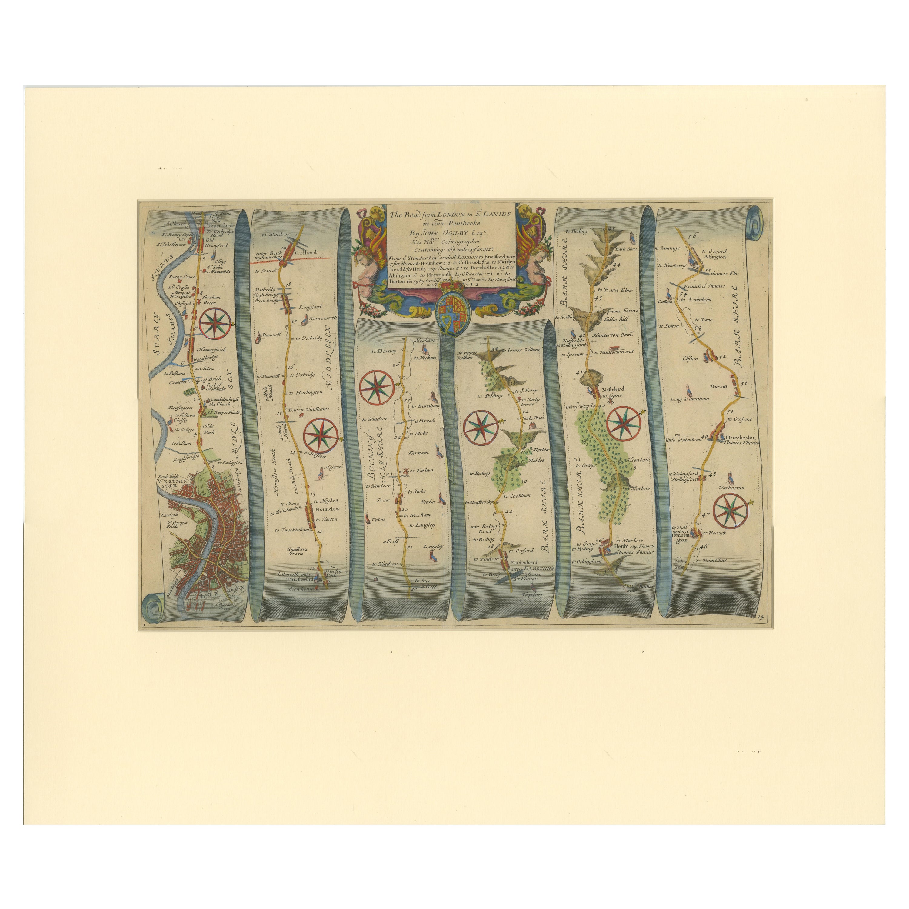
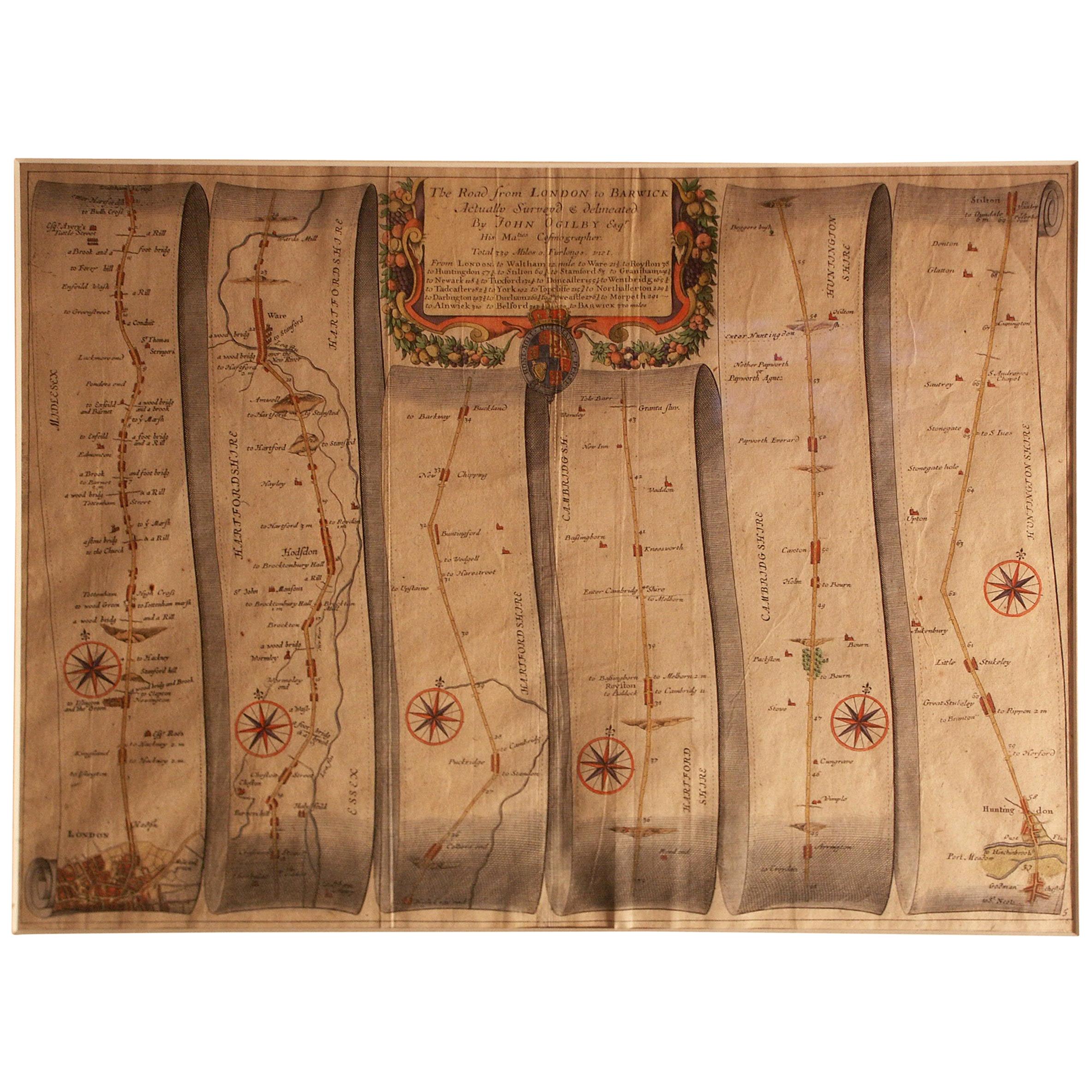
- Road Map Britannia No 32 the Road from London to Barnstable John Ogilby FramedBy John OgilbyLocated in BUNGAY, SUFFOLKA road map from Britannia, by John Ogilby Esq., Cosmographer and Geographick Printer to Charles II. Containing 293 miles. No 32. From Standard in Cornhill London to Andover thence to Amesbury, to Shruton, to Warminster, to Maiden-Bradley, to Bruton, to Weston, to Ascot and to Bridgewater Hand coloured, some foxing and creasing, commensurate with age. Floated in a cream mount with a gilded linear border within a burr walnut, ebonised and gilded frame. Provenance : purchased as pair from a collector with no 15 London to St Davids. Framed as a pair. Measures: Black Linear Border around Map Length 44cm., 17 1/8" Height 36cm., 14". Full Sheet Length 51cm., 20" Height 39cm., 15 1/4" Frame Length 62cm., 24 1/2 " Height 52cm., 20 1/2" Literature: In a remarkable life John Ogilby pursued, several careers, each ending in misfortune, and yet he always emerged undeterred, to carry on. His modern reputation is based on his final career, started in his sixty-sixth year, as a publisher of maps and geographical accounts. Ogilby was born outside Dundee, in 1600, the son of a Scottish gentleman. While he was still a child, the family moved to London. When the elder Ogilby was imprisoned for debt, the young John invested his savings in a lottery, won a minor prize, and settled his father's debts. Unfortunately, not enough money was left to secure John a good apprenticeship; instead, he was apprenticed to a dance master. Ogilby was soon dancing in masques at court but, one day, while executing a particularly ambitious leap, he landed badly. The accident left him with a permanent limp, and ended his dancing career. However, he had come to the attention of Thomas Wentworth, later Earl of Strafford, Charles I's most senior minister. Ever one to exploit his contacts, Ogilby became a dance instructor in Strafford's household. When Strafford was sent to Ireland, Ogilby accompanied him as Deputy-Master of the Kings Revels, and then Master of Revels. In Dublin, he built the New Theatre, in St. Werburgh Street, which prospered at first, but the Irish Rebellion, in 1641, cost Ogilby his fortune, which he estimated at £2,000, and almost his life. After brief service as a soldier, he returned to England, survived shipwreck on the way, and arrived back penniless. On his return, Ogilby turned his attention to the Latin classics, as a translator and publisher. His first faltering attempt, in 1649, was a translation of the works of Virgil, but after his marriage to a wealthy widow the same year, his publishing activities received a considerable boost. One means by which Ogilby financed these volumes was by subscription, securing advance payments from his patrons, in return for including their name and coats-of-arms on the plates of illustrations. Another approach was to secure a patron, preferably in the court circle. Ogilby's first patron was Strafford, who found out too late that all leading ministers are dispensable when Charles I assented to his execution in 1641. As he re-established himself, Ogilby sought a new patron, the King himself. In 1661, Ogilby was approached to write poetry for Charles II's coronation procession; he later published 'The Relation of His Majesties Entertainment Passing Through the City of London', and a much enlarged edition the following year, which included a Fine set of plates depicting the procession. Royal favour was bestowed in 1674 when John Ogilby received the title of 'His Majesty's Cosmographer and Geographick Printer' with a salary of £13.6s.8d per annum. In 1665, Ogilby left London to avoid the Plague then ravaging the capital. The following year, in the Great Fire of London, Ogilby claimed that he lost his entire stock of books valued at some £3,000, as well as his shop and house, leaving him worth just £5. As he sought to restore his fortunes, Ogilby was already looking in new directions. The initial opportunity he seized on was the reconstruction of London's burnt-out centre. He secured appointment as a 'sworn viewer', whose duty was to establish the property boundaries as they existed before the Fire. Ogilby was assisted in the project by his step-grandson, William Morgan...Category
Antique Late 17th Century English Charles II Maps
MaterialsPaper
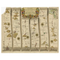
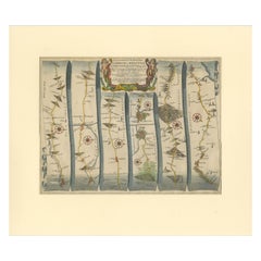
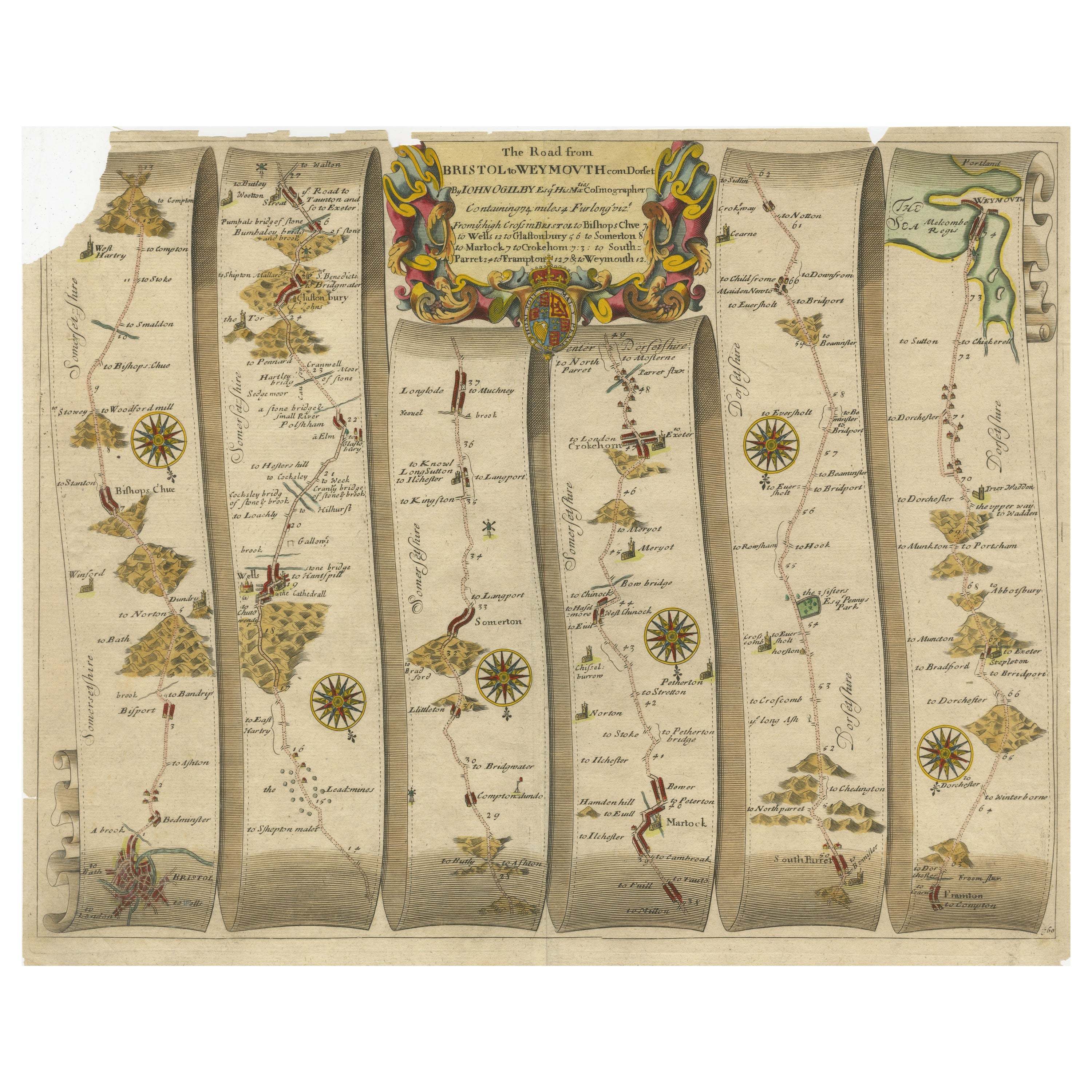
- Original Antique Map of the Road from Bristol to WeymouthLocated in Langweer, NLAntique map titled 'The Road from Bristol to Weymouth (..)'. Original antique map of the road from Bristol to Weymouth. Plate 60 from Ogilby's 'Britannia', the first road atlas of En...Category
Antique Late 17th Century Maps
MaterialsPaper
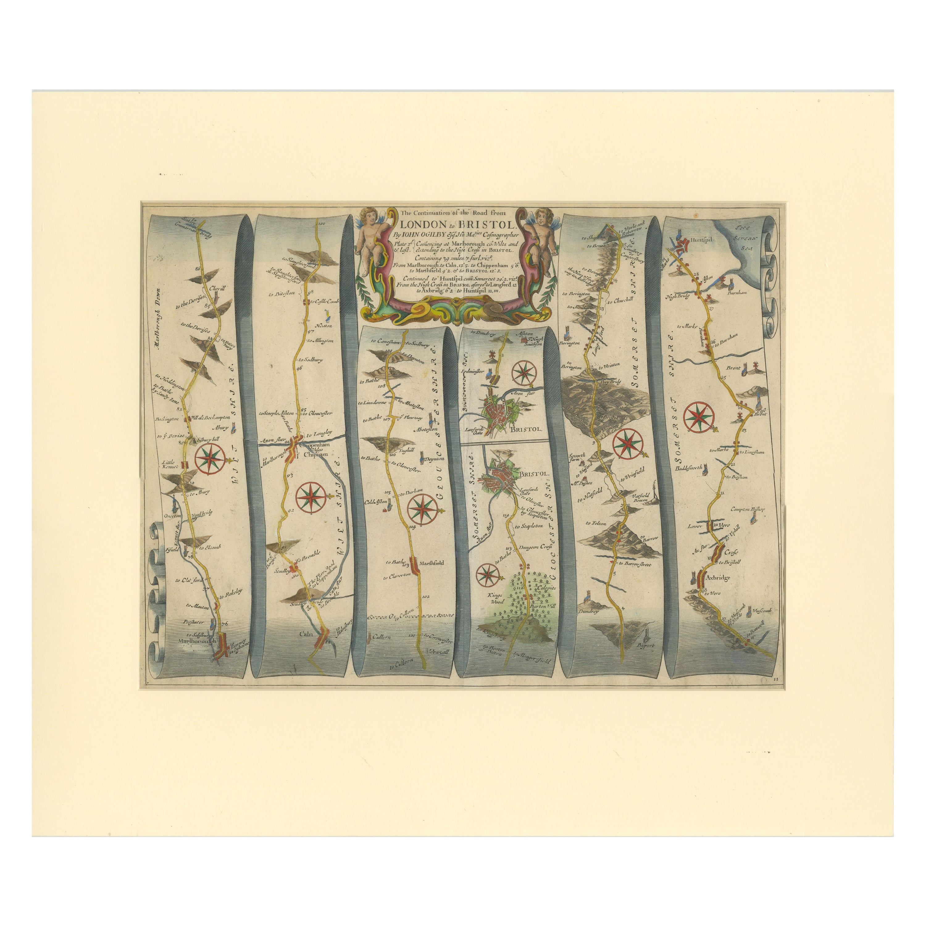
- Original Antique Map of the Road from Marlborough to HuntspilLocated in Langweer, NLAntique map titled 'The Continuation of the Road from London to Bristol (..)'. A strip map of the continuation of the road from London to Bristol, this particular sheet showing the r...Category
Antique Late 17th Century Maps
MaterialsPaper
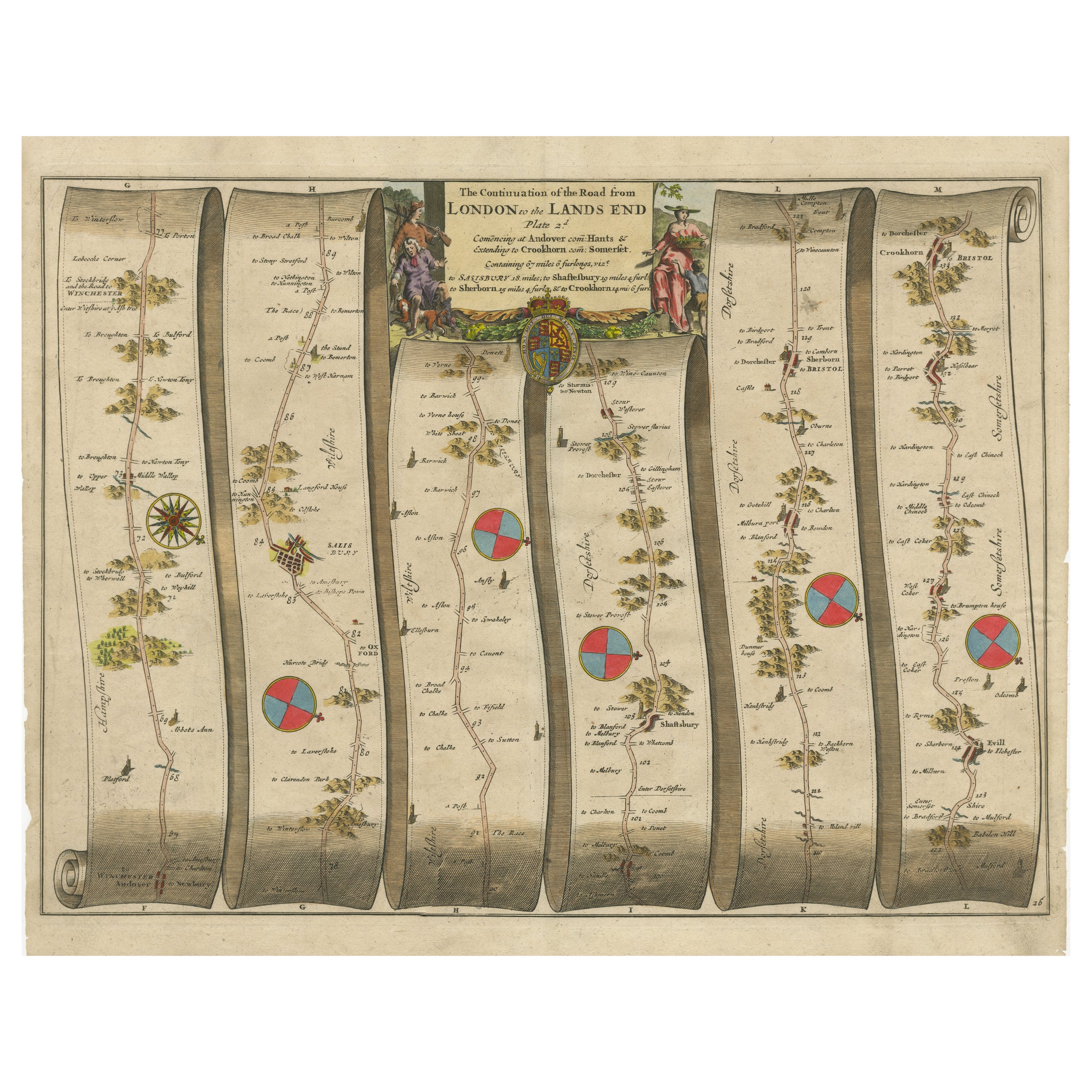
- Original Antique Map of the Road from Andover to CrewkerneLocated in Langweer, NLAntique map titled 'The Continuations of the Road from London to the Lands End'. Original antique map of the road from Andover to Crewkerne. Plate 26 from Ogilby's 'Britannia', the f...Category
Antique Late 17th Century Maps
MaterialsPaper