Items Similar to Original Antique Map of the Road from London to Bensington
Want more images or videos?
Request additional images or videos from the seller
1 of 8
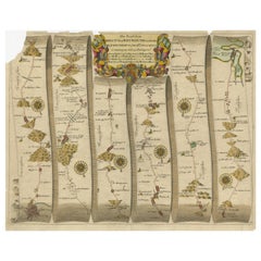
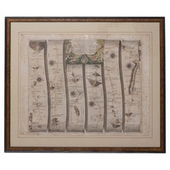
Original Antique Map of the Road from London to Bensington
About the Item
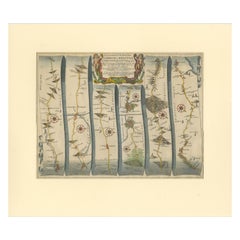
Antique map titled 'The Road from London to St. Davids in com: Pembroke (..)'. A strip map of the road from London to Bensington. The map is ornamented with numerous compass roses, and a decorative title cartouche. Originates from Ogilby's 'Britannia', the first road atlas of England & Wales, first published in 1675.
John Ogilby, born in Edinburgh in 1600, was a man of many parts, his various vocations included dancing instructor, tutor, theatre owner, translator, poet, printer, historian and mapmaker. He did not embark on his last profession until he was over sixty years of age but in the short time before his death in 1675 he achieved lasting fame with his great work on the English roads, 'Britannia', published the year he died. It proved to be a milestone in English cartography, the first real step forward since the publication of Saxton's atlas in 1579.
- Dimensions:Height: 20.08 in (51 cm)Width: 23.23 in (59 cm)Depth: 0.2 in (5 mm)
- Materials and Techniques:
- Period:Late 17th Century
- Date of Manufacture:c.1675
- Condition:Repaired: Original folding line, with repair. General age-related toning. Original folding line, with repair. Few tiny defects on folding line. Passepartout / matting included, however, the map can be easily removed. Minor wear and soiling, blank verso. Please study image carefully.
- Seller Location:Langweer, NL
- Reference Number:
About the Seller
5.0
Platinum Seller
These expertly vetted sellers are 1stDibs' most experienced sellers and are rated highest by our customers.
Established in 2009
1stDibs seller since 2017
1,960 sales on 1stDibs
Typical response time: <1 hour
- ShippingRetrieving quote...Ships From: Langweer, Netherlands
- Return PolicyA return for this item may be initiated within 14 days of delivery.
More From This SellerView All
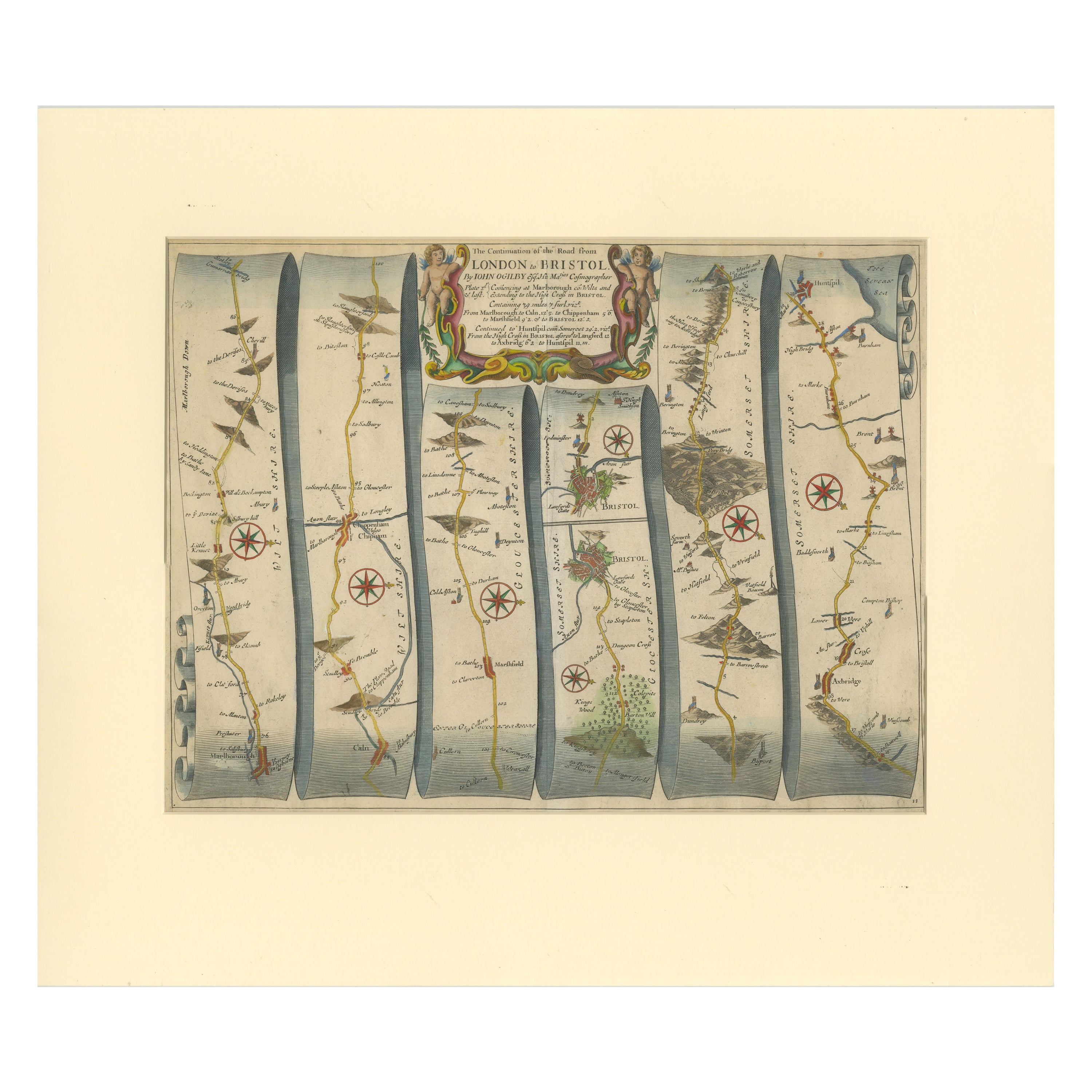
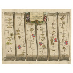
- Original Antique Map of the Road from Marlborough to HuntspilLocated in Langweer, NLAntique map titled 'The Continuation of the Road from London to Bristol (..)'. A strip map of the continuation of the road from London to Bristol, this particular sheet showing the r...Category
Antique Late 17th Century Maps
MaterialsPaper
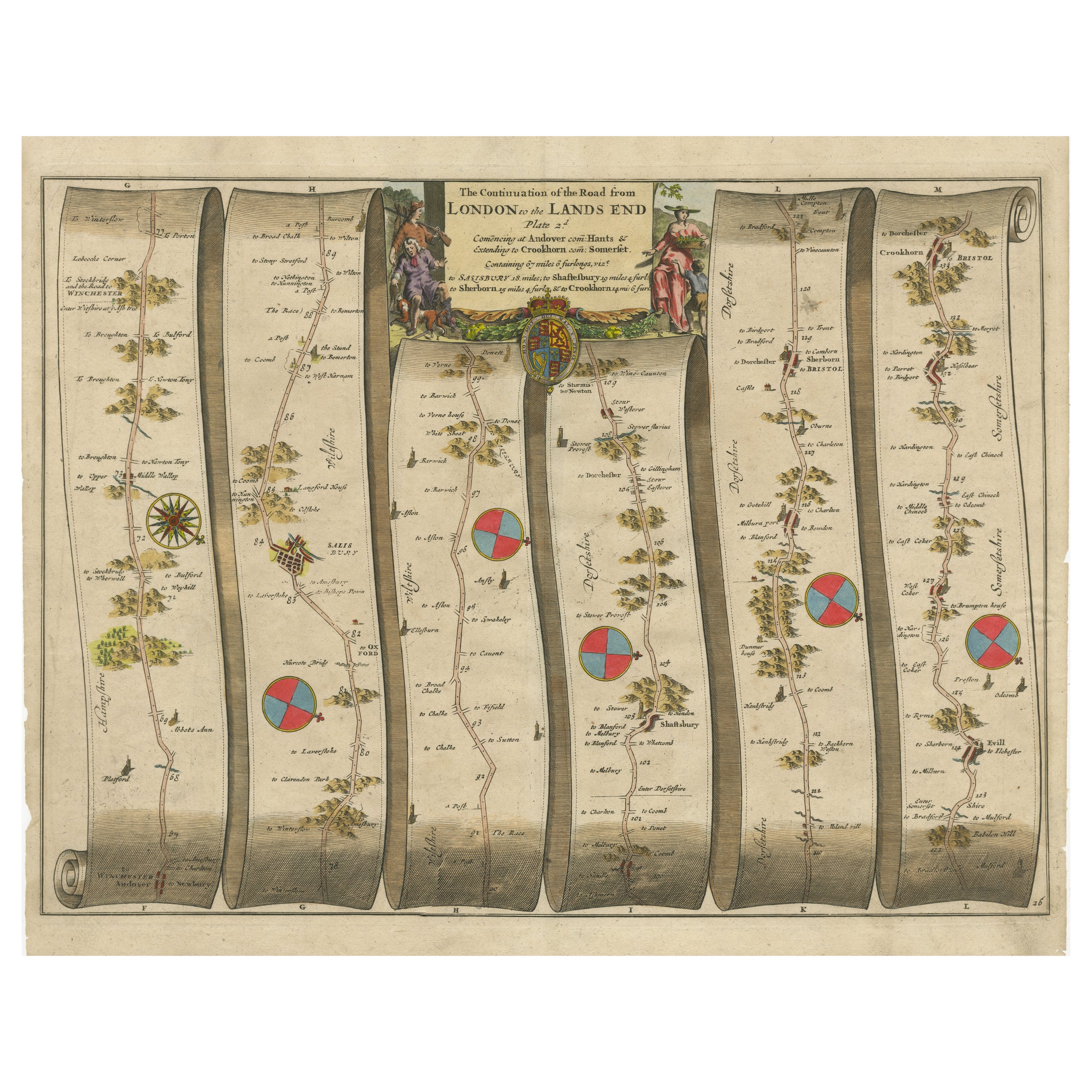
- Original Antique Map of the Road from Andover to CrewkerneLocated in Langweer, NLAntique map titled 'The Continuations of the Road from London to the Lands End'. Original antique map of the road from Andover to Crewkerne. Plate 26 from Ogilby's 'Britannia', the f...Category
Antique Late 17th Century Maps
MaterialsPaper
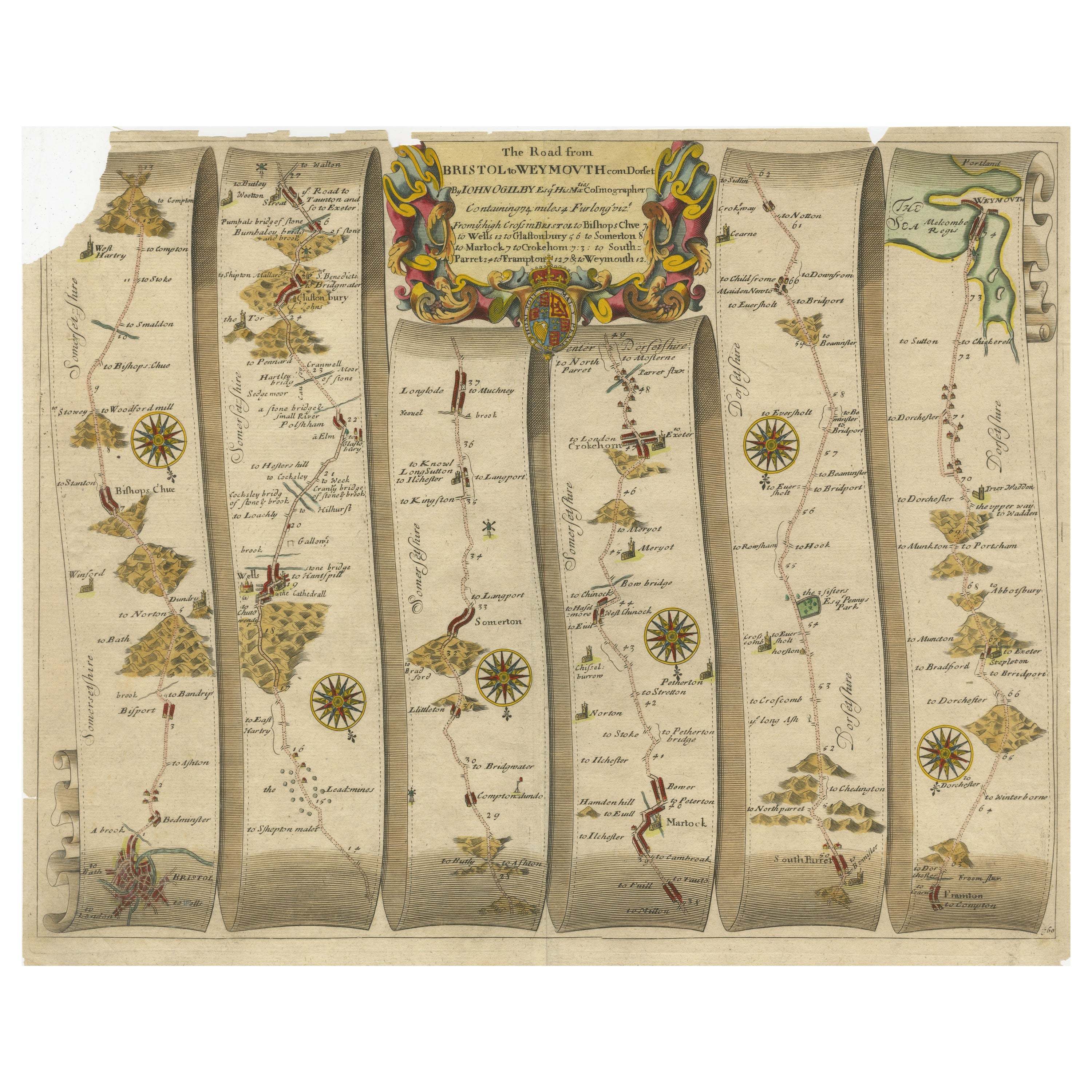
- Original Antique Map of the Road from Bristol to WeymouthLocated in Langweer, NLAntique map titled 'The Road from Bristol to Weymouth (..)'. Original antique map of the road from Bristol to Weymouth. Plate 60 from Ogilby's 'Britannia', the first road atlas of En...Category
Antique Late 17th Century Maps
MaterialsPaper
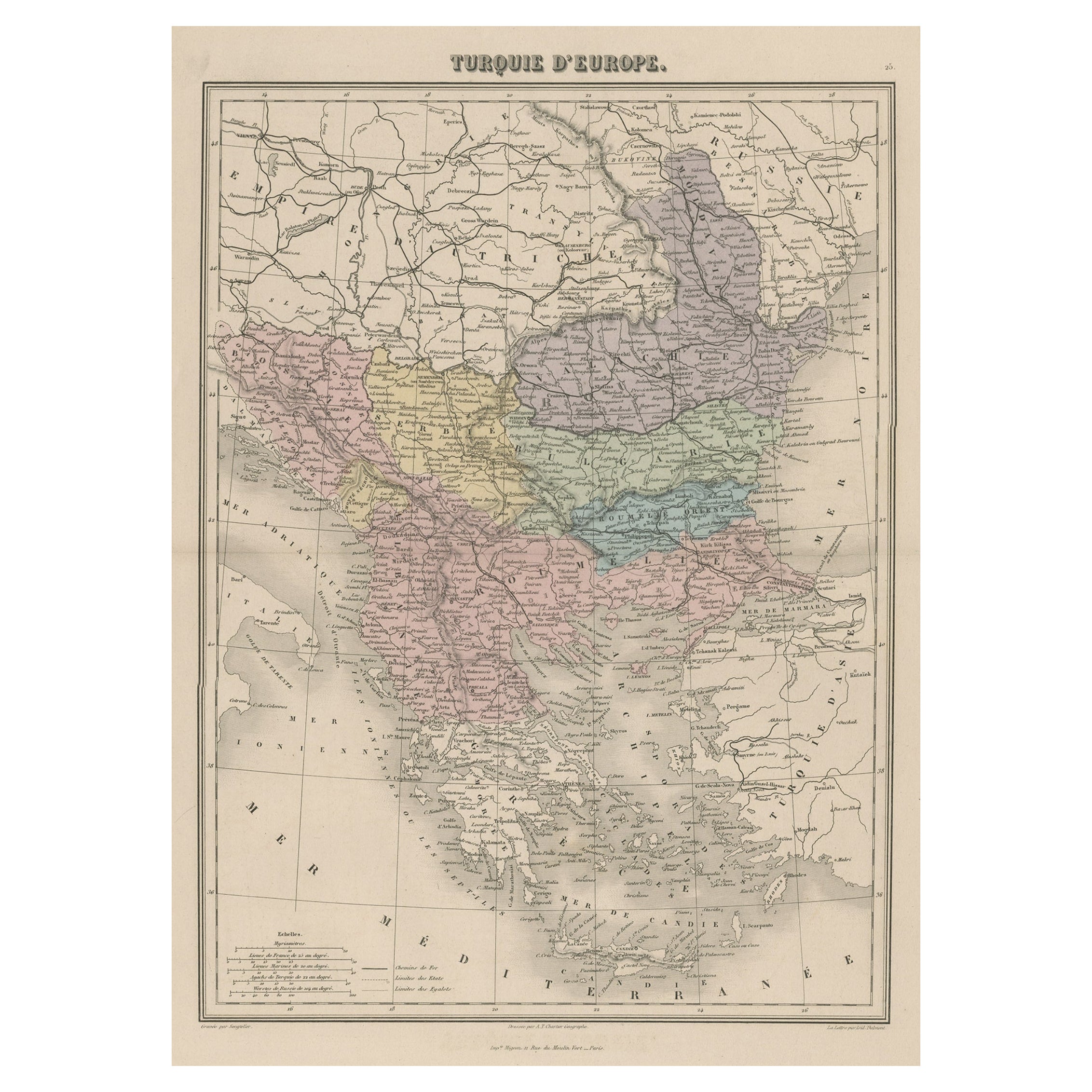
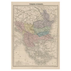
- Antique Map of Moldova to Thessaly and from the Adriatic to the Black Sea, 1880Located in Langweer, NLAntique map titled 'Turquie d'Europe'. Map of the european parts of Turkey. The map covers from Moldova to Thessaly and from the Adriatic to the Black Sea. Greece and the island ...Category
Antique 1880s Maps
MaterialsPaper
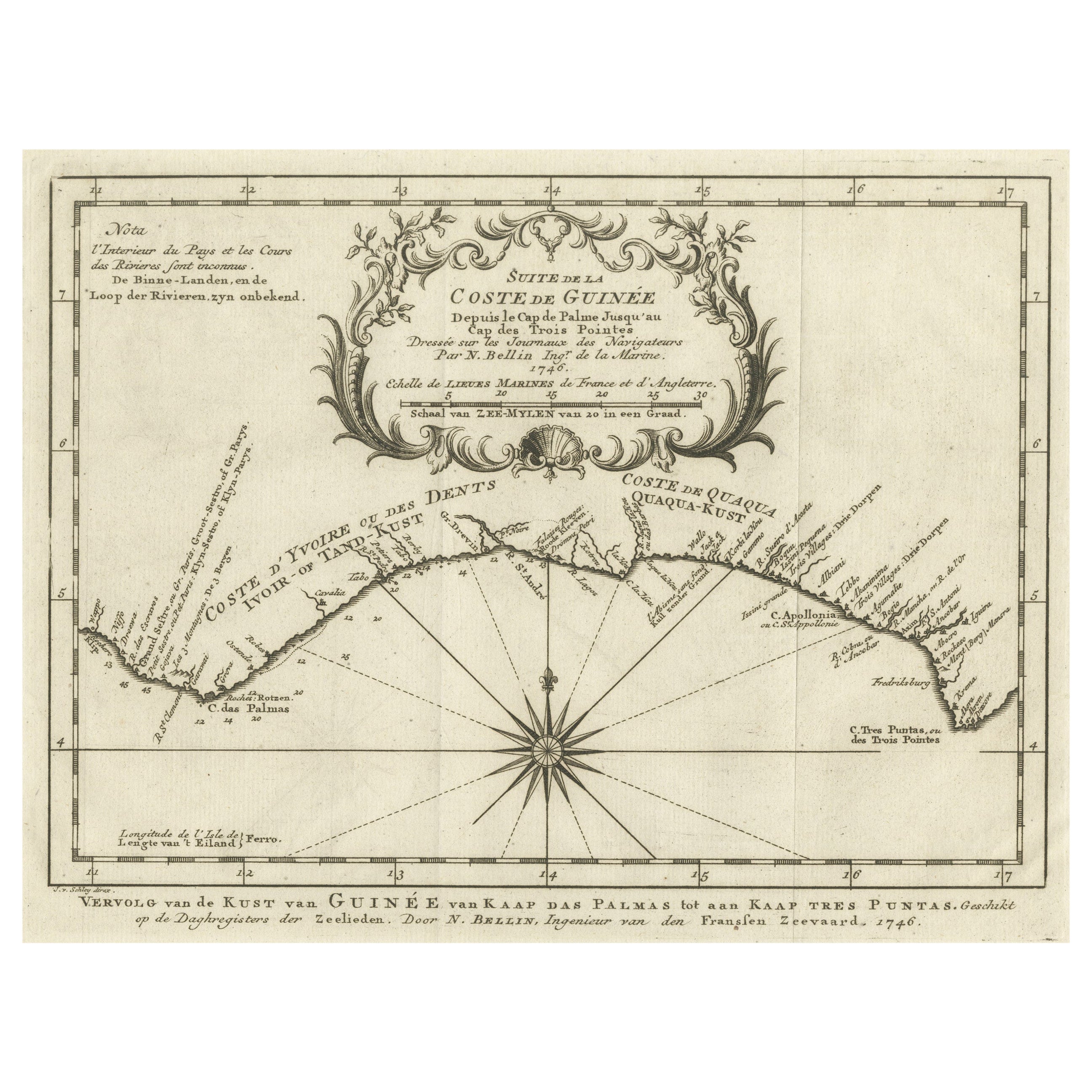
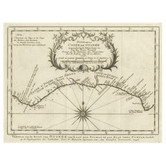
- Antique Map of the Coast of Guinea from, Cape Apollonia to the Volta RiverLocated in Langweer, NLAntique map titled 'Suite de la Coste de Guinée (..) - Vervolg van de Kust van Guinée (..)'. Decorative map of the coast of Guinea from, Cape Apollonia to the Volta River. Engraved b...Category
Antique Mid-18th Century Maps
MaterialsPaper
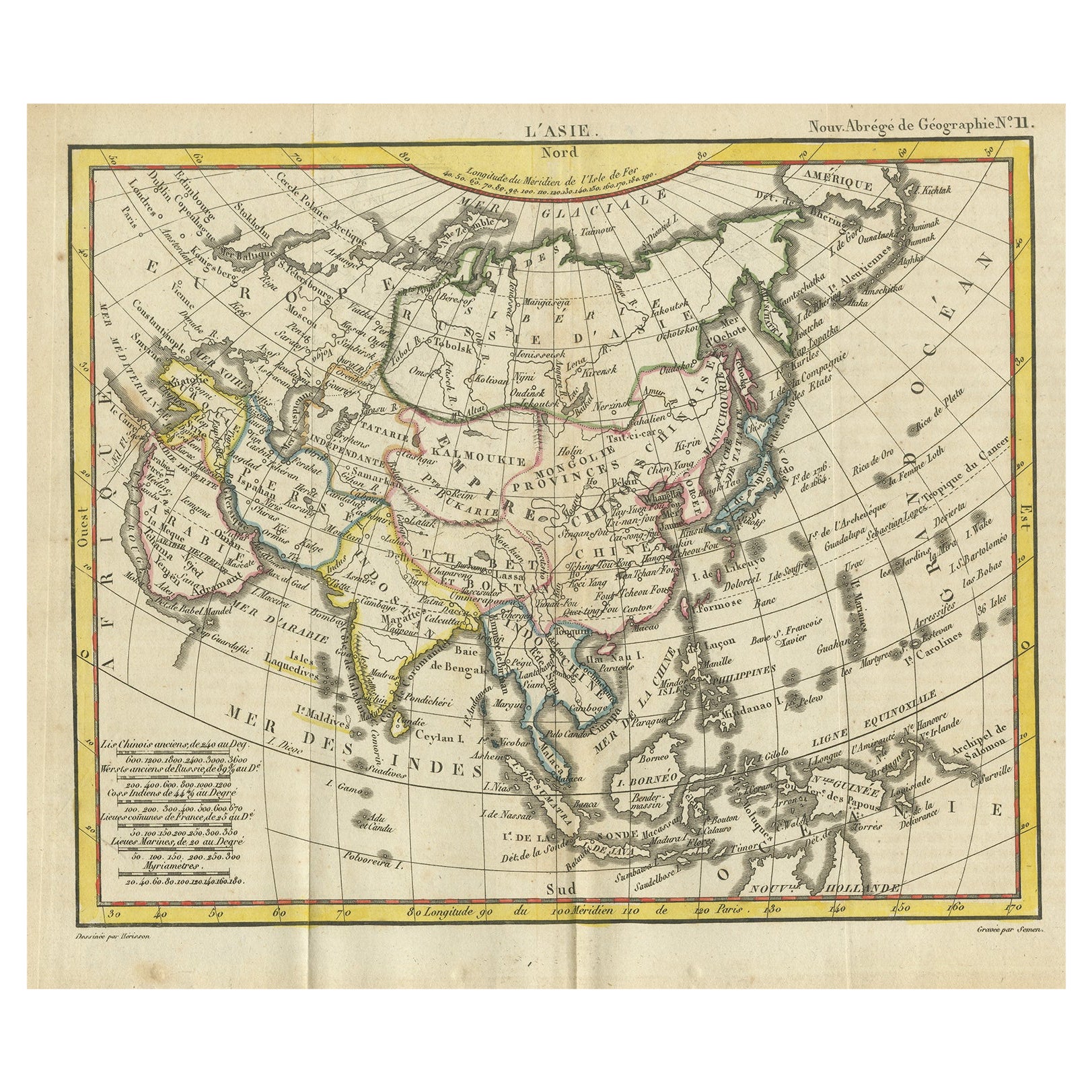
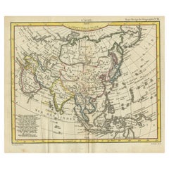
- Antique Map of Asia from the Middle East to the Coast of Alaska, 1816Located in Langweer, NLAntique map titled ‘L’Asie‘. This is an original antique map of Asia, by Hérisson, taken from atlas ""Nouv. Abrége de Géographie"". An engraved map with coloring of Asia from the Mid...Category
Antique 19th Century Maps
MaterialsPaper
You May Also Like
- Original Antique Map of Italy. C.1780Located in St Annes, LancashireGreat map of Italy Copper-plate engraving Published C.1780 Unframed.Category
Antique Early 1800s English Georgian Maps
MaterialsPaper

- Original Antique Map of Asia. C.1780Located in St Annes, LancashireGreat map of Asia Copper-plate engraving Published C.1780 Two small worm holes to right side of map Unframed.Category
Antique Early 1800s English Georgian Maps
MaterialsPaper

- Original Antique Map of India. C.1780Located in St Annes, LancashireGreat map of India Copper-plate engraving Published C.1780 Three small worm holes to right side of map and one bottom left corner Unframed.Category
Antique Early 1800s English Georgian Maps
MaterialsPaper

- Original Antique Map of The World by Thomas Clerk, 1817Located in St Annes, LancashireGreat map of The Eastern and Western Hemispheres On 2 sheets Copper-plate engraving Drawn and engraved by Thomas Clerk, Edinburgh. Published by Mackenzie And Dent, 1817 ...Category
Antique 1810s English Maps
MaterialsPaper
- Road Map Britannia No 32 the Road from London to Barnstable John Ogilby FramedBy John OgilbyLocated in BUNGAY, SUFFOLKA road map from Britannia, by John Ogilby Esq., Cosmographer and Geographick Printer to Charles II. Containing 293 miles. No 32. From Standard in Cornhill London to Andover thence to Amesbury, to Shruton, to Warminster, to Maiden-Bradley, to Bruton, to Weston, to Ascot and to Bridgewater Hand coloured, some foxing and creasing, commensurate with age. Floated in a cream mount with a gilded linear border within a burr walnut, ebonised and gilded frame. Provenance : purchased as pair from a collector with no 15 London to St Davids. Framed as a pair. Measures: Black Linear Border around Map Length 44cm., 17 1/8" Height 36cm., 14". Full Sheet Length 51cm., 20" Height 39cm., 15 1/4" Frame Length 62cm., 24 1/2 " Height 52cm., 20 1/2" Literature: In a remarkable life John Ogilby pursued, several careers, each ending in misfortune, and yet he always emerged undeterred, to carry on. His modern reputation is based on his final career, started in his sixty-sixth year, as a publisher of maps and geographical accounts. Ogilby was born outside Dundee, in 1600, the son of a Scottish gentleman. While he was still a child, the family moved to London. When the elder Ogilby was imprisoned for debt, the young John invested his savings in a lottery, won a minor prize, and settled his father's debts. Unfortunately, not enough money was left to secure John a good apprenticeship; instead, he was apprenticed to a dance master. Ogilby was soon dancing in masques at court but, one day, while executing a particularly ambitious leap, he landed badly. The accident left him with a permanent limp, and ended his dancing career. However, he had come to the attention of Thomas Wentworth, later Earl of Strafford, Charles I's most senior minister. Ever one to exploit his contacts, Ogilby became a dance instructor in Strafford's household. When Strafford was sent to Ireland, Ogilby accompanied him as Deputy-Master of the Kings Revels, and then Master of Revels. In Dublin, he built the New Theatre, in St. Werburgh Street, which prospered at first, but the Irish Rebellion, in 1641, cost Ogilby his fortune, which he estimated at £2,000, and almost his life. After brief service as a soldier, he returned to England, survived shipwreck on the way, and arrived back penniless. On his return, Ogilby turned his attention to the Latin classics, as a translator and publisher. His first faltering attempt, in 1649, was a translation of the works of Virgil, but after his marriage to a wealthy widow the same year, his publishing activities received a considerable boost. One means by which Ogilby financed these volumes was by subscription, securing advance payments from his patrons, in return for including their name and coats-of-arms on the plates of illustrations. Another approach was to secure a patron, preferably in the court circle. Ogilby's first patron was Strafford, who found out too late that all leading ministers are dispensable when Charles I assented to his execution in 1641. As he re-established himself, Ogilby sought a new patron, the King himself. In 1661, Ogilby was approached to write poetry for Charles II's coronation procession; he later published 'The Relation of His Majesties Entertainment Passing Through the City of London', and a much enlarged edition the following year, which included a Fine set of plates depicting the procession. Royal favour was bestowed in 1674 when John Ogilby received the title of 'His Majesty's Cosmographer and Geographick Printer' with a salary of £13.6s.8d per annum. In 1665, Ogilby left London to avoid the Plague then ravaging the capital. The following year, in the Great Fire of London, Ogilby claimed that he lost his entire stock of books valued at some £3,000, as well as his shop and house, leaving him worth just £5. As he sought to restore his fortunes, Ogilby was already looking in new directions. The initial opportunity he seized on was the reconstruction of London's burnt-out centre. He secured appointment as a 'sworn viewer', whose duty was to establish the property boundaries as they existed before the Fire. Ogilby was assisted in the project by his step-grandson, William Morgan...Category
Antique Late 17th Century English Charles II Maps
MaterialsPaper
- Antique 1901 National Publishing Company's Road Map of New Jersey GeologicalLocated in Dayton, OHThe National Publishing Company's road map of New Jersey, showing all county and township divisions, cities villages and post-offices, railroads, ste...Category
Antique Early 1900s Victorian Prints
MaterialsPaper


Recently Viewed
View AllMore Ways To Browse
Antique Compass London
Used Britannia Rose Furniture
John Ogilby
Antique Copper Australia
Antique Iranian Map
Antique Map New South Wales
Antique Newfoundland Canada
Bush Antiques
Canadian Atlas Furniture
Harley Antique
Iran Antique Map
Map Of Jerusalem
Map Of Ohio
Map Sea Monsters
Maria Magdalena
Richard Wentworth
Teak Sphere
Antique Agricultural Scales