Items Similar to Antique Map of Asia from the Middle East to the Coast of Alaska, 1816


Want more images or videos?
Request additional images or videos from the seller
1 of 5
Antique Map of Asia from the Middle East to the Coast of Alaska, 1816
About the Item
Antique map titled ‘L’Asie‘. This is an original antique map of Asia, by Hérisson, taken from atlas ""Nouv. Abrége de Géographie"". An engraved map with coloring of Asia from the Middle East to the coast of Alaska then known as Russia/America. Six scales and outline depicting countries.
Artists and Engravers: Eustache Hérisson (1759 – 1818) was a French cartographer and geographical engineer active in Paris during the early years of the 19th century. Hérisson was a student of the 18th century hydrography Rigobert Bonne. He was a member of the Société Royale. Much of his work was republished posthumously by Bassett, Brue, and others.
Condition: Good, general age-related toning. Original folding lines, blank verso. Please study image carefully.
Date: 1816
Overall size: 23 x 20 cm.
Image size: 0.001 x 21 x 17.5 cm.
We sell original antique maps to collectors, historians, educators and interior decorators all over the world. Our collection includes a wide range of authentic antique maps from the 16th to the 20th centuries. Buying and collecting antique maps is a tradition that goes back hundreds of years. Antique maps have proved a richly rewarding investment over the past decade, thanks to a growing appreciation of their unique historical appeal. Today the decorative qualities of antique maps are widely recognized by interior designers who appreciate their beauty and design flexibility. Depending on the individual map, presentation, and context, a rare or antique map can be modern, traditional, abstract, figurative, serious or whimsical. We offer a wide range of authentic antique maps for any budget.
- Dimensions:Height: 7.88 in (20 cm)Width: 9.06 in (23 cm)Depth: 0 in (0.01 mm)
- Materials and Techniques:
- Period:
- Date of Manufacture:1816
- Condition:
- Seller Location:Langweer, NL
- Reference Number:
About the Seller
5.0
Platinum Seller
These expertly vetted sellers are 1stDibs' most experienced sellers and are rated highest by our customers.
Established in 2009
1stDibs seller since 2017
1,940 sales on 1stDibs
Typical response time: <1 hour
- ShippingRetrieving quote...Ships From: Langweer, Netherlands
- Return PolicyA return for this item may be initiated within 14 days of delivery.
More From This SellerView All
- Antique Map of the West Coast of North America & North East Coast of Asia '1772'Located in Langweer, NLAntique map titled 'Carte des nouvelles decouvertes/ Extrait d'une Carte Japonoise de l'Universe'. Map of the West Coast of North America and North-East Coast of Asia, based upon Buache's report of the various Russian Discoveries between 1731 and 1742 including the various explorers routes and notes. The lower map is based upon a Japanese map...Category
Antique Late 18th Century Maps
MaterialsPaper
- Rare Antique Map of the Middle East, ca.1690Located in Langweer, NLDescription: Antique print, untitled. Two decorative maps on one sheet of the middle east in biblical times. Source unknown, to be determined. Artists and Engravers: Anonymous...Category
Antique 1690s Prints
MaterialsPaper
- Antique Map of the East Coast of Sumatra , Indonesia, 1900Located in Langweer, NLAntique map of the East Coast of Sumatra. Also depicting the Strait of Malacca. This map originates from 'Atlas van Nederlandsch Oost- en West-Indië' by I. Dornseiffen. Artists and...Category
20th Century Maps
MaterialsPaper
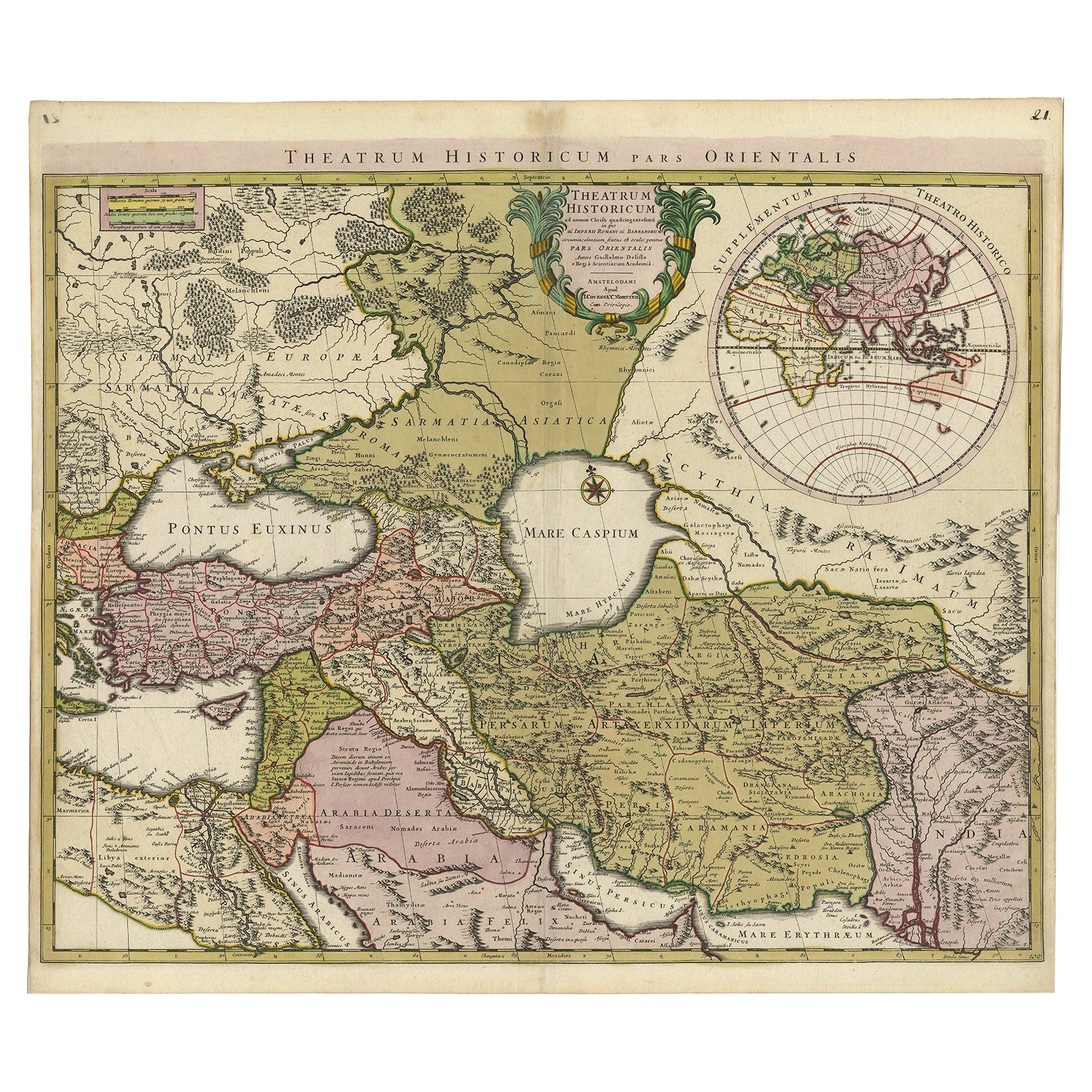
- Finely Engraved Historical Map of Middle East and Asia, c.1745Located in Langweer, NLDescription: Antique map titled'Theatrum Historicum pars Orientalis.' Finely engraved historical map with a profusion of details. It shows the Middle East and Asia. Decorative ti...Category
Antique 1740s Maps
MaterialsPaper
- Antique Bible Map of the Middle East by A. Schut, 1743Located in Langweer, NLAntique map titled 'De Gelegentheyt van 't Paradys en 't Landt Canaan'. Dutch Bible map covering the region between the Mediterranean and the Persian Gulf, ...Category
Antique Mid-18th Century Maps
MaterialsPaper
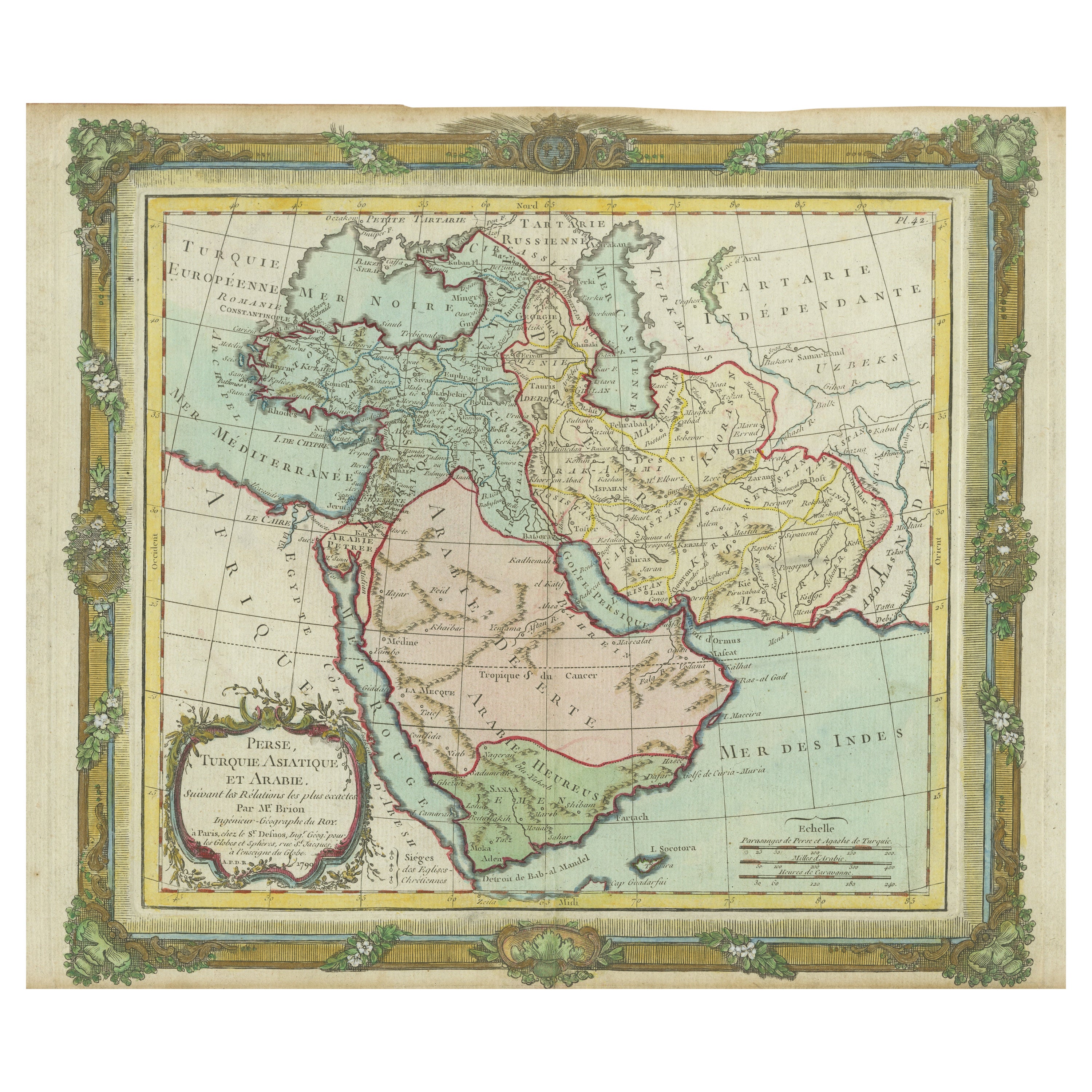
- Antique Map of the Middle East with a Large Arabia, 1799Located in Langweer, NLAntique map titled 'Perse, Turquie Asiatique et Arabie (..)'. Map of the Middle East with a large Arabia, extending from the Black Sea to the In...Category
Antique Late 18th Century Maps
MaterialsPaper


You May Also Like
- Original Antique Map of South East Asia, Arrowsmith, 1820Located in St Annes, LancashireGreat map of South East Asia Drawn under the direction of Arrowsmith Copper-plate engraving Published by Longman, Hurst, Rees, Orme and Brown, 1820 Unframed.Category
Antique 1820s English Maps
MaterialsPaper
- Original Antique Map of South East Asia by Becker, circa 1840Located in St Annes, LancashireGreat map of South East Asia Steel engraving with original color outline Engraved by Becker Published by Virtue, circa 1840. Unframed.Category
Antique 1840s English Other Maps
MaterialsPaper
- Original Antique Map of Asia. C.1780Located in St Annes, LancashireGreat map of Asia Copper-plate engraving Published C.1780 Two small worm holes to right side of map Unframed.Category
Antique Early 1800s English Georgian Maps
MaterialsPaper

- Original Antique English County Map, East Yorkshire, J & C Walker, 1851Located in St Annes, LancashireGreat map of The East Riding of Yorkshire Original colour By J & C Walker Published by Longman, Rees, Orme, Brown & Co. 1851 Unframed.Category
Antique 1850s English Other Maps
MaterialsPaper
- New Map of North America from the Latest Discoveries, 1763Located in Philadelphia, PAA fine antique 18th century map of the North American seaboard. Entitled "A New Map of North America from the Latest Discoveries 1763". By the Cartographer/Engraver - John Spil...Category
Antique Mid-18th Century English Georgian Maps
MaterialsPaper
- Vintage "View of the Center of Paris Taken from the Air" Lithograph MapLocated in San Diego, CAA very stylish "View of the Center of Paris Taken from the Air" lithograph map published by the Paris Ministry of Tourism, circa early 1950s. The piece measures 27" x 43" and shows...Category
20th Century French Mid-Century Modern Prints
MaterialsPaper


Recently Viewed
View AllMore Ways To Browse
Middle Ages Modern
Middle East Furniture
Middle East Antiques
French Map Of America
Alaska Furniture
Used Bassett Furniture
French Country Antique Furniture French 20country Furniture
18th Century Maps America
East Coast Antiques
Alaska Antique
Asie Antique
Bonne Map
Middle East Map
Middle East Antique Map
Antique Map Middle East
Middle East Maps
Map Of Middle East
Alaska Map