Alaska Map
2
to
6
42
29
25
24
23
15
15
10
9
8
7
5
4
4
4
4
4
3
2
2
2
2
2
2
2
1
1
1
1
1
1
1
1
1
1
6
4
2
2
1
Sort By
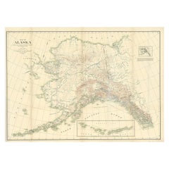
Antique Map of Alaska '1904'
Located in Langweer, NL
An antique map titled 'Map of Alaska Compiled Under the Direction of R.U. Goode, Geographer,' which
Category
Early 20th Century Maps
Materials
Paper
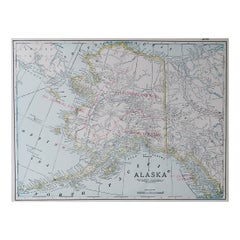
Large Original Antique Map of Alaska, USA, C.1900
Located in St Annes, Lancashire
Fabulous map of Alaska
Original color
Engraved and printed by the George F. Cram Company
Category
Antique 1890s American Maps
Materials
Paper
California, Alaska and Mexico: 18th Century Hand-Colored Map by de Vaugondy
By Didier Robert de Vaugondy
Located in Alamo, CA
day Alaska in the north to Baja California in the south. The map includes the Strait of Anian in the
Category
Antique 1770s French Maps
Materials
Paper
H 13.75 in W 16.63 in D 0.13 in
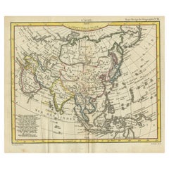
Antique Map of Asia from the Middle East to the Coast of Alaska, 1816
Located in Langweer, NL
Antique map titled ‘L’Asie‘. This is an original antique map of Asia, by Hérisson, taken from atlas
Category
Antique 19th Century Maps
Materials
Paper
1864 Map of North America, Antique Hand-Colored Map, by Adolphe Hippolyte Dufour
Located in Colorado Springs, CO
map at the lower left showing the edge of present day Alaska. The land of Alaska is labeled here as
Category
Antique 1860s French Maps
Materials
Paper
H 44.5 in W 33 in D 1.5 in
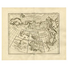
Antique Map of North and East Asia, 1751
Located in Langweer, NL
maps on one sheet, showing California, Alaska and Siberia, Korea and Japan. South to Korea the island
Category
Antique 18th Century Maps
Materials
Paper
Interesting Original Antique Hemisphere Map Showing the Latest Discoveries
Located in Langweer, NL
Antique world map titled 'A Map of the World from the best Authorities'. Detailed map of the World
Category
Antique Late 18th Century Maps
Materials
Paper
No Reserve
H 13.39 in W 22.05 in D 0.02 in
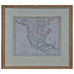
America "Amérique Septentrionale": A 19th Century French Map by Delamarche
By Maison Delamarche 1
Located in Alamo, CA
This framed mid 19th century map of North America entitled "Amérique Septentrionale" by Felix
Category
Antique Mid-19th Century American Other Maps
Materials
Paper
H 20 in W 22.63 in D 0.88 in
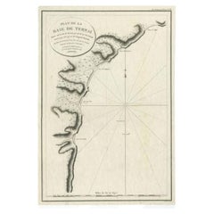
Antique Map of the Bay of Terney by La Pérouse, 1797
Located in Langweer, NL
Antique map titled 'Plan de la Baie de Ternai'. Old map of the north eastern coast of Russia. This
Category
Antique 18th Century Maps
Materials
Paper
Antique Railroad Map of the United States by Rand, McNally & Co, 1900
Located in Langweer, NL
reservations, and railroads; Oklahoma and "Indian Territory." Inset: "Map of Alaska." Published, 1900.
Category
20th Century Maps
Materials
Linen, Paper
Free Shipping
H 30.91 in W 43.9 in D 0.02 in
Antique Map of North Europe and East Asia by Vaugondy, circa 1750
Located in Langweer, NL
Asia. Five maps on one sheet, showing California, Alaska and Syberia, Korea and Japan. South to Korea
Category
Antique Mid-18th Century Maps
Antique Map with Details of Berings' Expedition into Russians' Far East, 1737
Located in Langweer, NL
first expedition to discover and partially map what is now Alaska. It opened the way to the lengthy
Category
Antique 1730s Maps
Materials
Paper
H 12.96 in W 22.64 in D 0 in
Antique Map of North America with Vignette of the Statue of Liberty, New York
Located in Langweer, NL
Antique map titled 'Amérique du Nord'. Original antique map of North America. Meticulous
Category
Antique Late 19th Century Maps
Materials
Paper
Free Shipping
H 15.44 in W 20.4 in D 0.02 in
Antique Map of The Bay of D'Estaing located on the Russian island Sakhalin, 1798
Located in Langweer, NL
Antique map titled 'Plan of La Baie d'Estaing'.
This map shows the bay of D'Estaing located on
Category
Antique 1790s Maps
Materials
Paper
H 16.34 in W 14.38 in D 0 in
Miniature Terrestrial Globe Newton & Son London, Post 1833, Ante 1858
By Newton and Son
Located in Milano, IT
). Canada is called "British Territory" and Alaska "Russian Territory" (it would become part of the United
Category
Antique 1840s English Early Victorian Maps
Materials
Bronze
Alaska, North America. Century Atlas antique vintage map
Located in Melbourne, Victoria
'The Century Atlas. Alaska, North America.'
Original antique map, 1903.
Inset maps of 'Sitka
Category
Early 20th Century Victorian More Prints
Materials
Lithograph
"Choke II: Bering Strait (Siberia & Alaska)" - ceramic sculpture - map - Nevelso
By Gregor Turk
Located in Atlanta, GA
This ceramic wall sculpture features a topographic map in black and white.
Gregor is inspired by
Category
2010s Abstract Sculptures
Materials
Ceramic
Alaska, United States of America, Century Atlas state antique vintage map
Located in Melbourne, Victoria
'The Century Atlas. Alaska.' Inset maps of 'Sitka, Glacier Bay' and Aleutian Is.'.
Original antique
Category
Early 20th Century Victorian More Prints
Materials
Lithograph
H 11.62 in W 15.95 in
Alaska, From the Mani- Cartes Postales series.
By Uwe Ommer
Located in Miami Beach, FL
Alaska
H 27.5 in. x 35.5 in. W
Edition 6
Unframed
This series of photographs were taken for a
Category
1990s Contemporary Nude Photography
Materials
Archival Pigment, Color
Funnel Creek by David Yarrow - Grizzly Bear - Alaska - Contemporary Photography
By David Yarrow
Located in Chicago, IL
see that I have aged a great deal camping in Alaska over the last 10 days), I can reasonably argue
Category
21st Century and Contemporary Contemporary Black and White Photography
Materials
Archival Pigment
United States of America. Century Atlas antique map
Located in Melbourne, Victoria
'The Century Atlas. United States of America.'
Original antique map, 1903.
Inset map of 'Alaska
Category
Early 20th Century Victorian More Prints
Materials
Lithograph
Antique Print of a Woman of Unalaska in the Aleutian Islands, Alaska, 1803
By Cook
Located in Langweer, NL
sell original antique maps to collectors, historians, educators and interior decorators all over the
Category
Antique 19th Century Prints
Materials
Paper
H 9.06 in W 5.52 in D 0 in
California: 18th Century Hand-colored Map by de Vaugondy
By Didier Robert de Vaugondy
Located in Alamo, CA
day Alaska in the north to Baja California in the south. The map includes the Strait of Anian in the
Category
1770s Landscape Prints
Materials
Engraving
American Election Map and 1960 Presidential Fact Sheet, Published 1960
Located in Langweer, NL
. Includes inset maps of Hawaii and Alaska with small American flags noting they were the final two states
Category
Vintage 1960s Posters
Materials
Paper
H 17.9 in W 24.9 in D 0.002 in
Siberia as Explored by Behring: Original 18th Century Hand-colored Map by Bowen
Located in Alamo, CA
This is an original 18th century hand-colored map entitled "An Exact Chart of all the Countries
Category
Mid-18th Century Old Masters Landscape Prints
Materials
Engraving
North America: A Framed Hand-colored 19th Century German Map by Adolph Stieler
By Adolf Stieler
Located in Alamo, CA
This framed early 19th century map of North America entitled "Nord-Amerika" is plate No. LIV (No
Category
1830s Landscape Prints
Materials
Engraving
H 19.5 in W 22 in D 0.88 in
Paul Laurtiz Winter Landscape
By Paul Lauritz
Located in San Francisco, CA
, he was in Alaska.
He was raised in the picturesque Norwegian village of Larvik and exposed to famous
Category
Mid-20th Century Impressionist Landscape Paintings
Materials
Canvas, Oil
Antique Print of Canoes of Unalaska by Cook, 1803
By James Cook
Located in Langweer, NL
Antique print Alaska titled 'Kanos van Oonalashka'. Antique print depicting two canoes of Unalaska
Category
Antique 19th Century Prints
Materials
Paper
Encounter at Lituya Bay: French Explorers Among the Tlingit, 1786
Located in Langweer, NL
known today as Lituya Bay in Alaska. This area was explored by the French during the late 18th century
Category
Antique Late 18th Century Prints
Materials
Paper
Free Shipping
H 8.08 in W 10.44 in D 0 in
Le Coste Nord Ovest Dell' America E Nord Est Dell' Asia Delineate Sulle Ultime O
Located in Bristol, CT
Alaska, the Bering Strait, and Siberia. Cassini issued this map in his 1798 atlas to illustrate the
Category
1790s Prints and Multiples
Materials
Paper
Pocket Globe, Nicholas Lane, London, post 1779
By Nicholas Lane
Located in Milano, IT
inaccurately: Alaska is barely described, and the northeastern coasts appear to be connected to Greenland
Category
Antique 1780s English Other Models and Miniatures
Materials
Leather, Wood, Paper
Antique Print of Two Japanese Vessels, 1799
Located in Langweer, NL
acquired in Alaska, dividing the profits among his men. Lapérouse sailed all the way south to the Spanish
Category
Antique 1790s Prints
Materials
Paper
Pocket Globe by Nathaniel Hill, London 1754
Located in Milano, IT
colonies. It shows California as a peninsula and the northwest coast of America as "unknown parts" (Alaska
Category
Antique 1750s English George II Globes
Materials
Shagreen, Paper
English Pocket Globe, London, Circa 1775-1798
By Herman Moll
Located in Milano, IT
region in his 1727 map. (Encyclopaedia Britannica, ed. 1902, under "States of Central Africa"); Tartary
Category
Antique Late 18th Century English George III Globes
Materials
Shagreen, Paper
Captain James Cook: 18th C. Portrait by William Hodges After Cook's 2nd Voyage
By William Hodges
Located in Alamo, CA
to explore the eastern coast of Australia, and he was the first to map the New Zealand coastline. He
Category
1770s Portrait Prints
Materials
Engraving
"On the Map"
By Laura Green
Located in Emeryville, CA
2015, with artists competing from Alaska to the Mexican border. Laura has shown at the DeYoung Museum
Category
2010s Modern Mixed Media
Materials
Mixed Media
Rare 1790s Russian Map of the World
Located in La Jolla, CA
Rare set of Eastern Hemisphere and Western Hemisphere maps, with place names in Cyrillic, likely
Category
Antique 1790s Russian Prints
Materials
Paper
Northwest Coast Walrus Tusk Cribbage Board and Map
Located in Chicago, IL
carving at the top, the piece was done in 1909, Kings Island, Nome, Alaska.
Category
Early 20th Century Folk Art Sculptures
Materials
Ivory
World map on Mercator's projection by Bonne - Engraving - 18th Century
Located in Zeeland, Noord-Brabant
Terre (…).' - World map on Mercator's projection. Greenland and the Arctic are attached to North America
Category
1780s Contemporary More Prints
Materials
Engraving
H 11.03 in W 16.26 in
L' Amerique Septentrionale (North America with California as an Island)
Located in New York, NY
Original and rare 1702 map of North America showing California as a island stretching as far north
Category
Early 1700s Realist Landscape Prints
Materials
Engraving
Arizona Mountains
By Paul Lauritz
Located in Graton, CA
desert landscapes. Early in his career, he was in Alaska.
He was raised in the picturesque Norwegian
Category
Early 20th Century Impressionist Landscape Paintings
Materials
Oil
Paul Laurtiz Original Winter Landscape Watercolor Painting Signed Artwork Framed
By Paul Lauritz
Located in Bloomington, MN
his career between California and Alaska. He first worked as a commercial artist completing maps
Category
20th Century Post-Impressionist Landscape Drawings and Watercolors
Materials
Watercolor
1844 Map of the World on Mercator's Projection by Atwood and Ensign, Antique Map
Located in Colorado Springs, CO
This 1844 large format world map is surrounded by several decorative elements including 91 flags of
Category
Antique 1840s American Maps
Materials
Paper
H 47.5 in W 60.5 in D 4 in
Antique Map of North America by Tallis 'c.1850'
Located in Langweer, NL
' (Alaska). This map originates from 'The History and Topography of the United States of America: edited by
Category
Antique Mid-19th Century Maps
Materials
Paper
1948 Official "Texas Brags" Vintage Map of North America
Located in Colorado Springs, CO
This is a uniquely Texas-centered, tongue-in-cheek map of the United States, published in 1948. The
Category
Vintage 1940s American Maps
Materials
Paper
Map of American Indian Reservations 1884 in Period Walnut Frame
Located in San Francisco, CA
Washington: Department of the Interior. This interesting 1884 map presents the Indian Reservations
Category
Antique 1880s American Maps
Materials
Walnut, Paper
Pocket Globe John and William Cary, London 1791
By Cary’s
Located in Milano, IT
. The United States occupies only the eastern half of its current territory. Alaska is not described and
Category
Antique 1790s English George III Maps
Materials
Shagreen, Paper
IMPORTANT MAP OF THE N.W. PASSAGE, CALIFORNIA, ASIA - Am. Revolutionary War Time
Located in Santa Monica, CA
, che nell' AMERICA
(Wagner 654. Armstrong, From Sea Unto Sea, 32. Falk, Alaskan Maps, 1776-2. Kershaw
Category
1770s Old Masters Landscape Prints
Materials
Engraving
Winter Landscape
By Paul Lauritz
Located in San Francisco, CA
, he was in Alaska.
He was raised in the picturesque Norwegian village of Larvik and exposed to famous
Category
Mid-20th Century Impressionist Landscape Paintings
Materials
Canvas, Oil
Funnel Creek
By David Yarrow
Located in Greenwich, CT
.
Also available in LARGE Size.
Unframed 56" x 64"/ Framed 71" x 79"
Editions of 2/12
Alaska 2016
Category
21st Century and Contemporary Contemporary Black and White Photography
Materials
Photographic Film, Archival Ink, Archival Paper, Photographic Paper, Dig...
Our National Parks by John Muir, First Edition, 1901
Located in Colorado Springs, CO
illustrations and map diagrams throughout. The ten essays included had previously appeared as separately issued
Category
Antique Early 1900s American Books
They Sang of Ancient Heroes and Dying Stars
By Michael Pajon
Located in New Orleans, LA
ones mortality--in a state of reanimation. These maps, postcards, children's book illustrations
Category
21st Century and Contemporary Contemporary Mixed Media
Tears of Blood to Strengthen the Weak
By Michael Pajon
Located in New Orleans, LA
ones mortality--in a state of reanimation. These maps, postcards, children's book illustrations
Category
21st Century and Contemporary Contemporary Mixed Media
She Smites Her Enemies with a Hiss and a Glance
By Michael Pajon
Located in New Orleans, LA
ones mortality--in a state of reanimation. These maps, postcards, children's book illustrations
Category
21st Century and Contemporary Contemporary Mixed Media
Animal of Tragedy
By Michael Pajon
Located in New Orleans, LA
ones mortality--in a state of reanimation. These maps, postcards, children's book illustrations
Category
21st Century and Contemporary Contemporary Mixed Media
Sisters of Fate, Daughters of Night
By Michael Pajon
Located in New Orleans, LA
ones mortality--in a state of reanimation. These maps, postcards, children's book illustrations
Category
2010s Contemporary Mixed Media
A Seed Under the Tongue and a Song Upon the Air
By Michael Pajon
Located in New Orleans, LA
ones mortality--in a state of reanimation. These maps, postcards, children's book illustrations
Category
2010s Contemporary Abstract Paintings
Antique World Map on Mercator's Projection, 1782
Located in Langweer, NL
Antique map titled 'Carte Reduite des Terres et des Mers du Globe Terrestre.'
World map on
Category
Antique 1780s Maps
Materials
Paper
Antique Map of North America by Tallis 'c.1850'
Located in Langweer, NL
' (Alaska). This map originates from 'The History and Topography of the United States of America: edited by
Category
Antique Mid-19th Century Maps
Materials
Paper
Modernist Alaska Russia Table Sculpture Wood Map Collage Box Heart Assemblage
Located in Surfside, FL
artists depicts Alaska and Russia on a wood cut map, and on the reverse side of the box top the
Category
1990s Cubist Abstract Sculptures
Materials
Granite, Metal
- 1
Get Updated with New Arrivals
Save "Alaska Map", and we’ll notify you when there are new listings in this category.
More Ways To Browse
California Impressionist Paintings For Sale
I Dare You
18th Century Canadian Art
Peter Link Print
Tonys Toys
David Brooker Fine Art
Map Southern Africa
Kinetic Outdoor Sculpture
I Would Like To Sell Something On Here
Surrey Hills
Bates David
Vintage Canvas World Map
North Pole Map
Korean Furniture 18th Century
Large Antique Maps North America
Antique Hawaiian Art
Large Antique Map Of Paris
Vancouver Antique
