Items Similar to Antique Map of the West Coast of North America & North East Coast of Asia '1772'

Want more images or videos?
Request additional images or videos from the seller
1 of 5
Antique Map of the West Coast of North America & North East Coast of Asia '1772'
About the Item
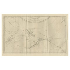
Antique map titled 'Carte des nouvelles decouvertes/ Extrait d'une Carte Japonoise de l'Universe'. Map of the West Coast of North America and North-East Coast of Asia, based upon Buache's report of the various Russian Discoveries between 1731 and 1742 including the various explorers routes and notes. The lower map is based upon a Japanese map taken back to Europe by Kaempfer.
The various Russian discoveries between 1731 and 1742 are shown in the upper map, including the Sea of the West and various explorers routes and notes. The bottom map is based upon a Japanese map taken by Kaempfer back to Europe. It depicts a fascinating and wholly different approach to the two regions.
- Dimensions:Height: 13.78 in (35 cm)Width: 18.78 in (47.7 cm)Depth: 0.02 in (0.5 mm)
- Materials and Techniques:
- Period:
- Date of Manufacture:1772
- Condition:Good, given age. Tiny hole in image; backed and only visble on verso. Original folds as issued. General age-related toning and/or occasional minor defects from handling. Please study images carefully.
- Seller Location:Langweer, NL
- Reference Number:
About the Seller
5.0
Platinum Seller
These expertly vetted sellers are 1stDibs' most experienced sellers and are rated highest by our customers.
Established in 2009
1stDibs seller since 2017
1,947 sales on 1stDibs
Typical response time: <1 hour
- ShippingRetrieving quote...Ships From: Langweer, Netherlands
- Return PolicyA return for this item may be initiated within 14 days of delivery.
More From This SellerView All
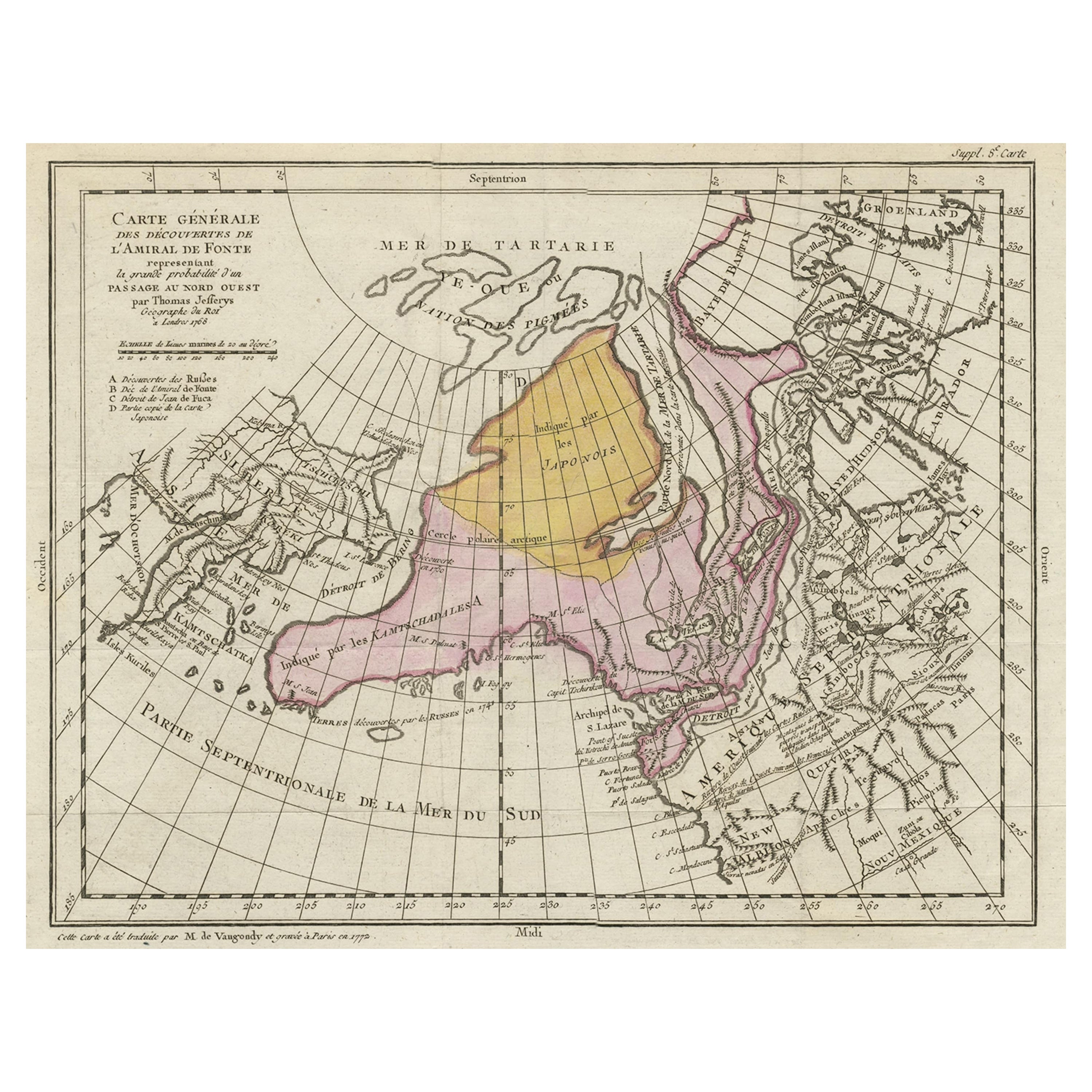
- Interesting Old Map of the Nw Coast of America and the Ne Coast of Asia, ca.1772Located in Langweer, NLAntique map titled 'Carte Generale des Decouvertes de l'Amiral de Fonte (..)'. Original antique map of the discoveries of Admiral de Fonte, showing the possibility of a north-west passage. Interesting map of the NW Coast...Category
Antique 1770s Maps
MaterialsPaper
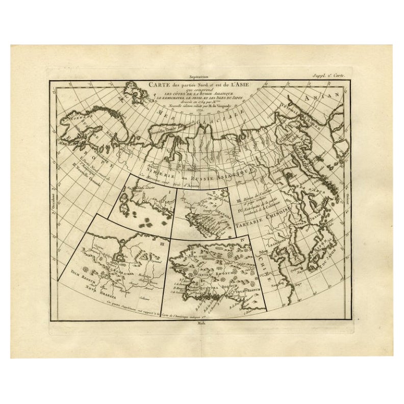
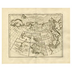
- Antique Map of North and East Asia, 1751Located in Langweer, NLMap 2: 'Carte des parties nord et est de L'Asie'. (Map of the Northern parts and East Asia.) Five maps on one sheet, showing California, Alaska and Siberia, Korea and Japan. South to...Category
Antique 18th Century Maps
MaterialsPaper
- Antique Map of North America Including the West IndiesLocated in Langweer, NLOriginal antique map titled 'Nord-America'. Old map of North America and the West Indies. Also showing British Overseas Territories and Hudson Bay. This map originates from Stiel...Category
Antique Mid-19th Century Maps
MaterialsPaper
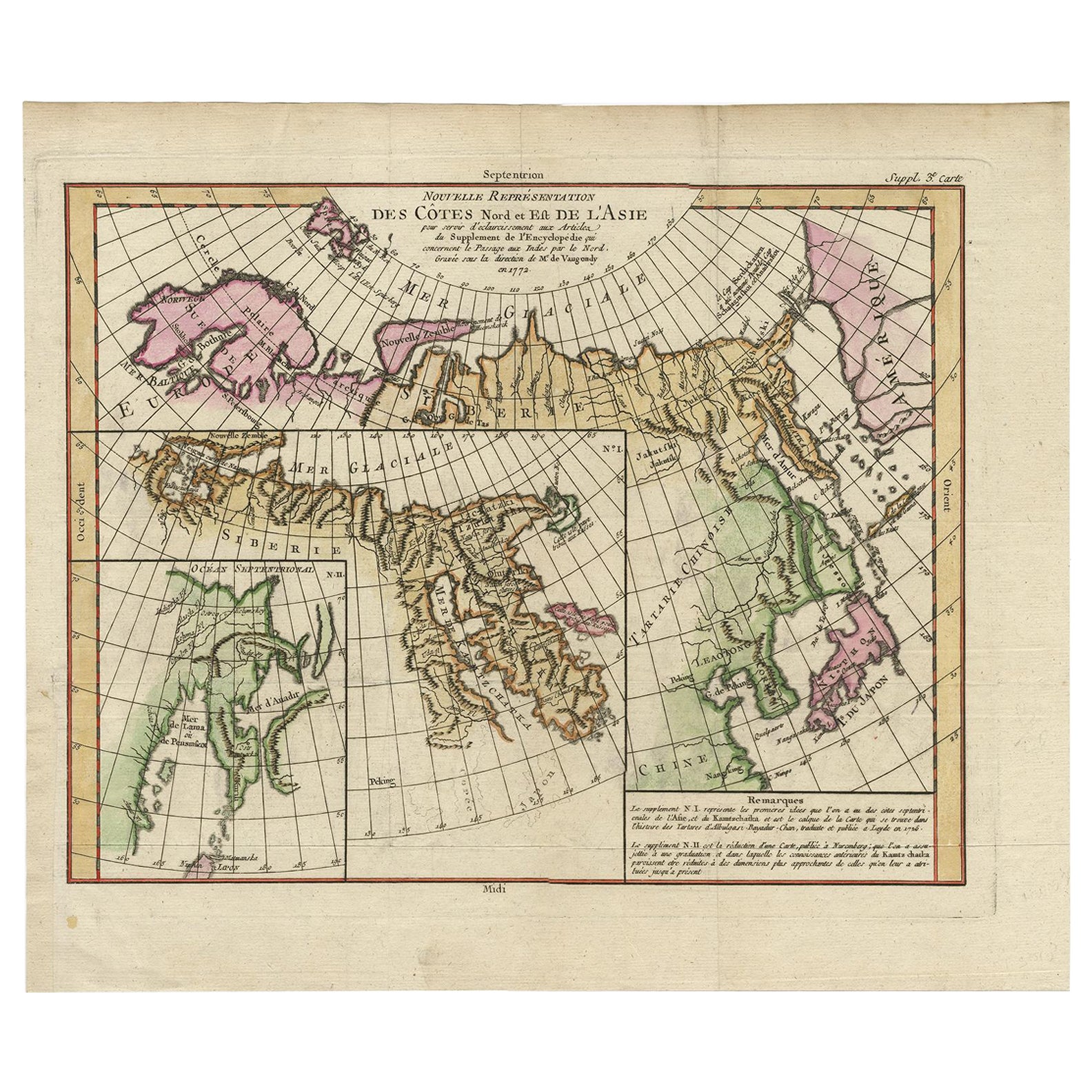
- Map of North and East coast of Asia with Japan & inset maps of Kamchatka, c1750Located in Langweer, NLAntique map titled 'Nouvelle representation des Cotes Nord et Est de L'Asie.' Map the north and east coast of Asia, showing an oddly shaped Japan and inset maps of Kamchatka. Thi...Category
Antique 1750s Maps
MaterialsPaper
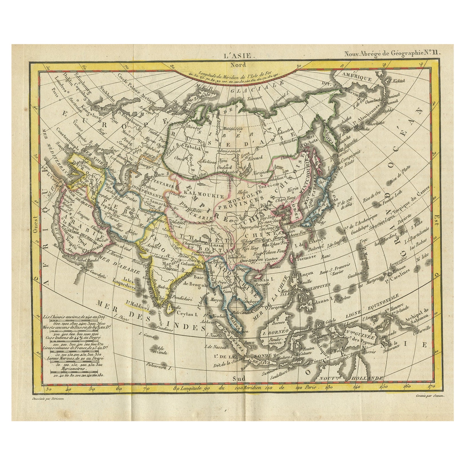
- Antique Map of Asia from the Middle East to the Coast of Alaska, 1816Located in Langweer, NLAntique map titled ‘L’Asie‘. This is an original antique map of Asia, by Hérisson, taken from atlas ""Nouv. Abrége de Géographie"". An engraved map with coloring of Asia from the Mid...Category
Antique 19th Century Maps
MaterialsPaper
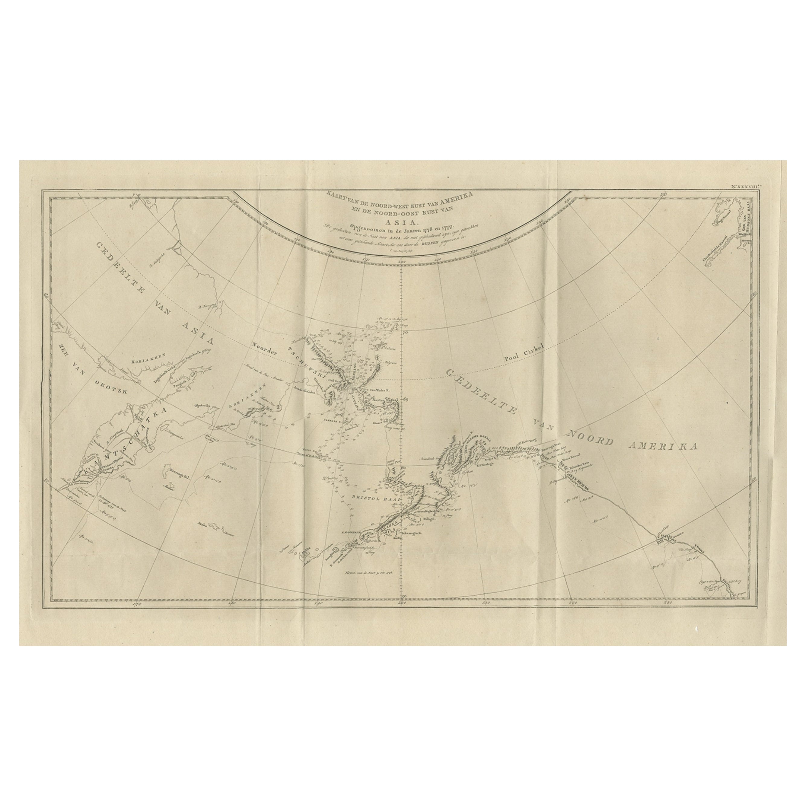
- Old Map Showing the Tracks of Cook Between North America and Asia's Coast, 1803Located in Langweer, NLDescription: Antique map titled 'Kaart van de Noord-West kust van Amerika en de Noord-Oost kust van Asia'. Antique chart depicting America's northwest coast and Asia's northeast ...Category
Antique Early 1800s Maps
MaterialsPaper


You May Also Like
- Large Antique 1859 Map of North AmericaLocated in Sag Harbor, NYThis Map was made by Augustus Mitchell in 1859 It is in amazing condition for being 163 years old. This price is for the rolled up easy to ship version of this piece. I will be Frami...Category
Antique Mid-19th Century American Maps
MaterialsCanvas, Paper

- New Map of North America from the Latest Discoveries, 1763Located in Philadelphia, PAA fine antique 18th century map of the North American seaboard. Entitled "A New Map of North America from the Latest Discoveries 1763". By the Cartographer/Engraver - John Spil...Category
Antique Mid-18th Century English Georgian Maps
MaterialsPaper
- Original Antique Map of South East Asia by Becker, circa 1840Located in St Annes, LancashireGreat map of South East Asia Steel engraving with original color outline Engraved by Becker Published by Virtue, circa 1840. Unframed.Category
Antique 1840s English Other Maps
MaterialsPaper
- Original Antique Map of South East Asia by Thomas Clerk, 1817Located in St Annes, LancashireGreat map of South East Asia Copper-plate engraving Drawn and engraved by Thomas Clerk, Edinburgh. Published by Mackenzie And Dent, 1817 Unframed.Category
Antique 1810s English Maps
MaterialsPaper
- Original Antique Map of Asia. C.1780Located in St Annes, LancashireGreat map of Asia Copper-plate engraving Published C.1780 Two small worm holes to right side of map Unframed.Category
Antique Early 1800s English Georgian Maps
MaterialsPaper

- West Coast of Africa, Guinea & Sierra Leone: An 18th Century Map by BellinBy Jacques-Nicolas BellinLocated in Alamo, CAJacques Bellin's copper-plate map entitled "Partie de la Coste de Guinee Dupuis la Riviere de Sierra Leona Jusquau Cap das Palmas", depicting the coast of Guinea and Sierra Leone in ...Category
Antique Mid-18th Century French Maps
MaterialsPaper


Recently Viewed
View AllMore Ways To Browse
Used Furniture North West
East West Furniture
Antique American 18th Century Furniture
18th Century American Antiques
Antique Furniture North West
American West Antiques
Antique Furniture North East
Map North America
Map Of North America
Late 18th Century Antique American
Route Map
Map Japan
Japan Maps
Map Of American West
Map Of Japan
Antique North America Map
Antique Maps North America
Antique Map North America