Items Similar to Map of North and East coast of Asia with Japan & inset maps of Kamchatka, c1750


Want more images or videos?
Request additional images or videos from the seller
1 of 6
Map of North and East coast of Asia with Japan & inset maps of Kamchatka, c1750
About the Item
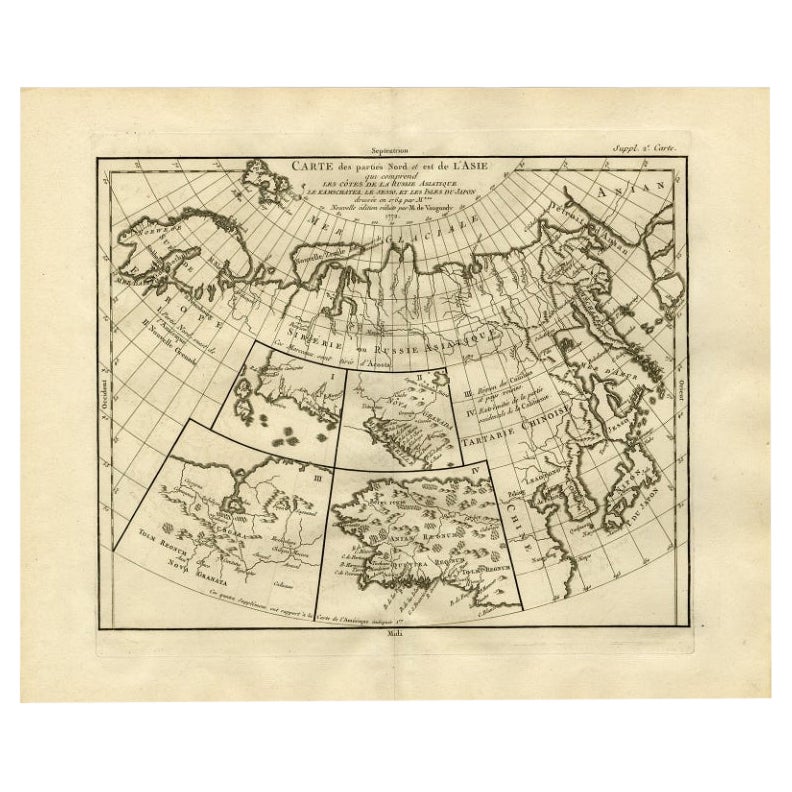
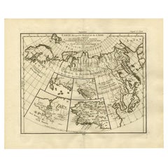
Antique map titled 'Nouvelle representation des Cotes Nord et Est de L'Asie.'
Map the north and east coast of Asia, showing an oddly shaped Japan and inset maps of Kamchatka. This old antique print originates from: 'The Encyclopédie ou Dictionnaire raisonné des sciences, des arts et des métiers, par une Société de Gens de lettres.' which was published under the direction of Diderot and d'Alembert, with 17 volumes of text and 11 volumes of plates between 1751 and 1772. It contained 72,000 articles written by more than 140 contributors. This encyclopdia was a massive reference work for the arts and sciences, as well as a means to propagate the ideas of the French Enlightment. The impact of this encyclopedia was enormous.
Artists and Engravers: Made by 'Gilles Robert de Vaugondy' after 'Denis Diderot'. Denis Diderot (1713-1784) was a French philosopher, art critic and writer. Jean le Rond d'Alembert (1717-1783) was a French mathematician, mechanician, physicist and philosopher. These plates are engraved by J.A.Defehrt and Bonaventure/Benoit-Louis Prevost after J.R Lucotte or Goussier. Gilles Robert de Vaugondy, a French cartographer with connection to the Sanson family, was born 1688 in Paris. He used Sanson's plates and also acquired plates of Jaillot. His major work was the beautiful "Atlas Universel" first issued in 1757. He died 1766 in Paris.
- Dimensions:Height: 14.77 in (37.5 cm)Width: 17.45 in (44.3 cm)Depth: 0 in (0.02 mm)
- Materials and Techniques:
- Period:1750-1759
- Date of Manufacture:circa 1750
- Condition:Wear consistent with age and use. Condition: Good, given age. A few minor crinkles. Original folds as issued. General age-related toning and/or occasional minor defects from handling. Please study image carefully.
- Seller Location:Langweer, NL
- Reference Number:
About the Seller
5.0
Platinum Seller
These expertly vetted sellers are 1stDibs' most experienced sellers and are rated highest by our customers.
Established in 2009
1stDibs seller since 2017
1,947 sales on 1stDibs
Typical response time: <1 hour
- ShippingRetrieving quote...Ships From: Langweer, Netherlands
- Return PolicyA return for this item may be initiated within 14 days of delivery.
More From This SellerView All
- Antique Map of the West Coast of North America & North East Coast of Asia '1772'Located in Langweer, NLAntique map titled 'Carte des nouvelles decouvertes/ Extrait d'une Carte Japonoise de l'Universe'. Map of the West Coast of North America and North-East Coast of Asia, based upon Buache's report of the various Russian Discoveries between 1731 and 1742 including the various explorers routes and notes. The lower map is based upon a Japanese map...Category
Antique Late 18th Century Maps
MaterialsPaper
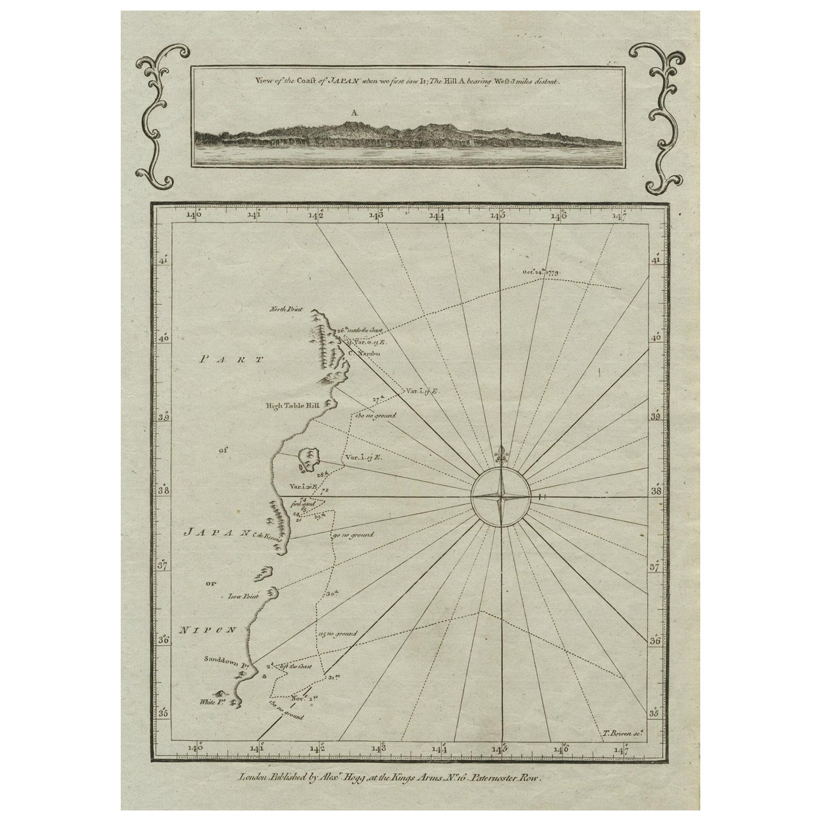
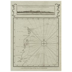
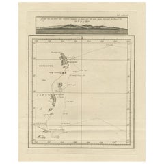
- Old Map of the East Coast of Honshu with an Inset, Japan, c.1785Located in Langweer, NLAntique map titled ‘Part of Japan or Nippon'. View of the Coast of Japan when we first saw it: The Hill a bearing West 3 miles distant. London Published by Allexer Hogg at the Kings Arms...Category
Antique 1780s Maps
MaterialsPaper
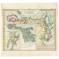
- Antique Map of North and East Asia, 1751Located in Langweer, NLMap 2: 'Carte des parties nord et est de L'Asie'. (Map of the Northern parts and East Asia.) Five maps on one sheet, showing California, Alaska and Siberia, Korea and Japan. South to...Category
Antique 18th Century Maps
MaterialsPaper
- Antique Map of the North and East Coast of Asia by Vaugondy, circa 1750Located in Langweer, NLAntique map titled 'Nouvelle representation des Cotes Nord et Est de L'Asie.' Map the north and east coast of Asia, showing an oddly shaped Japan and inset maps of Kamchatka. Origina...Category
Antique Mid-18th Century Maps
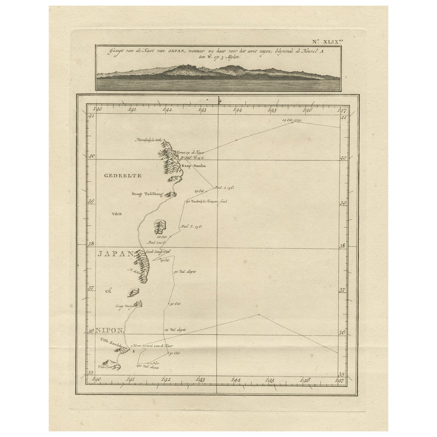
- Map of the East Coast of Hanshu or Honshu & a View of the Japanese Coast, 1803Located in Langweer, NLAntique map titled 'Gedeelte van Japan of Nipon'. Map of the east coast of Hanshu, with a view of the Japanese coast titled 'Gezigt van de Kust van Japan, wanneer wij haar voor h...Category
Antique Early 1800s Maps
MaterialsPaper
- Antique Map of Asia by with an Inset Map of Turkey in Asia, 1868Located in Langweer, NLAntique map Asia titled 'Carte Politique et Ethnographique d'Asie'. Old map of Asia with an inset map of Turkey in Asia. Includes descriptive text box...Category
Antique 19th Century Maps
MaterialsPaper


You May Also Like
- Original Antique Map of South East Asia, Arrowsmith, 1820Located in St Annes, LancashireGreat map of South East Asia Drawn under the direction of Arrowsmith Copper-plate engraving Published by Longman, Hurst, Rees, Orme and Brown, 1820 Unframed.Category
Antique 1820s English Maps
MaterialsPaper
- Original Antique Map of South East Asia by Becker, circa 1840Located in St Annes, LancashireGreat map of South East Asia Steel engraving with original color outline Engraved by Becker Published by Virtue, circa 1840. Unframed.Category
Antique 1840s English Other Maps
MaterialsPaper
- Original Antique Map of South East Asia by Thomas Clerk, 1817Located in St Annes, LancashireGreat map of South East Asia Copper-plate engraving Drawn and engraved by Thomas Clerk, Edinburgh. Published by Mackenzie And Dent, 1817 Unframed.Category
Antique 1810s English Maps
MaterialsPaper
- Original Antique Map of Asia. C.1780Located in St Annes, LancashireGreat map of Asia Copper-plate engraving Published C.1780 Two small worm holes to right side of map Unframed.Category
Antique Early 1800s English Georgian Maps
MaterialsPaper

- Large Antique 1859 Map of North AmericaLocated in Sag Harbor, NYThis Map was made by Augustus Mitchell in 1859 It is in amazing condition for being 163 years old. This price is for the rolled up easy to ship version of this piece. I will be Frami...Category
Antique Mid-19th Century American Maps
MaterialsCanvas, Paper

- New Map of North America from the Latest Discoveries, 1763Located in Philadelphia, PAA fine antique 18th century map of the North American seaboard. Entitled "A New Map of North America from the Latest Discoveries 1763". By the Cartographer/Engraver - John Spil...Category
Antique Mid-18th Century English Georgian Maps
MaterialsPaper


