Items Similar to 1616 Bertius Map of Sumatra, Singapore and the Straits of Malacca


Want more images or videos?
Request additional images or videos from the seller
1 of 8
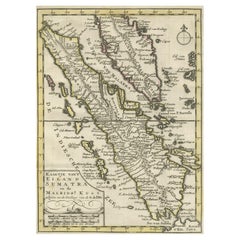
1616 Bertius Map of Sumatra, Singapore and the Straits of Malacca
About the Item
Title: "1616 Bertius Map of Sumatra and the Straits of Malacca"
Description: This is an exquisite 1616 original antique map by Petrus Bertius, titled "Sumatra Insula," showcasing Sumatra and the southern tip of Malaysia, with a unique early depiction of Singapore as 'Sinca: pura'. Oriented with north to the right, it stands as one of the earliest detailed maps emphasizing the Straits of Malacca. The map, never folded, is in very good condition, with light age-related browning at the margins and attractive old-time coloring. Latin text on the reverse side adds to its historical allure, making it a remarkable piece for collectors.
Petrus Bertius was a Flemish philosopher, theologian, historian, geographer, and cartographer, known for his work in mathematics, historical, and theological areas. He published an edition of Ptolemy's "Geographia" and is recognized for his contributions to cartography. Bertius was born in 1565 in Flanders and fled to London with his family for religious reasons, later studying at the University of Leiden. He had a significant academic career but eventually moved to France, where he became the cosmographer to Louis XIII and converted to Catholicism. He passed away in Paris in 1629.
- Dimensions:Height: 4.73 in (12 cm)Width: 7.49 in (19 cm)Depth: 0 in (0.02 mm)
- Materials and Techniques:Paper,Engraved
- Period:Early 17th Century
- Date of Manufacture:1616
- Condition:The map, never folded, is in very good condition, with light age-related browning at the margins and attractive old-time coloring. Latin text on the reverse. Study the images carefully.
- Seller Location:Langweer, NL
- Reference Number:
About the Seller
5.0
Platinum Seller
These expertly vetted sellers are 1stDibs' most experienced sellers and are rated highest by our customers.
Established in 2009
1stDibs seller since 2017
1,946 sales on 1stDibs
Typical response time: <1 hour
- ShippingRetrieving quote...Ships From: Langweer, Netherlands
- Return PolicyA return for this item may be initiated within 14 days of delivery.
More From This SellerView All
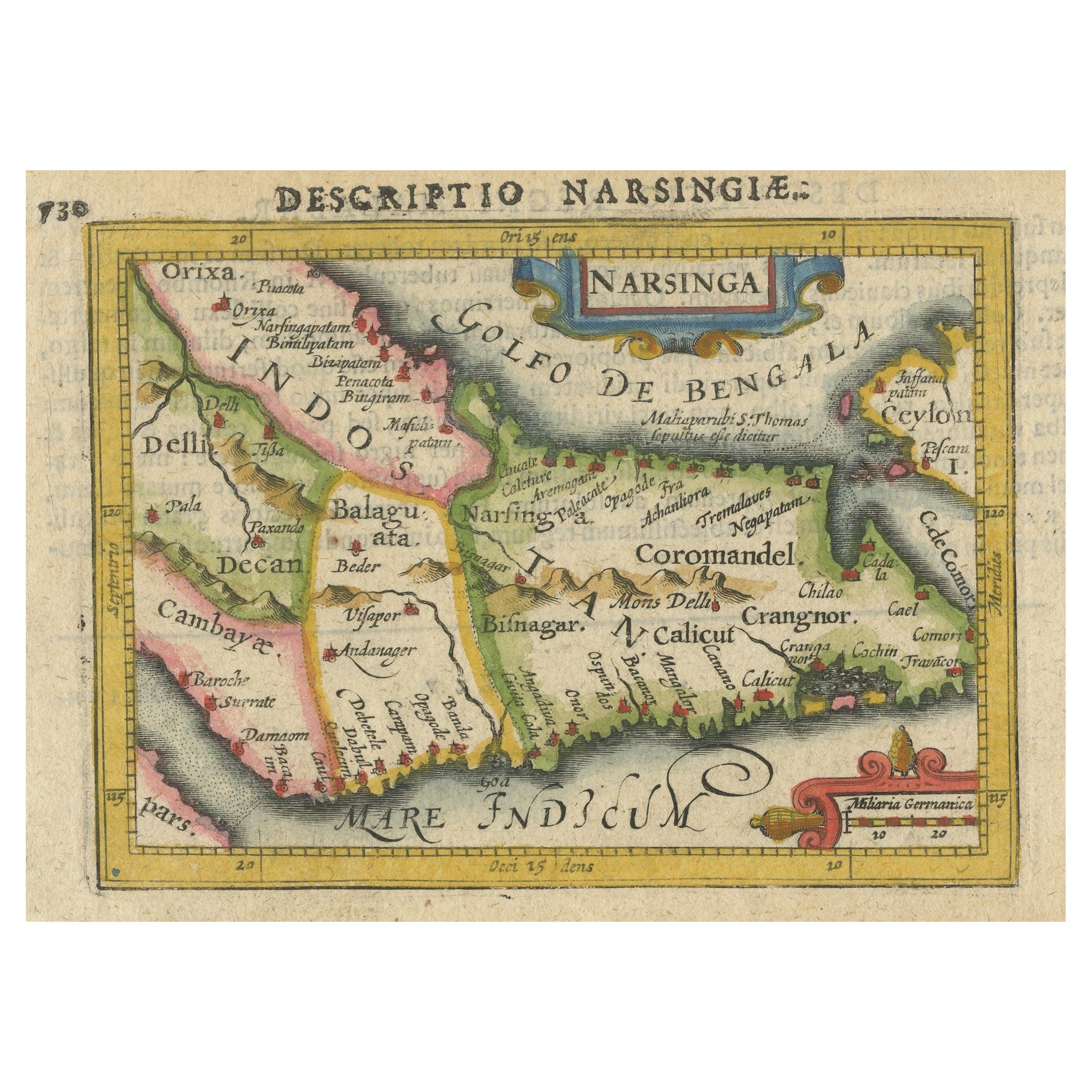
- Colorful and Decorative Miniature Map of India, Ceylon by Bertius 1616Located in Langweer, NLOld 17th century miniature antique map of India - Ceylon from the 1616 edition of Jadocus Hondius Atlas by Petrus Bertius. Original copperplate engraving with hand coloring. Carto...Category
Antique 17th Century Maps
MaterialsPaper
- Authentic Old Map of Sumatra, Malaysia and Singapore, 1745Located in Langweer, NLTitle: "Kaartje van't Eiland Sumatra en de Maleidse Kust gelegen na de stelling van de G. de L'Isle" Published by Jacob Keizer and by Jan de Lat Creator: Keizer, Jacob, active 1706...Category
Antique 1740s Maps
MaterialsPaper
- Antique Map of Singapore, Malaysia, Borneo, Sumatra and Java (Indonesia), 1739Located in Langweer, NL"Antique map titled 'Nieuwe kaart van de Sundasche Eilanden als Borneo, Sumatra en Groot Iava & c'. Detailed map of Southeast Asia, extending from the tip of Cambodia to Java. This m...Category
Antique 18th Century Maps
MaterialsPaper
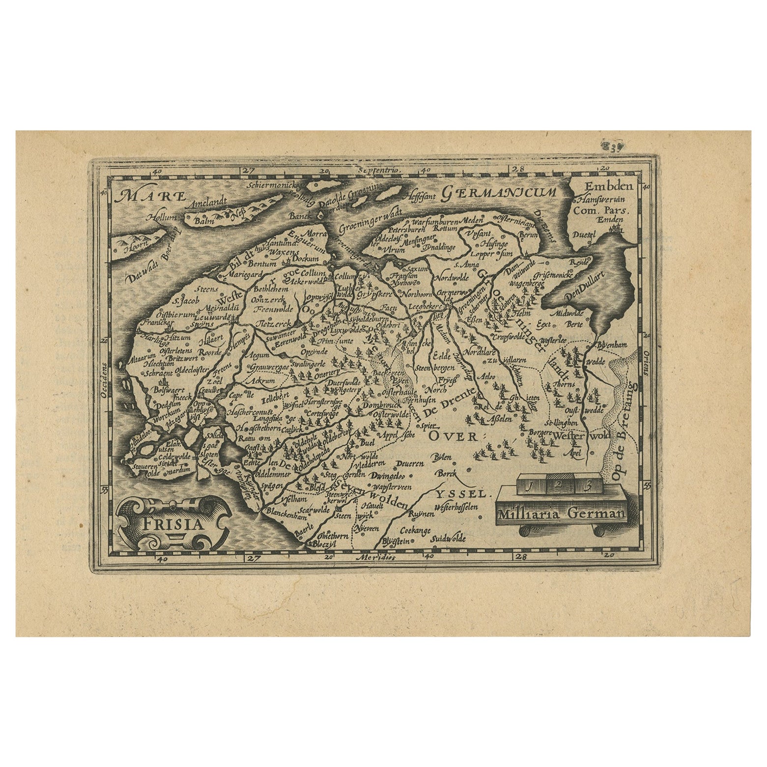
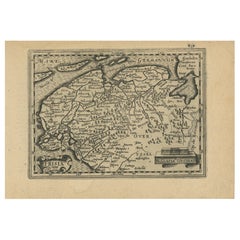
- Antique Map of Friesland and Groningen in The Netherlands, 1616Located in Langweer, NLAntique map titled 'Frisia'. Small map of the province of Friesland, the Netherlands. This map originates from 'Omnium Belgii, sive Inferioris Germaniae, regionum descriptio' by ...Category
Antique 17th Century Maps
MaterialsPaper
- Antique Miniature Map of the Turkish Empire by Bertius '1618'Located in Langweer, NLAntique miniature map titled 'Turcicum Imperium'. Rare miniature map of the Turkish Empire. This map originates from 'Tabularum Geographicarum Contractarum Libri septem (..)' by P. B...Category
Antique Early 17th Century Maps
MaterialsPaper
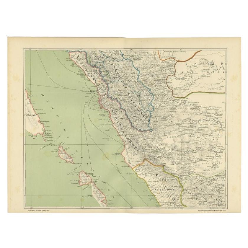
- Antique Map of the Mentawai Islands, Sumatra, 1900Located in Langweer, NLAntique map of the Mentawai Islands, Sumatra. Also depicting the region of Padang. This map originates from 'Atlas van Nederlandsch Oost- en West-Indië' by I. Dornseiffen. Artists ...Category
20th Century Maps
MaterialsPaper


You May Also Like
- 17th Century John Speed Map of the Barkshire Described, c.1616By John SpeedLocated in Royal Tunbridge Wells, KentAntique 17th century British very rare and original John Speed (1551-1629) map of the Barkshire Described, J. Sud and Georg Humble, publication (1616 or lat...Category
Antique 17th Century British Maps
MaterialsPaper
- Map of the Republic of GenoaLocated in New York, NYFramed antique hand-coloured map of the Republic of Genoa including the duchies of Mantua, Modena, and Parma. Europe, late 18th century. Dimension: 25...Category
Antique Late 18th Century European Maps
- Map of the Kingdom of Sardinia and Part of the Kingdom of Genoa, RomeBy Giovanni Maria CassiniLocated in Hamilton, Ontario18th century map by Italian engraver Giovanni Maria Cassini (Italy 1745-1824). Map of Part of the Kingdom of Sardinia and Part of the Kingdom of Genoa: Rome. This is a hand colored a...Category
Antique 18th Century Italian Maps
MaterialsPaper
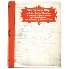
- Vinland Map and the Tartar RelationBy Thomas E. Marston, George D. Painter, R.A. SkeltonLocated in valatie, NYThe Vinland Map and the Tartar Relation. New Haven: Yale University Press, 1965. First edition third printing hardcover with dust jacket. 291 pp. A historical cartography of the Vinl...Category
20th Century American Books
MaterialsPaper
- Colored wall map of the WORLDBy ChambonLocated in ZWIJNDRECHT, NL“Mappe Monde, contenant les Parties Connues du Globe Terrestre” CHAMBON, Gobert-Denis (France, 17.. - 1781) Paris, Longchamps et Janvier, 1754 Size H. 115 x W. 145 cm. Gobert-Denis Chambon made copper engraving after the work of Guillaume De L’Isle, published in 1754 by Jean Janvier and S.G. Longschamps. A huge wall map of the world in two hemispheres printed on two sheets, depicting the Eastern and Western hemispheres supported by two male figures, decorated at the bottom right and left with two celestial hemispheres (boreal and southern) and at the bottom in the middle with an armillary sphere, in addition. This map is most notable for its depiction of the Sea of Japan labeled "Mer de Corée" and of "Mer de L'Ouest" or Sea of the West - a great sea, easily the size of the Mediterranean, to flow from the then-known Strait of Juan de Fuca...Category
Antique Mid-18th Century French French Provincial Maps
MaterialsWood, Paper

- Map "Estuary- Mouth of the Thames"Located in Alessandria, PiemonteST/426 - Antique French Map of the estuary of the Thames, map dated 1769 - "Mape of the entrance of the Thames. Designed by filing of Navy cards fo...Category
Antique Mid-18th Century French Other Prints
MaterialsPaper


Recently Viewed
View AllMore Ways To Browse
Blackwood Furniture
The Malay Archipelago
Antique Map Alabama
Fiji Map
Antique Map Of Southeastern Us
Malay Archipelago Map
Map Prussia Germany
Bad Bentheim
English County Maps By Blaeu
Map Of Lebanon
Wenceslas Hollar
Poired Metal
Antique Map Austro Hungarian
Arkansas Indian Map
Antique Cabbage Cutter
Brinkman Co
Eso Antique Maps
Map Of Charlevoix