
1883 "Map of Texas and Indian Territory" by Hiram H. Hardesty
View Similar Items


Want more images or videos?
Request additional images or videos from the seller
1 of 5
1883 "Map of Texas and Indian Territory" by Hiram H. Hardesty
About the Item
- Dimensions:Height: 38.13 in (96.86 cm)Width: 32 in (81.28 cm)Depth: 2 in (5.08 cm)
- Materials and Techniques:
- Place of Origin:
- Period:
- Date of Manufacture:1883
- Condition:Additions or alterations made to the original: New archival custom framing by Art Source International in January of 2023. Wear consistent with age and use. Minor structural damages.
- Seller Location:Colorado Springs, CO
- Reference Number:Seller: M3111stDibs: LU909733295742
About the Seller
4.9
Platinum Seller
These expertly vetted sellers are 1stDibs' most experienced sellers and are rated highest by our customers.
Established in 2010
1stDibs seller since 2011
402 sales on 1stDibs
Typical response time: 1 hour
More From This SellerView All
- "San Francisco, Upper California” 1851 Antique Map of San FranciscoLocated in Colorado Springs, COThis is a pictorial lettersheet view of the city and harbor of San Francisco. This lithograph was printed on grey wove paper, across a double sheet, by famed lithographers Britton & ...Category
Antique 1850s American Prints
MaterialsPaper
 $1,200 Sale Price20% Off
 - 1908 "Map of Texas" by The Kenyon CompanyLocated in Colorado Springs, COPresented is an antique map of the state of Texas, printed as a pocket map in 1908 by The Kenyon Company. The state map is brightly colored by county, with principal cities and towns listed. The congressional districts are numbered and boldly outlined in red. Rivers, roads, and railroads all appear prominently on this fantastic map...Category
Antique Early 1900s American Maps
MaterialsPaper
- Antique Map of Paris, "Carte Routiere des Environs de Paris" 1841Located in Colorado Springs, COThis beautiful hand-colored road map of Paris was published in 1841. The map shows Paris and the surrounding area in a folding pocket map. Organized and detailed for travelers, this ...Category
Antique 1840s French Maps
MaterialsPaper
- 1847 Antique Map of Mexico, Texas and California by Samuel Augustus MitchellBy Samuel Augustus Mitchell 1Located in Colorado Springs, COPresented is the second edition of Samuel Augustus Mitchell's Map of Mexico, Including Yucatan & Upper California, an important map showing the progress of the Mexican-American War. ...Category
Antique 1840s American Maps
MaterialsPaper
- 1859 "Colton's New Map of the State of Texas..." by Johnson & BrowningLocated in Colorado Springs, COPresented is "Colton's New Map of the State of Texas Compiled from De Cordova's Large Map", published in Alivin J. Johnson’s “New Illustrated Family Atlas.” The map was published in ...Category
Antique 1850s American Maps
MaterialsPaper
- “The Restaurant of the House of Representatives” Engraving by Harper's WeeklyLocated in Colorado Springs, COThis original wood engraving is titled “The Restaurant of the House of Representatives, Washington, DC.” It was published as a double-page image, in the August 12, 1893 issue of the famous 19th century newspaper Harper’s Weekly. The print was illustrated by Charles Stanley Reinhardt. The House Restaurant, a unique part of life in the Capitol, has been in the same location since the 1857 Capitol Expansion. Congressional members’ busy work schedule made the availability of food on site a necessity. But the restaurant also served as an informal meeting spot for members to continue conversations and deal making. This 1893 print illustrates the convivial atmosphere. Details including elegantly dressed tables...Category
Antique 1890s American Prints
MaterialsPaper


You May Also Like
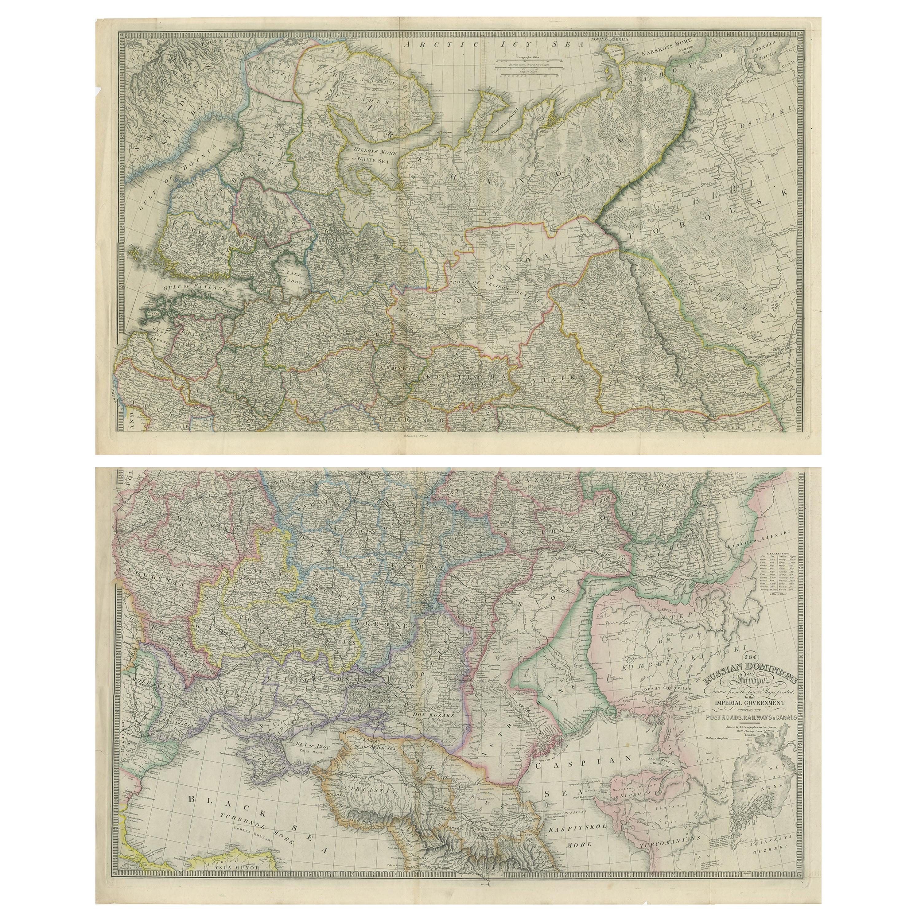
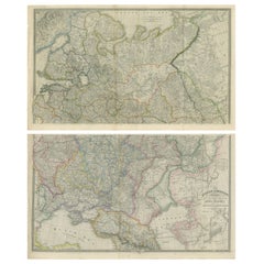
- Set of 2 Antique Maps of Russia by Wyld, 1883Located in Langweer, NLAntique map titled 'The Russian Dominions in Europe (..)'. Two separate sheets of Russia, remarkably detailed. Published by James Wyld, 1883. Please note, the last image is an imp...Category
Antique Late 19th Century Maps
MaterialsPaper
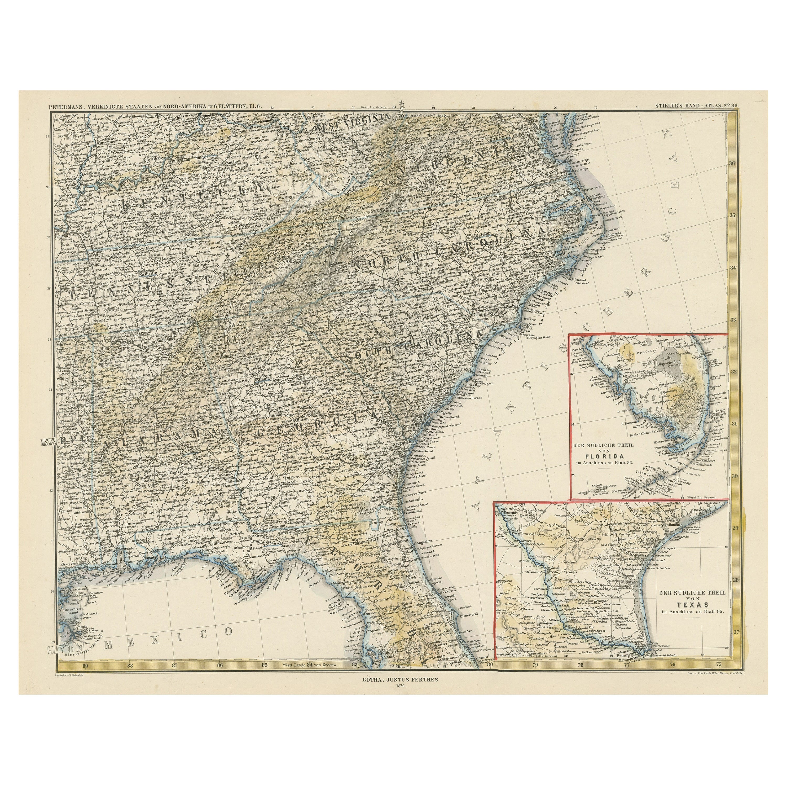
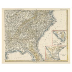
- Antique Map of the Region of Georgia with Inset Maps of Florida and TexasLocated in Langweer, NLAntique map of part of the United States showing Alabama, Georgia, North Carolina, South Carolina, Tennessee, Kentucky, Virginia and part of Florida. With inset maps of the southern ...Category
Antique Late 19th Century Maps
MaterialsPaper
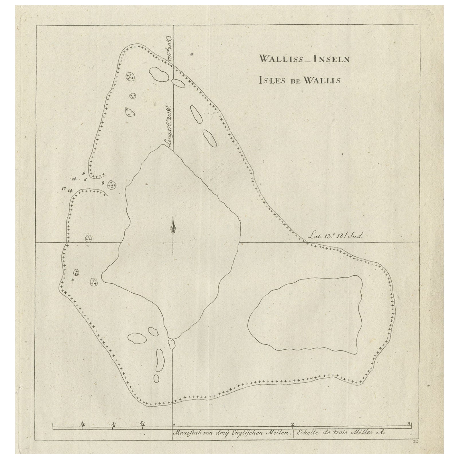
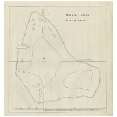
- Antique Map of the Wallis and Futuna Islands, French Overseas Territory, 1778Located in Langweer, NLAntique map titled 'Walliss Inseln, Isles de Wallis'. Old map of the Wallis and Futuna Islands, officially Territory of the Wallis and Futuna Islands, French overseas territory. The ...Category
Antique 18th Century Maps
MaterialsPaper
- Antique Map of the Eastern United States with Inset Map of TexasLocated in Langweer, NLAntique map titled 'Verein-Staaten von Nord-America mit Ausnahme Florida's und der Westlichen Territorien'. This map extends as far west as Louisiana and only includes the northern p...Category
Antique Mid-19th Century Maps
MaterialsPaper
 $479 Sale Price20% Off
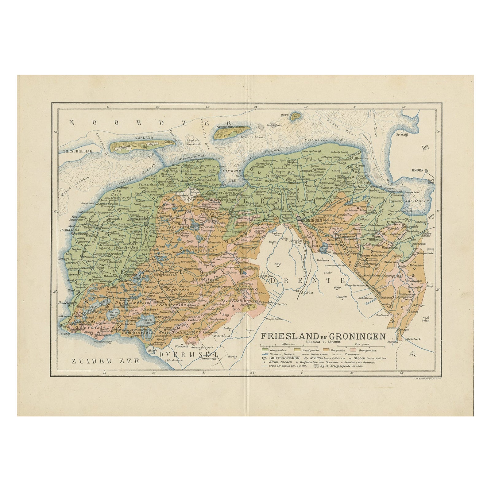
 - Antique Map of the Dutch Most Northern Provinces Friesland and Groningen, 1883Located in Langweer, NLAntique map titled 'Friesland en Groningen'. Map of Friesland and Groningen, provinces of the Netherlands. This map originates from 'Atlas van Nederland volgens de nieuwe spelregels'...Category
Antique 19th Century Maps
MaterialsPaper
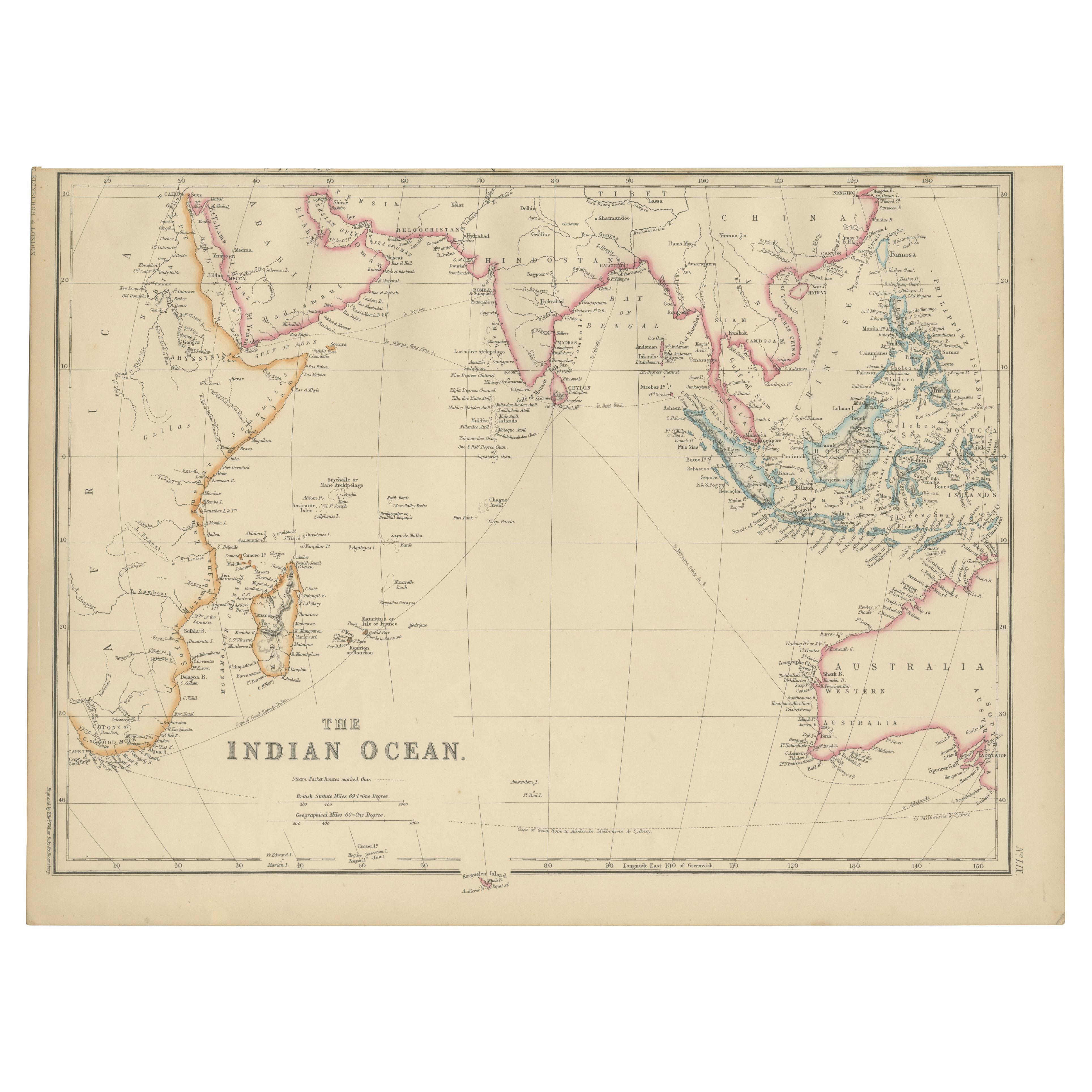
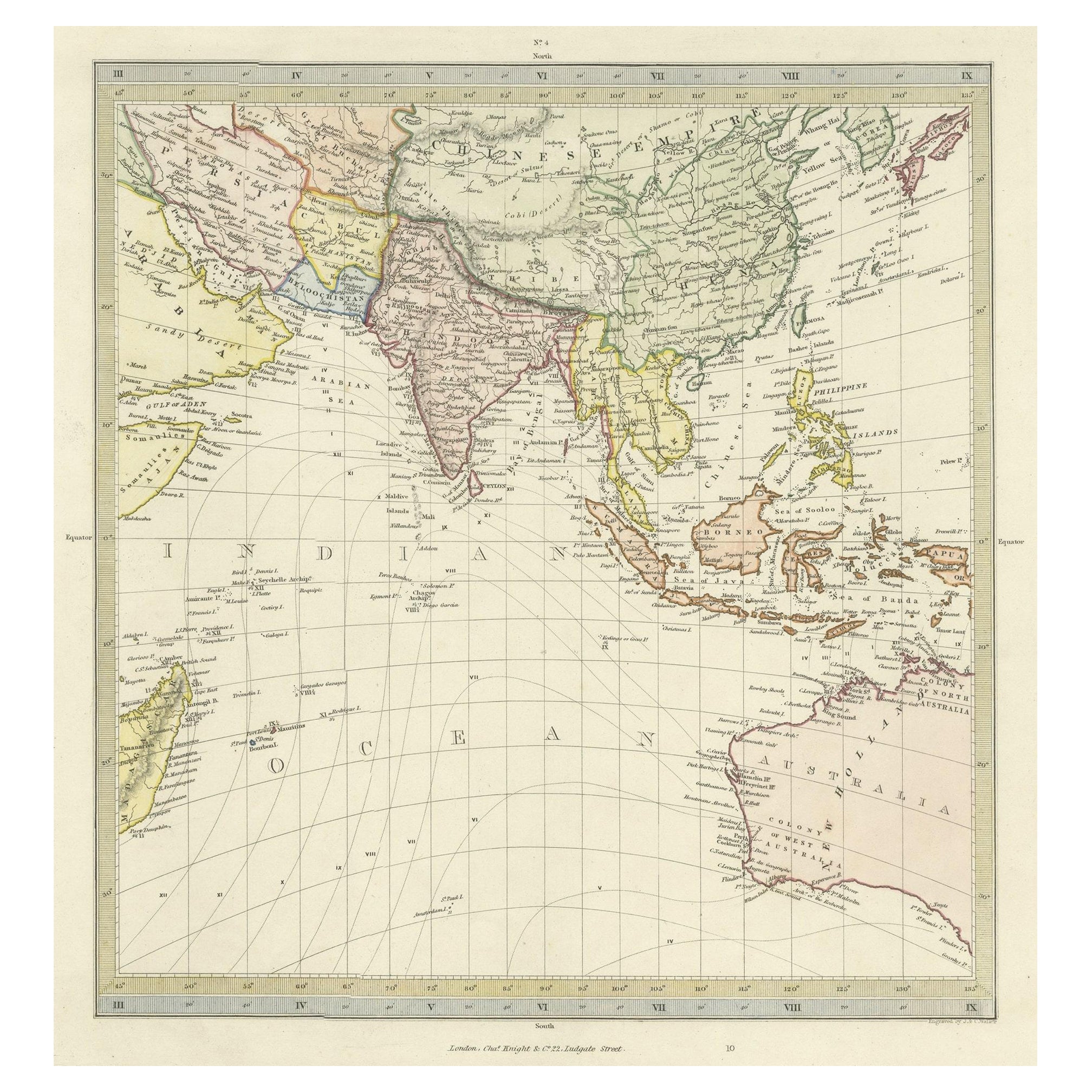
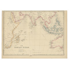
- Antique Map of the Indian Ocean by W. G. Blackie, 1859Located in Langweer, NLAntique map titled 'The Indian Ocean'. Original antique map of the Indian Ocean. This map originates from ‘The Imperial Atlas of Modern Geography’. Published by W. G. Blackie, 1859.Category
Antique Mid-19th Century Maps
MaterialsPaper

Recently Viewed
View AllMore Ways To Browse
Texas Furniture
Texan Furniture
Texas Used Furniture
Used Furniture In Texas
West Indian Furniture
Tom Green
Early Texas Furniture
Population Of Antique
Antique Wooden Indians
Antique Wooden Indian
Indian Antique Wooden Furniture
Toms Antique
Antique Tom
Antique Sterling Cross
Texas Maps
Texas Map
Map Of Texas
Large Wooden Cross