Items Similar to Antique Plan of the City of Calcutta 'India' by Letts, 1883


Want more images or videos?
Request additional images or videos from the seller
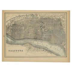
Antique Plan of the City of Calcutta 'India' by Letts, 1883
About the Item
Beautiful colored plan showing buildings (with key), Fort William, race ground, canals, railroads, etc. This plan originates from Letts's Popular Atlas.
- Dimensions:Height: 12.72 in (32.3 cm)Width: 17.01 in (43.2 cm)Depth: 0.02 in (0.5 mm)
- Materials and Techniques:
- Period:
- Date of Manufacture:1883
- Condition:Please study image carefully.
- Seller Location:Langweer, NL
- Reference Number:
About the Seller
5.0
Platinum Seller
These expertly vetted sellers are 1stDibs' most experienced sellers and are rated highest by our customers.
Established in 2009
1stDibs seller since 2017
1,950 sales on 1stDibs
Typical response time: <1 hour
- ShippingRetrieving quote...Ships From: Langweer, Netherlands
- Return PolicyA return for this item may be initiated within 14 days of delivery.
More From This SellerView All
- Antique Plan of the City of Bayonne, FranceLocated in Langweer, NLAntique map titled 'Plan de Bayonne'. Original old plan of the city of Bayonne, France. This map originates from 'Le Petit Atlas Maritime (..)' by J.N. Bellin. Published 1764. Be...Category
Antique Mid-18th Century Maps
MaterialsPaper
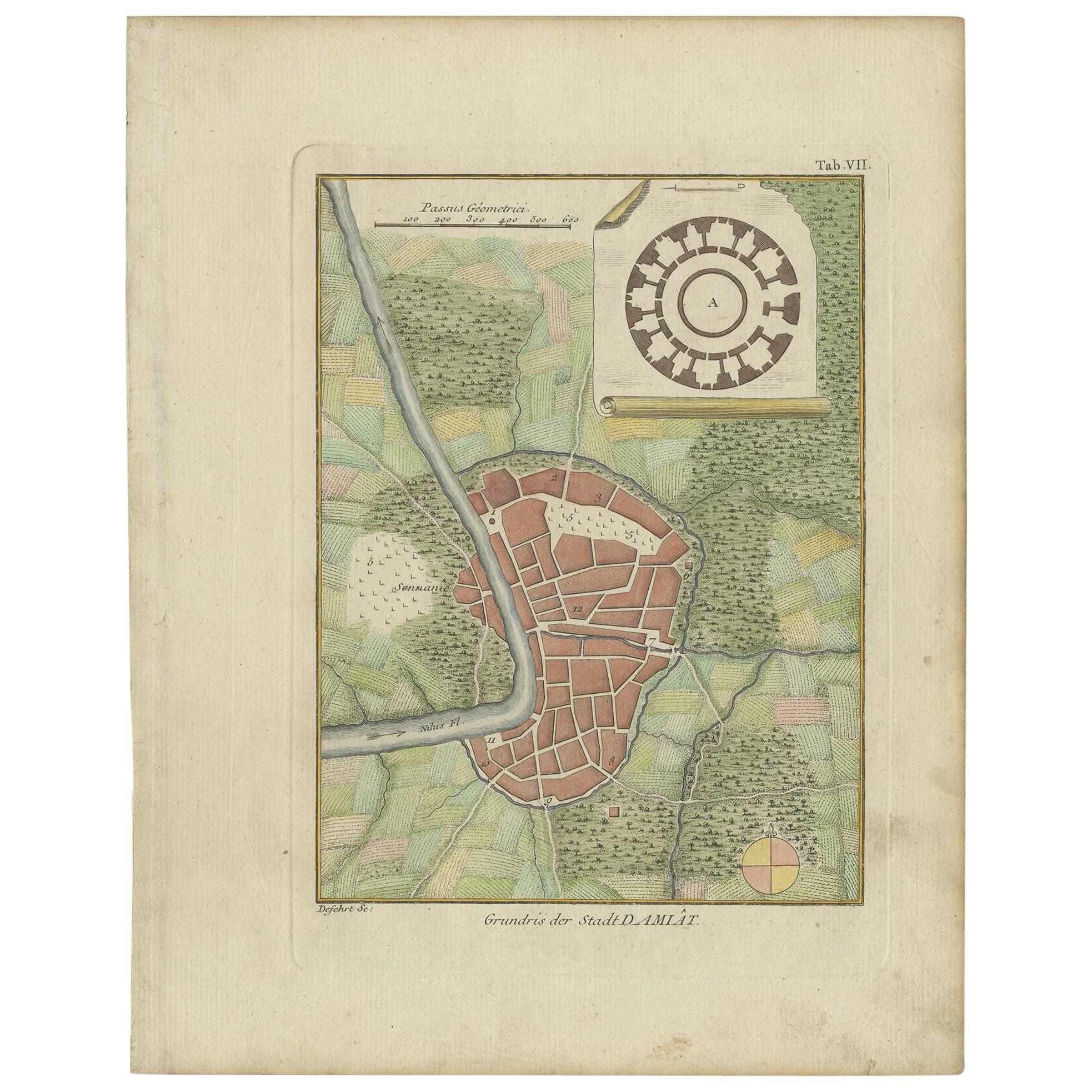
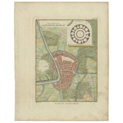
- Antique Plan of the City of Damietta Egypt by C. Niebuhr, 1774Located in Langweer, NLAntique print titled 'Grundris der Stadt Damiât'. This print originates from 'Reisebeschreibung nach Arabien und andern umliegenden Ländern' by C. Niebuhr, 1774.Category
Antique Late 18th Century Prints
MaterialsPaper
- Rare Antique Map of Calcutta 'Kolkata' in India, 1893Located in Langweer, NLAntique map titled 'Calcutta (India)'. Old map of Calcutta/Kolkata, India. On verso, a map of Egypt, Arabia, Upper Nubia and Abyssinia. Originates from 'The Columbian World's Fair at...Category
Antique 19th Century Maps
MaterialsPaper
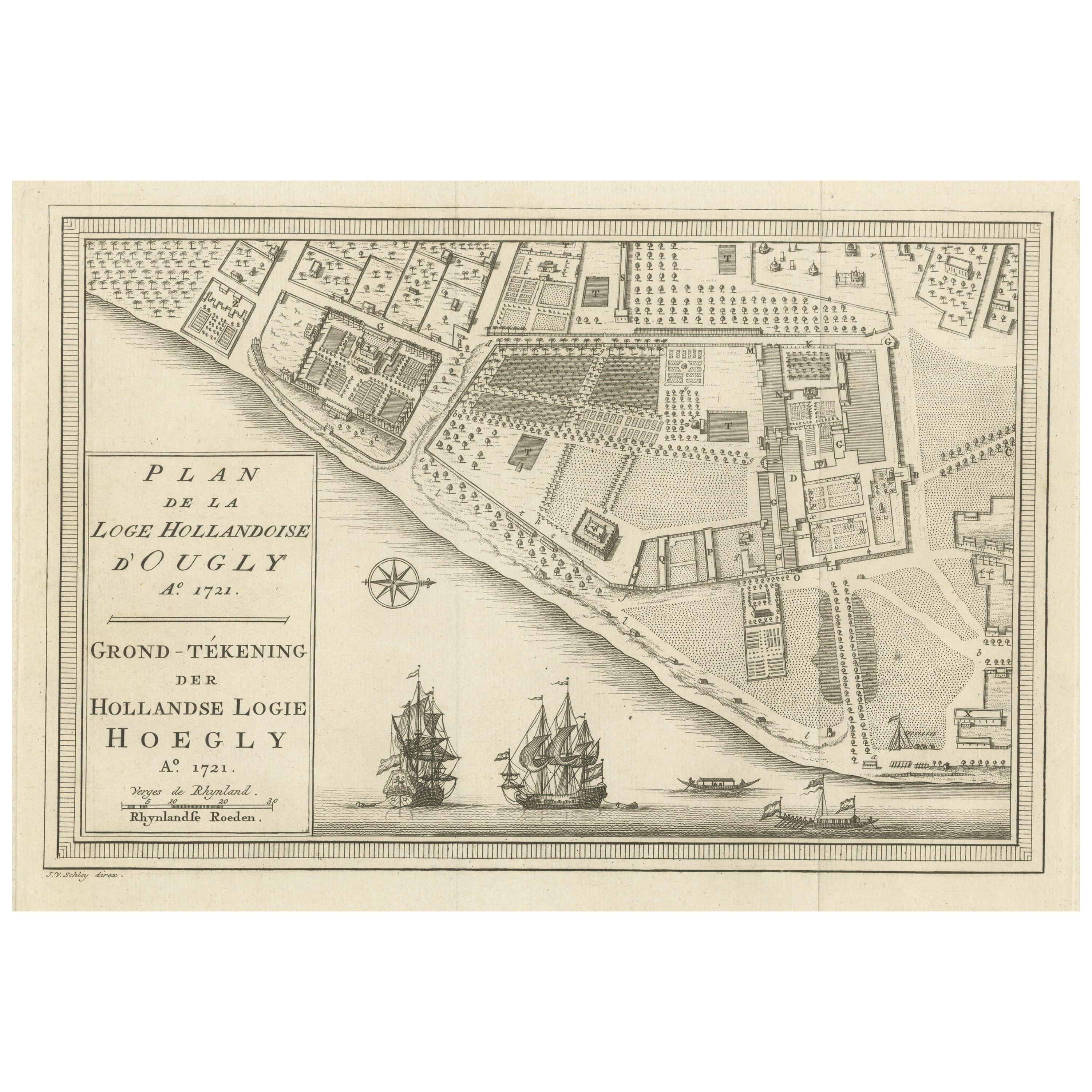
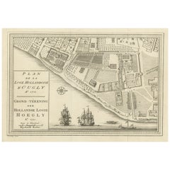
- Original Antique Plan of the Dutch Settlement at Chinsura-Hooghly, India, 1746Located in Langweer, NLAntique print, titled: 'Plan de la Loge Hollandoise d'Ougly'. A plan of the Dutch settlement at Chinsura-Hooghly, India. This print originates from Prevost's 'Histoire Generale d...Category
Antique 1740s Maps
MaterialsPaper
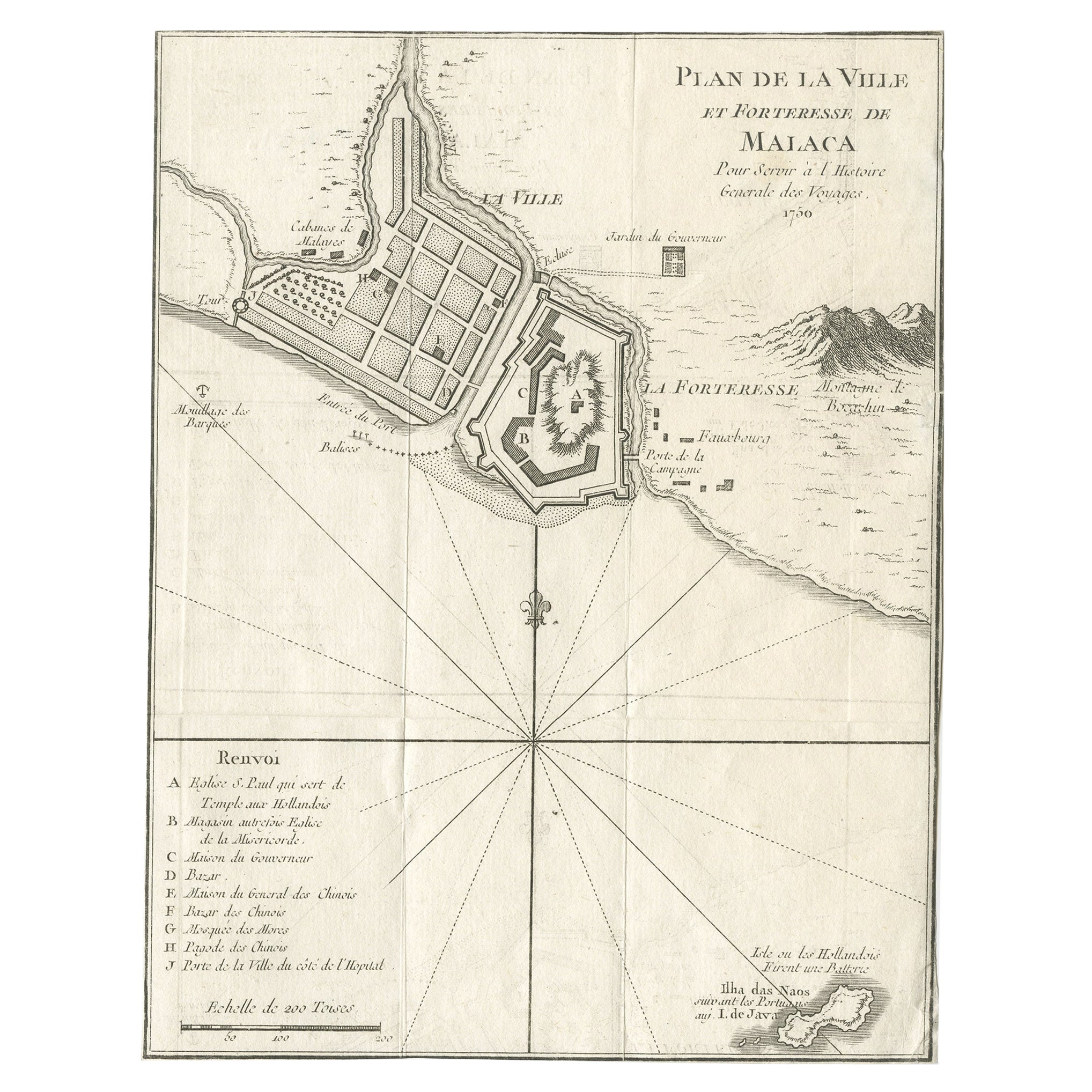
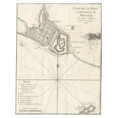
- Detailed Original Antique Plan of the City and Fort of Malacca, Malaysia, 1764Located in Langweer, NLDescription: Antique map titled 'Plan de la Ville et Forteresse de Malaca'. Detailed plan of the city and fort of Malacca on the southern Malay Peninsula, commanding the strategic st...Category
Antique 1760s Maps
MaterialsPaper
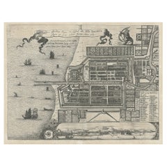
- Antique Plan of the Castle & City of Batavia 'Jakarta' on Java, Indonesia, c1669Located in Langweer, NLAntique map Batavia titled 'Ware Affbeeldinge wegens het Casteel ende Stadt Batavia'. Antique print of the castle and city of Batavia on the Island of Java'. Rare edition with En...Category
Antique 1660s Maps
MaterialsPaper

You May Also Like
- Original Antique Map / City Plan of Brussels by Tallis, circa 1850Located in St Annes, LancashireGreat map of Brussels. Steel engraving. Published by London Printing & Publishing Co. (Formerly Tallis), C.1850 Free shipping.Category
Antique 1850s English Maps
MaterialsPaper
- Catalogue of Engraved Views, Plans, Etc., Of New York City, 1st EdLocated in valatie, NYA catalogue of engraved views, plans, etc., Of New York City, (The Collection of Percy R. Pyne II). Privately Printed by The De Vinne Press, New York, 1912. Limited to 100 copies. Gr...Category
Early 20th Century American Books
MaterialsPaper
- Original Antique Map of India. C.1780Located in St Annes, LancashireGreat map of India Copper-plate engraving Published C.1780 Three small worm holes to right side of map and one bottom left corner Unframed.Category
Antique Early 1800s English Georgian Maps
MaterialsPaper

- Dutch Map and City Plan of La Roche-sur-Foron, France, 17th Century Hand ColoredBy Coenraet DeckerLocated in Alamo, CA"Rupes Allobrogum vulgo La Roche" by Dutch engraver Coenraet Decker (1650-1685) is from the atlas Theatrum Statuum Regiae Celestudinis Sabaudiae Ducis, published in 1682. This richly...Category
Antique Late 17th Century Dutch Maps
MaterialsPaper
- Original Antique City Plan of Kansas City, USA. 1894By Rand McNally & Co.Located in St Annes, LancashireFabulous colorful map of Kansas City Original color By Rand, McNally & Co. Published, 1894 Unframed Slightly reduced bottom margin. Free shipping.Category
Antique 1890s American Maps
MaterialsPaper
- Original Antique Map of The World by Thomas Clerk, 1817Located in St Annes, LancashireGreat map of The Eastern and Western Hemispheres On 2 sheets Copper-plate engraving Drawn and engraved by Thomas Clerk, Edinburgh. Published by Mackenzie And Dent, 1817 ...Category
Antique 1810s English Maps
MaterialsPaper


