Items Similar to Antique Map of the Batu Islands by Dornseiffen, 1900

Want more images or videos?
Request additional images or videos from the seller
1 of 5
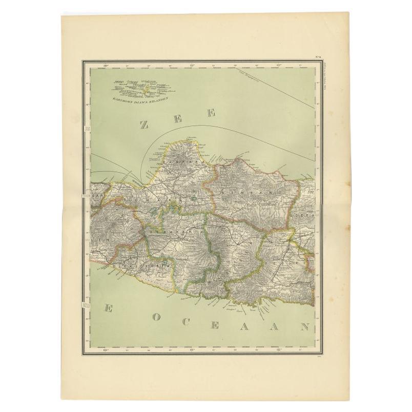
Antique Map of the Batu Islands by Dornseiffen, 1900
About the Item
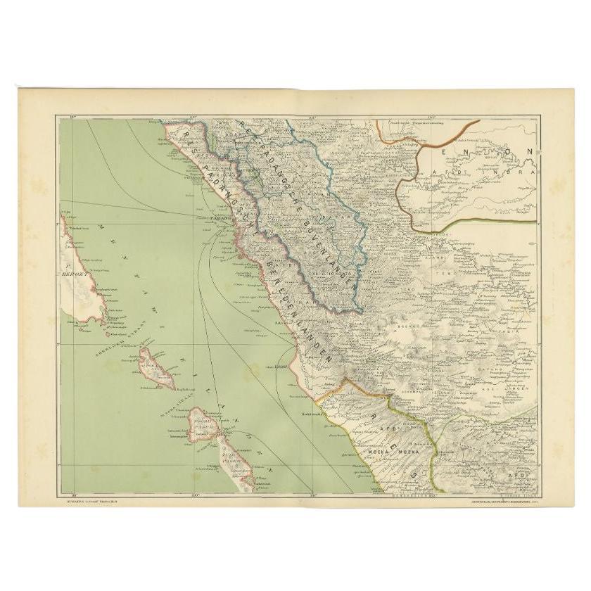
Antique map of the Batu Islands with the large title 'Soematra, Bangka en de Riouw-Lingga Archipel'. This map originates from 'Atlas van Nederlandsch Oost- en West-Indië' by I. Dornseiffen. Artists and Engravers: Published by Seyffardt's Boekhandel, Amsterdam.
Artist: Published by Seyffardt's Boekhandel, Amsterdam.
Condition: Very good, general age-related toning. Please study image carefully.
Date: 1900
Overall size: 52 x 38.9 cm.
Image size: 0.001 x 45.9 x 35.5 cm.
Antique prints have long been appreciated for both their aesthetic and investment value. They were the product of engraved, etched or lithographed plates. These plates were handmade out of wood or metal, which required an incredible level of skill, patience and craftsmanship. Whether you have a house with Victorian furniture or more contemporary decor an old engraving can enhance your living space. We offer a wide range of authentic antique prints for any budget.
- Dimensions:Height: 15.32 in (38.9 cm)Width: 20.48 in (52 cm)Depth: 0 in (0.01 mm)
- Materials and Techniques:
- Period:
- Date of Manufacture:1900
- Condition:
- Seller Location:Langweer, NL
- Reference Number:
About the Seller
5.0
Platinum Seller
These expertly vetted sellers are 1stDibs' most experienced sellers and are rated highest by our customers.
Established in 2009
1stDibs seller since 2017
1,959 sales on 1stDibs
Typical response time: <1 hour
- ShippingRetrieving quote...Ships From: Langweer, Netherlands
- Return PolicyA return for this item may be initiated within 14 days of delivery.
More From This SellerView All
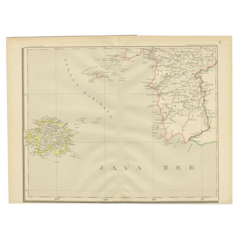
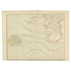
- Antique Map of the Java Sea by Dornseiffen, 1900Located in Langweer, NLAntique map of the Java Sea. Also depicts Bilitung, the Karimata Islands and Sukadana, Borneo. This map originates from 'Atlas van Nederlandsch Oost- en West-Indië' by I. Dornseiffen...Category
20th Century Maps
MaterialsPaper
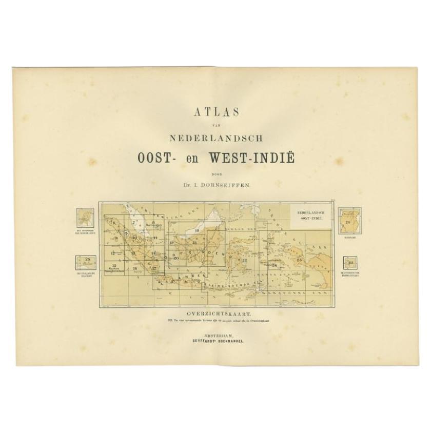
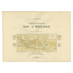
- Antique Map of the East Indies by Dornseiffen, 1900Located in Langweer, NLTitle page of 'Atlas van Nederlandsch Oost- en West-Indië' by I. Dornseiffen. It shows the regions of the various maps included in this atlas. Included are the Dutch East Indies and ...Category
20th Century Maps
MaterialsPaper
- Antique Map of the Mentawai Islands, Sumatra, 1900Located in Langweer, NLAntique map of the Mentawai Islands, Sumatra. Also depicting the region of Padang. This map originates from 'Atlas van Nederlandsch Oost- en West-Indië' by I. Dornseiffen. Artists ...Category
20th Century Maps
MaterialsPaper
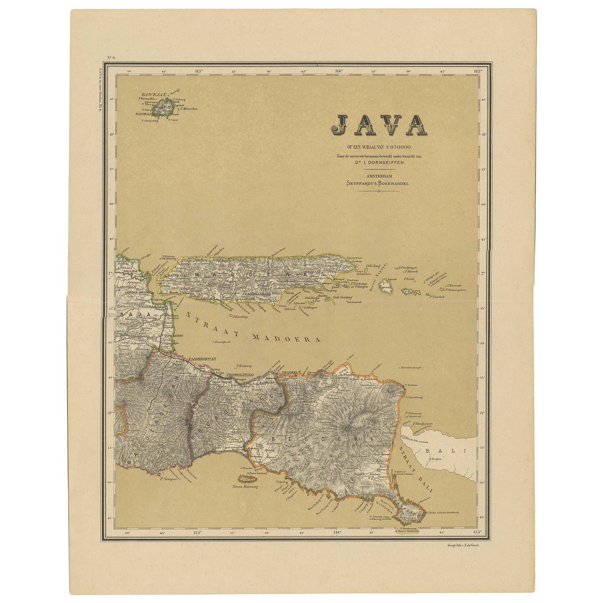
- Antique Map of Java in 4 sheets by Dornseiffen, 1884Located in Langweer, NLDetailed map of Java in 4 sheets, with an inset map of Batavia (Jakarta). This map originates from 'Atlas van Nederlandsch Oost- en West-Indie' by Dr. I. Dornseiffen. Published by Se...Category
Antique Late 19th Century Maps
MaterialsPaper
- Antique Map of the Islands of the Atlantic by J. TallisLocated in Langweer, NLA highly decorative and detailed mid-19th century map of the Islands of the Atlantic -- including the Azores, Madeira, Bermuda, the Canary Islands and the Cape Verde Islands -- which...Category
Antique Mid-19th Century Maps
MaterialsPaper
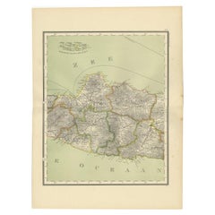
- Antique Map of Central Java Depicting The Karimun Islands, Indonesia, 1900Located in Langweer, NLAntique map of Central Java, also depicting the Karimun Islands. This map originates from 'Atlas van Nederlandsch Oost- en West-Indië' by I. Dornseiffen. Artists and Engravers: P...Category
20th Century Maps
MaterialsPaper


You May Also Like
- Large Original Antique Map of Rhode Island, USA, C.1900Located in St Annes, LancashireFabulous map of Rhode Island Original color Engraved and printed by the George F. Cram Company, Indianapolis. Published, C.1900 Unframed Free ...Category
Antique 1890s American Maps
MaterialsPaper
- 1854 Map of Massachusetts, Connecticut and Rhode Island, Antique Wall MapLocated in Colorado Springs, COThis striking wall map was published in 1854 by Ensign, Bridgman & Fanning and has both full original hand-coloring and original hardware. This impression is both informative and highly decorative. The states are divided into counties, outlined in red, green, and black, and subdivided into towns. Roads, canals, and railroad lines are prominently depicted, although they are not all labeled. The mapmakers also marked lighthouses, banks, churches, and prominent buildings, with a key at right. The map is an informative and comprehensive overview of the infrastructural development of New England prior to the Civil War. Physical geographies depicted include elevation, conveyed with hachure marks, rivers and lakes. The impression features an inset map of Boston...Category
Antique 19th Century American Maps
MaterialsPaper
- 1861 Topographical Map of the District of Columbia, by Boschke, Antique MapLocated in Colorado Springs, COPresented is an original map of Albert Boschke's extremely sought-after "Topographical Map of the District of Columbia Surveyed in the Years 1856 ...Category
Antique 1860s American Historical Memorabilia
MaterialsPaper
- Antique "New Plan of London" Map by John Bartholomew, 1900Located in Bridgeport, CTProduced for the W.H. Smith guide, folded in the original. The map here is unfolded and framed flat, with transportation routes shown and color details. sight 22 x 32" (original ful...Category
Antique Early 1900s English Victorian Maps
MaterialsPaper
- Large Original Vintage Map of The Pacific Islands Including HawaiiLocated in St Annes, LancashireGreat map of The Pacific Islands Unframed Original color By John Bartholomew and Co. Edinburgh Geographical Institute Published, circa 1...Category
Vintage 1920s British Maps
MaterialsPaper
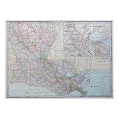
- Large Original Antique Map of Louisiana, USA, C.1900Located in St Annes, LancashireFabulous map of Louisiana. Original color. Engraved and printed by the George F. Cram Company, Indianapolis. Published, c.1900. Unframed. Repair ...Category
Antique 1890s American Maps
MaterialsPaper


Recently Viewed
View AllMore Ways To Browse
Long Island Furniture
Large Wood Island
Old Wood Island
Long Island Artists
Vintage Long Island Maps
Vintage Map Of Long Island
Vintage Long Island Map
Antique Map Paint
Israeli Antique
Tree Bag
Ohio Antique
16th Century Scotland
New England Maps
New England Map
Great Britain Maps
Used Furniture Depot
World Map British
Antique Topographic Maps