Items Similar to Antique Map of the Dongeradeel Township 'Friesland' by Halma, 1718

Want more images or videos?
Request additional images or videos from the seller
1 of 5
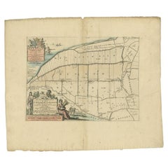
Antique Map of the Dongeradeel Township 'Friesland' by Halma, 1718
About the Item
Antique map Friesland titled 'Donger Deel West Zyde der Pasens (..)'. Old map of Friesland, the Netherlands. This map depicts the region of Dongeradeel and includes cities and villages like Dokkum, Holwerd and more. With coat of arms of the Van Aylva family. Originates from 'Uitbeelding van de Heerlijkheid van Friesland' by Bernardus Schotanus à Sterringa. This atlas is considered the best atlas of Friesland, the Netherlands.
Artists and Engravers: Published by F. Halma, Leeuwarden.
Condition: Good, general age-related toning. Minor defects and repair/split on folding line, blank verso. Please study image carefully.
Date: 1718
Overall size: 66 x 56 cm.
Image size: 51 x 35 cm.
We sell original antique maps to collectors, historians, educators and interior decorators all over the world. Our collection includes a wide range of authentic antique maps from the 16th to the 20th centuries. Buying and collecting antique maps is a tradition that goes back hundreds of years. Antique maps have proved a richly rewarding investment over the past decade, thanks to a growing appreciation of their unique historical appeal. Today the decorative qualities of antique maps are widely recognized by interior designers who appreciate their beauty and design flexibility. Depending on the individual map, presentation, and context, a rare or antique map can be modern, traditional, abstract, figurative, serious or whimsical. We offer a wide range of authentic antique maps for any budget.
- Dimensions:Height: 22.05 in (56 cm)Width: 25.99 in (66 cm)Depth: 0 in (0.01 mm)
- Materials and Techniques:
- Period:
- Date of Manufacture:1718
- Condition:
- Seller Location:Langweer, NL
- Reference Number:
About the Seller
5.0
Platinum Seller
These expertly vetted sellers are 1stDibs' most experienced sellers and are rated highest by our customers.
Established in 2009
1stDibs seller since 2017
1,965 sales on 1stDibs
Typical response time: <1 hour
- ShippingRetrieving quote...Ships From: Langweer, Netherlands
- Return PolicyA return for this item may be initiated within 14 days of delivery.
More From This SellerView All
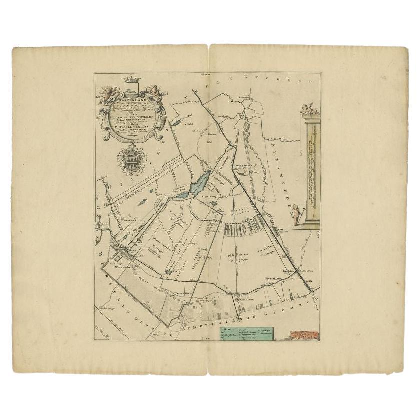
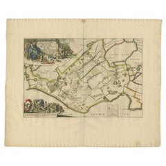
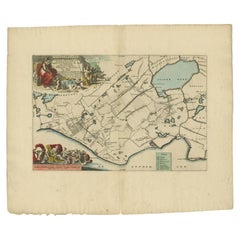
- Antique Map of the Haskerland Township 'Friesland' by Halma, 1718Located in Langweer, NLAntique map Friesland titled 'Haskerland, de vierde Grietenije van de Zevenwolden (..)'. Old map of Friesland, the Netherlands. This map depicts the region of Haskerland and includes...Category
Antique 18th Century Maps
MaterialsPaper
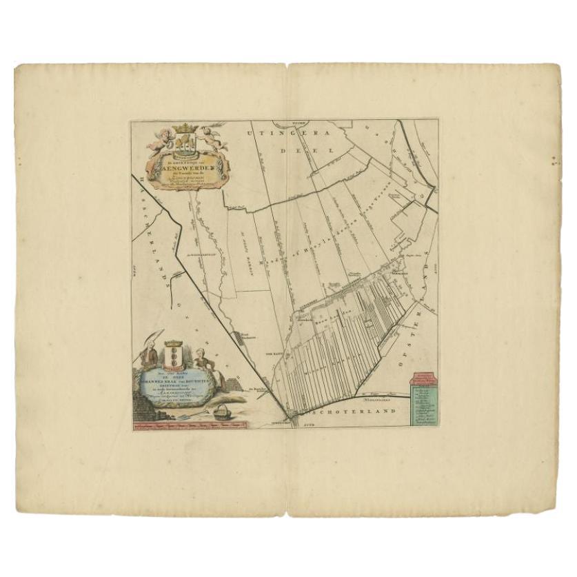
- Antique Map of the Aengwirden Township 'Friesland' by Halma, 1718Located in Langweer, NLAntique map titled 'De Grietenije van Aengwerden, de Tweede van de Zevenwolden (..)'. Old map of Friesland, the Netherlands. This map depicts the region of Aengwirden and includes ci...Category
Antique 18th Century Maps
MaterialsPaper
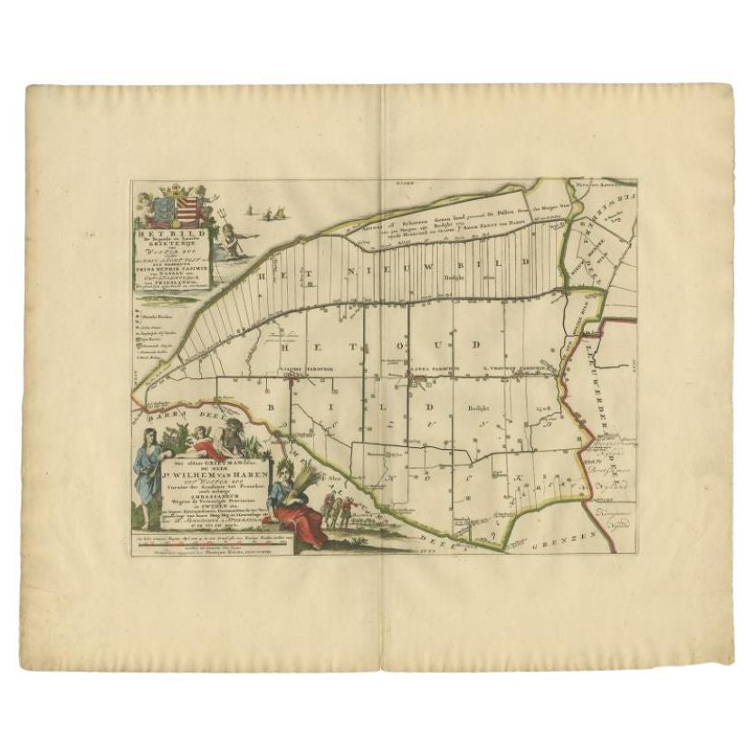
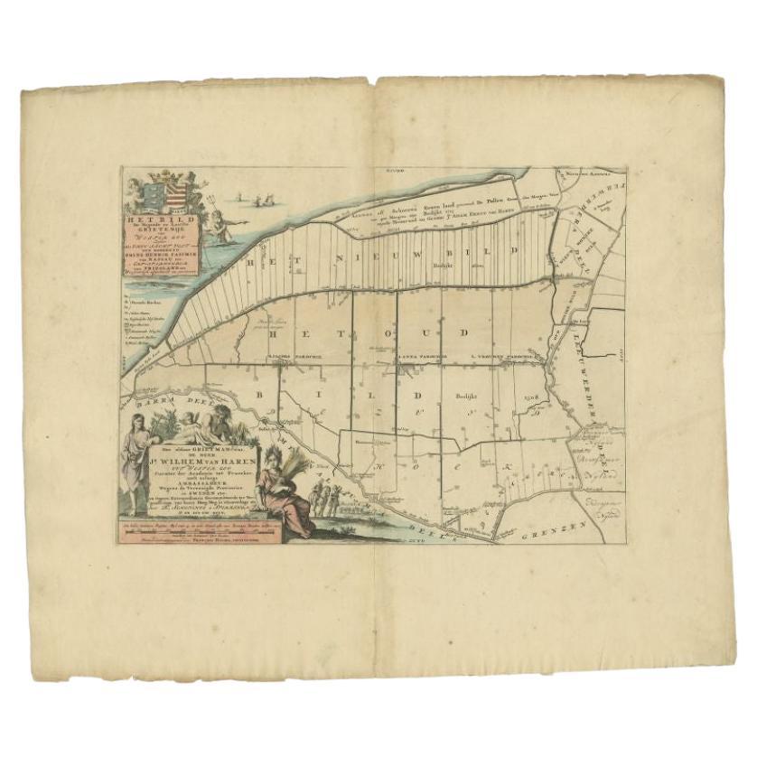
- Antique Map of the Bildt Township 'Friesland' by Halma, 1718Located in Langweer, NLThe map depicts the historical region of 't Bildt in Friesland, with notable places such as St. Jacobiparochie, St. Annaparochie, and Vrouwenparochie. These are still existing towns ...Category
Antique 18th Century Maps
MaterialsPaper
- Antique Map of the Bildt Township 'Friesland' by Halma, 1718Located in Langweer, NLAntique map Friesland titled 'Het Bild, de negende en laatste Grietenije van Wester Goo (..)'. Old map of Friesland, the Netherlands. This map depicts the reg...Category
Antique 18th Century Maps
MaterialsPaper
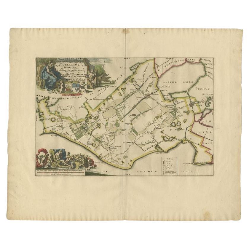
- Antique Map of the Gaasterland Township 'Friesland' by Halma, 1718Located in Langweer, NLAntique map Friesland titled 'Gaasterland de Zevende Grietenije van de Zevenwolden (..)'. Old map of Friesland, the Netherlands. This map depicts the region of Gaasterland and includ...Category
Antique 18th Century Maps
MaterialsPaper
You May Also Like
- 1861 Topographical Map of the District of Columbia, by Boschke, Antique MapLocated in Colorado Springs, COPresented is an original map of Albert Boschke's extremely sought-after "Topographical Map of the District of Columbia Surveyed in the Years 1856 ...Category
Antique 1860s American Historical Memorabilia
MaterialsPaper
- Original Antique Map of The World by Thomas Clerk, 1817Located in St Annes, LancashireGreat map of The Eastern and Western Hemispheres On 2 sheets Copper-plate engraving Drawn and engraved by Thomas Clerk, Edinburgh. Published by Mackenzie And Dent, 1817 ...Category
Antique 1810s English Maps
MaterialsPaper
- 1907 Map of Colorado, Antique Topographical Map, by Louis NellLocated in Colorado Springs, COThis highly detailed pocket map is a topographical map of the state of Colorado by Louis Nell from 1907. The map "has been complied from all availabl...Category
Antique Early 1900s American Maps
MaterialsPaper
- Original Antique Map of The Netherlands, Engraved by Barlow, Dated 1807Located in St Annes, LancashireGreat map of Netherlands Copper-plate engraving by Barlow Published by Brightly & Kinnersly, Bungay, Suffolk. Dated 1807 Unframed.Category
Antique Early 1800s English Maps
MaterialsPaper
- Original Antique Map of the American State of Nevada, 1889Located in St Annes, LancashireGreat map of Nevada Drawn and Engraved by W. & A.K. Johnston Published By A & C Black, Edinburgh. Original colour Unframed.Category
Antique 1880s Scottish Victorian Maps
MaterialsPaper
- Original Antique Map of the American State of Oregon, 1889Located in St Annes, LancashireGreat map of Oregon Drawn and Engraved by W. & A.K. Johnston Published By A & C Black, Edinburgh. Original colour Unframed.Category
Antique 1880s Scottish Victorian Maps
MaterialsPaper


Recently Viewed
View AllMore Ways To Browse
West Coat Of Arms
Antique Nautical Map
Antique Nautical Maps
Map Of Arabia
Antique Stand Up Scale
Civil War Map
Antique Furniture Cyprus
Antique Linen Map
Antique Nautical Charts
British Isles Antique Map
Georgia Map
Map Of West Indies
Scottish Coat Of Arms
Speed Map
West Indies Map
Antique Map Of South Africa
Antique Railroad Collectables
Antique Railroad Collectibles Collectibles