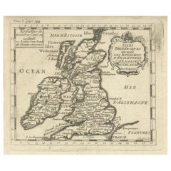
British Isles Antique Map
3
to
15
72
21
67
50
20
18
17
16
8
8
8
6
6
5
5
4
3
3
2
2
2
2
2
2
2
2
1
1
1
1
1
1
1
4
3
2
2
2
Sort By
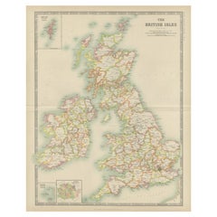
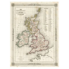
Antique Map of the British Isles by Johnston '1909'
Located in Langweer, NL
Antique map titled 'The British Isles'. Original antique map of the British Isles. With inset maps
Category
Early 20th Century British Isles Antique Map
Materials
Paper
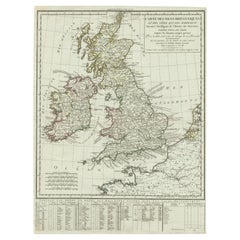
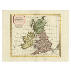
Antique Map of British Isles with Outline Hand Coloring
Located in Langweer, NL
old map of the British Isles with outline hand coloring. Published by P.G. Chanlaire and engraved by
Category
Early 19th Century British Isles Antique Map
Materials
Paper
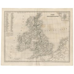
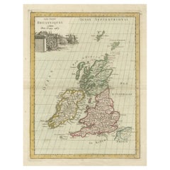
Antique Map of the British Isles by Balbi '1847'
Located in Langweer, NL
Antique map titled 'Iles Britanniques'. Original antique map of the British Isles. This map
Category
Mid-19th Century British Isles Antique Map
Materials
Paper
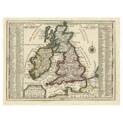
Map of the British Isles with Historical Kings, 1719
Located in Langweer, NL
of the British Isles, including England, Wales, Scotland, and Ireland. Additionally, a portion of the
Category
Early 18th Century British Isles Antique Map
Materials
Paper
Antique Map of the British Isles with Outline Coloring
Located in Langweer, NL
Antique map titled 'Iles Britanniques'. Attractive map of the British Isles. Details England
Category
Mid-19th Century British Isles Antique Map
Materials
Paper
Antique Map of the British Isles by Delamarche, 1806
Located in Langweer, NL
Antique map titled 'Les Isles Britanniques.' Decorative map of the British Isles by Robert de
Category
19th Century British Isles Antique Map
Materials
Paper
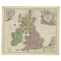
Antique Map of the British Isles by Lotter, 1764
Located in Langweer, NL
of the British Isles (main islands United Kingdom & Ireland). Features include a Fine large rococco
Category
18th Century British Isles Antique Map
Materials
Paper
Antique Map of the British Isles with Contemporary Hand Coloring
Located in Langweer, NL
Antique map titled 'Les Isles Britanniques'. Original antique map of the British Isles, with
Category
Late 18th Century British Isles Antique Map
Materials
Paper
Attractive Small Map of the British Isles with Decorative Cartouche
Located in Langweer, NL
'. Attractive small map of the British Isles with decorative cartouche. Published circa 1705.
Category
Early 18th Century British Isles Antique Map
Materials
Paper
Interesting Small Map of the British Isles with Hand Coloring
Located in Langweer, NL
Antique map titled 'Insularum Britannicarum Tabula'. Interesting small map of the British Isles by
Category
Early 18th Century British Isles Antique Map
Materials
Paper
Original Antique Map of the British Isles Surrounded by Text
Located in Langweer, NL
Antique map titled 'Des Isles Britanniques'. Original antique map of the British isles. This map is
Category
Late 18th Century British Isles Antique Map
Materials
Paper
Antique Map of the British Isles by Covens & Mortier, 1730
By Covens & Mortier
Located in Langweer, NL
Covens and Mortier's attractive double-page engraved map of the British Isles, based on the 1702 De
Category
Mid-18th Century British Isles Antique Map
Materials
Paper
Antique Map of the British Isles by H. Chatelain, 1719
By Henri-Abraham Chatelain
Located in Langweer, NL
Beautiful hand colored large format map of the British Isles, with large insets of the Eastern and
Category
Early 18th Century British Isles Antique Map
Materials
Paper
Antique Map of the Ancient British Isles by Janssonius 'circa 1640'
Located in Langweer, NL
ancient British Isles. England and Wales are labelled as Britannia Superior, and further divided into the
Category
Mid-17th Century British Isles Antique Map
Materials
Paper
Antique Map of the Palaeontology of the British Isles by Johnston '1850'
Located in Langweer, NL
palaeontology of the British Isles. This map originates from 'The Physical Atlas of Natural Phenomena' by A.K
Category
Mid-19th Century British Isles Antique Map
Materials
Paper
H 21.07 in W 14.18 in D 0.02 in
Antique Map 'Colored Cartouches' of the British Isles by Covens & Mortier ‘1761’
By Covens & Mortier
Located in Langweer, NL
Covens and Mortier's attractive double-page engraved map of the British Isles, based on the 1702 De
Category
Late 18th Century British Isles Antique Map
Materials
Paper
H 21.07 in W 25.6 in D 0.2 in
Antique Map of the British Isles with Walls, Settlements and Other Features
Located in Langweer, NL
Antique map titled 'Insulae Britannicae'. Interesting map of Britain, Scotland, and Ireland. It
Category
Late 18th Century British Isles Antique Map
Materials
Paper
H 7.88 in W 9.26 in D 0.02 in
Antique Map of the British Isles and Part of the Coast of France
Located in Langweer, NL
Antique map titled 'Carte Particuliere l'Angleterre (..)'. Original antique map of the British
Category
Mid-19th Century British Isles Antique Map
Materials
Paper
Antique Map of the British Isles, Insets of the Shetland Islands and Hebrides
Located in Langweer, NL
Antique map titled 'Great Britain and Ireland with ye Judges Circuits'. A scarce map of the British
Category
Late 18th Century British Isles Antique Map
Materials
Paper
H 16.82 in W 19.45 in D 0.02 in
Large Antique Map of the British Isles, with inset of the Orkneys and Shetlands
Located in Langweer, NL
Antique map titled 'A Map of Great Britain and Ireland (..)'. Large antique map of the British
Category
Late 18th Century British Isles Antique Map
Materials
Paper
H 18.43 in W 24.93 in D 0.02 in
Old Map of the British Isles with the Faroes and Shetlands, Showing Cock Fights
Located in Langweer, NL
of the British Isles with inset maps of the Faroes and Shetlands. The title cartouche depicts dog
Category
Early 18th Century British Isles Antique Map
Materials
Paper
H 10.36 in W 14.57 in D 0.02 in
Attractive Map of the British Isles with an Inset of the Shetland Islands, c1770
Located in Langweer, NL
D'Irlande, Divises en Grandes Provinces Subdivise par Comptes (…).'
Attractive map of the British Isles
Category
1770s British Isles Antique Map
Materials
Paper
H 20.87 in W 29.53 in D 0 in
Antique Map of the British Isles According to the Geography of the Roman Empire
Located in Langweer, NL
Antique map titled 'Insulae Britannicae'. Interesting map of Britain, Scotland, and Ireland. It
Category
Late 18th Century British Isles Antique Map
Materials
Paper
H 8.08 in W 10.24 in D 0.02 in
Antique Map of the British Isles and Part of Europe by Chatelain, c.1720
Located in Langweer, NL
showing the British Isles and the various regions conquered in Europe. Includese two elaborate family
Category
18th Century British Isles Antique Map
Materials
Paper
H 16.93 in W 19.89 in D 0 in
Large 17th Century Hand Colored Map of England and the British Isles by de Wit
By Frederick de Wit
Located in Alamo, CA
A large hand colored 17th century map of England and the British Isles by Frederick de Wit entitled
Category
Late 17th Century Dutch British Isles Antique Map
Materials
Paper
H 35 in W 30.5 in D 2 in
Large Antique County Map of Cornwall and the Isles of Scilly, England
Located in Langweer, NL
Antique map titled 'A Map of Cornwall from the best Authorities'. Original old county map of
Category
Early 19th Century British Isles Antique Map
Materials
Paper
H 17.37 in W 21.66 in D 0.02 in
Antique Map of the British Islands by J. Thomson, 1817
Located in Langweer, NL
Group of 5 maps of the Channel Islands, Scilly, Jersey, the Isle of Mann and the Isle of Wight
Category
Early 19th Century British Isles Antique Map
Materials
Paper
Hampshire County, Britain/England: A Map from Camden's" Britannia" in 1607
By John Norden
Located in Alamo, CA
Camden's great historical description of the British Isles, "Britannia". This map was drawn by cartographer
Category
Early 17th Century English British Isles Antique Map
Materials
Paper
H 17.13 in W 18.75 in D 0.88 in
Old Map of Indonesian Islands Borneo, Celebes, New Guinea & New Britain, 1792
Located in Langweer, NL
Antique map titled 'Partie de la Nouvelle Grande Carte des Indes Orientales, contenant les Isles de
Category
1790s British Isles Antique Map
Materials
Paper
Free Shipping
H 21.78 in W 25.99 in D 0 in
England, Scotland & Ireland: A Hand Colored Map of Great Britain by Tirion
By Isaak Tirion
Located in Alamo, CA
This is a hand-colored double page copperplate map of Great Britain entitled "Nieuwe Kaart van de
Category
Mid-18th Century Dutch British Isles Antique Map
Materials
Paper
H 17 in W 20.75 in D 0.07 in
Colorful Detailed Antique Map of The British Islands and `The North Sea, 1882
Located in Langweer, NL
Islands! This captivating original antique map offers a detailed view of the British Isles and the North
Category
1880s British Isles Antique Map
Materials
Paper
H 14.97 in W 22.45 in D 0 in
Antique Map of the South Part of Great Britain by Tirion, c.1750
By Isaak Tirion
Located in Langweer, NL
Koningryk Engeland (..).'
Attractive map showing the south part of Great Britain; the Kingdom of England
Category
18th Century British Isles Antique Map
Materials
Paper
Antique Map of Great Britain and Ireland by Brion de la Tour, 1766
Located in Langweer, NL
Antique map titled 'Les Isles Britanniques (..).'
Attractive map of Great Britain surrounded by
Category
18th Century British Isles Antique Map
Materials
Paper
Antique Map Made After a Roman Papyrus Travel Map, Known as Peutinger Map, 1773
Located in Langweer, NL
Iberian Peninsula and the British Isles), North Africa, and parts of Asia, including the Middle East
Category
18th Century British Isles Antique Map
Materials
Paper
H 15.56 in W 18.51 in D 0 in
Antique Map of the Queen Charlotte Islands, Haida Gwaii
Located in Langweer, NL
Antique map titled 'Isles de la Reine Charlotte (..)'. Original old map of the Queen Charlotte
Category
Late 18th Century British Isles Antique Map
Materials
Paper
Antique Map of New Ireland with 7 Coastal Profiles
Located in Langweer, NL
Antique print titled 'l'Isle St. Jean (..) - Cap St. George (..)'. Antique map of New Ireland, an
Category
Late 18th Century British Isles Antique Map
Materials
Paper
Antique Map of Coiba Island, Panama, South America, C.1740
Located in Langweer, NL
Antique map titled 'Plan de la partie orientale de l'Isle de Quibo'. Map of the eastside of Coiba
Category
18th Century British Isles Antique Map
Materials
Paper
Large Sea Chart of the British Islands, 1918
Located in Langweer, NL
Antique map titled 'The British Islands'.
Large sea chart of the British Islands. It shows
Category
1910s British Isles Antique Map
Materials
Paper
1859 Vintage Maps of England and Wales: Blackie's Imperial Geographic Detail
Located in Langweer, NL
the British Isles. It captures a pivotal moment in the history of England and Wales, reflecting the
Category
Mid-19th Century British Isles Antique Map
Materials
Paper
H 14.57 in W 21.26 in D 0.02 in
Antique Decorative Map of the Low Countries, '17 Provinces, Netherlands', c.1680
Located in Langweer, NL
the British Isles, but his first atlas consisted of maps printed from plates bought from van den Keere
Category
1680s British Isles Antique Map
Materials
Paper
H 21.26 in W 24.89 in D 0 in
Imperium Romanum: A Detailed Map of the Roman Empire in its Zenith, 1880
Located in Langweer, NL
, stretching from the British Isles in the northwest to the deserts of Arabia and the northern fringes of
Category
1880s British Isles Antique Map
Materials
Paper
Free Shipping
H 15.56 in W 18.51 in D 0 in
Old Map of the East Indonesian Islands Borneo, Celebes, New Guinea, Bali, 1792
Located in Langweer, NL
Antique map titled 'Partie de la Nouvelle Grande Carte des Indes Orientales, contenant les Isles de
Category
1790s British Isles Antique Map
Materials
Paper
H 21.66 in W 25.4 in D 0 in
Excellent Antique Map of America with Unusual Northwest Coast of America, c.1754
Located in Langweer, NL
serveral Atlases and Dutch town plans. The maps mainly based on those of Guillaume de l'Isle. He died in
Category
1750s British Isles Antique Map
Materials
Paper
No Reserve
H 13.98 in W 15.75 in D 0 in
Captain Cook's Exploration of Tahiti 18th C. Hand-Colored Map by Bellin
By Jacques-Nicolas Bellin
Located in Alamo, CA
This beautiful 18th century hand-colored copper plate engraved map is entitled "Carte de l'Isle de
Category
Mid-18th Century French British Isles Antique Map
Materials
Paper
H 11.38 in W 17.5 in D 0.13 in
Original Antique Detailed Map of the Rhine and Moselle River Regions, ca.1680
Located in Langweer, NL
been. From about 1620 he designed a number of individual maps, including one of the British Isles, but
Category
1680s British Isles Antique Map
Materials
Paper
H 20.87 in W 24.02 in D 0 in
West Coast of Africa, Guinea & Sierra Leone: An 18th Century Map by Bellin
By Jacques-Nicolas Bellin
Located in Alamo, CA
, including an unframed map of the island of St. Christophe, now known as St. Kitts, "Carte De De l'Isle St
Category
Mid-18th Century French British Isles Antique Map
Materials
Paper
H 10 in W 14.25 in D 0.07 in
Detailed Map of the Holy Land, Showing the Travels of Christ & Apostles, ca.1650
Located in Langweer, NL
one of the British Isles, but his first atlas consisted of maps printed from plates bought from van
Category
1650s British Isles Antique Map
Materials
Paper
H 44.2 in W 52.3 in D 0.002 in
Engraving of Allegorical Celebrations of the British Victories in America, 1880
Located in Langweer, NL
celebrations of the British victories in America at the conclusion of the French & Indian (Seven Years) War
Category
1880s British Isles Antique Map
Materials
Paper
Free Shipping
H 16.74 in W 21.93 in D 0 in
Spectacular Large Map of Upper and Lower Austria between Passau and Wien, c.1700
Located in Langweer, NL
1620 he designed a number of individual maps, including one of the British Isles, but his first atlas
Category
Early 1700s British Isles Antique Map
Materials
Paper
H 21.15 in W 35.63 in D 0 in
Antique Map of the Rhine and Moselle River Region in Germany and France, c.1680
Located in Langweer, NL
been. From about 1620 he designed a number of individual maps, including one of the British Isles, but
Category
17th Century British Isles Antique Map
Materials
Paper
H 20.4 in W 23.94 in D 0 in
Ancient Cartography of Britannia and Hibernia, Published in 1880
Located in Langweer, NL
This map depicts the geographical area of Great Britain and Ireland, labeled "BRITANNIA et HIBERNIA
Category
1880s British Isles Antique Map
Materials
Paper
Free Shipping
H 18.51 in W 15.56 in D 0 in
The Roman Empire from the Time of Constantine the Great, Published in 1880
Located in Langweer, NL
Empire, which covered a large portion of the known world at the time, from the British Isles to the Near
Category
1880s British Isles Antique Map
Materials
Paper
No Reserve
H 15.56 in W 18.51 in D 0 in
Views of Saunders, Osnaburg, Boscawens, Admiral Keppel's & Wallis Island, c.1774
Located in Langweer, NL
Antique print titled 'Isles de Sir Charles Saunder Latitude (..)'.
Coastal views of Sir Charles
Category
1770s British Isles Antique Map
Materials
Paper
H 10.63 in W 11.03 in D 0 in
England and the British Isles: A Large 17th Century Hand-colored Map by de Wit
By Frederick de Wit
Located in Alamo, CA
This is a large hand-colored 17th century map of England and the British Isles by Frederick de Wit
Category
Late 17th Century Other Art Style British Isles Antique Map
Materials
Engraving
Antique Paterson's Guide to Britain, English, Maps, Georgian, Published 1811
Located in Hele, Devon, GB
titling in gilt to the ribbed spine
Opens to a superb fold-out map of the British Isles, with table of
Category
Early 19th Century British Georgian British Isles Antique Map
Materials
Paper
H 7.49 in W 4.73 in D 1.58 in
Map of Hampshire County, Britain/England, from Camden's" Britannia" in 1607
By John Norden
Located in Alamo, CA
Camden's great historical description of the British Isles, "Britannia". This map was drawn by cartographer
Category
Early 1600s British Isles Antique Map
Materials
Engraving
H 17.13 in W 18.75 in D 0.88 in
Map of the World: An Original 18th Century Hand-colored Map by E. Bowen
Located in Alamo, CA
the British Isles, Europe, North America, Africa, and Asia. He also created maps for several important
Category
Mid-18th Century Old Masters British Isles Antique Map
Materials
Engraving
Map of the Russian Empire: An Original 18th Century Hand-colored Map by E. Bowen
Located in Alamo, CA
create comprehensive and useful maps. Bowen produced a wide range of maps, including maps of the British
Category
Mid-18th Century Old Masters British Isles Antique Map
Materials
Engraving
Map of the East Indies: An Original 18th Century Hand-colored Map by E. Bowen
Located in Alamo, CA
the British Isles, Europe, North America, Africa, and Asia. He also created maps for several important
Category
Mid-18th Century Old Masters British Isles Antique Map
Materials
Engraving
Cambridge map 17th century engraving after John Speed
By John Speed
Located in London, GB
theatre of the empire of Great Britaine,' the first comprehensive atlas depicting the British Isles, and
Category
1620s British Isles Antique Map
Materials
Engraving
- 1
Get Updated with New Arrivals
Save "British Isles Antique Map", and we’ll notify you when there are new listings in this category.
British Isles Antique Map For Sale on 1stDibs
Choose from an assortment of styles, material and more with respect to the british isles antique map you’re looking for at 1stDibs. A british isles antique map — often made from paper — can elevate any home. There are many kinds of the british isles antique map you’re looking for, from those produced as long ago as the 18th Century to those made as recently as the 20th Century. Covens & Mortier, Henri-Abraham Chatelain and Frederick de Wit each produced at least one beautiful british isles antique map that is worth considering.
How Much is a British Isles Antique Map?
Prices for a british isles antique map start at $79 and top out at $4,500 with the average selling for $441.
More Ways To Browse
San Pablo Bay
Christopher Farr
Royal Gouda
Shetland Map
Antique Maps Hampshire
Antique Map Nova Scotia
Taiwan Antique Map
Whitehall Palace
Palace Of Whitehall
Albania Antique Map
Magellan Map
Antique Land Surveyor
Sierra Leone Antique Map
James Riviere
Antique Miniature Globe
Antique Map Bahamas
Herman Mile
Jean Desnos
