Items Similar to Antique Map 'Colored Cartouches' of the British Isles by Covens & Mortier ‘1761’


Want more images or videos?
Request additional images or videos from the seller
Antique Map 'Colored Cartouches' of the British Isles by Covens & Mortier ‘1761’
About the Item
Covens and Mortier's attractive double-page engraved map of the British Isles, based on the 1702 De L'Isle map. The map features a large cartouche in the upper left comprised of numerous sea-related elements and topped by Poseidon.
- Creator:Covens & Mortier (Artist)
- Dimensions:Height: 21.07 in (53.5 cm)Width: 25.6 in (65 cm)Depth: 0.2 in (5 mm)
- Materials and Techniques:
- Period:
- Date of Manufacture:1761
- Condition:Please study image carefully.
- Seller Location:Langweer, NL
- Reference Number:
About the Seller
5.0
Platinum Seller
These expertly vetted sellers are 1stDibs' most experienced sellers and are rated highest by our customers.
Established in 2009
1stDibs seller since 2017
1,956 sales on 1stDibs
Typical response time: <1 hour
- ShippingRetrieving quote...Ships From: Langweer, Netherlands
- Return PolicyA return for this item may be initiated within 14 days of delivery.
More From This SellerView All
- Antique Map of the British Isles by Covens & Mortier, 1730By Covens & MortierLocated in Langweer, NLCovens and Mortier's attractive double-page engraved map of the British Isles, based on the 1702 De L'Isle map. The map features a large car...Category
Antique Mid-18th Century Maps
MaterialsPaper
- Antique Map of Denmark by Covens & Mortier, 1730By Covens & MortierLocated in Langweer, NLAntique Map of Denmark from: 'Atlas Nouveau ... Par Guillaume de l'Isle' Amsterdam, Covens & Mortier, 1730.Category
Antique Mid-18th Century Maps
MaterialsPaper
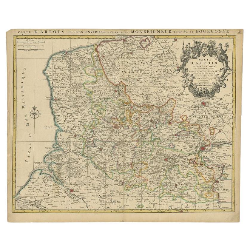
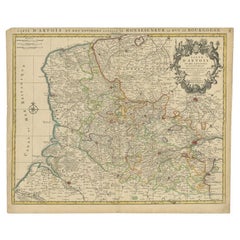
- Antique Map of the Region of Artois by Covens & Mortier, c.1730By Covens & MortierLocated in Langweer, NLAntique map titled 'Carte d'Artois et des environs'. Large map of the region of Artois, France. Artois is former province located in the northwestern part of France, boarding Belgium...Category
Antique 18th Century Maps
MaterialsPaper
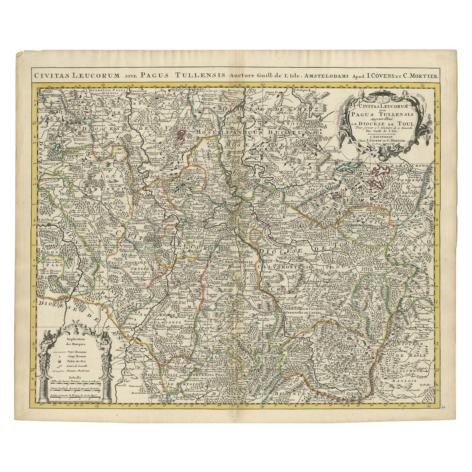
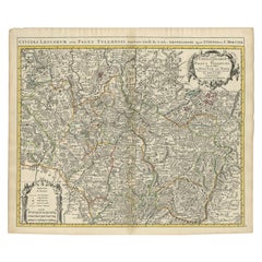
- Antique Map of the Diocese of Toul by Covens & Mortier, circa 1720By Covens & MortierLocated in Langweer, NLAntique map titled 'Civitas Leucorum sive Pagus Tullensis'. Detailed map of the Diocese of Toul, France. Centered on the cities of Nancy and Toul and including Metz, Verdun, S. Dizie...Category
Antique Early 18th Century Maps
MaterialsPaper
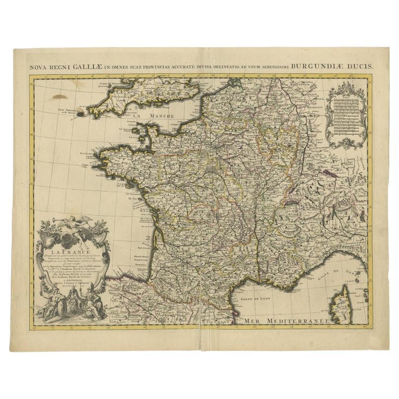
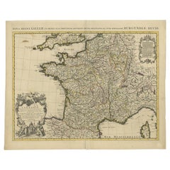
- Antique Map of France by Covens & Mortier, c.1730Located in Langweer, NLAntique map titled 'Nova regni Galliae (..) La France'. Old map of France with large decorative title cartouche. With great detail. Artists and Engravers: Pieter und David Mortie...Category
Antique 18th Century Maps
MaterialsPaper
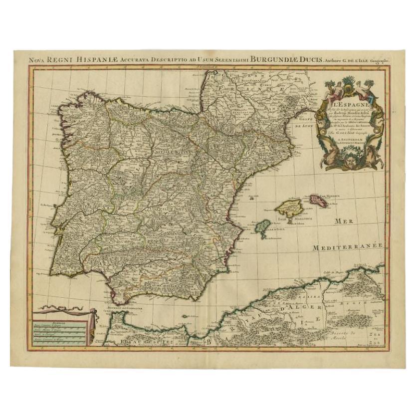
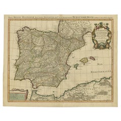
- Antique Map of Spain by Covens & Mortier, c.1740Located in Langweer, NLAntique map Spain titled 'L?Espagne dressée sur la Description qui en a eté faite par Rodrigo Mendez Sylva (..)'. Beautiful map of Spain with decorat...Category
Antique 18th Century Maps
MaterialsPaper


You May Also Like
- Large 17th Century Hand Colored Map of England and the British Isles by de WitBy Frederick de WitLocated in Alamo, CAA large hand colored 17th century map of England and the British Isles by Frederick de Wit entitled "Accuratissima Angliæ Regni et Walliæ Principatus", published in Amsterdam in 1680. It is a highly detailed map of England, Scotland, the Scottish Isles...Category
Antique Late 17th Century Dutch Maps
MaterialsPaper
- Colored wall map of the WORLDBy ChambonLocated in ZWIJNDRECHT, NL“Mappe Monde, contenant les Parties Connues du Globe Terrestre” CHAMBON, Gobert-Denis (France, 17.. - 1781) Paris, Longchamps et Janvier, 1754 Size H. 115 x W. 145 cm. Gobert-Denis Chambon made copper engraving after the work of Guillaume De L’Isle, published in 1754 by Jean Janvier and S.G. Longschamps. A huge wall map of the world in two hemispheres printed on two sheets, depicting the Eastern and Western hemispheres supported by two male figures, decorated at the bottom right and left with two celestial hemispheres (boreal and southern) and at the bottom in the middle with an armillary sphere, in addition. This map is most notable for its depiction of the Sea of Japan labeled "Mer de Corée" and of "Mer de L'Ouest" or Sea of the West - a great sea, easily the size of the Mediterranean, to flow from the then-known Strait of Juan de Fuca...Category
Antique Mid-18th Century French French Provincial Maps
MaterialsWood, Paper

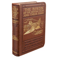
- Antique Book, Birds Of The British Isles, English, Ornithology Reference, C.1920Located in Hele, Devon, GBThis is an antique illustrated book of The Birds of the British Isles. An English, bound ornithology reference title, dating to the early 20th century, published 1920. Full Title - ...Category
Early 20th Century European Mid-Century Modern Books
MaterialsLeather, Paper
- England, Scotland & Ireland: A Hand Colored Map of Great Britain by TirionBy Isaak TirionLocated in Alamo, CAThis is a hand-colored double page copperplate map of Great Britain entitled "Nieuwe Kaart van de Eilanden van Groot Brittannien Behelzende de Kon...Category
Antique Mid-18th Century Dutch Maps
MaterialsPaper
- Antique Hand Colored Framed Map of EuropeLocated in West Palm Beach, FLAntique reproduction copied from an edition dated 1595 by Ortelius.Category
Antique Late 19th Century Maps
- Antique Lithography Map, Isle of Wight, English, Framed, Engraving, CartographyLocated in Hele, Devon, GBThis is an antique lithography map of the Isle of Wight. An English, framed atlas engraving of cartographic interest, dating to the early 19th century and later. Superb lithography ...Category
Antique Early 19th Century British Regency Maps
MaterialsWood


Recently Viewed
View AllMore Ways To Browse
Antique Cartouches
Sea Isle
British Isles Antique Map
Bonne Map
Bag With Map
Antique Ireland Map
Antique Irish Map
South Pole
New Zealand Map
Antique Maps Ireland
Antique Ireland Maps
Antique Map Ireland
Antique Map Of Ireland
Antique Maps Of Ireland
Antique Irish Maps
George Fleet
Antique Railroad Maps
Map Of New Zealand