Items Similar to Interesting Small Map of the British Isles with Hand Coloring

Want more images or videos?
Request additional images or videos from the seller
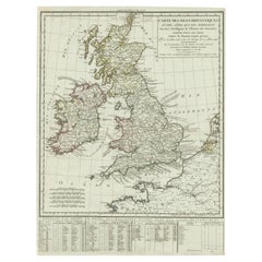
Interesting Small Map of the British Isles with Hand Coloring
About the Item
Antique map titled 'Insularum Britannicarum Tabula'. Interesting small map of the British Isles by Wells. This map originates from 'Oikumenes Periegesis, sive, Dionysii Geographia emendata & locupletata' by Edward Wells, published by A. & J. Churchill, London. 1704.
- Dimensions:Height: 7.49 in (19 cm)Width: 4.34 in (11 cm)Depth: 0.02 in (0.5 mm)
- Materials and Techniques:
- Period:
- Date of Manufacture:1704
- Condition:General age-related toning. Minor wear, blank verso. Please study image carefully.
- Seller Location:Langweer, NL
- Reference Number:
About the Seller
5.0
Platinum Seller
These expertly vetted sellers are 1stDibs' most experienced sellers and are rated highest by our customers.
Established in 2009
1stDibs seller since 2017
1,951 sales on 1stDibs
Typical response time: <1 hour
- ShippingRetrieving quote...Ships From: Langweer, Netherlands
- Return PolicyA return for this item may be initiated within 14 days of delivery.
More From This SellerView All
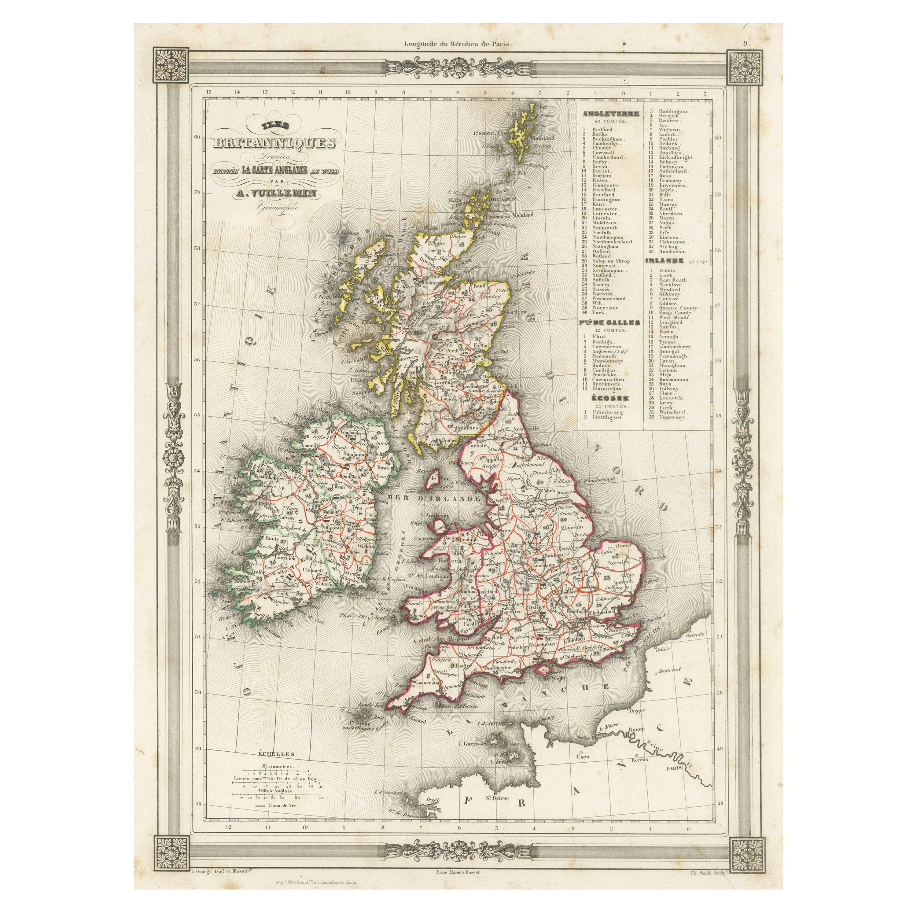
- Antique Map of the British Isles with Contemporary Hand ColoringLocated in Langweer, NLAntique map titled 'Les Isles Britanniques'. Original antique map of the British Isles, with original/contemporary hand coloring. Published by Crepe, circa 1767.Category
Antique Late 18th Century Maps
MaterialsPaper
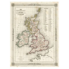
- Antique Map of the British Isles with Outline ColoringLocated in Langweer, NLAntique map titled 'Iles Britanniques'. Attractive map of the British Isles. Details England, Scotland and Ireland as well as parts of neighboring France. Upper right corner features...Category
Antique Mid-19th Century Maps
MaterialsPaper
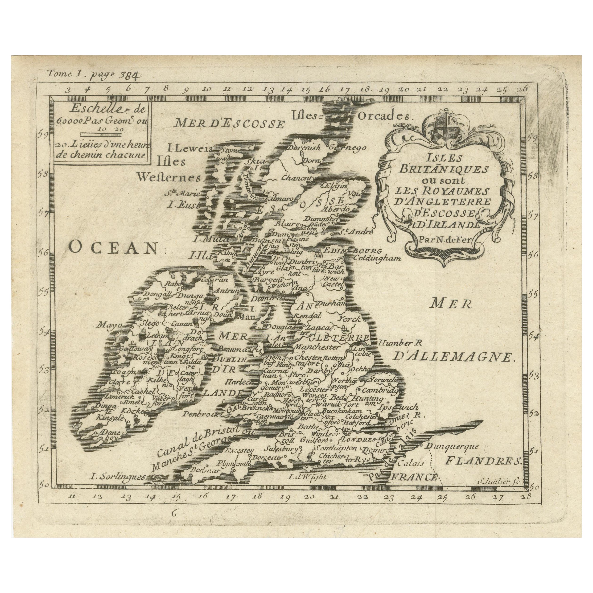
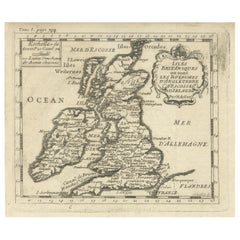
- Attractive Small Map of the British Isles with Decorative CartoucheLocated in Langweer, NLAntique map titled 'Isles Britaniques ou sont les Royaumes d'Angleterre, D'Escosse et d'Irlande'. Attractive small map of the British Isles with decorative cartouche. Published circa...Category
Antique Early 18th Century Maps
MaterialsPaper
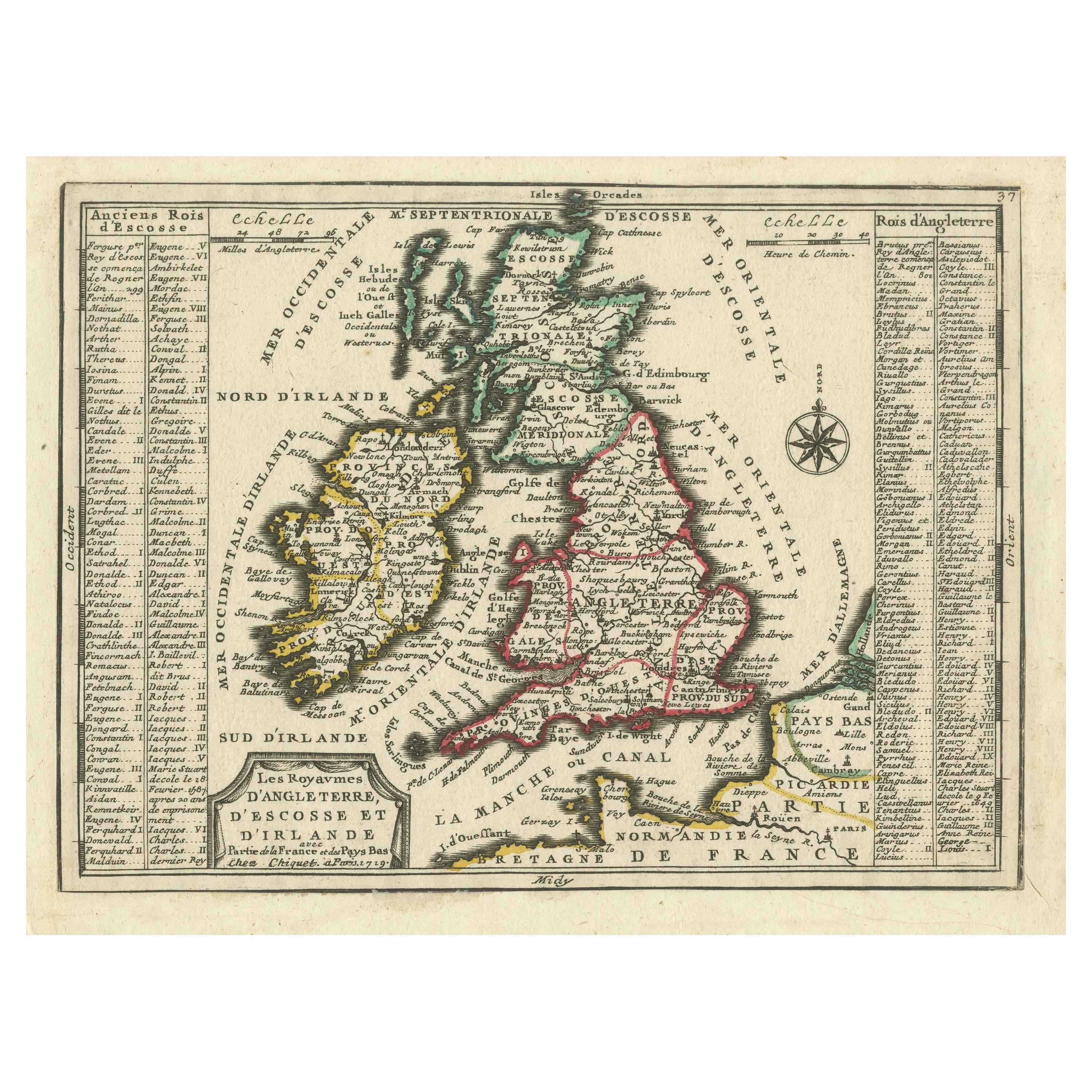
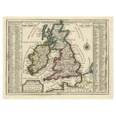
- Map of the British Isles with Historical Kings, 1719Located in Langweer, NLThis antique map, titled "Les Royaumes d'Angleterre d'Escosse et d'Irlande," offers a detailed view of the British Isles, including England, Wales, Scotland, and Ireland. Additionall...Category
Antique Early 18th Century Maps
MaterialsPaper
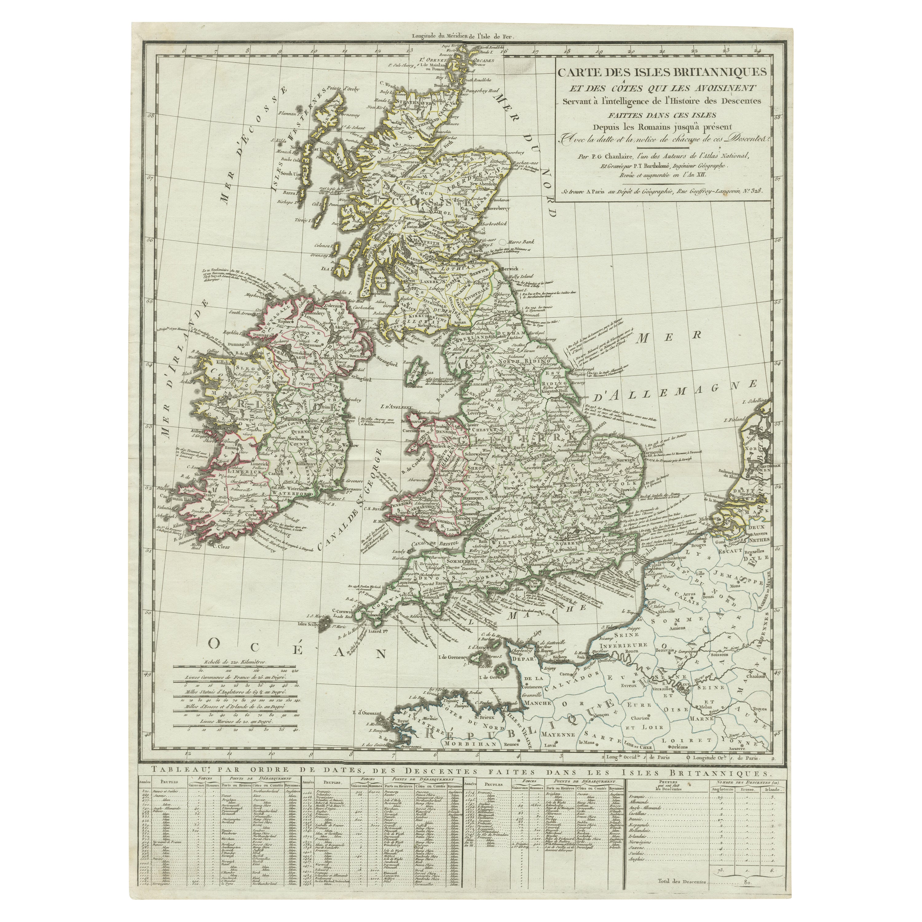
- Antique Map of British Isles with Outline Hand ColoringLocated in Langweer, NLAntique map titled 'Carte des Isles Britanniques et des Côtes qui les Avoisinent (..)'. Original old map of the British Isles with outline hand coloring. Published by P.G. Chanlaire ...Category
Antique Early 19th Century Maps
MaterialsPaper
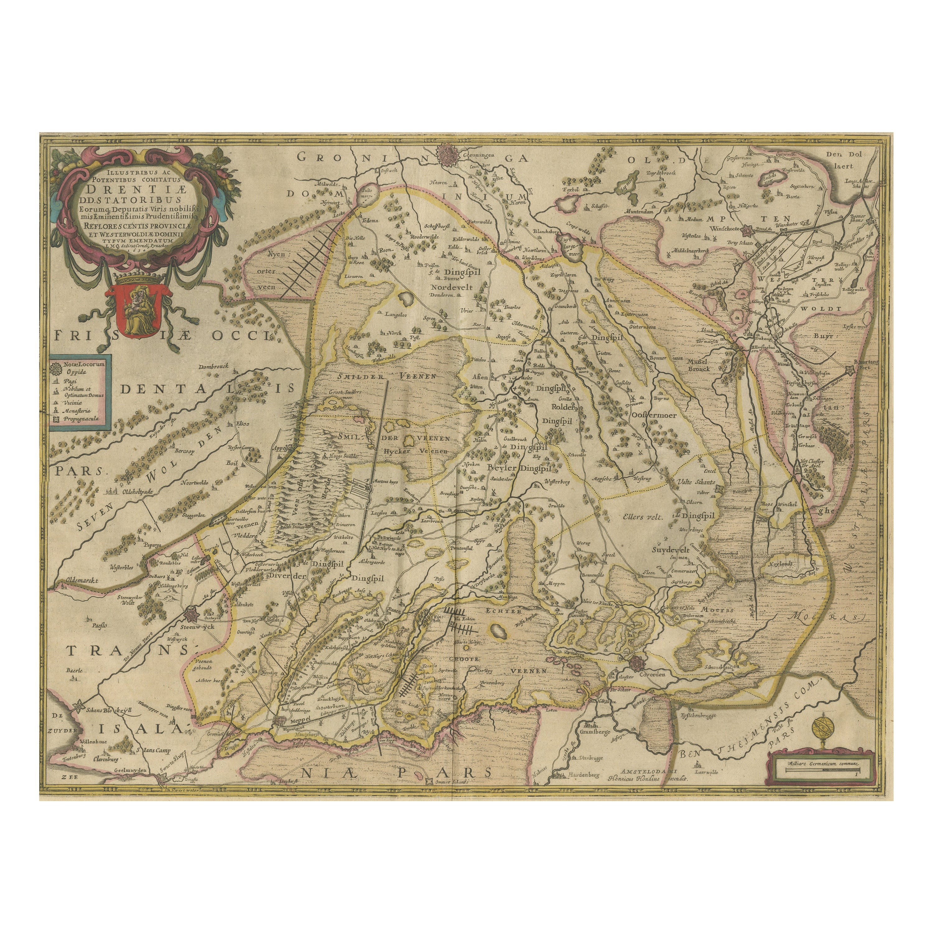
- Antique Map of Drenthe, the Netherlands, with Original Hand ColoringLocated in Langweer, NLOriginal antique map titled 'Illustribus ac Potentibus Comitatus Drentiae (..)'. Old map of the province of Drenthe, the Netherlands. Published by H. Hondius circa 1639. Hendrik ...Category
Antique Mid-17th Century Maps
MaterialsPaper

You May Also Like
- Large 17th Century Hand Colored Map of England and the British Isles by de WitBy Frederick de WitLocated in Alamo, CAA large hand colored 17th century map of England and the British Isles by Frederick de Wit entitled "Accuratissima Angliæ Regni et Walliæ Principatus", published in Amsterdam in 1680. It is a highly detailed map of England, Scotland, the Scottish Isles...Category
Antique Late 17th Century Dutch Maps
MaterialsPaper
- England, Scotland & Ireland: A Hand Colored Map of Great Britain by TirionBy Isaak TirionLocated in Alamo, CAThis is a hand-colored double page copperplate map of Great Britain entitled "Nieuwe Kaart van de Eilanden van Groot Brittannien Behelzende de Kon...Category
Antique Mid-18th Century Dutch Maps
MaterialsPaper
- Map of the Republic of GenoaLocated in New York, NYFramed antique hand-coloured map of the Republic of Genoa including the duchies of Mantua, Modena, and Parma. Europe, late 18th century. Dimension: 25...Category
Antique Late 18th Century European Maps
- Map "Estuary- Mouth of the Thames"Located in Alessandria, PiemonteST/426 - Antique French Map of the estuary of the Thames, map dated 1769 - "Mape of the entrance of the Thames. Designed by filing of Navy cards fo...Category
Antique Mid-18th Century French Other Prints
MaterialsPaper
- Hand-Colored 18th Century Homann Map of the Danube, Italy, Greece, CroatiaBy Johann Baptist HomannLocated in Alamo, CA"Fluviorum in Europa principis Danubii" is a hand colored map of the region about the Danube river created by Johann Baptist Homann (1663-1724) in his 'Atlas Novus Terrarum', publish...Category
Antique Early 18th Century German Maps
MaterialsPaper
- Germany West of the Rhine: A Hand-colored 18th Century Map by de WitBy Frederick de WitLocated in Alamo, CAThis original 18th century hand-colored map of the county of Moers, Germany entitled "Illustrissimo Celsissmo Principi GUILIELMO HENRICO D.G. Arausionum Principi Domino suo Clementis...Category
Antique Early 18th Century Dutch Maps
MaterialsPaper


