Early 18th Century Maps
8
255
to
98
240
15
255
255
255
5
2,889
2,121
411
5
227
31
11
84
7
56
7
3
3
4
5
2
248
6
1
36
17
9
6
3
12
10
2
2
2
Period: Early 18th Century
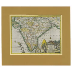
Antique Map of India during the height of the Mughal Imperial Expansion, 1713
Located in Langweer, NL
Antique map titled 'L'Inde de ca le Gange (..)'. Beautiful original antique map embracing most of India, made during the height of the Mughal imperial expansion. The map encompasses ...
Category
Antique Early 18th Century Maps
Materials
Paper
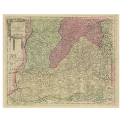
Senex Map of Castile, Leon & La Mancha in The Spanish Heartland, 1714
Located in Langweer, NL
This antique map, titled "A Map of Old & New Castile from the Observations of Rodrigo Mendes Silva and others," depicts the regions of Old Castile and New Castile in Spain, along wit...
Category
Antique Early 18th Century Maps
Materials
Paper
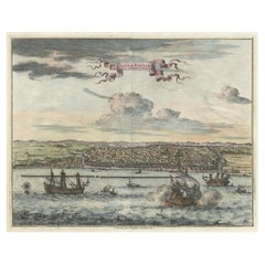
Original Antique Bird's Eye View of Banten or Bantam in Java, Indonesia, 1725
Located in Langweer, NL
Antique print titled 'La Ville de Bantam capitale du Roiaume de meme nom'.
A bird's eye view of the city Banten or Bantam near the western end of Java in Indonesia. Several tall ...
Category
Antique Early 18th Century Maps
Materials
Paper
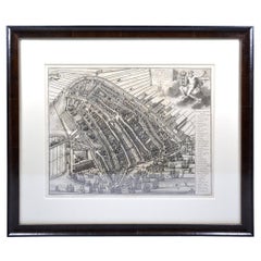
Amsterdam city plan - Joost van Sassen
Located in UTRECHT, UT
“Afbeeldinge der Stad Amsterdam, gelyk deselve in den jaren 1536 door Cornelis Antonisz na ’t leven is geschildert, en Ao 1544 in druk uytgegeven.”, engraved by Joost van Sassen and ...
Category
Dutch Other Antique Early 18th Century Maps
Materials
Paper
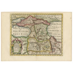
Historical Map of the Black Sea and Surrounding Regions, 1705
Located in Langweer, NL
Title: "Map of Turcomania, Georgia, and Comania"
This print presents an intricately detailed map of the Caucasus region, titled “Turcomania, Georgien Commanie,” by the esteemed cart...
Category
Antique Early 18th Century Maps
Materials
Paper
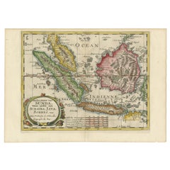
Antique Map of the Sunda Islands Including Sumatra, Java, and Borneo, 1705
Located in Langweer, NL
Title: “Antique Map of the Sunda Islands Including Sumatra, Java, and Borneo”
This print is a beautifully detailed and relatively rare map of Western Indonesia, encompassing the reg...
Category
Antique Early 18th Century Maps
Materials
Paper
Cartographic Elegance of the Mughal Dominion in a Hand-Colored Antique Map, 1705
Located in Langweer, NL
This original antique map titled “'T Ryk van den Grooten Mogol” by Nicolas Sanson from 1705 is an interesting historical artifact. It depicts the extent of the Mughal Empire in North...
Category
Antique Early 18th Century Maps
Materials
Paper
Antique Coaching Road Map, Devon, English, Regional Cartography, Georgian, 1720
Located in Hele, Devon, GB
This is an antique coaching road map of Devon. An English, framed lithograph engraving of regional interest, dating to the early 18th century and later.
Fascinating 18th century hig...
Category
British Georgian Antique Early 18th Century Maps
Materials
Wood
Antique Coaching Road Map, South Devon, English, Framed, Cartography, Georgian
Located in Hele, Devon, GB
This is an antique coach road map of South Devon. An English, framed lithograph engraving of regional interest, dating to the early 18th century and later.
Delightful early 18th cen...
Category
British Georgian Antique Early 18th Century Maps
Materials
Wood
Antique Coach Road Map, East Devon, English, Framed, Cartography, Georgian, 1720
Located in Hele, Devon, GB
This is an antique coach road map of East Devon. An English, framed lithograph engraving of regional interest, dating to the early 18th century and later.
Fascinating 18th century h...
Category
British Georgian Antique Early 18th Century Maps
Materials
Wood
Antique Lithography Map, Cumbria, English, Framed Cartography Interest, Georgian
Located in Hele, Devon, GB
This is an antique lithography map of Cumbria. An English, framed engraving of cartographic interest, dating to the early 18th century and later.
...
Category
British Georgian Antique Early 18th Century Maps
Materials
Wood
Antique Lithography Map, Durham, English, Framed, Cartography, Early Georgian
Located in Hele, Devon, GB
This is an antique lithography map of Durham. An English, framed engraving of cartographic interest, dating to the early 18th century and later, circa 1720.
Superb lithography of Du...
Category
British Georgian Antique Early 18th Century Maps
Materials
Wood
1720 Panoramic Vista of Istanbul and the Bosphorus - with Column of Pompey
Located in Langweer, NL
Title: "1701-1720 Bosphore de Thrace and Views of Istanbul - Chatelain/Guedeville"
Description: This finely detailed folio from Chatelain's 'Atlas Historique', dated 1720, features ...
Category
Antique Early 18th Century Maps
Materials
Paper
1726 Valentyn's Map of Bali and Lombok, Original Engraving
Located in Langweer, NL
This antique map is a detailed 18th-century chart of the island of Bali, one of the many islands of Indonesia, with an inset of the neighboring island Lombok, attributed to François ...
Category
Antique Early 18th Century Maps
Materials
Paper
Antique Print of the Malabar Coast of India showing the VOC establishments, 1726
Located in Langweer, NL
Dutch print with the title: Platte Grond van t'Fort Tricoen male met de daar aangelegen Pagoods-Berg (Trincomalee, Sri Lanka)
The map is taken from: 'Oud en Nieuw Oost-Indiën' van...
Category
Antique Early 18th Century Maps
Materials
Paper
Antique Engraving of the Island Nzwani or Anzuany of the Comoros Islands, 1726
Located in Langweer, NL
Historical titles: Ansjouan, Ansuany, Anjouan, Anzuani, Anzuany
Country: Comoros
The map is taken from: 'Oud en Nieuw Oost-Indiën' van François Valentyn.
1) Ottens, Frederik (engra...
Category
Antique Early 18th Century Maps
Materials
Paper
Print of a Dutch VOC Fort on the Peninsula Trincomalee, Ceylon (Sri Lanka), 1726
Located in Langweer, NL
Dutch print with the title: Platte Grond van t'Fort Tricoen male met de daar aangelegen Pagoods-Berg (Trincomalee, Sri Lanka)
The map is taken from: 'Oud en Nieuw Oost-Indiën' van...
Category
Antique Early 18th Century Maps
Materials
Paper
Antique Map of the Philippines and Guam by Scherer, circa 1702
Located in Langweer, NL
Antique map titled 'Nova et Vera Exhibitio Geographica Insularum Marianarum (..)'. Rare and very attractive map of the Mariana Islands, Philippines, Ko...
Category
Antique Early 18th Century Maps
Materials
Paper
Antique Map of Southeast Asia, China, Philippines and India
Located in Langweer, NL
Antique map titled 'Indiae Orientalis et Insularum Adiacentium'. Decorative map of Southeast Asia, China, Philippines, and India. A native holds a wild dog or hyena on a chain, while...
Category
Antique Early 18th Century Maps
Materials
Paper
Antique Map of Northeastern India, Nepal, Bhutan, Assam and Bangladesh
Located in Langweer, NL
Antique map titled 'De Land-Reyse door Benedictus Goes, van Lahor gedaan, door Tartaryen na China'. Interesting map showing the region of northeastern India, Nepal, Bhutan, Assam and...
Category
Antique Early 18th Century Maps
Materials
Paper
Antique Map of the Nassau Region in Western Germany
Located in Langweer, NL
Antique map titled 'Nassovia Principatus (..)'. Detailed map of the Nassau region in western Germany between Koblenz, Hadamar, Giessen, Frankfurt and Mainz. The map is filled with in...
Category
Antique Early 18th Century Maps
Materials
Paper
Antique Map of the North Sea and Dunkirk
Located in Langweer, NL
Untitled map of the North Sea, top left a large compass rose, bottom right Dunkirk (Duinkerke / Dunkerque), France. Part of a bundled collection of plans of battles and cities renown...
Category
Antique Early 18th Century Maps
Materials
Paper
Antique Map of Cyprus and Asia Minor with Medallions and Vignettes
Located in Langweer, NL
Antique map titled 'Asiae Peninsula sive Asia intra Taurum'. Decorative map of Cyprus and Asia Minor, featuring the geographical features known to the ancients and decorated with a v...
Category
Antique Early 18th Century Maps
Materials
Paper
Antique Map of the French Coast at Boulogne and Picardy
Located in Langweer, NL
Antique map titled 'Les Costes du Boulenois et de la Picardie'. Map of the French coast at Boulogne and Picardy. Left a large wind rose. Part of a bundled collection of plans of batt...
Category
Antique Early 18th Century Maps
Materials
Paper
Antique Map of the Holy Land with Picture Frame Border
Located in Langweer, NL
Antique map titled 'Terre Sainte Suivant les Nouvelles Observations (..)'. Original old map of the Holy Land with the picture frame border. The term "Holy Land" usually refers to a t...
Category
Antique Early 18th Century Maps
Materials
Paper
Original Hand-colored Antique Map of the Southern Part of India
Located in Langweer, NL
Antique map titled 'Orarum Malabariae, Coromandelae &c Tabula Accuratissima - Carte des Cotes de Malabar et de Coromandel'. Beautiful map of the southern part of India. It focuses on...
Category
Antique Early 18th Century Maps
Materials
Paper
Antique Map of the Empire of the Great Mogol and the Kingdom of Kachimere
Located in Langweer, NL
Antique map titled 'Genealogie des Empereurs Mogols depuis Tamberlan ou Tamerlan'. Two maps, a genealogical tree and three indigenous views of the Mogol Empire on one sheet with desc...
Category
Antique Early 18th Century Maps
Materials
Paper
Set of 2 Antique Maps covering part of modern-day Czech Republic
Located in Langweer, NL
Set of two antique maps titled 'Marchionatus Moraviae circulus Preroviensis'. Two individual sheets covering part of modern-day Czech Republic. Cities included are Opava, Fulnek, Lip...
Category
Antique Early 18th Century Maps
Materials
Paper
Fabulous Original Antique two-sheet Map of the Caspian Sea, ca.1723
Located in Langweer, NL
Carte Marine de la Mer Caspiene... [and] Coste de Perse sur la Mer Caspiene et Partie de Celles de Tartarie", Delisle, Guillaume (2 maps)
Subject: Caspian Sea
Period: 1723 (circa)
P...
Category
Antique Early 18th Century Maps
Materials
Paper
Antique Bird's Eye-view Atjien or Atjeh in Aceh in Northern Sumatra, Indonesia
Located in Langweer, NL
Description: Antique print Indonesia titled 'Atsjien'. Bird's eye-view of the Town of Atjien on the northernmost point of Sumatra. This print originates from 'Oud en Nieuw Oost-Indië...
Category
Antique Early 18th Century Maps
Materials
Paper
Original Antique Map of England, Ireland, Scotland and Wales
Located in Langweer, NL
Antique map titled 'Les Isles Britanniques, ou sont les Royaumes d Angleterre (..)'. Detailed map of England, Ireland, Scotland and Wales, with French coast and part of the Netherlan...
Category
Antique Early 18th Century Maps
Materials
Paper
Antique Map of the Area centered on the Rhine River, Germany
Located in Langweer, NL
Antique map titled 'Uterque Rheni Circulus Superior (..)'. Fine old color map of the area centered on the Rhine River, from Strassbourg to Wesel and Duisburg, Germany. With cities hi...
Category
Antique Early 18th Century Maps
Materials
Paper
Antique Map of the Area centered on the Rhine River with original coloring
Located in Langweer, NL
Antique map titled 'Uterque Rheni Circulus Superior (..)'. Fine old color map of the area centered on the Rhine River, from Strassbourg to Wesel and Duisburg, Germany. The map also c...
Category
Antique Early 18th Century Maps
Materials
Paper
Antique Map of the Rhine centered on Cologne, Germany, with outline coloring
Located in Langweer, NL
Antique map titled 'Archiepsiscopatus et Electoratus Coloniensis (..)'. Original antique map of the Rhine river, centered on Cologne, Germany. The Rhine River cuts across this map fr...
Category
Antique Early 18th Century Maps
Materials
Paper
Antique Map of the Rhine centered on Cologne, Germany, with original coloring
Located in Langweer, NL
Antique map titled 'Archiepsiscopatus et Electoratus Coloniensis (..)'. Original antique map of the Rhine river, centered on Cologne, Germany. The Rhine River cuts across this map fr...
Category
Antique Early 18th Century Maps
Materials
Paper
Antique Map of the Rhine centered on Cologne, Germany
Located in Langweer, NL
Antique map titled 'Archiepsiscopatus et Electoratus Coloniensis (..)'. Original antique map of the Rhine river, centered on Cologne, Germany. The Rhine River cuts across this map fr...
Category
Antique Early 18th Century Maps
Materials
Paper
Small Antique Map of England, Wales, Scotland and Ireland with Original Coloring
Located in Langweer, NL
Antique map titled 'Les Royaumes d'Angleterre d'Escosse et d'Irlande (..)'. A lovely, small map of England, Wales, Scotland and Ireland with a portion of the coastline of France and ...
Category
Antique Early 18th Century Maps
Materials
Paper
Antique Map of the Holy Land, Showing the Location of the Various Tribes
Located in Langweer, NL
Antique map titled 'Judaea seu Terra Sancta quae Hebraeorum sive Israelitarum (..)'. Map of The Holy Land, showing the location of the various tribes, in two kingdoms, Judah and Isra...
Category
Antique Early 18th Century Maps
Materials
Paper
Antique Map of Tartary, Also Showing the Great Wall of China
Located in Langweer, NL
Antique map titled 'Carte de Tartarie'. Detailed map of Tartary, consisting of the Eastern part of Russia, Central Asia, China and Korea, first published by Guillaume De L'Isle in 1706. The map extends from the Peninsula of Korea in the east to the Caspian and Black Seas. The Great Wall of China...
Category
Antique Early 18th Century Maps
Materials
Paper
Original Antique Map of England, Showing the Most Memorable Battles
Located in Langweer, NL
Antique map titled 'Carte d'Angleterre ou l'on fait observer les Batailes les plus Memorables de ce Royaume'. Original antique map of England, showing the most memorable battles. Thi...
Category
Antique Early 18th Century Maps
Materials
Paper
Old Map of the British Isles with the Faroes and Shetlands, Showing Cock Fights
Located in Langweer, NL
Antique map titled 'Les Isles Britaniques ou sont les Royaumes d'Angleterre (..)'. Original old map of the British Isles with inset maps of the Faroes and Shetlands. The title cartouche depicts dog...
Category
Antique Early 18th Century Maps
Materials
Paper
Interesting Small Map of the British Isles with Hand Coloring
Located in Langweer, NL
Antique map titled 'Insularum Britannicarum Tabula'. Interesting small map of the British Isles by Wells. This map originates from 'Oikumenes Periegesis, sive, Dionysii Geographia em...
Category
Antique Early 18th Century Maps
Materials
Paper
Attractive Small Map of the British Isles with Decorative Cartouche
Located in Langweer, NL
Antique map titled 'Isles Britaniques ou sont les Royaumes d'Angleterre, D'Escosse et d'Irlande'. Attractive small map of the British Isles with decorative cartouche. Published circa...
Category
Antique Early 18th Century Maps
Materials
Paper
Map of the British Isles with Historical Kings, 1719
Located in Langweer, NL
This antique map, titled "Les Royaumes d'Angleterre d'Escosse et d'Irlande," offers a detailed view of the British Isles, including England, Wales, Scotland, and Ireland. Additionall...
Category
Antique Early 18th Century Maps
Materials
Paper
Antique Map of European Russia with Picture Frame Border
Located in Langweer, NL
Antique map titled 'La Moscovie Septentrionale (..)'. Decorative example of van der Aa's map of the northern part of European Russia. With the picture frame border, which appeared in...
Category
Antique Early 18th Century Maps
Materials
Paper
Map Holy Land La Terre Sainte Engraved van Loon Published N de Fer 1703 French
Located in BUNGAY, SUFFOLK
La Terre Sainte, The Holy Land, Tiree Des Memoires De M.De.La Rue. Par N. de Fer. Geographe de Sa Majeste Catoliq et de Monseigneur le Dauphin. Avec Privil du Roi 1703
Detailed map of the Holy Land from Nicholas de Fer's L'Atlas Curieux ou le Monde. East is oriented at the top.
MAKER Nicolas de Fer 1646-1720
The French cartographer and engraver, Nicolas de Fer, was a master at creating maps that were works of art. The maps that he published were printed during the Baroque period when the decorative arts were characterized by ornate detail. De Fer’s detailed maps and atlases were valued more for their decorative content than their geographical accuracy.
Nicolas de Fer was born in 1646. His father, Antoine de Fer, owned a mapmaking firm. At the age of twelve, Nicolas was apprenticed to a Parisian engraver named Louis Spirinx. The family business was starting to decline when his father died in 1673. Nicolas de Fer’s mother, Genevieve, took over the business after the death of her husband. In 1687 the business was passed on to Nicolas and the profits increased after he took over the firm. Nicolas de Fer was a prolific cartographer who produced atlases and hundreds of single maps. He eventually became the official geographer to King Louis XIV of France and King Philip V...
Category
French Louis XIV Antique Early 18th Century Maps
Materials
Paper
Original Antique Map of Greece and part of Turkey
Located in Langweer, NL
Original antique map titled 'La Grece ou partie meridionale de la Turquie d'Europe'. Small map of Greece and part of Turkey. This map originates from 'Le nouveau et curieux Atlas Geo...
Category
Antique Early 18th Century Maps
Materials
Paper
Genuine Antique Engraved Map of Helvetia or Switzerland, 1729
Located in Langweer, NL
Decorative early 18th century engraved map of Switzerland.
Title: Helvetia Conterminarumq terra rum antiqua.
Translated from Latin: Switzerland is an ancient land
Description: Switzerland, antique copperplate engraved map with hand coloring and a decorative title cartouche. Two figures greatly enhances visual appeal.
Author: Phillip Cluver, or Philip Cluverius, Philipp Clüver, Latinized as Philippus Cluverius studied law in Leiden and settled over there in 1615.
We only sell Guaranteed Absolutely Original authentic Maps and Prints.
A Certificate of Authenticity ( COA ) will be supplied on request.
We ship our antique maps and prints...
Category
Antique Early 18th Century Maps
Materials
Paper
Striking Antique Map Centered on the Malay Peninsula
Located in Langweer, NL
Antique map titled 'D'Indiaanze Landschappen Zeen en Eylanden, van Couchin af tot in de Moluccos (...)'. Striking map of the region from the Philippines and Formosa to India and the ...
Category
Antique Early 18th Century Maps
Materials
Paper
Original Antique Map of the Region Between the Gulf of Lybia and the Red Sea
Located in Langweer, NL
Original antique map titled 'Aegyptus et Cyrene'. Detailed ancient map of the region between the Gulf of Lybia and the Red Sea, with marvelous detail along the Mediterranean Coastline and the Nile, Egypt. This map originates from 'Philippi Cluveri Introductionis in universam geographiam (..)' by P. Clüver. Published 1729.
Philipp Clüver was an Early Modern German geographer and historian. Cluver's Geography was one of the most enduring works of the 17th & 18th Centuries, issued by several different publishers with many different sets of maps...
Category
Antique Early 18th Century Maps
Materials
Paper
Rare Theodore Danckerts Map of the Lower Rhine and Moselle River Regions
Located in Langweer, NL
Original antique map titled 'Accuratissima Rheni Inferioris Mosae et Mosellae Tabula'. Rare Theodore Danckerts map of the Lower Rhine and Moselle River Regions. The map covers the lo...
Category
Antique Early 18th Century Maps
Materials
Paper
Detailed Antique Map of the Windward Islands in the Caribbean
Located in Langweer, NL
Antique map titled 'Carte des Antilles Francoises et des Isles Voisines'. Original antique map of the French Antilles, covering an area stretching from Guadeloupe in the north to Gre...
Category
Antique Early 18th Century Maps
Materials
Paper
Antique Map of the Mediterranean, Telemachus' Journey, Publ. Early 18th Century
Located in Langweer, NL
Title: Carte des voyages de Télémaque.
Description: Antique map of Telemachus journey, the son of Odysseus and Penelope (Greek mythology ). This map appeared for the first time, e...
Category
Antique Early 18th Century Maps
Materials
Paper
Old Antique Map of the Sumbawa, Flores, Timor in the Banda Region of Indonesia
By F. Valentijn
Located in Langweer, NL
Original antique map titled 'Kaart der Zuyd-Wester Eylanden van Banda'. A fascinating map of the islands in the southwestern part of the Banda Sea including Sumba, Flores and Timor. Published 1724-1726 by Joannes van Braam...
Category
Antique Early 18th Century Maps
Materials
Paper
Large Antique Map of the City of Bremen and Surroundings, Germany
Located in Langweer, NL
Original antique map titled 'Prospect und Grundris der Keiserl Freyen Reichs und Ansee Stadt Bremen (..)'. This is a superb chart of the city of Bremen and the surrounding small vill...
Category
Antique Early 18th Century Maps
Materials
Paper
Antique Map of Saxony, Germany
Located in Langweer, NL
Original antique map titled 'Circulus Saxoniae Superioris'. Original antique map of Saxony, Germany. The cities of Leipzig, Freiburg and many others are highlighted in gold. This map originates from 'Atlas Novus Terrarum Orbis...
Category
Antique Early 18th Century Maps
Materials
Paper
Old Antique Map of the Banda Islands (Southeast), Indonesia & Northern Australia
By F. Valentijn
Located in Langweer, NL
Original antique map titled 'Kaart van de Zuyd-Ooster Eylanden van Banda'. Important map of the seas and islands surrounding the Banda Islands, Indonesia, extending south to northern Australia, east to Papua New Guinea and north to Ceram. Published 1724-1726 by Joannes van Braam...
Category
Antique Early 18th Century Maps
Materials
Paper
Original Antique Map of the Coast of Part of Greece, with Athens and Thebes
Located in Langweer, NL
Original antique map titled 'Achaia quae et Hellas hodie Livadia'. Detailed map of the coast of part of Greece. With inset maps of Athens and Thebes. This map originates from 'Philippi Cluveri Introductionis in universam geographiam (..)' by P. Clüver. Published 1729.
Philipp Clüver was an Early Modern German geographer and historian. Cluver's Geography was one of the most enduring works of the 17th & 18th Centuries, issued by several different publishers with many different sets of maps...
Category
Antique Early 18th Century Maps
Materials
Paper
Recently Viewed
View AllMore Ways To Browse
Antique Nautical Maps
Antique Mexican Maps
Antique Nautical Map
Antique Classroom
Antique Map Box
Sea Chart Map
Antique Nautical Charts
King Charles I Of England
17th Century Corpus
Mexican Antique Map
Antique Celestial Map
Celestial Maps Antique
Antique Celestial Maps
Middle East Antique Map
Topographical Plate
Central America Map
Antique Map Middle East
Vintage Wooden Roller
