Early 18th Century Maps
7
256
to
99
240
16
256
256
256
5
2,888
2,121
411
5
228
30
11
85
7
56
6
3
3
4
5
2
249
6
1
37
17
9
6
3
12
10
2
2
2
Period: Early 18th Century
Antique Map of the Region of Venice, Italy by F. De Wit, circa 1700
Located in Langweer, NL
Antique map of the Dominion of Venice, extending from Stato di Milano and Genoa to Istria. Including Lake Garda, Venice and Istria.
Category
Antique Early 18th Century Maps
Materials
Paper
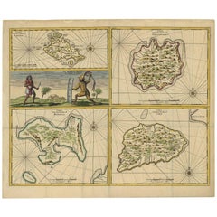
Antique Map of Manipa, Nusa-Laut, Saparua & Haruku 'Indonesia' by F. Valentijn
Located in Langweer, NL
Four maps of islands and two figures in native dress. The islands are: Manipa, Nusa-Laut (Noessa-Laoet), Saparua (Honimoa) and Haruku (Oma). These islands...
Category
Antique Early 18th Century Maps
Materials
Paper
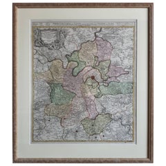
Antique Map of the Region of Paris ‘France’ by H. Heirs, circa 1720
Located in Langweer, NL
Antique map titled 'Agri Parisiensis Tabula particularis, qua maxima Pars Insulae Franciae (..)'. Incredibly detailed map showing everything from tiny villages to forests, farmland, ...
Category
Antique Early 18th Century Maps
Materials
Paper
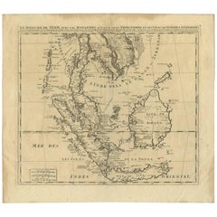
Antique Map of Southeast Asia by H. Chatelain, circa 1720
Located in Langweer, NL
Antique map titled 'Le Royaume de Siam aves les Royaumes qui luy sont Tributaires et les Isles de Sumatra Andemaon'. Influential map of Southeast Asia, including modern day Thailand, southern Vietnam, Cambodia, Malaysia, Singapore, Borneo, Sumatra and Java. Chatelain incorporated information provided by the French Jesuits and charts the route of the French Embassy to and from Siam in 1685-1686 through the Straits of Banca and the Gulf of Siam.
With good detail of the Andaman Islands, the Gulf of Thailand (Golfe de Siam) and coastal Vietnam. In the Kingdom of Siam, this map shows the fortress of Bangkok, the ancient Siamese capital of Ayutthaya, royal palace, and the Dutch trading colony. In Cambodia, it details the village of Ponompingn (Phnom Penh...
Category
Antique Early 18th Century Maps
Materials
Paper
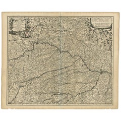
Antique Map of Bavaria ‘Bayern, Germany’ by N. Visscher, circa 1700
Located in Langweer, NL
Antique map titled 'Bavariae pars inferior cum insertis et adjacentibus regionibus (..)'. Published circa 1700 in N. Visscher's World Atlas.
The map "Bavariae pars inferior cum inse...
Category
Antique Early 18th Century Maps
Materials
Paper
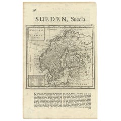
Antique Map of Sweden and Norway by H. Moll, circa 1715
Located in Langweer, NL
Beautiful and rare map of Sweden and Norway including English text. This map most likely originates from 'The Compleat geographer, or, The chorography and topography of all the known...
Category
Antique Early 18th Century Maps
Materials
Paper
Antique Map of Manilla Bay Philippines by P. van der Aa, 1719
Located in Langweer, NL
Rare antique map titled 'La Baie de Manille (..)'. Map of Manilla Bay, the map is oriented with southwest at the top and includes a small town plan for Manilla and other places. This...
Category
Antique Early 18th Century Maps
Materials
Paper
Antique Map of Portugal by P. Schenk, circa 1700
Located in Langweer, NL
Antique map titled 'Portugalliae et Algarbia'. Striking example of Schenk's rare map of Portugal, with the coats of arms of Portugal, Algarbia and a Spanish sailing vessell in the ca...
Category
Antique Early 18th Century Maps
Materials
Paper
Antique Map of Herefordshire 'England' by R. Morden, 1708
Located in Langweer, NL
This antique County map of Herefordshire by Robert Morden was first published in 1701 in a work entitled 'The New Description and State of England'...
Category
Antique Early 18th Century Maps
Materials
Paper
Antique Map of the City of Materan 'Indonesia' by P. van der Aa, circa 1725
Located in Langweer, NL
Antique map titled 'La Ville de Materan, capitale de Roiaume de meme nom, avec ses environs. Le tout environne de Montagnes qui lui serve de murailles.' The city of Materan, capital ...
Category
Antique Early 18th Century Maps
Materials
Paper
Antique Map of the City of Jerusalem by N. Visscher, 1702
Located in Langweer, NL
Antique map titled 'Die Heylige en Wytvermaerde stadt Jerusalem Eerst Genaemt Salem, Genesis 14 vers 18'. This map originates from 'Biblia. Ouden ende Nieuwen Testaments (..)'. Publi...
Category
Antique Early 18th Century Maps
Materials
Paper
Antique Map of the Island of Java, Indonesia by P. Van Der Aa, 1713
Located in Langweer, NL
This rare map shows the Indonesian island of Java. With compass rose and scale. From: Nouvel Atlas, très exact et fort commode pour toutes sortes de personnes, Contenant Les Principa...
Category
Antique Early 18th Century Maps
Materials
Paper
Antique Map of the Coast of France, 1710
By Jacobus Harrewijn
Located in Langweer, NL
Antique map titled 'Les Embouchures de la Somme et de Bresle'.
Map of the coast of Northern France showing the estuaries of the Somme and the Bresle. This map is part of a serie of...
Category
Antique Early 18th Century Maps
Materials
Paper
Antique Map of Livonia Baltic States by P. Van Der Aa, circa 1729
Located in Langweer, NL
Decorative map of Livonia. This well executed engraving was published in 1729 and 1727 by Pieter Van Der Aa, in Leiden in "Les Voyages tres-curieux et tres-renommez faits en Moscovie...
Category
Antique Early 18th Century Maps
Materials
Paper
Antique Map of the Lorraine 'North-East France' by J. B. Homann, circa 1720
Located in Langweer, NL
Antique map of Lorraine in north-east France by J. B. Homann. Covering the area around Metz, Nancy and Sarrebruck with Luxembourg in the North and Mulhouse in Southeast. With a decor...
Category
Antique Early 18th Century Maps
Materials
Paper
Antique Sea Chart of the coasts of Denmark and Sweden by C.A. Berey, 1720
Located in Langweer, NL
This beautiful large sea chart depicts the Oresund, which forms the border between Skane, Sweden and Sjaelland, Denmark. The chart is filled with navigational details and topographical information along the coastline. A large inset focuses on the area around Copenhagen and the islands of Amager and Saltholm. Two large compass...
Category
Antique Early 18th Century Maps
Materials
Paper
Antique Map of the City of Antwerpen ‘Belgium’ by A. Deur, 1729
Located in Langweer, NL
Copper-engraving by A. Deur. Published by I. van der Kloot in Den Haag, 1729. With French and Dutch title-cartouches and explanatory notes, several ships o...
Category
Antique Early 18th Century Maps
Materials
Paper
1629 Historic Miniature Map of Batavia (Jakarta) - Dutch Colonial Era
Located in Langweer, NL
An original490 historic map or bird's-eye view of Batavia (now Jakarta) as it was in the year 1629. Batavia was the name given to the city by the Dutch during their colonization of w...
Category
Antique Early 18th Century Maps
Materials
Paper
Botanical Grandeur at the VOC Garden of Cape of Good Hope, 1727
Located in Langweer, NL
An illustration of the garden of the Dutch East India Company at the Cape of Good Hope, dating from 1727. The Cape of Good Hope, now part of Cape Town, South Africa, was a key stopov...
Category
Antique Early 18th Century Maps
Materials
Paper
Original Antique Map of the Sangi Islands and of the Talaud Islands, Indonesia
Located in Langweer, NL
Dutch print with the title: De Talautse Eylanden
Map of the Sangi Islands, and of the Talaud Islands, Indonesia.
The map is taken from: 'Oud en Nieuw Oost-Indiën' van François Vale...
Category
Antique Early 18th Century Maps
Materials
Paper
Original Anitque Map of the Banda or Spice islands in the Dutch East Indies
Located in Langweer, NL
Dutch print with the title: Nieuw Caart der Eylanden van BANDA. Gemaakt door François Valentyn, J.van Braamen G.O. Linden
The map is taken from: 'Oud en Nieuw Oost-Indiën' van Franç...
Category
Antique Early 18th Century Maps
Materials
Paper
Antique Map of Ancient Italy and the Islands Corsica, Sicily and Sardinia
Located in Langweer, NL
Antique map titled 'Italia Antiqua of Oud Italje (..)'. Very decorative map of ancient Italy and the islands Corsica, Sicily and Sardinia after N. Sanson, published by Francois Halma...
Category
Antique Early 18th Century Maps
Materials
Paper
Antique Map of Asia by N. de Fer, 1700
Located in Langweer, NL
Antique map titled 'L‘ Asie Suivant les Nouvelles Decouvertes dont les Point Principaux (..)'. By N. de Fer, 1700. Depicting China, Japan, India, New Zealand, Borneo, Sumatra, Java, ...
Category
Antique Early 18th Century Maps
Materials
Paper
Original High Detailed Antique Map of France by C. Weigel, 1719
Located in Langweer, NL
Antique map titled 'Gallia'.
This highly detailed map shows France divided up into its provinces. The map provides a lot of information on place names, rivers, mountains, etc. The ...
Category
Antique Early 18th Century Maps
Materials
Paper
Recently Viewed
View AllMore Ways To Browse
Map Of Colorado
Ottoman Empire Map
Rene Descartes
The Gambia
Vintage Wooden Roller
Antique Furniture Arkansas
Antique Furniture Kingston
Antique Indian Furniture Australia
Antique Map Burgundy
Antique Map Of Yorkshire
Antique Maps Of Cape Of Good Hope
Antique Maps Yorkshire
Antique Outpost
Chinese Wall Pocket
Map Manila
Map Of Essex
Map Of Normandy
Victorian Floor Vase

