Items Similar to Antique Map of Italy by Andriveau-Goujon, 1855


Want more images or videos?
Request additional images or videos from the seller
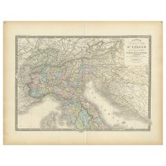
Antique Map of Italy by Andriveau-Goujon, 1855
About the Item
Antique folding map of Italy titled 'Italie'. Detailed map of Italy. The map originates from 'Atlas Universel' and is mounted on linen.
- Dimensions:Height: 26.58 in (67.5 cm)Width: 19.89 in (50.5 cm)Depth: 0.02 in (0.5 mm)
- Materials and Techniques:
- Period:
- Date of Manufacture:1855
- Condition:Some wear and age-related toning. Please study images carefully.
- Seller Location:Langweer, NL
- Reference Number:
About the Seller
5.0
Platinum Seller
These expertly vetted sellers are 1stDibs' most experienced sellers and are rated highest by our customers.
Established in 2009
1stDibs seller since 2017
1,951 sales on 1stDibs
Typical response time: <1 hour
- ShippingRetrieving quote...Ships From: Langweer, Netherlands
- Return PolicyA return for this item may be initiated within 14 days of delivery.
More From This SellerView All
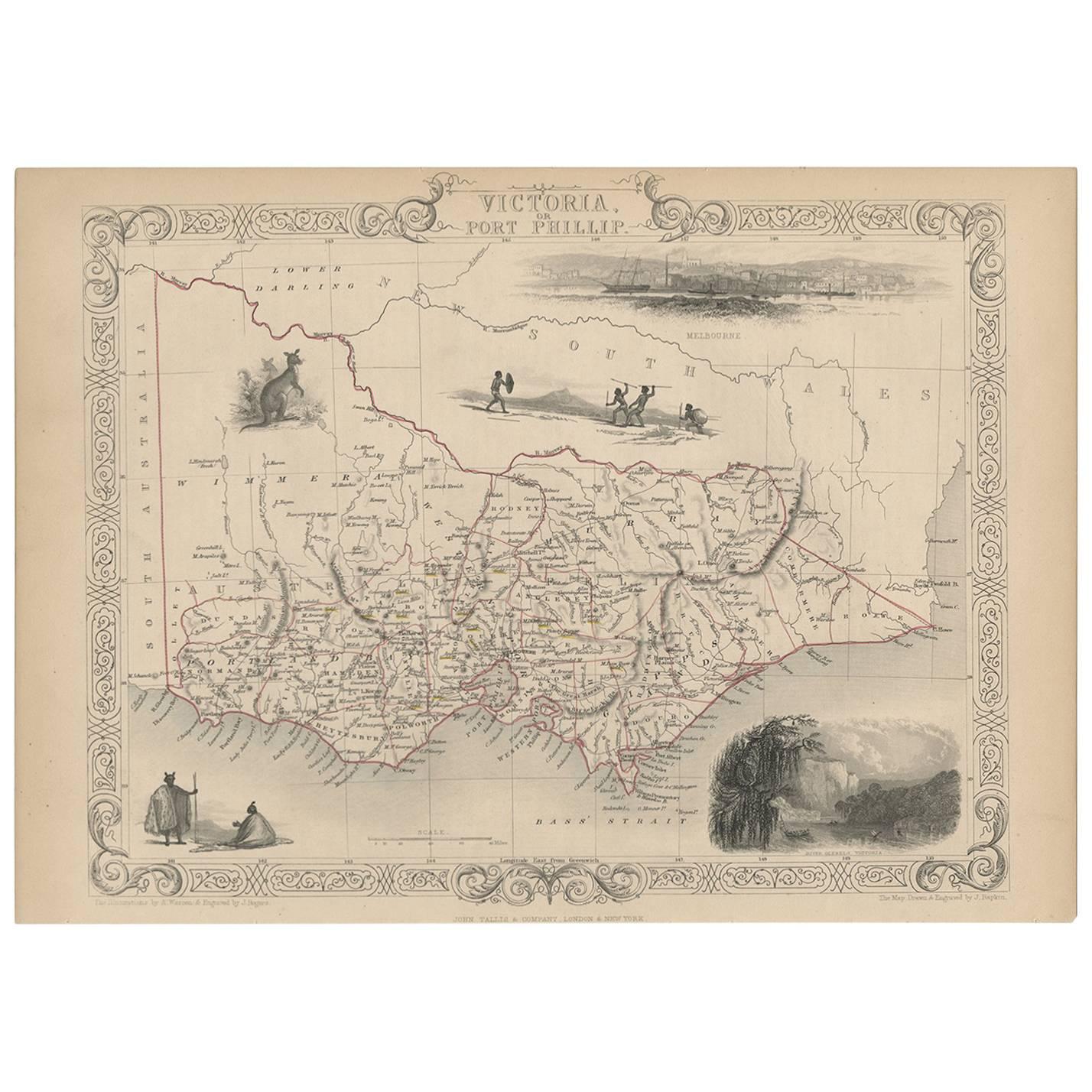
- Antique Map of Victoria ‘Australia’ by J. Tallis, circa 1855Located in Langweer, NLA highly decorative and finely engraved mid-19th century map of Victoria, Australia which appeared in John Tallis & co.'s The Illustrated Atlas (London...Category
Antique Mid-19th Century Maps
MaterialsPaper
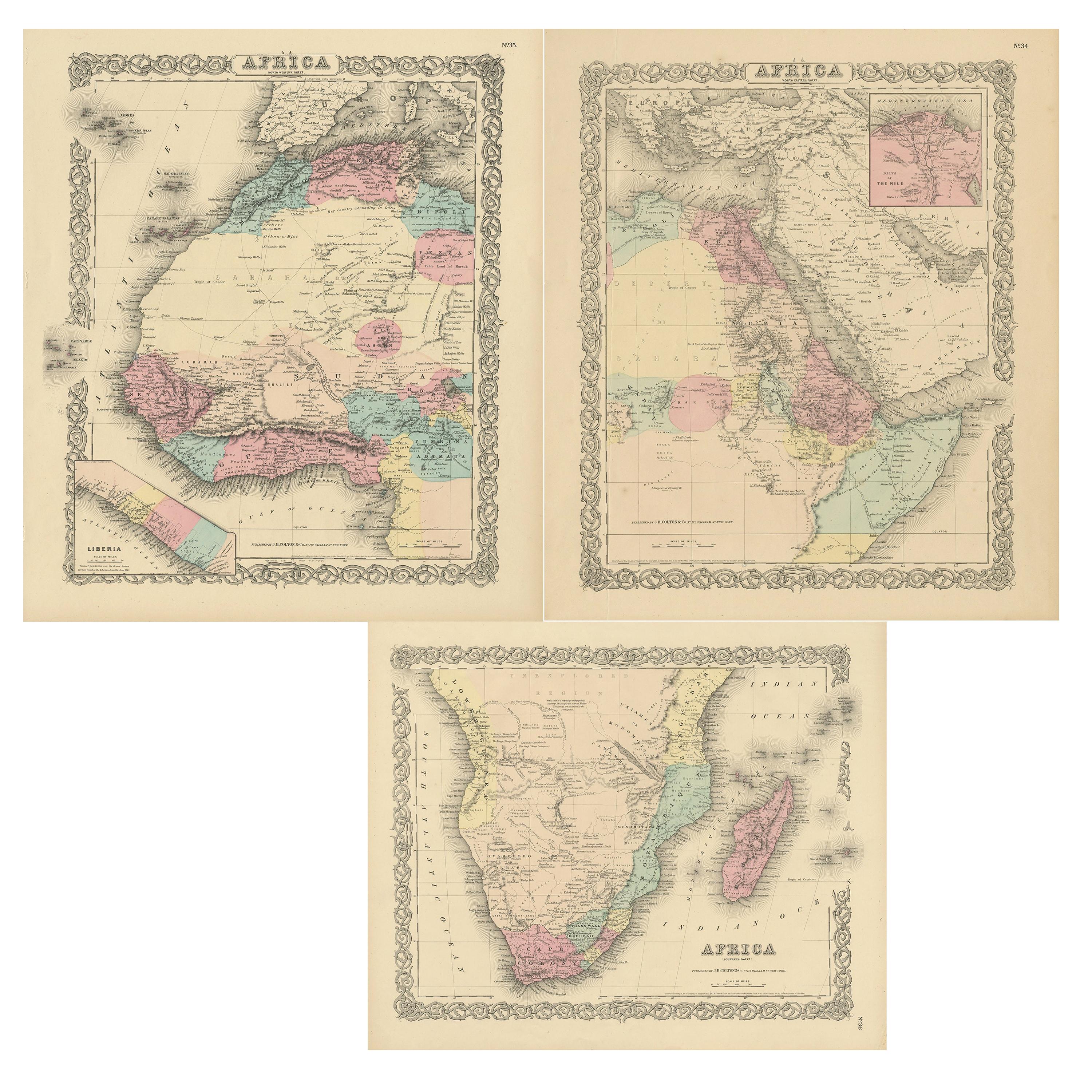
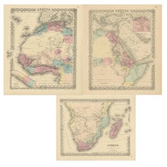
- Set of Three Antique Maps of Africa by Colton (circa 1855)Located in Langweer, NLSet of three individual maps of Africa including 'North West Africa', 'North Eastern Africa' and 'Southern Africa'. All three maps are surrounded by Colton's typical spiral motif border. Colton names numerous African tribes and nations throughout. An interesting set of maps...Category
Antique Mid-19th Century Maps
MaterialsPaper
- Antique Map of Italy by Lapie, 1842Located in Langweer, NLAntique map titled 'Carte de l'Italie Ancienne'. Map of Italy. This map originates from 'Atlas universel de géographie ancienne et moderne (..)' by Pierre...Category
Antique Mid-19th Century Maps
MaterialsPaper
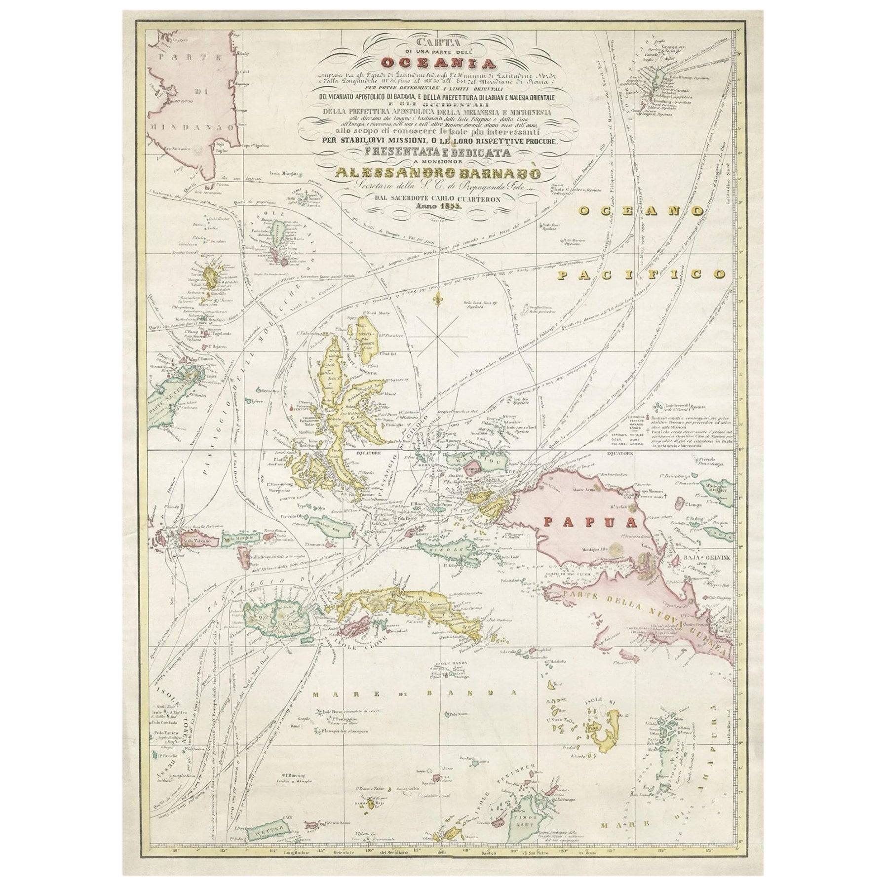
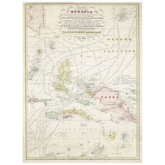
- Large Italian Map of Islands of Oceania, incl Papua, Timor, Banda, Ceram, 1855Located in Langweer, NLDescription: Antique map titled 'Carta di una parte dell'Oceania'. Beautiful large map of the (Spice) islands of Oceania. Depicting Papua, Timor, Ceram, Gilolo and many more. Source ...Category
Antique 1850s Maps
MaterialsPaper
- Antique Map of Italy by R. Bonne, circa 1780Located in Langweer, NLBeautiful map of Italy, Corsica, Sardinia and Sicily. Highly detailed, showing towns, rivers, some topographical features and political boundaries. Published by R. Bonne, circa 1780.Category
Antique Late 18th Century Maps
MaterialsPaper
- Antique Map of Northern Italy by Levasseur, 1875Located in Langweer, NLAntique map titled 'Carte l'Italie (..)'. Large map of Northern Italy. This map originates from 'Atlas de Géographie Moderne Physique et Politique' by A. Levasseur. Published 1875.Category
Antique Late 19th Century Maps
MaterialsPaper


You May Also Like
- Antique Map of Italy by Andriveau-Goujon, 1843By Andriveau-GoujonLocated in New York, NYAntique Map of Italy by Andriveau-Goujon, 1843. Map of Italy in two parts by Andriveau-Goujon for the Library of Prince Carini at Palazzo Carini i...Category
Antique 1840s French Maps
MaterialsLinen, Paper
- Original Antique Map of Italy. C.1780Located in St Annes, LancashireGreat map of Italy Copper-plate engraving Published C.1780 Unframed.Category
Antique Early 1800s English Georgian Maps
MaterialsPaper

- Original Antique Map of Italy. Arrowsmith. 1820Located in St Annes, LancashireGreat map of Italy Drawn under the direction of Arrowsmith Copper-plate engraving Published by Longman, Hurst, Rees, Orme and Brown, 1820 Unframed.Category
Antique 1820s English Maps
MaterialsPaper
- Antique Map of Principality of MonacoBy Antonio Vallardi EditoreLocated in Alessandria, PiemonteST/619 - "Old Geographical Atlas of Italy - Topographic map of ex-Principality of Monaco" - ediz Vallardi - Milano - A somewhat special edition ---Category
Antique Late 19th Century Italian Other Prints
MaterialsPaper
- Original Antique Map of Russia By Arrowsmith. 1820Located in St Annes, LancashireGreat map of Russia Drawn under the direction of Arrowsmith Copper-plate engraving Published by Longman, Hurst, Rees, Orme and Brown, 1820 Unframed.Category
Antique 1820s English Maps
MaterialsPaper
- Original Antique Map of China by Thomas Clerk, 1817Located in St Annes, LancashireGreat map of China Copper-plate engraving Drawn and engraved by Thomas Clerk, Edinburgh. Published by Mackenzie And Dent, 1817 Unframed.Category
Antique 1810s English Maps
MaterialsPaper


