Items Similar to Antique Map of Kuinderschans, Part of the Frisian Defense Line, Netherlands 1649


Want more images or videos?
Request additional images or videos from the seller
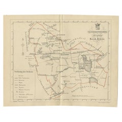
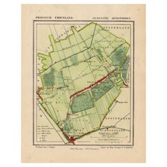
Antique Map of Kuinderschans, Part of the Frisian Defense Line, Netherlands 1649
About the Item
Antique Dutch map titled 'Kuynder-Schans'. Old map of the 'Kuinderschans', a rampart to block passage over the Zuiderzeedijk and prevent an attack from the waterside.
The building of the Friese Waterlinie started around 1580. The Kuinderschans was one of ten 'schansen' or defense walls. The traject of the defenceline starts at the Zuidersea, along the river Linde until the De Blessebridge. Then the defence line goes to the north to Kuinre along Heerenveen, Terband, Gorredijk, Donkerbroek, Bakkeveen until Frieschepalen. The area along the forts, dams were flooded during the Eighty Years' War against the Spanish and in 1672 Rampjaar (Disaster year) against Bernard von Galen and the French troops helping the bishop of Munster. In the east the defence line is connected with the Groninger waterlinie which carries on to Delfzijl. Part of the Frisian Water Line is also called the Tjonger-Lindelinie.
The ten schansen were situated in Schoterland nearby Oudehorne, just north of the river the Tjonger nearby Oudeschoot along the road to Wolvega and nearby Terbant. Currently the defence line is under restoration.
This map originates from 'Atlas van Loon'. Artists and Engravers: The Atlas Van Loon is the extremely sumptuous atlas commissioned by Frederik Willem van Loon from Amsterdam. It contained many maps by Blaeu, Janssonius and Pieter Goos.
Condition: Good, general age-related toning. Some soiling, Dutch text on verso. Please study image carefully.
- Dimensions:Height: 12.41 in (31.5 cm)Width: 20.87 in (53 cm)Depth: 0 in (0.01 mm)
- Materials and Techniques:
- Period:
- Date of Manufacture:1649
- Condition:
- Seller Location:Langweer, NL
- Reference Number:
About the Seller
5.0
Platinum Seller
These expertly vetted sellers are 1stDibs' most experienced sellers and are rated highest by our customers.
Established in 2009
1stDibs seller since 2017
1,949 sales on 1stDibs
Typical response time: <1 hour
- ShippingRetrieving quote...Ships From: Langweer, Netherlands
- Return PolicyA return for this item may be initiated within 14 days of delivery.
More From This SellerView All
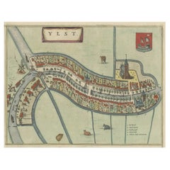
- Antique Hand-Colored Map of the Frisian City of IJlst, The Netherlands, 1649Located in Langweer, NLAntique hand-colored map titled 'Ylst'. Original antique map of the city of IJlst, Friesland, the Netherlands. This map originates from 'Novum Ac Magnum Theatrum Urbium Belgicae ...Category
Antique 17th Century Maps
MaterialsPaper
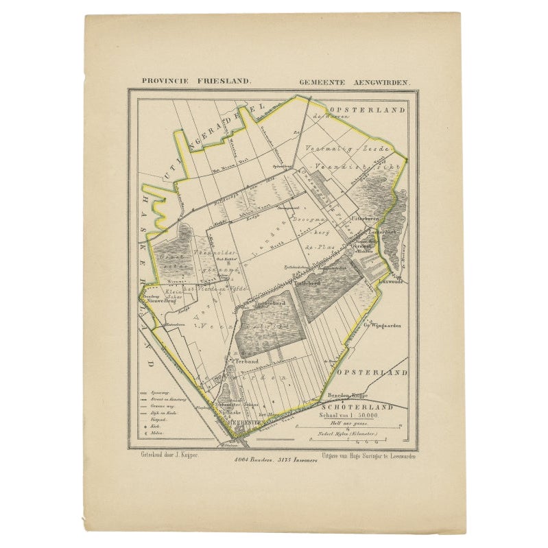
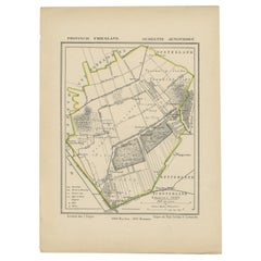
- Antique Map of Frisian Municipality Aengwirden in the Netherlands, 1868Located in Langweer, NLAntique map titled 'Provincie Friesland - Gemeente Aengwirden'. Map of the township Aengwirden including Heerenveen, Terband, Tjalleberd, Gersloot and many other villages. This map o...Category
Antique 19th Century Maps
MaterialsPaper
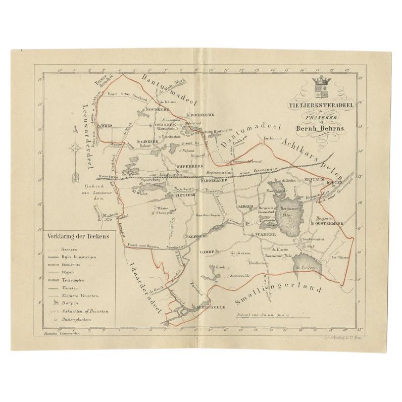
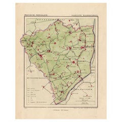
- Antique Map of the Frisian Tietjerksteradeel Township in the Netherlands, 1861Located in Langweer, NLAntique map titled 'Gemeente Tietjerksteradeel'. Old map depicting the Tietjerksteradeel township including cities and villages like Wijns, Oenkerk, Rijperkerk, Hardegarijp, Tietjerk...Category
Antique 19th Century Maps
MaterialsPaper
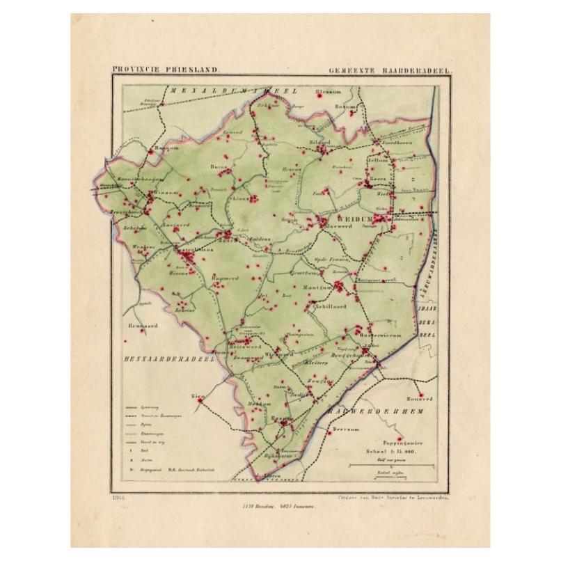
- Antique Map of Frisian Township of Baarderadeel in the Netherlands, 1868Located in Langweer, NLAntique map titled 'Provincie Friesland - Gemeente Baarderadeel'. Map of the township Baarderadeel including Weidum, Oosterlittens and many other villages. This map originates from '...Category
Antique 19th Century Maps
MaterialsPaper
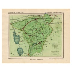
- Antique Map of Frisian Municipality of Achtkarspelen in the Netherlands, 1868Located in Langweer, NLAntique map titled 'Provincie Friesland - Gemeente Achtkarspelen'. Map of the township of Achtkarspelen including Buitenpost, Surhuisterveen and many other villages. This map origina...Category
Antique 19th Century Maps
MaterialsPaper
- Antique Map of Frisian Municipality of Aengwirden in the Netherlands, 1868Located in Langweer, NLAntique map titled 'Provincie Friesland - Gemeente Aengwirden'. Map of the township Aengwirden including Heerenveen, Terband, Tjalleberd, Gersloot and many other villages. This map o...Category
Antique 19th Century Maps
MaterialsPaper
You May Also Like
- Original Antique Map of The Netherlands, Engraved by Barlow, Dated 1807Located in St Annes, LancashireGreat map of Netherlands Copper-plate engraving by Barlow Published by Brightly & Kinnersly, Bungay, Suffolk. Dated 1807 Unframed.Category
Antique Early 1800s English Maps
MaterialsPaper
- Map of the Kingdom of Sardinia and Part of the Kingdom of Genoa, RomeBy Giovanni Maria CassiniLocated in Hamilton, Ontario18th century map by Italian engraver Giovanni Maria Cassini (Italy 1745-1824). Map of Part of the Kingdom of Sardinia and Part of the Kingdom of Genoa: Rome. This is a hand colored a...Category
Antique 18th Century Italian Maps
MaterialsPaper
- School Chart or Pull Down Map of Geography of the Netherlands, 1950sLocated in Hemiksem, VANA beautiful old school map of the Netherlands, painted on linen. The map shows the 3 different reliefs (low, middle, high) of the Netherlands. The beau...Category
Vintage 1950s Belgian Mid-Century Modern Maps
MaterialsLinen, Paint
- 1868 Map of the Upper Part of the Island of Manhattan Above 86th StreetBy Wm. Rogers Mfg. Co.Located in San Francisco, CAThis wonderful piece of New York City history is over 150 years old. It depicts 86th street and above. It was lithographed by WC Rogers and company. It was made to show what was the Battle of Harlem during the Revolutionary war...Category
Antique 1860s American American Colonial Maps
MaterialsPaper
- 1861 Topographical Map of the District of Columbia, by Boschke, Antique MapLocated in Colorado Springs, COPresented is an original map of Albert Boschke's extremely sought-after "Topographical Map of the District of Columbia Surveyed in the Years 1856 ...Category
Antique 1860s American Historical Memorabilia
MaterialsPaper
- 1844 Map "Russia in Eurpoe, Part II to Part VIII", 7 Maps Ric.r023Located in Norton, MA1844 Map "Russia in Eurpoe, Part II to Part VIII" 7 Maps Ric.r023 Fine, original, steel-engraved Map of Russia in Europe Part II t oPart VIII, by the Society for the Diffusion of Useful Knowledge. Detailed map of the regions to the northeast of Moscow. Including Arkhangel, Vologda, Viatka, Perm, Olonetz, Iaroslavl. The SDUK began its map publishing project under the leadership of Captain Francis Beaufort R.N. in 1829, and published the maps in parts, haltingly, over the next 15 years, completing the series in 1844, finally permitting the publication of a whole atlas. Many of the maps were actually drawn by Beaufort, who at the time was the Hydrographer to the Royal Navy, and all were closely supervised by him. J. & C. Walker worked closely with Beaufort in engraving the maps. Finely engraved, carefully researched, the maps set...Category
Antique 19th Century Unknown Maps
MaterialsPaper


