French Wall Map

6
to
35
469
197
310
228
198
120
115
81
64
51
41
38
32
30
24
24
24
17
16
15
15
13
13
13
11
10
8
8
7
7
5
4
4
4
4
4
4
4
3
3
3
3
3
2
2
2
2
2
2
1
1
1
1
1
1
42
42
18
12
7
Sort By
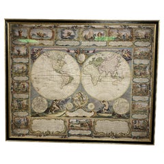
Colored wall map of the WORLD
By Chambon
Located in ZWIJNDRECHT, NL
huge wall map of the world in two hemispheres printed on two sheets, depicting the Eastern and Western
Category

Antique Mid-18th Century French French Provincial Maps

Materials

Wood, Paper

Colored wall map of the WORLD
Free Shipping
H 45 in W 57 in D 0.8 in
1864 Map of North America, Antique Hand-Colored Map, by Adolphe Hippolyte Dufour
Located in Colorado Springs, CO
published wall map was produced by Adolphe Hippolyte Dufour. This map includes vibrant and elaborate hand
Category

Antique 1860s French Maps

Materials

Paper

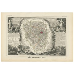
Antique Map of Seine et Oise 'France' by V. Levasseur, 1854
By Victor Levasseur
Located in Langweer, NL
Antique map titled 'Dépt. de Seine et Oise'. Map of the French department of Seine-et-Oise. Centred
Category

Antique Mid-19th Century Maps

Materials

Paper

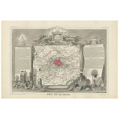
Decorative Antique Map of the Seine River and Paris in France, ca.1854
By Victor Levasseur
Located in Langweer, NL
Antique map titled 'Dépt. de la Seine'. Map of the French department of Seine. Focusing on Paris
Category

Antique Mid-19th Century Maps

Materials

Paper

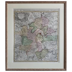
Antique Map of the Region of Paris ‘France’ by H. Heirs, circa 1720
Located in Langweer, NL
(..)'. Incredibly detailed map showing everything from tiny villages to forests, farmland, walled cities and more
Category

Antique Early 18th Century Maps

Materials

Paper

Antique Map of Paris, "Carte Routiere des Environs de Paris" 1841
Located in Colorado Springs, CO
surrounds the gray center of Paris, as the map clearly shows, however, that wall was soon replaced by the
Category

Antique 1840s French Maps

Materials

Paper

1633 Map Entitled "Beauvaisis Comitatus Belova Cium, Ric.0002
Located in Norton, MA
den Keere * 1595 Europe (wall map): with Pieter van den Keere * 1598 World and the Continents * 1599
Category

Antique 17th Century Dutch Maps

Materials

Paper

Antique Map of Western Tartary, with Information from Kyrkov's Surveys
Located in Langweer, NL
Antique map titled 'Carte de la Tartarie Occidentale'. This map covers western Tartary with a focus
Category

Antique Mid-18th Century Maps

Materials

Paper

1864 Johnson's Map of the World on Mercator's Projection, Ric.B009
Located in Norton, MA
Celtic design. This beautiful map of France Spain and Portugal shows countries, states and or provinces
Category

Antique 19th Century Dutch Maps

Materials

Paper

Original Antique Map of the Philippines, Malaysia, Indonesia, Singapore, c.1690
Located in Langweer, NL
Antique map titled 'Isole dell' Indie, diuise in Filippine, Molucche e della Sonda'. Old map of
Category

Antique 1690s Maps

Materials

Paper

Antique Map of Africa with a Decorative Dedication to the Dauphin, 1717
Located in Langweer, NL
Decouvertes (..).' This map is a reduced derivative of De Fer's wall map of Africa (1696-98) with its
Category

Antique 18th Century Maps

Materials

Paper

Antique Map of Kuinderschans, Part of the Frisian Defense Line, Netherlands 1649
Located in Langweer, NL
Antique Dutch map titled 'Kuynder-Schans'. Old map of the 'Kuinderschans', a rampart to block
Category

Antique 17th Century Maps

Materials

Paper

Antique Map of Tibet, The Gobi Desert and China by Bellin, circa 1764
Located in Langweer, NL
Antique map titled 'Carte de l'Empire de Hya et Partie de Tangut'. Old map of Tibet, Gobi desert
Category

Antique 18th Century Maps

Materials

Paper

Antique Map of Ancient Jerusalem, depicting The Temple of Solomon, c.1725
Located in Langweer, NL
Antique map titled 'Nieuwe Plattegrond van het Oude Jeruzalem Volgens den Schryver.' Bird's-eye
Category

Antique 18th Century Maps

Materials

Paper

Antique Map of Eastern Tartary and the Gobi Desert by Van Schley, 1758
By Jakob van der Schley
Located in Langweer, NL
the Gobi desert showing the silk road and the Great Wall of China. While these maps by Van Schley
Category

Antique 18th Century Maps

Materials

Paper

Antique Map of Cities in the Hubei and Hunan Provinces of China, 1755
By Jacques-Nicolas Bellin
Located in Langweer, NL
plans of walled cities in what are now China's Hubei (Hou-Quang) and Hunan Provinces on a single plate
Category

Antique 18th Century Maps

Materials

Paper

Detailed Antique Map of the Province of Overijssel in the Netherlands, ca.1700
Located in Langweer, NL
4 Willem Blaeu Continental Wall maps in about 1669 with French border texts. The family remained
Category

Antique Early 1700s Maps

Materials

Paper

Old Hand-Colored Map of Western Tartary with Focus on Present-Day Mongolia, 1749
Located in Langweer, NL
Antique map titled 'Carte de la Tartarie Occidentale pour Servir a l'Histoire Générale des Voyages
Category

Antique 1740s Maps

Materials

Paper

Rare Unusual Antique Map of Asia with a Landbridge from Korea to America, 1717
Located in Langweer, NL
print and map seller, Antoine de Fer [d.1673]. He became an official geographer to both French and
Category

Antique 18th Century Maps

Materials

Paper

Original Vintage Rail Travel Map Poster France Map SNCF National French Railway
Located in London, GB
Original vintage rail travel map poster - France Societe Nationale des Chemins de Fer Francais
Category

Vintage 1950s French Posters

Materials

Paper

Large French Paris Metro Map 1960s
Located in North Hollywood, CA
Large French Paris Metro Map 1960s. A large Vintage French framed map of the Parisian Metro from
Category

Mid-20th Century French Industrial Prints

Materials

Wood, Paper

Large French Paris Metro Map 1960s
H 30.5 in W 37.75 in D 1 in
Vintage Mural Rollable Map Wall Chart France Benelux Countries South England
Located in Berghuelen, DE
A cottagecore pull-down wall chart map illustrating France and the Benelux countries (the
Category

Mid-20th Century German Country Prints

Materials

Canvas, Wood, Paper

Antique Map of France
Located in Dallas, TX
Nice antique map of France in wood frame. This would make a great gift for a collector. A wonderful
Category

Early 20th Century Decorative Art

Materials

Glass, Wood, Paper

Antique Map of France
H 25 in Dm 37 in
Original Antique Engrving of Chinese Tartary in the 18th Century, 1737
Located in Langweer, NL
Tartary. Maps 3, 11, 12 show Great Wall of China. Map 18 shows Japan. Maps show topography, vegetation
Category

Antique 1730s Maps

Materials

Paper

Gilt Framed Vintage Wine Regions of France Map
Located in Alton, GB
Framed French wine region map 1973. The print has been removed to clean the glass, the frame has
Category

Vintage 1970s French Posters

Materials

Paper

Gilt Framed Vintage Wine Regions of France Map
H 26.78 in W 35.44 in D 1.19 in
Lucien Boucher, Air France 'Nova et Vetera' Poster Map, Paris France, 1939
By Lucien Boucher
Located in Firenze, IT
Air France 'Nova et Vetera' poster map designed by Lucien Boucher Paris France 1939
Category

Vintage 1930s French Modern Prints

Materials

Glass, Wood, Paper

Four Reproduction Vintage Panels of Air France World Map
Located in Los Angeles, CA
Reproduction of a beautiful green and blue mid-century Air France world map on four individual
Category

21st Century and Contemporary French Prints

Materials

Wood, Paper

Four Reproduction Vintage Panels of Air France World Map
Located in Los Angeles, CA
Reproduction of beautiful blue and green mid-century Air France world map on four individual panels
Category

21st Century and Contemporary French Prints

Materials

Paper, Wood

Map 2 Wall Lamp by Éric de Dormael
By Eric de Dormael
Located in Geneve, CH
Map 2 wall lamp by Éric de Dormael Dimensions: D 18.5 x W 9.5 x H 39 cm Materials: Steel, Brass
Category

2010s French Post-Modern Wall Lights and Sconces

Materials

Brass, Steel

Map 2 Wall Lamp by Éric de Dormael
H 15.36 in W 3.75 in D 7.29 in
Original Vintage Poster Illustrated Map Madagascar French Colony Industry Travel
Located in London, GB
illustrated map showing the various places on a road route, the cities and towns marked with the highlands and
Category

Vintage 1930s French Posters

Materials

Paper

Original Vintage Poster French Equatorial Africa Map Afrique Chad Congo Francais
Located in London, GB
Original vintage pictorial map poster of French Equatorial Africa / Afrique Equatoriale Francaise
Category

Vintage 1950s French Posters

Materials

Paper

Original Vintage Travel Poster For La Normandie France Normandy Illustrated Map
Located in London, GB
Original vintage travel poster for Normandy - La Normandie France - featuring a pictorial map
Category

Vintage 1950s French Posters

Materials

Paper

Great Britain Scandinavia Northern France Netherland Germany Mural Map
Located in Berghuelen, DE
The vintage pull-down cottagecore mural map illustrates the North Sea countries with Great Britain
Category

Vintage 1970s German Country Posters

Materials

Canvas, Wood, Paper

Original Vintage Poster French West Africa Map Afrique Occidentale Francaise Art
By alain cornic
Located in London, GB
Original vintage poster featuring an illustrated map of French West Africa / Afrique Occidentale
Category

Vintage 1950s French Posters

Materials

Paper

Original Vintage Poster Air France Reseau Aerian Mondial Planisphere World Map
By Lucien Boucher
Located in London, GB
Original vintage Air France travel advertising poster featuring a map of the world by Lucien
Category

Vintage 1930s French Posters

Materials

Paper

Original Vintage Travel Poster Air France World Map Postal Network Reseau Aerian
Located in London, GB
Original vintage Air France map poster - Air France Reseau Aerian Postal / Air France Postal
Category

Vintage 1940s French Posters

Materials

Paper

Original Vintage Poster, Lucien Boucher, Air France, World Map Planisphere, 1948
By Lucien Boucher
Located in SAINT-OUEN-SUR-SEINE, FR
Planisphere Air France from 1948 to promote world tourism through the famous French airline
Category

20th Century French Mid-Century Modern Posters

Materials

Paper

Large Vintage France Map, Continental, Historical Cartography, Late 20th Century
Located in Hele, Devon, GB
This is a large vintage map of France. A Continental, framed example of historical cartography
Category

Late 20th Century European Mid-Century Modern Prints

Materials

Glass, Wood, Paper

Original Vintage Poster Vineyards Of Champagne Wine Map Les Vignobles De France
Located in London, GB
of France Wines of Champagne featuring a pictographic map of the Champagne wine region framed by an
Category

Vintage 1960s French Posters

Materials

Paper

Original Vintage Poster Les Vignobles De France Vineyards Wine Map Cockerel Logo
Located in London, GB
Original vintage drink advertising poster for The Vineyards Of France / Les Vignobles De France
Category

Vintage 1960s French Posters

Materials

Paper

Original Vintage Poster Vignobles De France Vins De Bourgogne Burgundy Wine Map
Located in London, GB
Original vintage drink advertising poster promoting French wines (one of a series issued by the
Category

Vintage 1950s French Posters

Materials

Paper

Original Antique Poster French Infantry In Battle WWI Hindenburg Line Europe Map
Located in London, GB
Original antique World War One poster - French Infantry In Battle / L'Infanterie Francais Dans La
Category

Vintage 1910s French Posters

Materials

Paper

Original Vintage Poster Vineyards Of Bordeaux Wine Map Les Vignobles De France
Located in London, GB
France Bordeaux Wines featuring a pictographic map of the Bordeaux wine region with colourful
Category

Vintage 1960s French Posters

Materials

Paper

Original Vintage Poster Les Vignobles d'Alsace Vineyards French Wine Map Rhine
Located in London, GB
Wine Information Centre Colmar France. The poster features a colourful decorative map of the Alsace
Category

Vintage 1950s French Posters

Materials

Paper

Original Vintage Air Maroc Travel Poster Route Map France Morocco Spain Services
By E. Esperance
Located in London, GB
jet plane flying towards the viewer with propellers on each wing and a route map in the background of
Category

Vintage 1950s French Posters

Materials

Paper

1800s French Map of the World in Two Hemispheres - Le Dictionnaire Géographique
Located in Montréal, CA
Language: French Coloured: Black and White Condition: The print is in excellent condition.
Category

Antique Early 19th Century French Prints

Materials

Paper

18th Century Map of Paris
Located in Washington, DC
18th century map of Paris.
Category

Antique Late 18th Century French Prints

Materials

Glass, Wood, Paper

18th Century Map of Paris
H 23 in W 32 in D 1 in
World Map Clock
Located in Paris, FR
Clock world map with natural solid wengue wood back panel on which are placed different time zone
Category

21st Century and Contemporary French Wall Clocks

Materials

Glass, Wenge

World Map Clock
World Map Clock
H 20.87 in W 37.8 in D 2.56 in
Hand-Colored French Map, Carte des Etats Unis, Par Bonne, Late 18th Century
By Rigobert Bonne
Located in Chappaqua, NY
Hand-colored French map, Carte de la Partie Nord, des Etats Unis, de l'Amérique Septentrionale
Category

Antique Late 18th Century French Louis XVI Prints

Materials

Paper

Original Vintage Poster Vignobles De France Vineyards Vins D'Alsace Wine Map Art
Located in London, GB
Original vintage drink advertising poster promoting French wines (one of a series issued by the
Category

Vintage 1950s French Posters

Materials

Paper

Original Vintage Poster Vignobles De France Vins Du Val De Loire Valley Wine Map
Located in London, GB
Original vintage drink advertising poster promoting French wines (one of a series issued by the
Category

Vintage 1950s French Posters

Materials

Paper

Map "Estuary- Mouth of the Thames"
Located in Alessandria, Piemonte
ST/426 - Antique French Map of the estuary of the Thames, map dated 1769 - "Mape of the entrance
Category

Antique Mid-18th Century French Other Prints

Materials

Paper

 Map "Estuary- Mouth of the Thames"
 Map "Estuary- Mouth of the Thames"
H 25.2 in W 34.65 in D 0.04 in
1749 Jacques Nicolas Bellin Map of the Great Wall of China Near Kiang-nan fu
Located in Langweer, NL
Wall of China as it was understood in the mid-18th century. The map includes French text. The title
Category

Antique 1750s Prints

Materials

Paper

c.1900 Handwoven French Tapestry Map New Netherlands, Amsterdam, 1626 New York
Located in Jensen Beach, FL
Striking depiction of a map of the New Netherlands after the Dutch purchase in 1626, including New
Category

Early 20th Century Tapestries

Materials

Wool

Rare Set of 3 Map Samplers by A Charles. Italy, Spain & France
Located in Chelmsford, Essex
respective countries. The first entitled, 'SPAIN and PORTUGAL'. The second, 'MAP OF FRANCE'. The third
Category

Antique Early 19th Century English Tapestries

Materials

Linen

French 1930s Map of Paris à Vol d'Oiseau under Glass in Custom Iron Frame
Located in Atlanta, GA
A French map of Paris from the early 20th century, with custom iron frame. Created in Paris during
Category

Early 20th Century French Prints

Materials

Iron

Old Nautical Map of Corsica
Located in Alessandria, Piemonte
ST/556/1 - Old map of Corsica isle, surveyed by Captain Hell, of the French Royal Navy in 1824
Category

Antique Early 19th Century English Other Prints

Materials

Paper

Old Nautical Map of Corsica
H 40.95 in W 27.96 in D 0.04 in
French Mid-Century Reprint of Early 18th Century Map of Paris in Sepia Colors
Located in Haddonfield, NJ
Custom Wooden Framed Map of 1700's Hundreds Paris, France. This reprint of the early antique map
Category

Mid-20th Century French Baroque Decorative Art

Materials

Linen, Wood, Paper

Original Vintage Illustrated Map Poster Afrique Equatoriale Francaise Cameroon
Located in London, GB
Original vintage illustrated map poster for Cameroun AOF Afrique Occidentale Francaise / Cameroon
Category

Vintage 1950s French Posters

Materials

Paper

Delaye, Original Vintage Poster, South Morocco Map, Maghreb, Marrakech, 1930
Located in SAINT-OUEN-SUR-SEINE, FR
Original Vintage Poster for South Morocco Map dating from 1930 by Jean Theophile Delaye. Artist
Category

Vintage 1930s French Art Deco Posters

Materials

Paper

  • 1
  • ...
Get Updated with New Arrivals
Save "French Wall Map", and we’ll notify you when there are new listings in this category.

French Wall Map For Sale on 1stDibs

At 1stDibs, there are many versions of the ideal French wall map for your home. A French wall map — often made from paper, wood and glass — can elevate any home. Find 123 options for an antique or vintage French wall map now, or shop our selection of 4 modern versions for a more contemporary example of this long-cherished piece. Whether you’re looking for an older or newer French wall map, there are earlier versions available from the 18th Century and newer variations made as recently as the 21st Century. A French wall map is a generally popular piece of furniture, but those created in Mid-Century Modern, Art Deco and Baroque styles are sought with frequency. A well-made French wall map has long been a part of the offerings for many furniture designers and manufacturers, but those produced by Lucien Boucher, Air France and Andriveau-Goujon are consistently popular.

How Much is a French Wall Map?

The average selling price for a French wall map at 1stDibs is $1,482, while they’re typically $117 on the low end and $45,460 for the highest priced.

Read More

In Francks Deceus’s ‘Mumbo Jumbo #5,’ the Black Experience Is . . . Complicated

Despite the obstacles, the piece’s protagonist navigates the chaos without losing his humanity.

12 Floral-Accented Rooms with a Handmade, Folkloric Feel

Who needs a flower garden? Just use your imagination — and some beautifully patterned wallpaper or fabric — to bring the outdoors in.

This Wolf Kahn Pastel Is the Epitome of Beauty at Its Most Essential

A longtime admirer of Kahn’s work, 1stDibs editorial director Anthony Barzilay Freund explores why it’s relevant now more than ever.

Why Jules Chéret Was the King of the Modern Poster

The streets of fin-de-siècle Paris were set aglow with colorful poster ads, thanks to the printing techniques invented by Jules Chéret. Now, the Milwaukee Art Museum is celebrating this undersung talent in America's first solo show dedicated his exuberant works.

Anna Condo’s Multifaceted Career Spans Film, Photography and NFTs

From her historic Manhattan townhouse, the talented creator and curator of 1stDibs' latest NFT exhibition tells us about the art in her home and how she got involved with cryptoart.

How Keith Rivers Went from NFL Linebacker to Blue-Chip Art Aficionado

The former football player is as serious about becoming a great contemporary-art patron as he once was about making tackles. Here, Rivers tells us how he got the collecting bug and how his tastes have evolved over the years.

More Than Ever, the Female Design Council Is Embracing Funked-Up Creativity

The organization's "Womxn’s History Month" collection celebrates female-identified creators pushing the boundaries of technique and material.

This New Orleans Antiques Dealer’s Stylish Home Doubles as Her Art Studio

A former lawyer, Karina Gentinetta has achieved second-act success as a furniture gallerist and painter.