Items Similar to Detailed Antique Map of the Province of Overijssel in the Netherlands, ca.1700


Want more images or videos?
Request additional images or videos from the seller
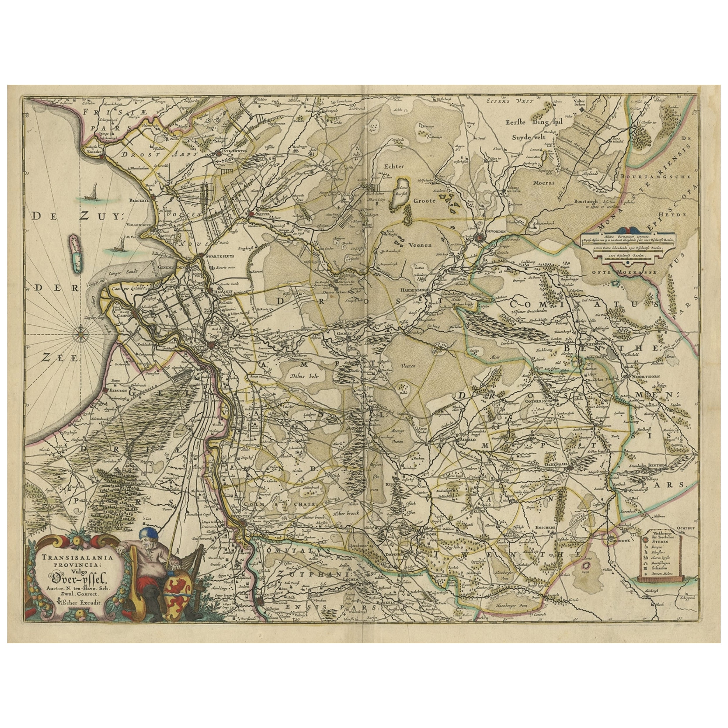
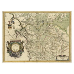
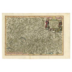
Detailed Antique Map of the Province of Overijssel in the Netherlands, ca.1700
About the Item
Antique map titled 'La Seigneurie d'Over-Yssel subdivisee en Trois Parties, Sallant, Twente, et Drente.'
Detailed map of the province of Overijssel in the Netherlands. From Jaillot’s “Nouvelle introduction a le geographie....” Embellished with a beautifully engraved title and scale cartouche. Cartographically this map is based on the work of Nicholas Sanson. "Nouvelle introduction a le geographie (…)" by Jaillot, published in Amsterdam by Pierre Mortier ca. 1690.
Artists and Engravers: Made by 'Nicholas Sanson d'Abbeville' after 'Alexis Hubert Jaillot'. Nicholas Sanson d'Abbeville (1600 - 1667) and his descendents were important French cartographer's active through the 17th century. Sanson started his career as a historian where, it is said, he turned to cartography as a way to illustrate his historical studies. In the course of his research some of his fine maps came to the attention of King Louis XIII who, admiring the quality of his work, appointed Sanson 'Geographe Ordinaire du Roi'. Sanson's duties in this coved position included advising the King on matters of Geography and compiling the royal cartographic archive. Sanson's corpus of some three hundred maps initiated the golden age of French Cartography. Alexis Hubert Jaillot (1632-1712) , was a French sculptor, engraver, publisher and cartographer. Native of Franch-Comtac, followed his elder brother, Pierre Simon to Paris in 1657. From 1664 he was student at the St. Lucas Academy. In 1665 he was created Sculpteur du Roi & in 1678, Sculpteur & Geographe ordinaire du Roi, official geographer to King Louis XIV. He worked closely with the heirs of Nicolas Sanson, Guillaume & Adrien Sanson, in the late 1660's and early 1670's. His most famous works include the Atlas Nouveau, first published in 1674 (reissued in numerous editions, including Dutch editions by Mortier and Covens and Mortier) and Neptune Francois (1692) and Atlas Francais (1695). He also reissued the series of 4 Willem Blaeu Continental Wall maps in about 1669 with French border texts. The family remained closely involved in cartography, Alexis Hubert being succeeded by his son, Bernard Jean Hyacinthe Jaillot (1673-1739) and grandson, Bernard Antoine Jaillot (d.1749) and the latter's brother-in-law, Jean Baptiste-Michel Renou de Chauvignac-Jaillot (1710-1780). At the latter's death, the stock of Jaillot was liquidated in auction in 1781, most being melted down. However a few plates were purchased by the French cartographer Jean-Claude Dezauche, which appeared in his Catalogue of November 1781 and Desnos, who in 1789 reissued the 6-sheet map of Asia by Sanson-Jaillot.
- Dimensions:Height: 24.57 in (62.4 cm)Width: 19.69 in (50 cm)Depth: 0 in (0.02 mm)
- Materials and Techniques:
- Period:1700-1709
- Date of Manufacture:circa 1700
- Condition:Condition: Very good, given age. A small crease in the lower left margin corner. Some soft creases in the margins. A sharp crease just left of the image (probably from binding). Remains of attachment to carrier to the left margin verso.
- Seller Location:Langweer, NL
- Reference Number:
About the Seller
5.0
Platinum Seller
These expertly vetted sellers are 1stDibs' most experienced sellers and are rated highest by our customers.
Established in 2009
1stDibs seller since 2017
1,949 sales on 1stDibs
Typical response time: <1 hour
- ShippingRetrieving quote...Ships From: Langweer, Netherlands
- Return PolicyA return for this item may be initiated within 14 days of delivery.
More From This SellerView All
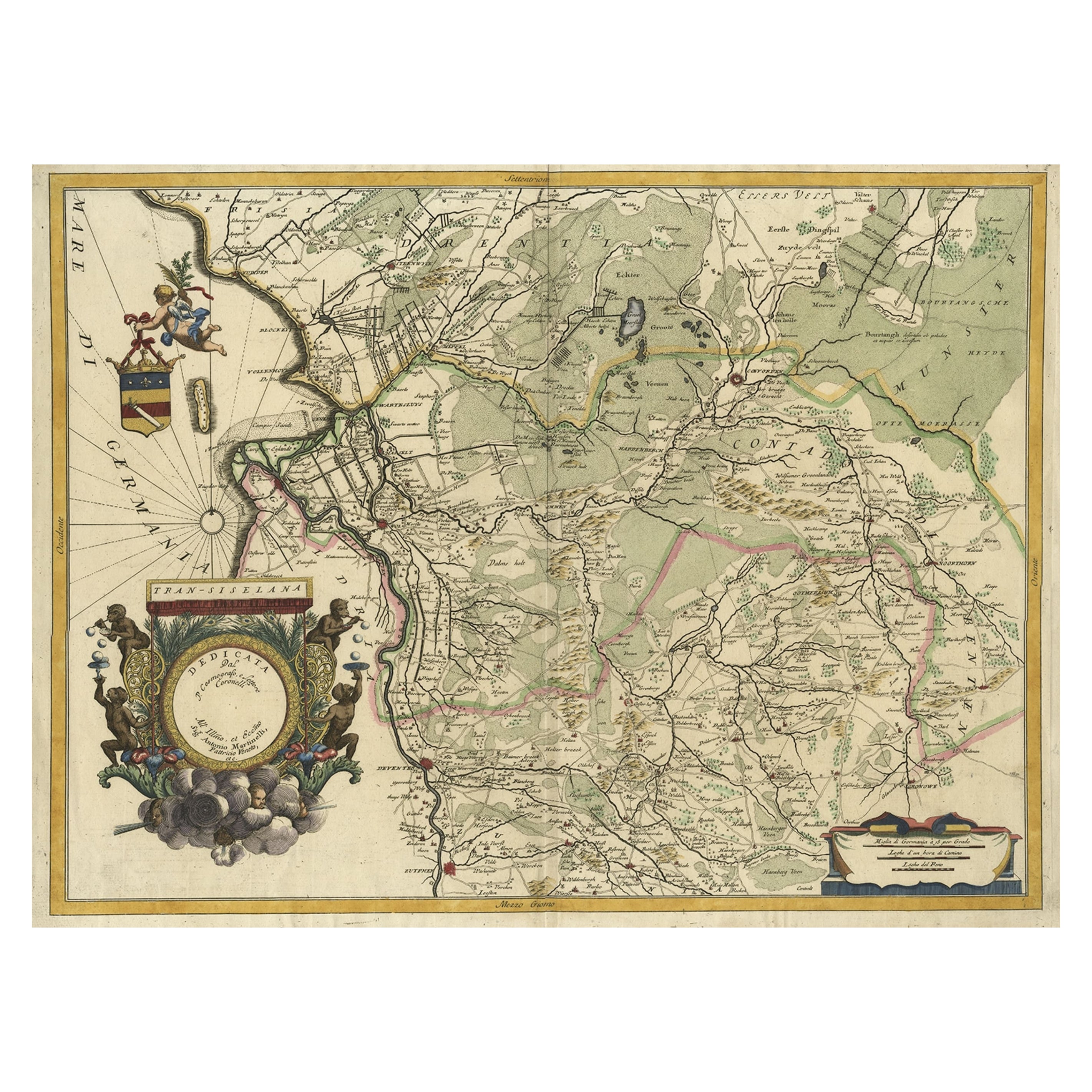
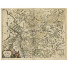
- Splendid Detailed Map of the Province of Overijssel in the Netherlands, ca.1692Located in Langweer, NLAntique map titled 'Tran-siselana'. Splendid detailed and decorative map of the province of Overijssel in the Netherlands by Vincenzo Coronelli. An elaborate title cartouche garlande...Category
Antique 1690s Maps
MaterialsPaper
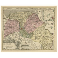
- Attractive Original Map of the Province of Overijssel, the Netherlands, Ca.1700Located in Langweer, NLAntique print, titled: 'Transisalania Provincia vulgo Over-yssel.' Attractive original handcoloured map of the province of Overijssel, The Netherlands. With beautiful title carto...Category
Antique Early 1700s Maps
MaterialsPaper
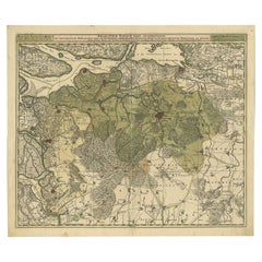
- Antique Map of the Province of Overijssel, the NetherlandsLocated in Langweer, NLOriginal antique map titled 'Ditio Trans-Isulana'. Original old map of the province of Overijssel, the Netherlands. With coat of arms and two decorative cartouches. Published by J. J...Category
Antique Mid-17th Century Maps
MaterialsPaper
- Antique Map of the Province of Groningen in the Netherlands, c.1700Located in Langweer, NLAntique map titled 'Groningae et Omlandiae Dominium vulgo de Provincie van Stadt en Lande'. Old map of the province of Groningen, the Netherlands. This map originates from 'Atlas C...Category
Antique 18th Century Maps
MaterialsPaper
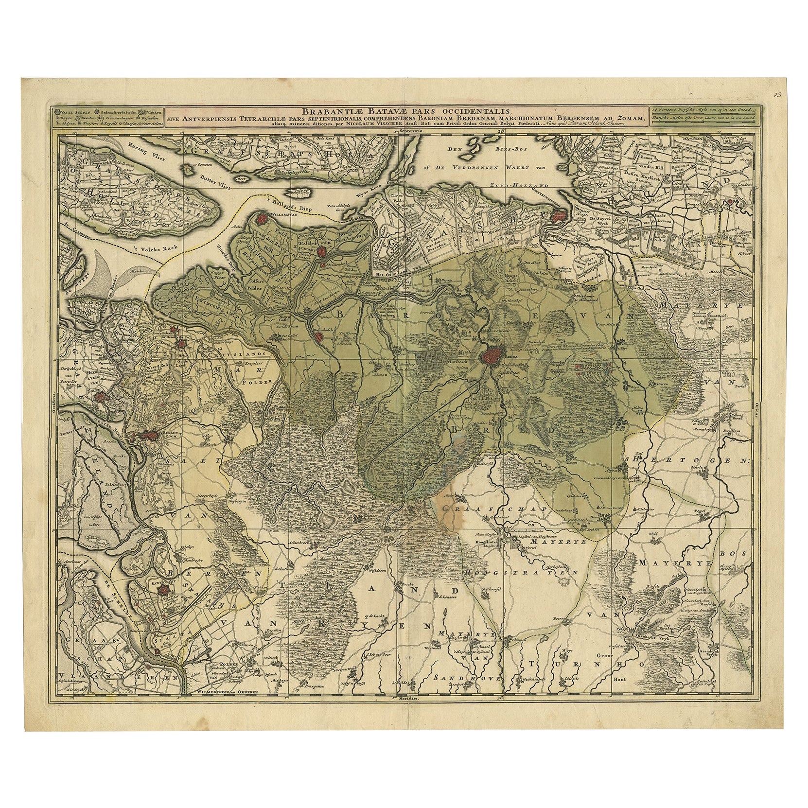
- Highly Detailed Antique Map of Brabant, Province of the Netherlands, ca.1700Located in Langweer, NLAntique print, titled: 'Brabantiae Batavae Pars Occidentalis : sive Antuerpiensis Tetrarchiae Pars Septentrionalis comprehendens Baroniam Bredanam, Marchionatum Bergensem ad Zoman al...Category
Antique Early 1700s Maps
MaterialsPaper
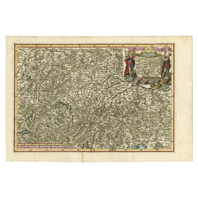
- Very Detailed Antique Map of the Jesuit Province of Bavaria, Germany, c.1700Located in Langweer, NLAntique map titled 'Provinciae Superior Germaniae Societatis.' Very detailed map of the Jesuit province of Bavaria, Germany. Source unknown, to be determined. Artists and Engravers:...Category
Antique 18th Century Maps
MaterialsPaper

You May Also Like
- Antique 18th Century Map of the Province of Pensilvania 'Pennsylvania State'Located in Philadelphia, PAA fine antique of the colony of Pennsylvania. Noted at the top of the sheet as a 'Map of the province of Pensilvania'. This undated and anonymous map is thought to be from the Gentleman's Magazine, London, circa 1775, although the general appearance could date it to the 1760's. The southern boundary reflects the Mason-Dixon survey (1768), the western boundary is placed just west of Pittsburgh, and the northern boundary is not marked. The map has a number of reference points that likely refer to companion text and appear to be connected to boundaries. The western and southern boundaries are marked Q, R, S, for example. A diagonal line runs from the Susquehanna R to the Lake Erie P. A broken line marked by many letters A, B, N, O, etc., appears in the east. There are no latitude or longitude markings, blank verso. Framed in a shaped contemporary gilt wooden frame and matted under a cream colored matte. Bearing an old Graham Arader Gallery...Category
Antique 18th Century British American Colonial Maps
MaterialsPaper
- Original Antique Map of The Netherlands, Engraved by Barlow, Dated 1807Located in St Annes, LancashireGreat map of Netherlands Copper-plate engraving by Barlow Published by Brightly & Kinnersly, Bungay, Suffolk. Dated 1807 Unframed.Category
Antique Early 1800s English Maps
MaterialsPaper
- Original Antique Map of The Netherlands, Sherwood, Neely & Jones, Dated 1809Located in St Annes, LancashireGreat map of The Netherlands Copper-plate engraving by Cooper Published by Sherwood, Neely & Jones. Dated 1809 Unframed.Category
Antique Early 1800s English Maps
MaterialsPaper
- Map of the Republic of GenoaLocated in New York, NYFramed antique hand-coloured map of the Republic of Genoa including the duchies of Mantua, Modena, and Parma. Europe, late 18th century. Dimension: 25...Category
Antique Late 18th Century European Maps
- Original Antique Map of The World by Thomas Clerk, 1817Located in St Annes, LancashireGreat map of The Eastern and Western Hemispheres On 2 sheets Copper-plate engraving Drawn and engraved by Thomas Clerk, Edinburgh. Published by Mackenzie And Dent, 1817 ...Category
Antique 1810s English Maps
MaterialsPaper
- Antique Map of Principality of MonacoBy Antonio Vallardi EditoreLocated in Alessandria, PiemonteST/619 - "Old Geographical Atlas of Italy - Topographic map of ex-Principality of Monaco" - ediz Vallardi - Milano - A somewhat special edition ---Category
Antique Late 19th Century Italian Other Prints
MaterialsPaper


Recently Viewed
View AllMore Ways To Browse
Auctions Of Antique Furniture
Dutch Turn Of The Century
Antique Cartography
Antique Wall Map
Antique Wall Maps
French Wall Map
Wall Map Of France
Fine Antique Maps
Antique 1600s
King Louis Plater
Antique Paper Stock
Francois Francais
In Stock In La
Le Roi A Paris
Paris Wall Map
Antique Province Map Of Antique
Antique Province Map
Map Of Antique Province